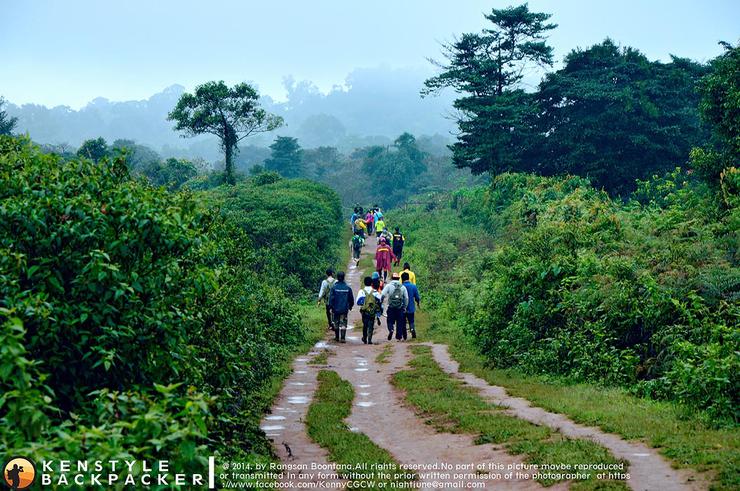
..On this trip, we will take you across the water but not the sea with the team of Pi Kan "The Backpacker" to the land of the Bolaven Plateau, or Borlaven, which is not as far as Bolivia but is just across the border from Ubon to Laos, here in Pakse, Champasak, Southern Laos. We will take you to see the magnificent waterfalls of Tad Ta Khed, Tad Seua, Tad Khamid, and Tad Yeung (waterfalls in Lao are called "Tad").
The Boloven Plateau is renowned for its high-quality coffee, Dao Coffee, which the Lao people call "Phu Phiang Boloven," meaning "the abode of Lao lavender." It is home to the largest number of Mon-Khmer ethnic minorities in the region. The plateau covers the provinces of Salavan, Sekong, Champasak, and Attapeu, with an average altitude of 1,200 meters, making it suitable for growing important cash crops. In addition to the Laven tribe, the Katu, Alak, Taoy, and Suoy tribes also reside here. These tribes believe in and worship spirits. The Laven tribe is also skilled in weaving, incorporating beads into their woven patterns. The tools they use are backstrap looms. Although their weaving skills are not as refined as those in northern Laos, they have a distinct style that clearly reflects Khmer influences.
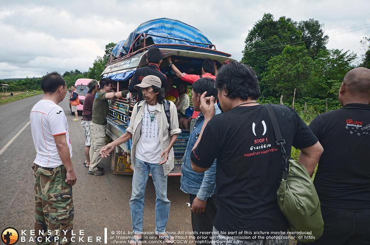
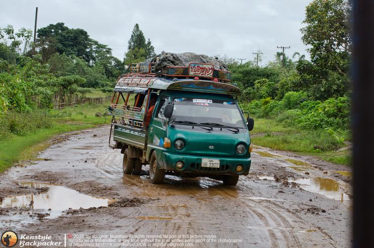
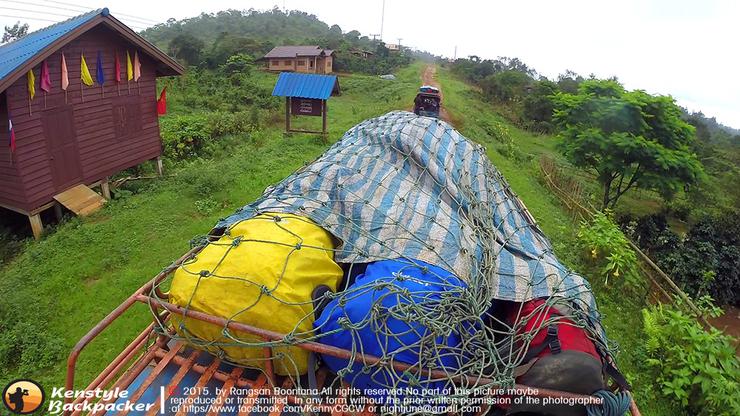
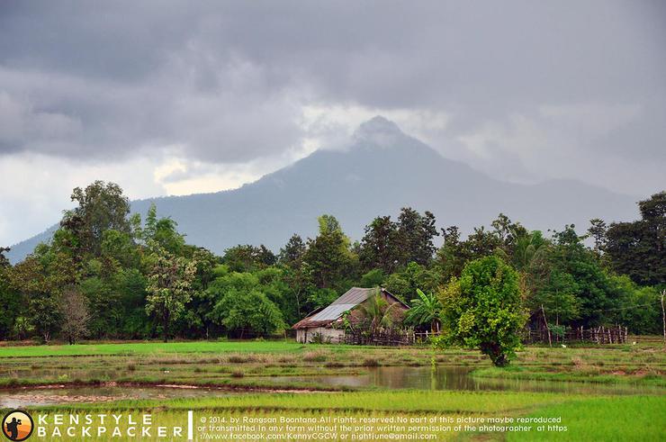
We crossed the border at Chong Mek in Ubon Ratchathani province, where we paid 40 baht each to the Lao officials as a "fee" (which they pocketed themselves). We then traveled to Champasak Province, Pakseong District, to reach Nong Luang Village, a distance of approximately 110 km. Nong Luang Village is the starting point for a trek into the Bolovens Plateau forest. Throughout the journey, we didn't realize we were climbing a mountain as the road gradually ascended. The scenery along the way remained natural, resembling the rural areas of Thailand 20 years ago. The roads were mostly dirt and gravel, with some paved sections under construction as part of the country's development. We heard that they are building a road to Nong Luang Village in preparation for the construction of the Xayaburi Dam. This may mean that the beautiful waterfalls in this area will disappear in the future. The landscape from Pakse to Pakseong, where Nong Luang Village is located, is full of fields, gardens, and farms, with abundant water and a sense of prosperity.


"Nong Luang Village" is a small village located on the edge of the Dong Hua Sao National Reserve. It was established in 1977 after the Lao People's Revolutionary Party successfully overthrew the American-backed monarchy and declared full independence on December 2, 1975. Initially, the village belonged to "Unit 08," which brought together families of soldiers, police officers, and forces opposed to the government or the American side during the National Liberation War. The purpose was to adjust their political thinking through a process called "seminar" based on Marxist-Leninist ideology, which has been the guiding principle of the country's socialist government to this day.
Nong Luang Village is one of the few villages on the Bolaven Plateau that produces high-quality coffee, especially the "Arabica Typica" variety. This rare and exceptional coffee variety is found in only a few places worldwide. It is the same variety used by coffee giant "Starbucks" as a raw material, making it a favorite among coffee lovers around the globe. [Source: Roger: http://www.oknation.net/blog/theexplorer (Excerpt from the report on the exploration of tourist attractions in Nong Luang Village, Lao PDR)]


A small truck took us to Nong Luang Village around 2 pm. We could feel the temperature dropping, and a chill began to set in. We quickly prepared our belongings and started our hike up to the main checkpoint. The sky was overcast all day, with occasional light rain. The distance to the main checkpoint was about 5 km. We started our hike around 3 pm. As we walked away from the village, the landscape on both sides was filled with coffee plantations. We came across a sign at the entrance to the forest that read "Welcome to the Million-Year-Old Stone Labyrinth Natural Heritage Tourist Site," which is considered one of the symbols of this area.


As we walked on, there was a sign on the right-hand side saying "To Kiriwongkot Forest Monastery". We accidentally wandered off the path for a while because our group had split up and we were left with only two people. We waited for the group behind us to catch up, but they turned left onto another path. From this path, we started to see many young snails welcoming us. We were bitten by several of them, but they didn't get to drink our blood before we flicked them off. Only the small ones were able to crawl into our socks and suck our blood. There were snails only in this area. As we walked along the small checkpoint path, we encountered a small adventure that got our adrenaline pumping. It was the first stream we had to cross, which flowed down to Tad Khamued. From old reviews, there was supposed to be a small wooden bridge to cross, but it must have collapsed. So our group tied a rope across the stream and waded through the strong current, with the village's "ghosts" (local soldiers) flanking us to prevent us from being swept away by the current.


After passing the first point, we walked through a forest soaked with many small streams, which were caused by the recent storm. Hiking in the forest during the rainy season will give you a refreshing feeling all the way and also prevent you from getting tired.


It took us about 3 hours to walk from Ban Nong Luang to our first campsite, which is called Dan Yai. The first thing we saw was a beautiful wide field full of flowers in the misty fog. We walked along the path admiring the pink fields of Pua flowers. Although it wasn't as full as we expected because it had started to fade, there were still patches of it interspersed with purple rice grass and monkey cups at intervals. We'll come back to take pictures tomorrow morning because it's getting late. We quickly set up camp and cooked food. After we were full, we sat around and had fun like backpackers do until 4 pm when it started to rain. I started to go to bed and slept on and off all night because I was sleeping in a hammock. The flysheet that was stretched out started to fail. The storm was so strong that my clothes were soaked. I got up and walked through the rain to the main camp at 3 am. The main camp, which was laid out for sleeping "pla too" (meaning sleeping together like in a basket of pla too, so hikers call it sleeping pla too), had become several small puddles. Everyone who was sleeping there tried to move to a dry place to sleep, but I don't think anyone slept soundly. I decided to go and sit and sleep by the "fire in the rain" (a campfire while it's raining, we use a flysheet to cover the fire but it has to be high enough so that the fire doesn't spread and burn). I sat and talked with the porters until morning.


The rain poured all night, from 10 pm to 5 am. Our camp was in ruins, our sleeping bags soaked through. It was like we were all sleeping in small puddles. But despite the hardships we faced last night, the morning air was beautiful. The mist covered the entire field, and we could see the faint shadows of two-leaved pine trees surrounding the meadow. Pink brittle flowers contrasted with the bright green grass, forming cute little patches. The purple-hearted wild rice, the heart of the field, stood tall, challenging the mist. In addition, pitcher plants and hermit's rice, which we often find in high-humidity forests, grew in clumps scattered throughout the meadow. This was clearly heaven in the mist!


Some people grabbed their cameras and looked for different angles to capture these images. Some went to cook breakfast. Today, we received bad news that "Tad Ta Ket", which was the first waterfall we were going to camp at on the second night, was closed due to a landslide blocking the path, making it impossible to reach. So we changed our plan to only visit Tad Khumid-Tad Seua and then return to sleep at the homestay in Ban Nong Luang. The next day, we will visit Tad Chet Chan and the high-angle panoramic viewpoint instead. Additionally, some of our sleeping bags and belongings got soaked in the rain.


After finishing their meal, they packed up the camp and lined up for a group photo before setting off.


After that, we walked back the way we came. The area where we were walking and camping was the top of the Bolaven Plateau. Tad Fa was below, which meant we would be walking down from now on. But of course, the deeper we went down, the more we would have to walk up when we went back up. We took our time, taking pictures and enjoying the scenery. We took full advantage of the open fields (Thanks to P'Yee Nam Fa Pa for the map illustration).


Descending from Thung Praeo Phu via the old path, after a while there will be a small left fork to cut down into the valley. Some sections are densely overgrown, while others are steep. Trees and rocks are covered in moss and lichen due to the year-round humidity of the Dong Hua Sao forest.


After a while of climbing down, we left our backpacks behind to admire the beauty of Tad Khamid and Tad Seua. We had to return the same way, so we stopped by the top of Tad Seua first. The water was flowing very fast, and looking down made us feel a little dizzy. If we fell, we wouldn't stand a chance. We then had to climb down further until we saw a small wooden path and various adventure bases built on the trees. These were created by the Tree Top Exploror company for the convenience of customers who come to play zip line across the waterfall.


Finally, we arrived at the panoramic viewpoint where the two streams we had crossed converged and flowed down a steep cliff, forming two large waterfalls: Tad Khmud on the left and Tad Seua on the right. The word "Khmud" means "monkey," and the waterfall is indeed large, majestic, and beautiful. We sat down to eat lunch and drink coffee at the company's central rest house, which offered a view of the two waterfalls. The mist from the falls was so fine that it sprayed onto our skin even though we were a fair distance away. But because the water was flowing so strongly and falling from a height of hundreds of meters, crashing against the rocks below, the spray spread out in all directions, creating a sound like thunder that never stopped. From this viewpoint, we couldn't see Tad Seua because it was hidden by large trees, so we only managed to capture Tad Khmud in our photos. We had to hurry to take pictures and put our cameras away because the mist was so heavy.


After capturing the breathtaking view of Tad Chompu, I ventured towards the spot offering the closest glimpse of Tad Seua. The sheer magnificence of the waterfall, up close and personal, left me awestruck. It was a humbling reminder that we humans are but tiny specks in the grand scheme of nature. However, capturing such close-up shots meant sacrificing the use of my bulky camera. I took a calculated risk, snapping just one shot before quickly switching to my trusty GoPro.


After spending a considerable amount of time soaking up the atmosphere and enjoying the warmth of the campfire at the treetop camp, we set off on our return journey to Nong Luang village.


Now it's time to climb up. From the cold, sweat began to seep out all over my back. I don't want to imagine how bad it would be if Tadtaket didn't close the path. Because Tadtaket had to climb down from Tadseua for another 2-3 hours. We walked back to pick up our backpacks and walked back to the head of Tadseua. We will take a shortcut to the back of Wat Kiriwongkot, where there is another field of flowers. But before we get there, let's take a look at one of the most thrilling points of this trip. That is, we have to cross a wooden suspension bridge with a narrow walkway no more than two rulers wide. Of course, if we miss it, we don't know where we'll end up. But the bridge itself has a fairly good safety system.


We finally climbed up to the small checkpoint behind the temple, where there was a lot of wild rice grass growing. We took some pictures and then had to hurry back to the Nong Luang home stay to cook some rice and fish to eat. Anyway, we still have one more day tomorrow morning to take pictures.


Along the way, we stopped to greet Roger, a Thai man who came here to get a wife and work on a coffee farm. Roger was a pioneer in developing tourist attractions with Kan and the first generation of hikers, turning it into a popular hiking destination among Thai hikers for decades.

After arriving at Nong Luang village and finishing our meal, we were all exhausted from the day's activities. As a result, we all slept soundly that night at the Nong Luang home stay.
The scene cuts back to the morning after a brutal night. This morning, we will go to see the panoramic view of Tad Seua and Tad Khammoud from a high angle, which is located behind Wat Kiriwongkot. But somehow, we split into two groups. One group went to the viewpoint, but my group went to Tad 7 Chang.


It was a good thing that our group went to Tat 7, as we later learned that those who went to the high viewpoint of Tat Seua-Tat Khammid returned disappointed because the fog obscured the view, making it impossible to see anything. So we played in the water amidst the fog at Tat 7 with great pleasure.


After that, I walked back, stopped by to pay respects at Wat Kiriwongkot, and then walked back to the village.


Along the way, I met the grandchildren of Nong Luang village who were having fun playing together. I gave them each one or two packs of snacks, and they were happy. I felt that even though they were poor, they were lucky to be born in the midst of nature and fertile land. They will grow up to help develop Nong Luang village in the future.


Tonight will be our last night to rest, so we celebrated to the fullest. We woke up early the next morning to make merit by offering food to the monks who walked to collect alms within the village. We took pictures as a souvenir and said goodbye to the old man and woman who owned the house where we stayed before traveling back to our home in Thailand. This place, if anyone gets to experience it, will feel that it has both beautiful nature and friendly people. It also preserves old customs and traditions. If this place is to be destroyed by the development that is approaching, I hope it will be done slowly.


Leaving Nong Luang village, we stopped by Tad Yeuang waterfall, where the entrance fee was 10,000 kip or 40 Thai baht per person. Tad Yeuang waterfall is located about 40 km from Pakse. Cars can be parked at the waterfall, and a short walk will take you to the word "Yeuang", which means "cliff deer". Together, it becomes "cliff deer waterfall". After leaving the waterfall, we went to have lunch by the Mekong River, at the foot of the Laos-Japan Friendship Bridge, before heading back to the border in the evening.


Many thanks to Pi Kan from Khon Baak Pae website www.khonbaakpae.com for taking us on this trip. This year, he is opening this trip again. If you are interested, please follow the details on the Khon Baak Pae website.
Thank you to all my fellow travelers. I promise we will return to conquer Tad Ta Ket.
Thank you for the friendship of the people of Nong Luang.
Thank you to our kind-hearted brother Roger from Nong Luang village for providing us with this information.
Thank you, Ai Klao Adventure, for sharing the photos that make the review even more complete.
Thank you to P'Yee, Nam, Fah, Pa, and Khao for providing the map for study.
And thank you to all viewers who took the time to watch this review.
See you on the next trip, explore Tad Sekhampo https://th.readme.me/p/2957
For information exchange or inquiries about travel, please visit our Fanpage: Studdoy Hundred Stories
Follow old articles here All travel trips
Video clip
สตั๊ดดอย ร้อยเรื่องราว
Friday, September 27, 2024 10:02 AM


