This trip took place last year. I happened to be in San Francisco for a while and when I had some free time, I gathered my troops and drove south of San Francisco, following the Pacific Ocean coastline along a road that is said to be one of the most beautiful in America: Highway 1 (California State Route 1), all the way down to the city of Santa Barbara. Some people, if they have a little more time, drive all the way down to Los Angeles or even Seattle, which is also a good option.

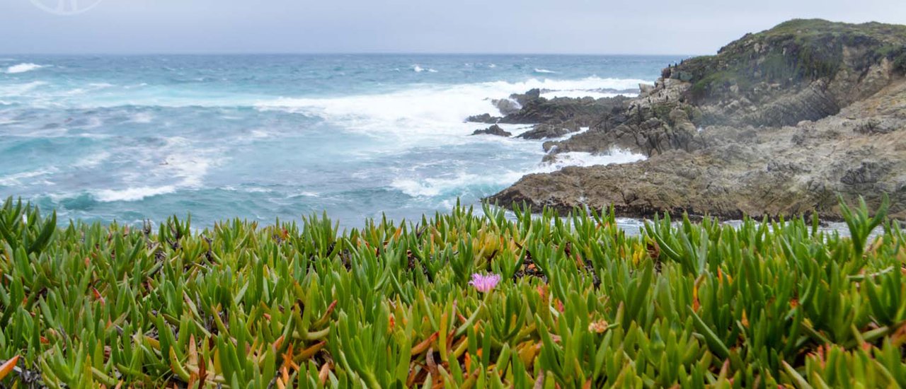
The Pacific Ocean coastal views along the road we're taking would probably fit the topic "Same place, but never the same" which coincidentally happens to be the current dramatic mood. 555 Because the view we see each day might be completely different. Sometimes we have to cross our fingers and hope that the fog won't obscure everything and prevent us from seeing anything, like going to San Francisco and not being able to see the Golden Gate Bridge, or going to Japan and not being able to see Mount Fuji. When we were planning, we were worried because it had been raining almost every day throughout December. But luckily, the sky was clear and there was no rain when we arrived.
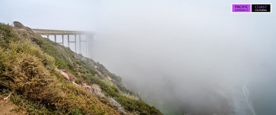
On a foggy day

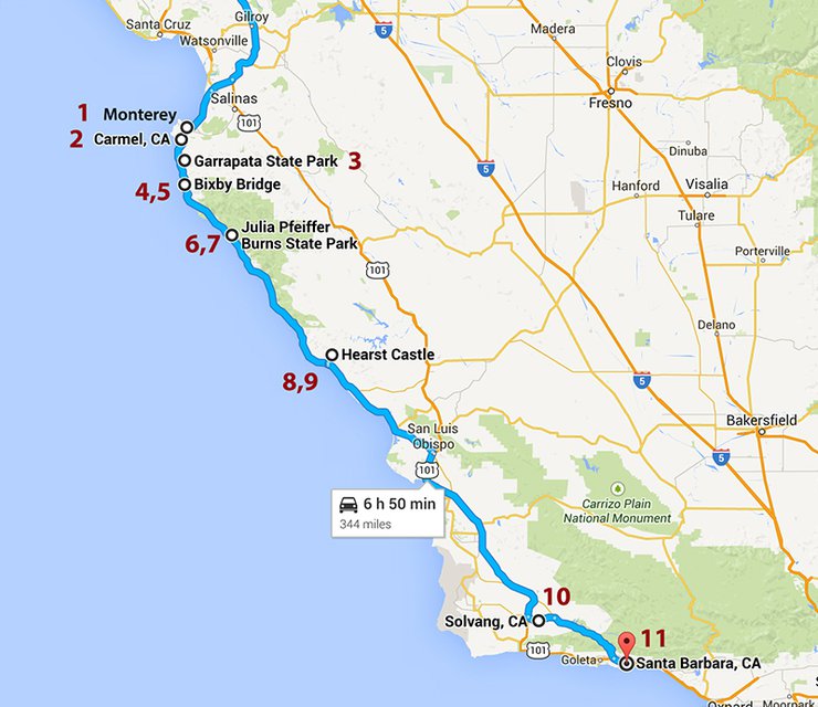
Highway 1 stretches from Orange County south of Los Angeles all the way up to US Highway 101 near Mendocino County. However, the scenic route that is most famous runs from Carmel to San Luis Obispo. This time, we will be visiting the Monterey Bay Area, Big Sur, the town of Solvang, and Santa Barbara. The total distance from San Francisco to Santa Barbara is approximately 350 miles (one-way). On the way back, we will take US Highway 101, which is about 50 miles shorter and takes about an hour less to drive.

This review does not cover all the viewpoints, as I did not visit every single one. I will only talk about the important ones and the ones I have been to. For a more detailed review, please refer to my idol's travel blog at the following link: http://pantip.com/topic/32138581
This road is not only known for its beauty, but also for being a relatively dangerous road. This is probably because it is a two-lane road, and some sections, especially between Big Sur and San Luis Obispo, may have a lot of curves and some sections are close to the edge of a cliff (but there are fences). However, it is not really difficult to drive and there are not many cars because it is not a main road (but you may need to prepare some motion sickness medication).
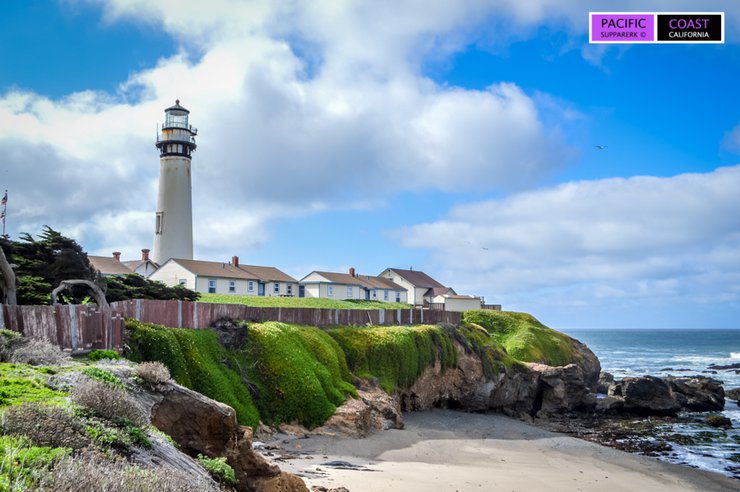
If you're starting your journey from San Francisco, you can access Highway 1 from Half Moon Bay or Santa Cruz, both popular vacation spots. You'll pass Pigeon Point Lighthouse, a renowned photo stop and scenic viewpoint in the area. However, we'll skip this stop to save time and avoid unnecessary detours, as the ocean views aren't significantly better than our upcoming destinations. Instead, we'll head straight down to Monterey.
Pigeon Point Lighthouse where I stopped by last time (taken in July 2014)

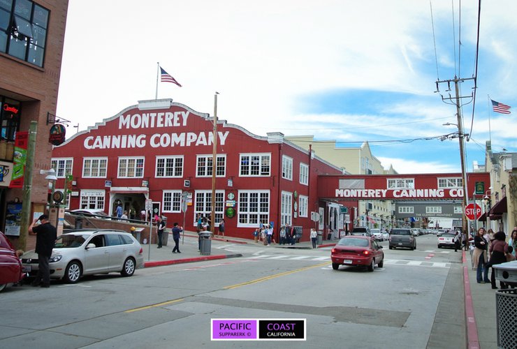
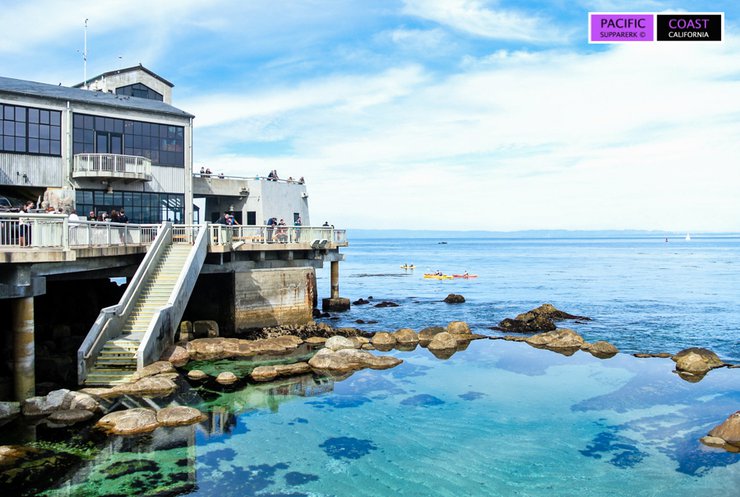
After driving for almost 2 hours, we arrived in Monterey (point 1 on the map above). Monterey is a small town located south of Monterey Bay. The main attractions here are Fisherman's Wharf and Monterey Bay Aquarium. At Fisherman's Wharf, one of the activities is whale watching, which I haven't tried yet. The Aquarium is very famous in this area, but the entrance fee is quite expensive, around $39.


This is a picture from a previous trip, as this time we didn't go in. This was because we planned to go down to Mcway Falls before dark.

Even if you don't visit or do any activities, this is a great place to stop for lunch, as there are quite a few restaurants, and you can take a walk and enjoy the sea view.


Not long after driving from Monterey, you will reach a small town called Carmel-By-The-Sea, or simply Carmel (point 2 on the map above).
Located in Monterey County, this is another great place to take a stroll through town. There are plenty of cute little shops, a decent number of restaurants, and the beach is a popular spot for relaxation and swimming. However, the waves can be quite strong, especially in the winter, and there are rocks in some areas, making water activities less common than in Santa Cruz. This city is known as another dog-friendly city, so you'll see people walking their dogs all over the beach. It's hard not to smile when you see it.


Between Monterey and Carmel, there is a scenic road called 17-Mile Drive, which runs in a loop along Pebble Beach and Pacific Grove. For those who don't have time to drive further, you can stop by to see the Pacific coast view from here. However, there is an entrance fee of around $10. There are several entrances depending on where you are coming from, as shown on the map below.
Map of the 17-mile drive

This time, we drove past here and crossed over to Carmel, then continued down Highway 1. The views to the south are more beautiful.
The picture below is a view from the 17-mile drive, a view that is often seen on postcards.

About 6.7 miles down from Carmel, you'll reach Garrapata State Park (point 3 on the map above). It stretches for about 2 miles along the beach, with scenic overlooks where you can park and walk down to the beach.

In the spring, around March to July, there is a view that photographers love to capture, especially during sunset. This is the angle where you can see rows of Calla Lilies blooming towards the beach (but I'm not sure if they bloom in other months). You can reach this spot by taking the path down to Garrapata Beach (Gate 19) (you'll see a lot of cars parked on the side of the road). After going down the stairs, walk along the beach to the north. You will see a shallow stream flowing into the sea. Walk back up along the stream and you will find it. However, when I visited this time, the tide was high and I couldn't walk any further. Alternatively, you can walk from the top via Gate 18, but the sign is very small.
Calla Lilies (Photo taken in April 2014)

Drive a little further and you will find the Rocky Creek Bridge (point 4,5 on the map above).

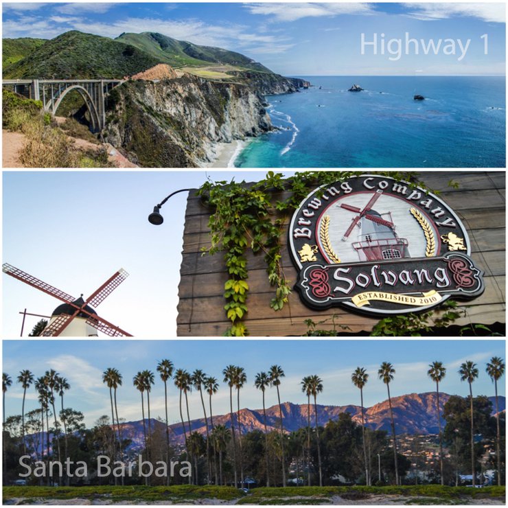
The next bridge you'll encounter is the Bixby Bridge (points 4,5 on the map above), which marks the beginning of Big Sur, approximately 13 miles south of Carmel.

Drive further and there will be a viewpoint to look back at the bridge.

Coming as a couple is also romantic. It's a place where you can create many good memories.


California poppy flowers (April 2014)

Big Sur At first, I was confused about whether it was a city or something else. But according to Wikipedia, it's like an area in the Central Coast that doesn't have clear boundaries, but covers a distance of about 90 miles from the Carmel River down.
From Bixby Bridge, we continued driving down until we reached the entrance to Pfeiffer Beach. Initially, we wanted to skip this spot and come back later to capture the sunset with the sun's rays shining through the rock formations. However, the beach was closed, so we missed our chance. We continued driving to the next sunset viewing point, which was about a 30-minute drive away. This was Julia Pfeiffer State Park (points 6 and 7 on the map above).

This area offers a scenic view of a waterfall cascading down to the beach and into the ocean, known as McWay Falls. Only five waterfalls in North America flow directly into the ocean. You can park inside the park and walk along the waterfall overlook trail, or park along the roadside (be cautious as it is narrow but free) and follow the path down to the viewpoint. Additionally, the park offers various trails and smaller waterfalls to explore.
Waterfall overlook trail Walk from the parking lot in Julia Pfeiffer State Park


At the end of the trail, you will find the remains of the original owner's house.

Waterfall view (taken in April 2014 around 2:00 PM. If you come during the sunset, it will be a bit backlit. The sunset at that time is around 8:00 PM.)

This photo is from a recent trip, taken during the time when the sun was about to set, which happens earlier now that it's winter (around 5:30 PM). In my opinion, it's most beautiful when the sunlight illuminates the cliff face and the waterfall.


From here, we will continue our journey to the accommodation near Hearst Castle (points 8,9 on the map above), which we will visit tomorrow. The accommodation is located in San Simeon, which has a limited number of hotels and restaurants. Most of the restaurants are attached to hotels, so if you go late, the queue will be quite long. However, it is convenient and close to the castle. From this area, if you return to San Francisco, you can take US Highway 101 without having to go back the same way.
Usually, if I have one day to spare, I will come down to this area and then go to the castle the next day and drive back. But if I come in the morning and return in the evening, I usually only come down to Mcway Falls and then return.
The next day, we set off early to visit the elephant seal viewing point (Piedras Blancas Rookery) (points 8,9 on the map above), which is about 10 minutes north of Hearst Castle.

Dad

And the children.


And then hurry down to the castle in time for the castle tour. To visit this castle, you must book a tour to enter. It is divided into three main parts (excluding the evening tour): the Grand Rooms tour, the Upstairs Suites tour, and the Cottages and Kitchen tour. Each tour costs $25 and takes about 45 minutes. For those who are visiting for the first time or only once, it is recommended to choose the Grand Rooms tour as it covers the main highlights of the castle.

Hearst Castle is located in San Simeon on the land of William Randolph Hearst, a newspaper magnate, film producer, and art collector who owned the property from 1919. The castle was designed by architect Julia Morgan. The construction of the castle took a long time because Hearst kept changing the design. When he died in 1951, the castle was still not fully completed. During Hearst's lifetime, the castle was often used for social gatherings of celebrities, politicians, and Hollywood stars. The castle is luxuriously decorated and has over a hundred rooms, including outdoor and indoor swimming pools, tennis courts, and even a small movie theater. The castle is now owned by the state and is open to tourists, as we have come to see. I have been on two tours in total. The first time I came was for the Grand Rooms tour, and the second time (which is this time) I booked the Upstairs Suites tour. I have never been to the Cottages and Kitchen.
To get here, drive and park at the Visitor Center and pick up your ticket. They will have a bus to take you up to the castle on the mountain, which is about 5 miles away.
View of the castle on the top of the mountain from the Visitor center

Bus route from Visitor center to the castle

Outside the castle


The hotel's magnificent swimming pool (Neptune Pool) was closed for repairs both times I visited.

The Grand Rooms tour showcases the main rooms of the house used for entertaining guests and hosting parties. It also includes a short film about the house at the end of the tour. This tour takes place on the lower floor of the house and is accessible to wheelchair users.

Indoor Pool (Roman Bath)

The Upstairs Suites tour will include the bedrooms, library, and study.


Mr. Hearst's bedroom

Library and study room


------------------------------------------------------
From here, we continued driving to the city where we would be staying for the night, Solvang (point 10 on the map above). -- Solvang is a small town located in the Santa Ynez Valley in Santa Barbara County. The buildings and shops are decorated in a cute Danish style, and the windmill is one of the symbols of the city (green dot on the map below). There are not many activities to do in this city, most people just come to walk around, eat, drink wine, and maybe go on to other cities. But we stayed here for one night.

We left Hearst Castle at almost 1 pm and stopped for lunch in San Luis Obispo. By the time we arrived in Solvang, it was almost 4 pm and it was getting dark. However, the town center was not very big, so we took a leisurely stroll and looked at the various shops, which were all very cutely decorated. There were also Christmas lights up at this time of year.


This place is also famous for its bakery.


We are only here for the evening, staying one night and leaving for Santa Barbara tomorrow morning.
---------------------------------------------------------
The next day, we continued driving to the final destination of our trip, the city of Santa Barbara (point 11 on the map above). This is a popular spot for tourists in California, whether it's a stopover or a relaxing getaway by the beach and sea. There are small art museums, zoos, and many restaurants. The city has two main parts: the downtown area and the harbor/beach, both of which are worth exploring.
The downtown area boasts a plethora of shops and restaurants, all adorned with inviting decor and offering a delightful strolling experience. Additionally, there are historic landmarks to explore, as indicated on the map below. For a convenient starting point, begin your walk at number 1, the County Courthouse, which serves as a prominent landmark.
Walking tour: Historic Landmarks (This photo is taken from the review of One Light One Shadow, according to the link in the original post.)

The city center is beautifully decorated with buildings, with mountains as a backdrop in some areas. The whole city is beautiful.


Built in 1929, the County Courthouse boasts a beautiful Spanish-Moorish style interior and exterior. The doors, windows, and tiles are adorned with intricate designs, and the clock tower offers stunning 360-degree views of the city.
Santa Barbara Courthouse


Inside the Courthouse


A view of the city from the clock tower's observation deck.


Another charming spot here is the beach and harbor area, which you can see on the map below. If you walk straight from the main street of the city, State Street, you will come across a dolphin statue, which is the part called Stearns Wharf. There are restaurants and a small aquarium here. It was built over a hundred years ago by John P. Stearns and is also one of the symbols of this place.

The walkway area at Stearns Wharf

If you walk west (on the left side of the map), you will reach Santa Barbara Harbor, a marina with stunning views of the ocean, boats, and mountains in the background. It's truly beautiful.


Leadbetter Beach (the yellow line on the map)

The end of the Santa Barbara Harbor walkway

After this point, we will go to see the sunset at East Beach, a wide beach with few people and relatively fine sand.
East beach (blue line on the map)


In addition to the aforementioned attractions, Santa Barbara offers a variety of other places to visit, including museums and zoos. If you have time, you can stop by and check them out.
We end our journey along the Pacific Ocean coast here. Along the way, there are beautiful coastal views and many stops. It's another place you shouldn't miss if you visit California.
Follow our travel adventures in America and beyond at https://breathemyworld.com
Thank you :)
Breathe-My-World
Friday, September 27, 2024 10:06 AM

