Start
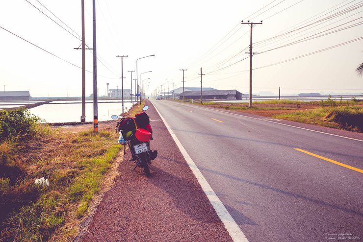
This article is a copy of a post I wrote on my own website, with some minor edits. My main goals are to experience motorcycle travel and take photos (to try selling them as stock photos). I also have an idea for a travel website, and this is part of an experiment to find ways to improve my travels and see if I can actually create the website I envision. (If it seems feasible, I'll definitely need to revamp my website in the future. Right now, it's more of a test to see how well I can turn my experiences and information into a website. I have to admit that I'm not doing very well yet, but I'm still trying.)
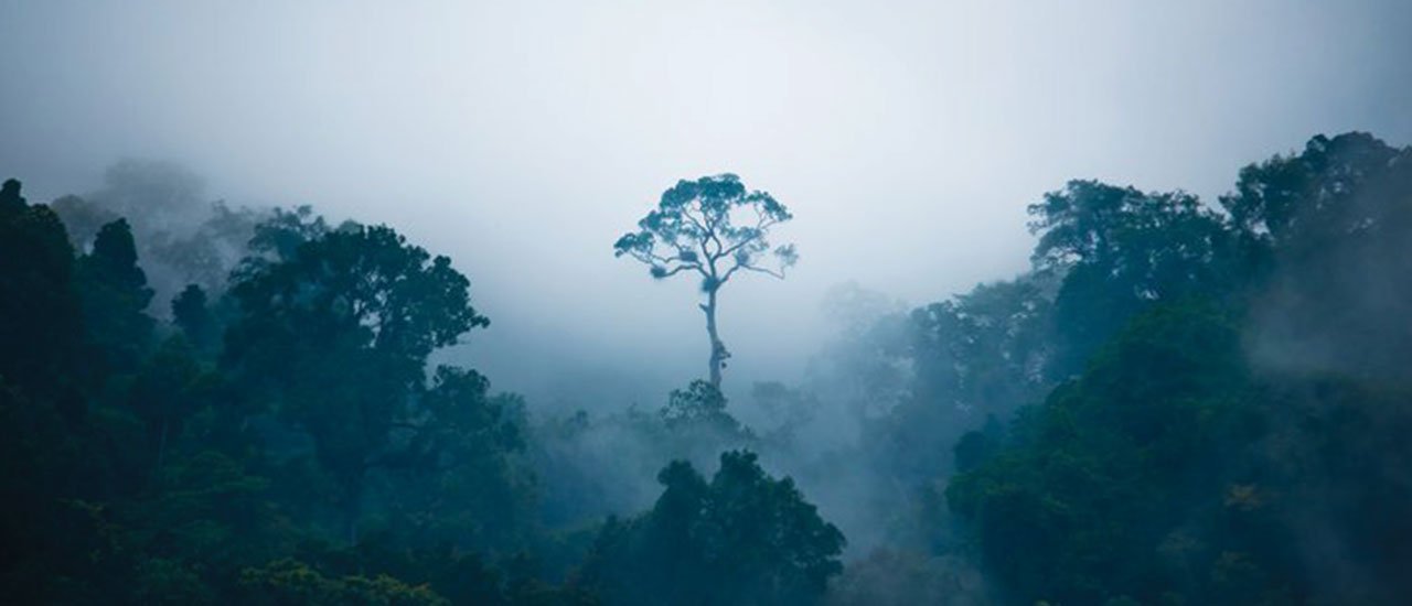
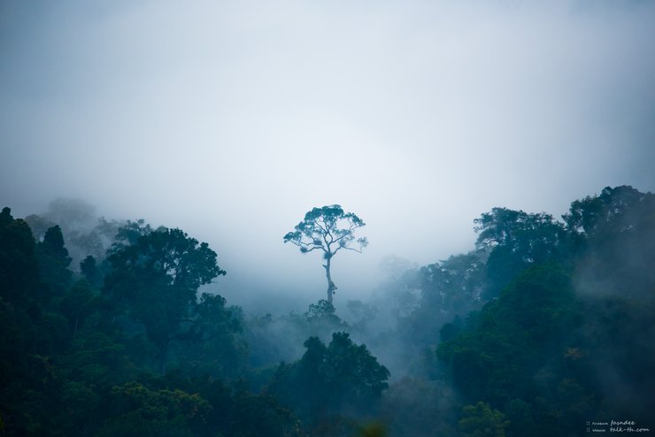
The overlapping mountain ridges veiled by the mist of Khao Pha Nen Thung.
Ranked 20th among Thailand's national parks, Kaeng Krachan National Park may seem far from the top spot. However, considering that there are 148 national parks in Thailand, it is evident that it is a popular destination.
This information did not entice me to travel here to take photos, as I only came to gather information for these articles later. However, the first thing that drew me to this location was...
1. I have seen some previews of the scenery here from Google, and I believe it will not disappoint.
2. It's not far from Bangkok. I wouldn't dare to take my Spark 115i too far without any prior experience camping alone in a tent.
3. I have previously traveled to Phetchaburi to take photographs, which at least gives me some peace of mind knowing that I have some idea of where to go and how to get around.
This is an empty paragraph.
The trip was hastily arranged within hours of the decision being made. The plan was to stay for two nights (although in the end it was only one).
All images are taken by me and I intend to sell them. If anyone wants to use them for personal use, not for profit or any other purpose that generates income, I am happy to let them use them without asking. For other cases, please inquire. Thank you.

Preparation: Be Cautious and Plan Ahead
The goal is to spend two nights camping on the mountain while minimizing expenses as much as possible (my current financial situation is akin to being partially unemployed). Photography is also a priority. Here is the equipment I brought with me. Items marked with "**" are not included in my current gear but are recommended based on past experiences and should be considered for similar situations.
1. Cameras and related equipment
1.1 Nikon D750 camera
1.4 Tamron SP 70-200mm f/2.8 Lens
1.5 ** For birdwatching and wildlife photography, a longer focal length lens, such as 300mm or more, is recommended. However, I do not currently own a lens with this focal length.**
1.6 Tripod legs
1.7 Battery Camera 2 Batteries
1.8 Basic lens cleaning kit
1.9 Battery charging set with Powerbank (The Ben leg does not have a power outlet for you to use, but there are restaurants. I'm not sure if they will let you use the outlet, but the electricity is not designed for constant use anyway. To avoid problems, I use this type of battery charging set.)
1.10 Action Camera Sony AS200VR
1.11 Action Camera Battery
1.12 Other accessories for Action Camera
1.13 A small camera bag that can be carried around and allows for easy access to the camera for on-the-go shooting.
1.14 Large backpack camera bag (very large) can hold 2 main camera sets. However, I removed the shockproof rubber base of the first set and used it to store clothes instead. I also put 2 lenses that were not attached to the camera in the second set, which is located at the top of the backpack. The backpack can also hold many other small items.
2. I only filled the reserve fuel tank halfway because I hang it with a rope. If it is full, it will be too heavy and the rope might break. I need a reserve tank for long trips because my motorcycle's fuel tank is very small. However, I didn't use it at all because there were gas stations along the way. You don't need to bring it, especially if you are riding a motorcycle, because you will have to leave it behind at Khao Pha Nen Thung. If you leave the fuel tank with the motorcycle, loosen the cap a little because it might swell due to the sun. It is unknown whether it will explode, but it is better to be safe than sorry, especially since we will be parked for a long time.
3. Motorcycle lock and helmet: I use a keyless cable lock with a combination dial for convenience and to avoid carrying keys. When parking at a park, I look for a nearby tree or other fixed object to secure the lock to, preventing the motorcycle from being lifted. However, be cautious of dry trees, as falling branches could damage the vehicle.
4. Emergency repair equipment: I didn't bring any, and I don't know how to use it. I'm very afraid of car problems or flat tires on the road. I want to upgrade to a new, more powerful car (I'm looking at the M-Slaz) and I also want tubeless tires because they're easier to manage when they get punctured.
5. Personal clothing and belongings
5.1 A thick long-sleeved shirt, as it can get cold on the mountain at night.
5.2 One short-sleeved shirt. I use it for two nights so that I have a short-sleeved shirt to change and keep the long-sleeved shirt to sleep in. The long-sleeved shirt will not get dirty.
5.3 Long pants, 1 pair. The reason is the same as in point 1.
5.4 Shorts 1 piece This is actually just for casual wear, but I actually recommend long pants.
5.5 Clothing
For my attire, I opted for a short-sleeved shirt and long pants, layering a long-sleeved denim jacket on top. This choice aligns with the recommendation to wear protective clothing when riding a motorcycle. Notably, I wore the same denim jacket the following day during the daytime, while reserving another long-sleeved shirt for nighttime wear.
5.6 Bring soap, toothbrush, and toothpaste with you so you don't have to buy them. Unless you don't want to shower or brush your teeth, it's up to you.
- Bedding
6.1 Sleeping bags provide significant comfort due to their warmth and thickness, mitigating the discomfort of sleeping on hard ground in a tent.
6.2 Quick-drying fabric, which I use in a fairly large size, serves as a towel, a pillow, a blindfold, and a scarf to protect against morning dew and cold.
6.3 ** (If you are easily cold, I recommend bringing an extra blanket, as the temperature on the mountain can be very cold at night. It's better to carry a little extra weight and sleep comfortably, so you can wake up feeling refreshed in the morning.)
7. Tent
7.1 The tent, which should have a flysheet to prevent condensation and, of course, in case of rain. Your tent must be at least somewhat waterproof.
A 7.2 footprint can be used under your tent to prevent it from getting dirty, especially if you're dancing on it. It can also be placed inside the tent during heavy rain or dew to prevent water from entering. Even if your tent is already waterproof, using a footprint underneath and extending it beyond the tent entrance creates a clean and dry area for activities like relaxing, eating, or preparing gear. This eliminates the need to stay inside the tent or risk making it dirty.
- Kitchenware (There are actually restaurants that sell food, water, and coffee. You don't have to prepare it yourself.)
8.1 Field kitchen + pan + plate + spoon + cup It comes as a set.
8.2 My stove is a small stove, smaller than a hand span, foldable and expandable base.
8.3 Canned gas is used with the stove. It is a stove that is used together like this.
8.4 Instant noodles, canned fish, and instant Ovaltine. You can bring whatever you want to eat, but I'm only bringing these.
8.5 ** (Bring your own dishwashing sponge and detergent. There is a water tap outside the bathroom on the mountain for washing dishes.)
8.6 Plastic shopping bags, the kind you get from 7-Eleven. I will have one large bag to hold food and other non-heavy bags hanging from the handlebars. I will have four bags in total: a large bag, a bag for sandals (which I will use to store my sneakers at night because if I leave my shoes outside the tent they will get wet from the dew), a garbage bag, and another bag for anything else I might need.
9. Paper map: Even though I always use my phone for navigation, I still need to have a backup and study the map on Google Maps roughly (or even in detail). In fact, if you are traveling long distances, you should memorize the road numbers or locations on the map where you are going. In case your phone is unreliable, you won't get lost, especially when traveling at night when you can't find anyone to ask for directions.
10. I carry a 16,000 mAh power bank, which is connected to a motorcycle-mounted charger that draws power from the motorcycle's battery. This eliminates my reliance on household electricity.
- Portable LED Light: This USB-powered light can be plugged into a power bank and used as a tent light. It's flexible and can be bent to hang inside the tent or used as a flashlight. However, it's not as powerful as a dedicated flashlight and doesn't project a focused beam.
Additional Notes:
- The original text mentions a "Jump Starter," which is a device that can jump-start a car or motorcycle battery. The writer considers buying one but decides against it because they don't go hiking at night. However, they acknowledge that it might be useful for hiking before sunrise to reach a viewpoint.
12. I have a small, detachable-blade fan with a USB connector that can be plugged into a power bank. This is useful in case I sweat from doing something and then need to go into a tent. If it's the season or a tourist spot where the weather isn't cool enough, you'll be hot and uncomfortable sleeping. The fan can blow dry the sweat before you go to sleep, making you feel much more comfortable. It's small, detachable, and convenient.
13. Others
13.1 I use my headphones to listen to navigation instructions from my phone, and my Moto 360 watch displays the navigation route. When the route involves turns on bridges or similar situations, simply listening to the navigation instructions is not clear enough, so I don't have to take out my phone.
13.2 Sunglasses, I brought them just in case, but I didn't end up using them.
13.3 ** Hats: I recommend hats with brims. In addition to sun protection, the brim can also protect your face from branches and blades of grass that may flick up when you're riding or walking. A brim can help mitigate the impact of such objects. However, I haven't purchased one yet because I haven't found one that I like.
13.4 ** Knit hats are great for sleeping in, especially the ones that cover your entire head like a bank robber's mask. This is because they keep your head and face warm, which is especially helpful for people who get cold easily. In the morning, you can roll it up to cover half your head to protect yourself from the morning dew.
13.5 A compass or directional device. I don't think you'll get lost in the forest, but if you're going hiking, you should have one. Personally, I use my phone to check the direction of the sunrise and sunset for photography.
13.6 I carry three micro USB to standard USB charging cables, two long and one short, to charge all my devices with a power bank.
13.7 Pain relievers and medications for chronic conditions. If you have a chronic condition, do not forget to take your medication.
13.8 I wanted to bring my notebook with me so I could process the photos right after taking them while the inspiration was still fresh. However, the battery on my notebook at home is dead, so I couldn't bring it. I've been wanting to buy a new one, but I'm putting it off for now. -*- It's important, but right now I want a new motorcycle. I'm interested in the Yamaha M-Slaz because it's powerful, reliable, and has good specs for the price. But I also like the Keeway Superlight 200 because I fell in love with its design as soon as I saw it. However, I've never bought a Chinese motorcycle before, and I'd have to learn how to maintain it, which I don't know anything about. Even though many people I've talked to who own one say it's fine and they haven't had any major problems, even when riding uphill or on rough terrain.

Preparation: Be aware (continued)
There are restaurants and cafes on the mountain. There are two restrooms with approximately 20 toilets, 10 for men and 10 for women. There are also 5 shower rooms with showerheads. In front of the restrooms, there are sinks for washing your face and dishes.
The campsite on Khao Pha Nen Thung can accommodate approximately 30-50 tents, based on my observations.
As night falls on the mountain, a generator will be used to provide lighting, but it won't be overly bright. The lights will be turned off late at night. It is recommended that you take a shower in the early evening and complete any necessary tasks before the lights are turned off or before nightfall. Be prepared if you need to engage in activities during the night, as you should prepare before dark to avoid any inconvenience when it gets dark and visibility is limited.
Mobile phone signals are generally unreliable in that area. While one source mentioned that AIS occasionally works due to a temporary signal booster near the center tent, its functionality is inconsistent. True, on the other hand, is unlikely to function at all. Therefore, it is advisable to carry an AIS SIM card as a backup, especially considering your phone's dual SIM capability. Both AIS and True offer relatively wide coverage, unlike DTAC, which has a significantly narrower range, particularly in mountainous regions.
There are no mosquitoes up here. I haven't stayed in the forest like this for a long time. I asked the elder, and he said it might be because it's cold or because we're at a high altitude. But at night, there will be moths coming out to feed. You should close the garbage bag or put the garbage in a box to prevent the smell from attracting wild animals to rummage through the garbage. Be responsible for the forest. We are visiting their home, so let's not disrupt their natural way of life.
Musical instruments, speakers, and alcohol: Please refrain from bringing these items. While playing musical instruments when no other tourists are present may be acceptable, doing so when there are many other tourists could be disruptive to those who have different preferences.

Journey to the End of the Mist

Normally, I would use my mobile phone to record my travel route and mark it on Google Maps as a rough guide. However, this time I noticed that the mobile phone signal was lost as soon as I entered the park area, so I did not test the recording of the travel coordinates at all (which later felt like, even if the mobile phone signal was not available, the GPS was still working and the app was still recording the location, the app I used is called My Tracks).[Spoil] Click to view the hidden messagehttps://play.google.com/store/apps/details?id=com.google.android.maps.mytracks&hl=th
The map linked above shows three designated destinations:
1. Kaeng Krachan National Park Headquarters
2. Sam Yot Checkpoint (marked on the map as Kaeng Krachan Protection Unit, K. 2)
3. Baan Grang Camp
The question is whether Ban Krang Camp is the same as Khao Phanein Thung. The answer is no, but the reason I only marked this location is because after Ban Krang Camp, it becomes a one-way road with a time limit. If you continue driving along the road, you will eventually reach Khao Phanein Thung. However, there are three points at this location that you should be aware of.
Kaeng Krachan National Park Headquarters
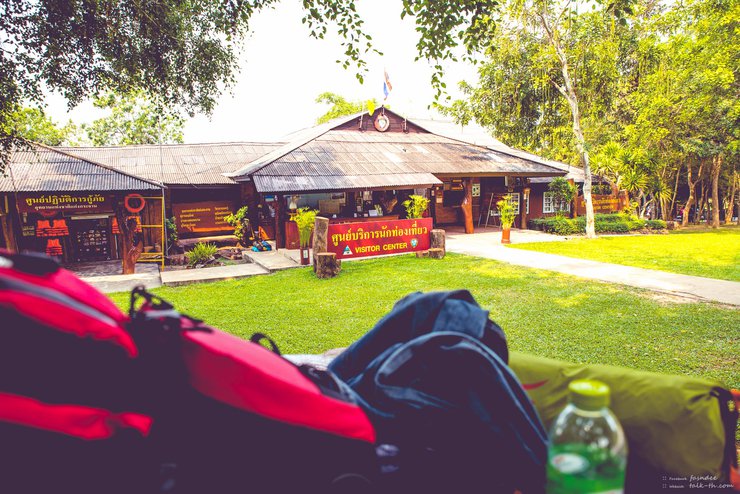
Located next to the Kaeng Krachan Dam reservoir, this site is accessible via Route 3432. Zooming in on the map, you'll find a "Tourist Service Center" adjacent to the park headquarters. This is where you can purchase entrance tickets to Kaeng Krachan National Park and set up your tent for camping right by the dam. Restrooms and restaurants are conveniently located nearby.
This location offers electricity, water, and True mobile phone signal (I'm unsure about other providers, as I only have a True SIM card). The roads are in good condition. If you tire of the dining options within the service center, you can ride to the area near the dam entrance, where you'll find a variety of restaurants. However, my primary objective for this visit was Mount Phanom Thung, and this location served merely as a stopover to purchase an entry pass.
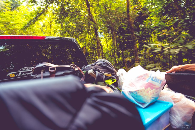
However, I had read beforehand that motorcycles were not allowed on the Pha Nen Thung, so I parked my car here. I locked the car, helmet, and spare fuel tank (loosened the fuel tank cap slightly to prevent the tank from swelling if exposed to the sun). There is a parking lot here, and motorcycle parking is prepared separately. There is no roof to protect from the sun and rain, but there are some trees that provide shade in some areas.
The provided text is empty. There is nothing to translate.

Khao Sam Yot Checkpoint
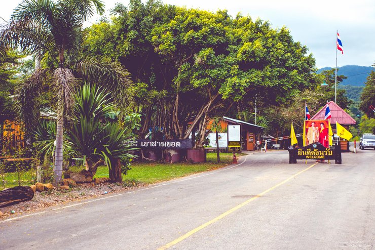
The map will indicate "Kaeng Krachan Unit 2", where you can actually purchase tickets to enter the national park. You can ride your motorbike directly to this point, which is the last accessible point for motorbikes. At this point, your pass will be checked before you are allowed to continue your journey.
After passing the checkpoint, you will encounter several tree tunnels. If you are traveling in a pickup truck hired from a local, you may be able to ask them to stop for photos. The road in this area is in good condition and wide enough for two-way traffic. You may also spot wild monkeys foraging near the road. On my return trip, I encountered a whole troop of them.

Baan Krarng Camp
This is an empty paragraph.
The final checkpoint marks the end of the good road. Brace yourself for a bumpy ride after this point, as the road becomes riddled with potholes, steep inclines, and sheer drops that will leave your backside sore from the constant jolting.
This checkpoint features a butterfly photography spot known as the Butterfly Garden, as well as a designated camping area. Vehicles are only permitted to pass through this checkpoint at specific times established by the national park authorities.
The ascent to Pha Nen Thung Mountain is permitted only during two time slots: 5:30 AM – 7:30 AM and 1:00 PM – 3:00 PM. This restriction is in place due to the narrow, rough, and steep nature of the road beyond the starting point, which makes it unsafe for oncoming traffic.
The descent will also have two time slots: 09:00 - 10:00 / 16:00 - 17:00.
My guide, who frequently visits this location, advised me to arrive before 5:00 AM if I wanted to find tourists to share a pickup truck with. This is because some tourist groups choose to spend the night here before beginning their ascent at 5:30 AM. As a result, finding travel companions is simple. Although I haven't personally tried this method, I believe it would be preferable to waiting at the visitor center below, where I waited for three hours.

Journey to the End of the Mist (Continued)
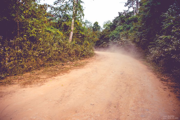
My brother told me that cars used to be able to drive up here, but whether they could handle it is another story. Now, I see a sign that says cars are prohibited. Vans are also prohibited, only pickup trucks are allowed. From what I've seen, I think it's for the best. The road is incredibly rough, with some potholes deeper than half an arm's length, and there are a lot of them. It seems like the road was built, but then it was completely destroyed, probably by flash floods. Sometimes I think a gravel road or a dirt road would be better. When the concrete road is damaged, some small parts are still intact, but when it breaks, it creates potholes and sand, causing the wheels of some cars to spin freely. The road is also steep and close to cliffs, so driving requires caution, especially when going downhill. It's very dangerous if you're not experienced.
From the Khao Sam Yot checkpoint to this point, the mobile phone signal for both True and AIS has been intermittent.
This stretch of road is dusty, so it's advisable to wear a mask and eye protection to avoid inhaling dust and getting hit by twigs. As the road ascends, you may experience ear discomfort due to the change in altitude. To alleviate this, you can chew something or move your jaw. Alternatively, you can follow the lead of my companion and stop briefly on a flat section to allow your body to adjust.
Along the way, you will encounter three streams, which are not far from Ban Krang Camp. You can walk to take pictures here if you come from Ban Krang Camp. The stream does not have much water, so it is not difficult to drive through.
Let's take a look at some pictures along the way. I should warn you that the pictures of the gravel road are for children, as some sections are much worse than this.

This gravel road may seem easy for children, but it is actually quite challenging. Some sections are curved and have a steep incline of almost 45 degrees. The road is in very poor condition, as it was built and likely eroded by water, making it even more difficult to navigate than a typical gravel road.
The photos I took of the rough road are unusable. The car was bouncing so much that the photos are blurry. However, I have a video from an action camera that I haven't checked yet. If the video is usable, I will share it with you.
The image below depicts a tree tunnel located between the Sam Yot checkpoint and Ban Krang Camp. Occasionally, troops of monkeys can be observed foraging in this area.


After leaving Ban Krang Camp, you will encounter three streams. The water level is not high, but it may rise during the rainy season. However, the park is usually closed during the rainy season. During the dry season, many butterflies gather near the streams to feed on minerals.

As the road ascends, trees encroach upon it, leaving only a narrow passage. Beware of stray branches that may whip across your path.

The view now consists of dense, overgrown forest with occasional large bamboo trees. The road becomes increasingly steep and deteriorates significantly.

Welcome to Pha Nen Thung.

The road conditions at the checkpoint, which indicated our arrival at Pha Nen Thung, were not as bad as the roads we had traveled on earlier.
Upon arrival at approximately 4 pm, I unloaded my belongings and promptly set up my tent. Delaying this task until nightfall would have significantly hindered progress due to limited visibility. Fortunately, the designated camping area was conveniently located near the parking lot, minimizing the need for extensive荷物搬运。
This location offers two restrooms equipped with showers and sinks for washing hands and dishes. There is a restaurant and coffee available for purchase. Mobile phone signal from AIS is intermittent. Staff are present on-site. Electricity is generated to provide lighting in specific areas during the early evening hours, but is switched off later at night (likely around 10 pm).

Let us know when we arrive at Pha Nen Thung.

The sign at the entrance clearly indicates the boarding and alighting times.
A short walk away, there is a spacious viewpoint visible from the camping area. The view offers a panorama of rolling hills. However, using a wide-angle lens may capture the foreground trees. It might be necessary to take close-up shots of specific points. This expansive viewpoint, encompassing both the camping area and the scenic vista, is known as Kilometer 30.
Despite the challenging road leading up, the summit offers cool weather and sufficient amenities for a comfortable stay amidst nature. However, careful planning is crucial, as the descent time is limited as mentioned earlier. Choose your descent time wisely.

Located on the Phaneun Thung hill, this restaurant is not only close to a camping area but also within walking distance of restrooms and a scenic viewpoint known as "Kilometer 30 Viewpoint".
There is no text to translate in the provided HTML code. Please provide the text you want me to translate from Thai to English.
Besides the viewpoint at Km 30, there is another viewpoint at Km 36, which offers unobstructed views for photography. However, it requires driving a bit further. There are also waterfalls in the area (which I didn't visit). It seems there are quite a few scenic spots and waterfalls, but I didn't inquire about the details or visit any of them because I had to leave with my companions the next day. Although I would have liked to stay for two nights, I thought it was okay since this was just a preliminary visit. I didn't expect all the photos I took to be usable, so I figured I would have to come back and take more.
At night, if we are quiet enough, we may see wild animals walking around the campsite. However, I did not see any. I slept in the tent feeling cold because I forgot to close the flysheet, so it was full of dew.
Waking up to cloudy weather, I was unable to capture the sunrise from the viewpoint at Km 30. The trees in the foreground would have obstructed the view anyway. I met another visitor and his sister during the night, and we had a long conversation. He offered to take me to another viewpoint for sunrise, but I declined. Instead, I hitched a ride with another visitor who took me to the viewpoint at Km 36 in the morning. The reward was stunning: moving mist over the mountains. It's important to note that camping is not permitted at the Km 36 viewpoint.

Upon arriving at the entrance of Pha Nen Thung checkpoint in the morning, you will be greeted by a thick blanket of fog. On some days, if the wind conditions are favorable, you will witness both the fog and the mist moving distinctly, creating a breathtaking spectacle.
The morning mist at the campsite (km 30) was quite thick, giving the impression of being in a foggy city. It was beautiful, but I didn't think much of it, just that the mist was a bit thick. However, as the morning progressed, the mist began to form streaks, with a slight breeze blowing. The movement of the mist was clearly visible, and I must say it was incredibly beautiful. If I had recorded a video, it would have been stunning. The movement of the mist was perfect. I would say that day was the most beautiful day of moving mist I had ever seen. But then again, this was the first time I had ever seen mist like this. I have only recently started traveling.

After passing the shop, you will find a path leading up and down. The upward path leads to a spacious viewpoint, and in the picture, you will see the building on the upward path, which is the restroom.

The ascent to the viewpoint at Km 30 is not very steep, with only a short flight of stairs to climb.

The image depicts a vast plain, though its true extent is not fully captured.

The background view is a series of alternating mountains. If you come in the morning, there will be many tourists taking pictures because the fog will be thicker. If you come and the fog is too thick, wait a little longer and the fog will decrease. It will be just right.


The six images above were taken in the late afternoon after I finished setting up my tent, around 4:30 PM.
The following images were taken the next morning, including photos taken at Km 30 and the next viewpoint, which requires a further drive and is called the Km 36 viewpoint.


After returning from the viewpoint at Km 36, I had to hurry back because if I was late after 10 am, I wouldn't be able to go down the mountain. I had to wait until the evening. The person who gave me a ride up the mountain had to go down early because his uncle who came with him had business to attend to. I asked to go down with him. He was kind enough to take me to lunch. I have to thank him very much because he took me up, gave me breakfast to eat on the mountain, took me sightseeing, took me down, and even treated me to lunch after we got down. Thank you very much.
Despite encountering unpleasant experiences during the trip, such as noisy and unruly tourists, discarded trash, and a large bird resembling an eagle that startled us, there were also heartwarming moments that linger in my memory. One such instance involved a friendly encounter with a foreign driver. As we were driving, we noticed a large bird perched on a tree, possibly an eagle. We pointed it out to the driver, who stopped his car and exclaimed "bird, bird!" with a smile. He then thanked us and continued driving. Though a small gesture, it left a positive impression. Another memorable encounter was a brief conversation with a man who was visiting with his sister. He possessed a deep understanding of spiritual principles, and we engaged in a lengthy discussion. While I regret not exchanging contact information, I also recognize the need to overcome my tendency towards solitude. Additionally, I am grateful for the kindness of a soldier who offered me a ride up and down the mountain and treated me to a meal. He was visiting with his family, and I took a picture of him, which I sent to him via Line. Before parting ways, he extended an invitation for me to join him on future trips.
I still have tasks to return to here, but when that will be is another matter. For now, I will take my leave and share some of the scenic photos I captured during my visit.
เดินทางตามฝัน
Friday, September 27, 2024 10:22 AM

