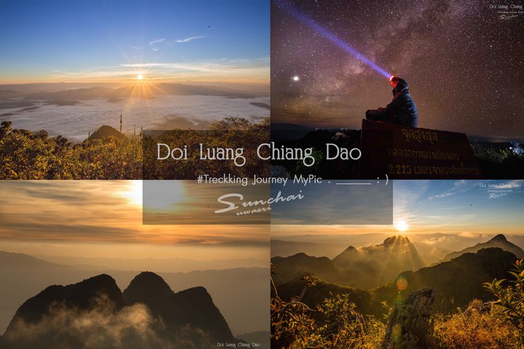

**Doi Luang Chiang Dao #trekking Journey My picture.____ : )**
Hello everyone, brothers and sisters. From 21st to 23rd November 2016, I had the opportunity to go hiking up Doi Luang Chiang Dao, located in the Doi Chiang Dao Wildlife Sanctuary, Chiang Dao District, Chiang Mai Province. From this trip, I felt that it was very worthwhile to hike up the mountain this time. Because I saw the beautiful and magnificent nature, it was very beautiful. Compared to many other mountains, in my personal opinion, I consider Doi Luang Chiang Dao to be the most beautiful natural place in Thailand.
A Brief History of Doi Luang Chiang Dao
Doi Luang Chiang Dao is the third highest mountain in Thailand, after Doi Inthanon and Doi Pha Hom Pok. It is located in Chiang Dao District, Chiang Mai Province, and has an elevation of 2,275 meters above sea level. The climate is cool almost all year round, but in the winter it is very cold, with temperatures dropping to 5-10 degrees Celsius or even lower, sometimes even causing frost. Visitors to Doi Luang Chiang Dao can find a variety of plants and flowers that are not found anywhere else, as they are endemic to the area. If you are lucky, you may also see the serow, a mammal that is native to Doi Luang Chiang Dao.
Contact and Permission for Doi Luang Chiang Dao
Conditions:
The Chea Chiang Dao Wildlife Sanctuary is open to tourists for five months each year, from November 1st to March 31st.
This trip is recommended to take 3 days and 2 nights to avoid fatigue and fully explore the surrounding scenery.
- Reservations must be made at least 15 days in advance. The park limits the number of visitors to 150 per day.
- One guide must be booked in advance.
- A pickup truck is required to transport the group to the starting point of the trek (1 truck can accommodate approximately 10 people, including the guide and porters).
- Porters are available for hire at the park, but it is advisable to book them in advance as there are no porters waiting at the park headquarters.
- There is a garbage deposit. If you go up and do not bring down all the garbage you used, money will be deducted.
**Contact number for the park: 081 111 6203**
Travel Methods
- Private vehicles can be driven to the park for parking.
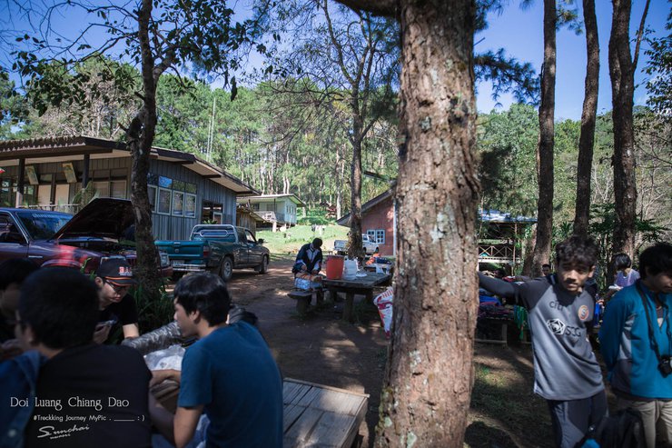
- If you arrive in Chiang Mai by tour bus, take the Chiang Mai - Tha Ton bus (40 baht) or the Chiang Mai - Fang van (150 baht). Buses depart every 40 minutes to 1 hour and the journey takes approximately 1.5 hours. Before you go, arrange for the pickup truck you booked from the park to pick you up and tell the driver to stop at Lotus Chiang Dao. The park staff will then pick you up at the meeting point. Once you arrive at this point, you can buy food and supplies as there are very few options inside.
Visitors are advised to arrive at the park no later than 9-10 am, as the journey to the starting point of the hike can take up to 2 hours. This could result in starting the hike around noon or afternoon, potentially reaching the campsite after dark and missing the sunset.
Main Expenses - Personal Items - Living Expenses
- Transportation costs are at your own expense.
- Guide fee: 550 baht per day (3 days 2 nights = 1,650)
- Porters are paid 450 baht per day and can carry up to 20 kilograms, with some flexibility. The number of porters needed depends on individual preferences. (3 days and 2 nights = 1,350 baht)
- The cost of a pickup truck to pick up and drop off at the starting point will be 2 ways.
- The cost of a car ride up to the top of the mountain is 1,200 baht.
The estimated travel time is approximately 2 hours, covering a distance of 8.5 kilometers on foot. This route is recommended as it is relatively easy and not too steep.
- Up to Pang Wua 600 baht
The estimated travel time is approximately 40 minutes. The walking distance is 6.5 kilometers (shorter but quite steep, with very little flat ground).
- Waste deposit fee of 300 baht per group.
- Park entrance fee: 40 baht per person.
- Tent pitching fee is 30 baht per tent. (Please note that the park does not provide tents or bedding for rent. You must bring your own.)
************Go in a group and split the cost, it's easy on the wallet*************
Food and Eating
This passage describes the logistical challenges of a three-day, two-night camping trip where participants must provide all their own supplies. Key points include:
- Self-sufficiency: Participants are responsible for bringing everything they need, including food, water, and shelter.
- Limited cooking options: Open fires are prohibited, and only portable gas stoves are allowed.
- Water considerations: Careful water planning is crucial, with a minimum of one large bottle per person per day. Excess weight can be offloaded to porters.
- Lack of amenities: There are no showers or flushing toilets, only pit latrines.
Note: The informal tone and colloquialisms of the original text have been replaced with a more formal academic style.
Personal Belongings
- If you are visiting during the winter season, it is advisable to bring thick and warm clothing, as the weather can be quite cold.
- Gloves-feet (essential when sleeping in cold air to the bone)
- Sleeping bag (optional)
- Wet wipes (for cleaning the body instead of bathing)
- A headlamp is highly recommended as it will be quite dark when ascending and descending during sunrise and sunset. Additionally, both hands may be needed to grip rocks or branches.
**Note:** If you do not have friends or have a small group, you can search for tour trips. They will charge per person and arrange food, accommodation, and transportation for you.
If you have any questions or need further information, please feel free to ask me.
https://www.facebook.com/Bekimsz
**Day 1, 2:00 PM: Journey commences.**


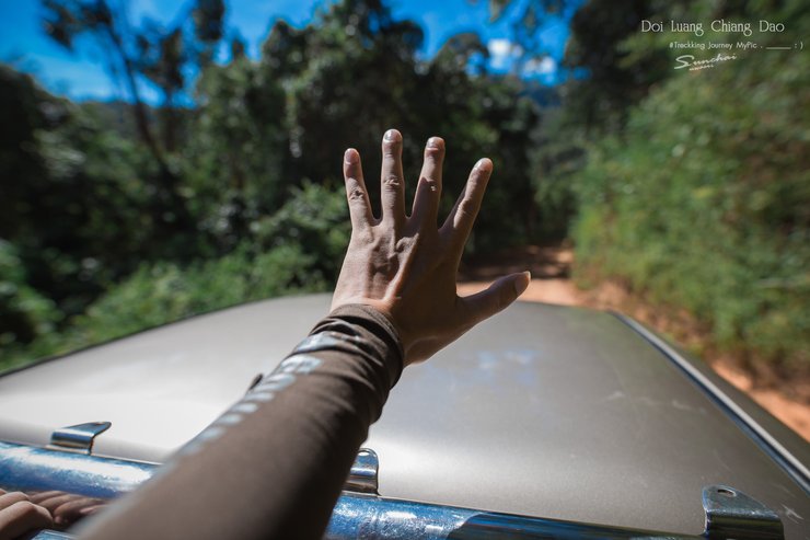
After obtaining permission to climb Doi Luang from the National Park Office, our team set off for the starting point at Den Ya Khat. The journey took almost 2 hours by pickup truck, covering a distance of 30 kilometers. The road was rough and steep, mostly gravel, and by the time we reached the starting point, our stomachs were churning.


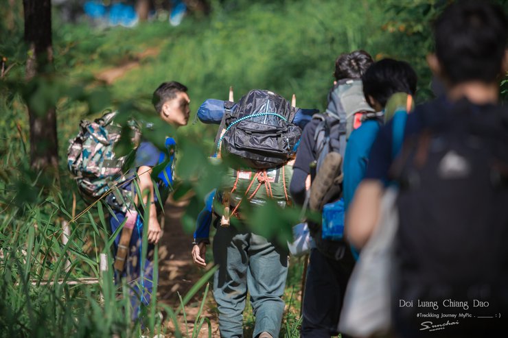
After arriving at the office, we took a break for lunch and prepared to set off. We arrived at 1:30 PM and started walking at 2:00 PM, which was very late. The officials almost didn't let us go because they were afraid we wouldn't make it back before dark. However, we assured them that we were experienced hikers and had done many trails before. They finally allowed us to go, as they knew we would have someone to guide us. Don't forget to bring a small bottle of water (1-2 bottles) to sip on along the way, or snacks to keep you going if you get hungry.
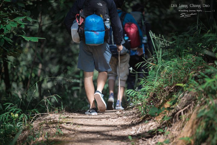
The trail is easy to navigate, with mostly flat terrain and gentle slopes. The grassy path provides good traction, making the hike comfortable. The stunning views along the way are truly breathtaking.


Strolling along, I didn't take many photos as I was pressed for time and worried about arriving in the dark.


The weather was not too hot, and it became even cooler and more refreshing as we walked into the forest. We took breaks when we were tired and took photos along the way.


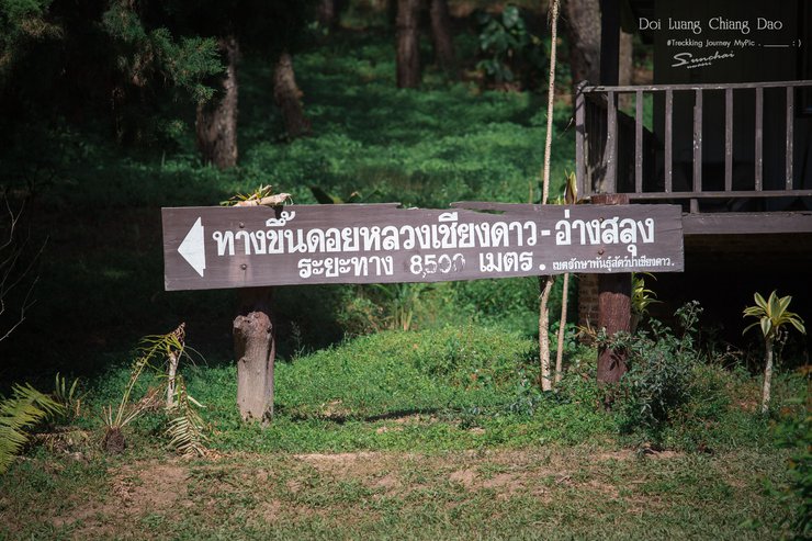
Upon reaching this sign, you will have covered approximately half of the journey (educated guess). This three-way junction marks the convergence of the ascending and descending paths from Pang Wa.


After walking about halfway, the scenery on both sides of the road gradually became more beautiful. It was surrounded by valleys, which were very beautiful.
Note: This set of images was taken during the descent.


6:30 p.m.
And we were the last group to arrive at the Ang Slung tent site.
The weather at that time was quite windy and the cold was biting.
As dusk settled, the stars began to emerge. We couldn't wait, so we snapped some photos before retiring to our tents.
I also saw an elephant. Hehe.


Day 2, 3:30 AM
The cold weather penetrated the tent, making it difficult to sleep.
It is recommended to bring your own sleeping bag for a comfortable night's sleep.
Woke up at 3 am and saw the moonlight shining in, so I took a picture.


4:00 AM
After completing personal tasks, prepare to hike to the top of Kiew Lom to watch the sunrise. It takes about 30-40 minutes to reach the summit, which has two viewpoints: Kiew Lom North and Kiew Lom South.
Most people tend to go to Kiew Lom Tai to watch the sunrise because it has more space to stand and there are several viewpoints, although it is slightly higher.
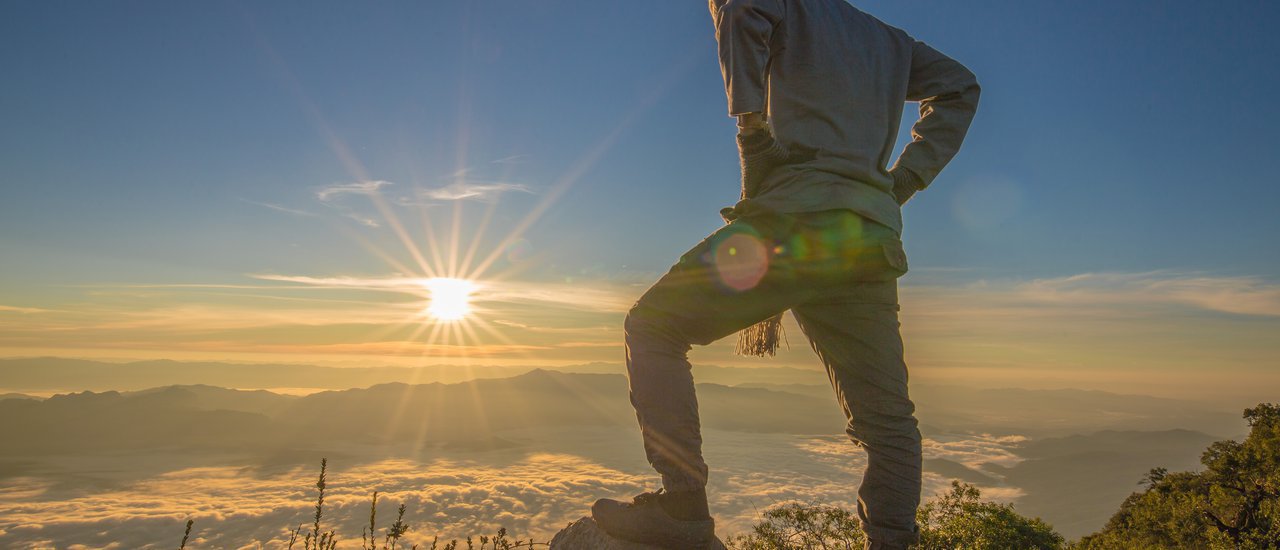
However, I opted to ascend to the summit of Kiew Lom to capture the sun directly in the center of my photograph.


This is a view from the north wind gap, looking west. You can see Doi Pyramid and Doi Sam Phee Ngon.
It was almost 6 am.
The sky began to brighten.
The fog started to gather.
I was so lucky to meet you, the sea of fog >_<


Zoom in on the telephoto lens.

This reminds me of the fluff inside a pillow. 5555

This is a great way to enjoy yourself.
It's almost here.


The rising sun's peak light creates an aura-like effect.

Volunteer model, one set please.


After capturing the stunning sunrise, we descended to our tents for a hearty breakfast.
From the top of Kiew Lom peak, you can see our campsite below.
Is there anything else I can help you with?


We did not bring much cooking equipment, so we will have to find simple meals to alleviate our hunger each day.
Simple menu is
- Mama (asking to borrow gas to boil water from the peddler who went to borrow it)
- Boiled egg
- Canned fish
- Bread and jam sandwiches, for example.
But if you come with a tour trip, you might get to eat well and live well. I'm jealous.


After a long rest, we decided to hike up to the top of Kiew Lom again, but this time we would take the southern route, opposite the northern route we had taken earlier that morning. This would allow us to capture images from multiple vantage points.

Upon reaching the summit, the temperature was noticeably warm, yet the surrounding views were equally breathtaking.
Is there anything else I can help you with?


On the mountain, there is also a boy band gang, haha.

Pyramid Peak, view from South Wind Pass

After climbing for over an hour, we quickly descended from the southern wind gap, rested for a while, and prepared to climb to the highest peak to watch the sunrise.
4:30 PM.
We are victors.
We have conquered Doi Luang Chiang Dao!


The air is getting cooler and cooler, and the sunset is very beautiful.


As the sky gradually darkened, the sun began its descent, casting long shadows across the landscape. A cool mist settled in, signaling the approach of nightfall. Those who wished to capture the stars in their photographs braced themselves for the frigid temperatures and relentless wind that accompanied the darkness.
Before coming to Doi Luang Chiang Dao, I had already planned and calculated the days to come up here to take pictures of the Milky Way. Before that, my friends told me that it was gone, wasn't it? Some said they didn't see it before. But I still didn't stop thinking and thought that I must have seen it if there was no moonlight to disturb it. So I looked for information to come on the day when the moon appeared the least, so that it would be easy to take pictures of the Milky Way.
Despite the limited luck, the absence of moonlight was a blessing in disguise. I couldn't help but grin, as this trip proved to be worthwhile after all.


Day 3
Due to exhaustion from climbing three peaks the previous day, I was unable to wake up early enough to witness the sunrise from the highest summit. This was unfortunate, as the mist was swirling around the peak that day, and I could have captured another set of stunning images from the summit.
After breakfast, we prepared to descend back down. We opted for the Pa Vua trail on the return journey due to its shorter distance compared to the Den Ya Khat trail. The descent was quite slippery, as it was steep and the path was mostly composed of dirt.


Our descent took approximately 3 hours, and the pickup truck that transported us was waiting for us at the bottom of Pang Wua.


Fantastic!

I shall be your loyal subject in every lifetime. . . .

A group photo before leaving.

In Summary:
This trip was an unforgettable experience. Doi Luang Chiang Dao is undoubtedly one of the most stunning tourist destinations in Thailand (in my personal opinion, the most beautiful). Access is limited, requiring a challenging hike of nearly 10 kilometers, which may not be suitable for everyone. However, for those who are up for the challenge, the reward is well worth it. The breathtaking views and the sense of accomplishment make it a truly once-in-a-lifetime experience. For me, one visit was definitely not enough, and I will certainly be back for more in the future.
We apologize for any errors.
Until our next adventure!
Bekims
Friday, October 4, 2024 3:03 PM

