

Continuing our long trek, the fourth trip this month, 17-18 December 2016. This trip was very urgent, so we announced on Facebook and didn't have much time to talk. We found people, created a Line group, chatted a bit, and then set off.
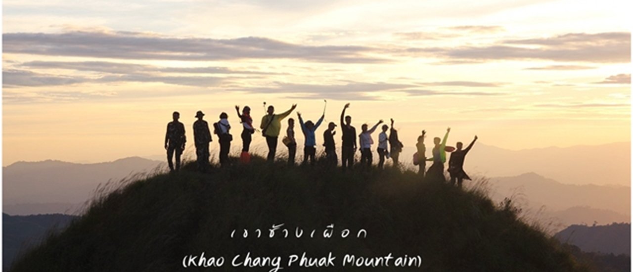
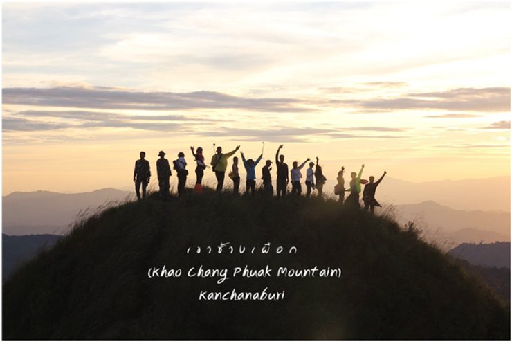
Khao Chang Phuak Mountain, situated within the Thong Pha Phum National Park, rises 1,249 meters above sea level. From its summit, one can witness the majestic peak of Pha Phum, the highest point of the Chang Phuak range.
Khao Chang Puak, a prime destination for adventurers, is located within the Thong Pha Phum National Park in Kanchanaburi Province, Thailand. It stands at an elevation of approximately 1249 meters above sea level.
The distance from the starting point to the camping site is 8 km. From the camping site to Khao Chang Phuak is 1 km.
The name "E-tong Village" originates from the phrase "Nat-eng-tong Village," where "Nat" translates to "deity" or "angel," "Eng" means "house," and "Tong" signifies "mountain." Therefore, the combined meaning is "a village located on the mountain of deities." Over time, the pronunciation evolved into "E-tong Village," which remains in use today.
Even the mighty mountains can be reshaped.
The vastness of the river can still bring a sense of calm.
However, one's inner nature is difficult to fathom, making it challenging to change. I choose to love only the feeling.
Deep down in my heart is enough.
No loss, no gain.
No need to love anyone, then no need to cry.
No one, no heartbreak.
Imagine, boy.
Photographer
Figure 1. From above, Natthanan Wonganan, brush.
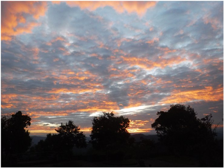
Figure 2-4: Pakon Homchoti, "N'a Joe"
Figure 6. Chirapan Sophaphon (Fai)
Note: The images may not be aesthetically pleasing due to time constraints. They were captured while walking. However, I hope the written information will be beneficial to the readers.

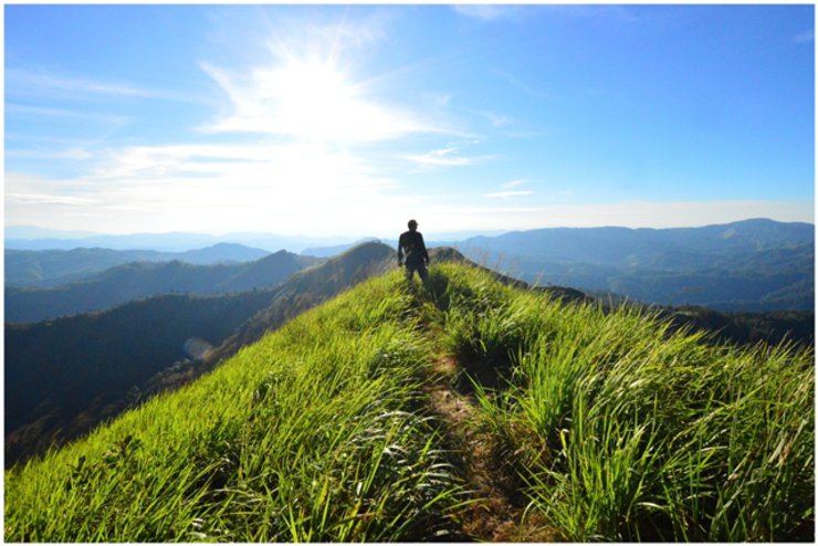
Khao Chang Puak is a popular destination for hikers and adventure seekers who want to conquer its towering peak. The mountain's sharp ridge, known as the "knife's edge," offers a thrilling challenge for experienced climbers. Located within the Thong Pha Phum National Park in Kanchanaburi Province, Khao Chang Puak features a grassy summit with scattered rocks along its ridge.
1. Mount Chang Phuak stands at an elevation of 1,249 meters above sea level.
2. Khao Chang Puak National Park is typically open to visitors from October to February. However, the park may be closed to tourists in some years due to weather conditions.
3. The park limits the number of tourists who can climb Khao Chang Phuak to no more than 60 people per day.
4. To reach the summit of Khao Chang Puak, visitors must begin their ascent from Ban E-Tong (not the park headquarters). The trail starts with a gentle incline, followed by a gradual climb along the ridge. The path alternates between ascents and descents, with limited shade due to the exposed nature of the ridge.
5. Porter service is available.
The hiking trail is 8 kilometers long and takes approximately 3-5 hours to complete. Hikers must camp overnight on the mountaintop.
7. The summit lacks amenities, including electricity and shops. Hikers are advised to carry 2-3 liters of water for hydration and cooking at designated rest stops.
8. AIS mobile phone signal and internet are available.
9. Pit latrine available.
10. Prepare essential personal equipment, such as wet tissues, flashlights, raincoats, medications, and various camping equipment.
11. Thong Pha Phum National Park offers tent and sleeping gear rentals.
12. Camping is only allowed in the designated area on the summit due to limited space and the absence of water.
13. Suitable clothing for hiking up Khao Chang Puak should include long-sleeved shirts with good ventilation and sneakers. This is because hikers will need to navigate through sharp grass that could potentially cause cuts and abrasions.
14. The optimal time to start the ascent of Mount Chang Puak is before 8:00 AM (don't forget to bring a hat), as the trail is exposed to direct sunlight with minimal shade.
Khao Chang Puak
15. The highlight of Khao Chang Puak is the "Sarn Kom Mee," or "Sarn Wat Jai," a narrow, knife-like ridge where tourists must walk in single file. Although not very high, it can make many people's hearts race as they look out at the steep drop on either side. Some may even find their legs trembling and unable to move.
16. After conquering the Knife Edge Ridge, a highlight of the trek, hikers will encounter a gentle slope leading to the summit. This vantage point offers unobstructed panoramic views, making it the perfect spot for a celebratory photo with the "Summit Conquered" sign, a testament to their successful journey across the Knife Edge Ridge.
17. Prepare your body: Hiking up Khao Khang Pheuak requires physical fitness. It is recommended to engage in regular exercise for at least one month before embarking on the journey.
The most beautiful period of Khao Chang Puak is during the late rainy season and early winter. This is because the mountain is incredibly scenic during this time. Everywhere you look, you will see lush greenery. At night, the air is cool and there is fog, which makes for a truly unforgettable experience for tourists like us.
19. Strictly follow the instructions of the officials. Do not deviate from the designated path or travel alone.


Let's follow our journey together.
Our group of 10 people spent Friday night in Thong Pha Phum. We were able to pitch our tents at the park, which allowed us to wake up and register for the event right away.
However, we arrived very late and therefore did not stay overnight at the park.

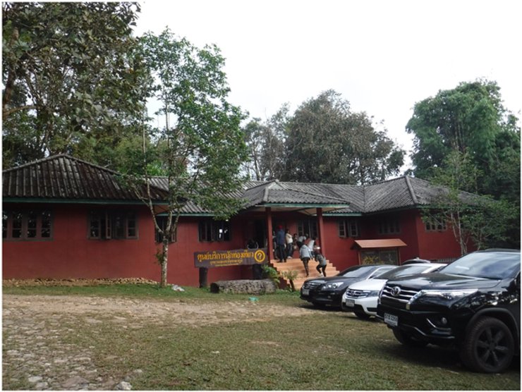
7:00 AM, December 17, 2016. We woke up at seven and drove to the National Park to register.
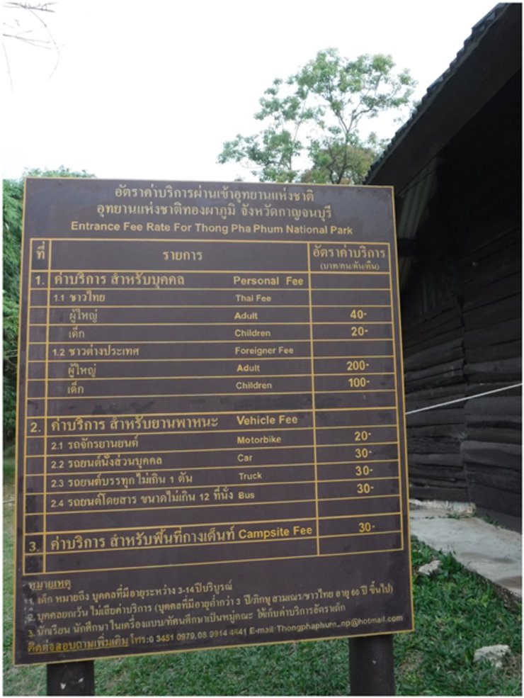
The entrance fee for Doi Chang Mup is 40 baht.
Tent pitching fee: 30 baht


Booking requirements for climbing Khao Chang Puak
1. Reservations can be made up to 7 days in advance.
2. Reservations can be made by phone at 0 3451 0979 and 09 8252 0359 between 8:00 AM and 4:30 PM.
3. A maximum of 10 people can be booked per officer.
Email: [email protected] within 1 day.
5. Register at the Tourist Service Center between 7:00 AM and 8:00 AM.
6. Security personnel 1 person per 10 tourists 1,800 baht
A porter can carry a maximum load of 30 kilograms for 1,300 baht.
7. Food should be easy to prepare. It is recommended to use a field gas for cooking.
The


Digressing for a moment,
Upon arrival, you will be greeted by two hornbills. The first one is unnamed, while the second one is named Mom Mam. Previously, there was another hornbill named Jaew Wae, but it has passed away. Visitors to this location may recall Jaew Wae.


Register, fill out the documents, and pay 1,800 baht at the National Park. There are also souvenirs for sale. Please consider buying some to support the park.


After completing the registration, we traveled to E-tong Village. The weather was cool and comfortable. I must say that it is very beautiful. No matter how many times I visit, I always enjoy it. It is very romantic.
Nestled amidst the mountainous terrain of Pilok, E-tong Village is a quaint settlement in Thong Pha Phum District, Kanchanaburi Province. This former mining town once flourished as a hub of mineral extraction.
E-tong village serves as a passage and accommodation for tourists aiming to conquer the peak of Chang Phuak, with the starting point for the trek located within the village. It also acts as a stopover for exploring various routes in Pilok sub-district, such as the Neung Chang Suk viewpoint, Chok Kradin waterfall, and Thong Pha Phum National Park. The village's peak tourist season falls during October, when the Chang Phuak mountain opens for climbing, and continues through the winter months with its pleasantly cool weather.


We gathered at P'Noi's shop because there was food to eat and a bathroom for us to shower.
Note: Traveling to E-tong Village
Car
- From Kanchanaburi city, drive on Saeng Chuto Road, the main road, to Kaeng Sean Intersection. Turn left following the signs for Sai Yok - Thong Pha Phum District (Highway 323). Continue straight to Thong Pha Phum District (the route will connect to Route 3272). Drive past the district center (the district center is on the right) and follow the reservoir in the dam for about 30 kilometers. You will reach the Ban Rai-Pilok intersection. Turn left towards Pilok. From this point, the road will be winding uphill for approximately 24 kilometers. Thong Pha Phum National Park is on the right-hand side.
Bus
Take the 5:00 AM BKS 999 bus from Mo Chit Bus Terminal (Floor 1, Gate 21) in Bangkok to Dan Chedi Sam Ong. This bus costs approximately 227 baht and is the only one that will allow you to catch the last songthaew to the national park. Disembark at Thong Pha Phum District and transfer to a yellow songthaew at Thong Pha Phum Market to reach Ban E-Tong (departs around 10:30 AM). The songthaew fare is approximately 70 baht, and the journey takes about 2 hours. On the return trip, songthaews run from Ban E-Tong to Thong Pha Phum District in the morning (around 8:00 AM). It is recommended to confirm the exact schedule with the national park officials.


Eat lunch and prepare lunch.


There are 2 bathrooms with showers.


Distribute the communal supplies to the porters and prepare to depart.

Are you ready? Let's go. I'll be back at noon to continue working.


The distance from the starting point to the campsite is 8 km. From the campsite to Khao Chang Phuak is 1 km. The officers will lead the hike up Khao Chang Phuak at 4:00 PM.
The hike begins around 10:00 AM. There is no need to rush, as the park rangers will lead the group up in the evening. Arriving early would only result in unnecessary heat exposure. There are ample tent sites available.


The initial section of the trail is not very steep.


The sun was blazing and the sky was clear. The previous day, while we were traveling, it had been raining lightly and the sky was overcast. We had already braced ourselves for the rain, but when morning came, the sky was bright and clear, which was very encouraging for us.


A 1 km walk from E-tong village leads to a checkpoint where you must register your name. Don't forget to take a picture with the sign!


After completing the photo shoot with the sign, the team proceeded to walk, passing by the team that had just arrived.


Alternating flat and steep terrain


The scenery was beautiful throughout the journey, but the sun was also very strong.


"It's beautiful, isn't it? This was taken with an underwater camera."


Enjoy the view.


Checkpoint 1


Secretly took a picture of the officer. Come join the Numenius group and have fun together.


Will we be able to walk there today? We've been taking photos all day, and every spot is beautiful.


It's a joy to the heart.
You can close your eyes to avoid seeing.
Things I don't want to see.
Yet, you cannot close your heart to feeling.
In what you don't want to feel .... can.


Words cannot describe her beauty.


The picture you saw was of a group of hikers, right? I replied that it was, and then I secretly took a picture. Thanks for saying hello, kisses.
The majestic Elephant Tusk Mountain, with its breathtaking pathways, offers an unforgettable experience.


Oh, the lavender fields are amazing! The song is playing in my head.
I smile at love, I smile at sorrow.
I smile at the lover who walks away, while in my heart we are still together as before.
I am glad that there is still love, I am glad that there is still sorrow.
It is a reason to confirm that love has not disappeared, it is still in the hearts of the people in our hearts, in our hearts. May love be with you.


The second stop was a photo opportunity with a celebrity named Milo.


After walking for a while, we encountered a small hill called "Hup Karen" to warm up our legs.
The incident occurred at this location. The footage shows Joe standing and taking pictures, while the others are following him uphill. Non noticed something rolling down from the top of the hill. It was Joe, who fell into a deep ravine.


Colorful leaves can be found throughout the mountain.
Uncle Joe attempted to collect the items himself, but to no avail. He then requested the assistance of porters to help him gather them.


Uncle Joe generously gave 300 baht to the young hawker as a token of appreciation. (In the picture above, we are very worried about Uncle Joe.)


Green, red, orange, yellow are commonly seen.


The journey continued after the incident. Each trip always has a story. On this trip, Uncle Joe, the owner of the story, lost his backpack in a ravine.

After noon, we took a break for lunch, enjoying the million-dollar view. It was amazing!


After a short break, we continued our journey. As before, there was no shade along the way.


The view is so beautiful that it makes you forget the heat.


Checkpoint 3: Khao Chamod, elevation 1,038 meters


After traversing the grassy field, we will then proceed through a section known as the bamboo grove.


And then the grassland, the bamboo grove


The sky is completely clear.

The small hill that we saw earlier is called Khao Chang Noi.


Entering the swaying grassland, the wind was so beautiful, I sat and watched for a long time.


Gradually walking along the ridge, the campsite area comes into view.


Peeking and zooming in to see what's going on below, there are quite a few people walking to the camp.
Before reaching the campsite, we had to hike up a rather steep hill, leaving us breathless. However, upon reaching the summit, the breathtaking view made all the effort worthwhile. We stood there admiring the scenery for about 15 minutes before descending to the campsite.


The descent to the campsite is very steep. Please be careful.


The first thing you encounter after descending the slope is...
Pit toilet I have a pit toilet, yay!
No need to pour water, use a wet cloth or tissue.


Khao Chang Puak is the highest peak in Thong Pha Phum National Park, reaching an elevation of 1,249 meters above sea level. The ascent to the summit involves an 8-9 kilometer hike, traversing a challenging trail that winds across multiple peaks. Hikers must navigate over 3-4 peaks before reaching the designated campsite known as "Giw Lom".
Upon arrival, they encountered individuals who had gone to sleep resembling dried fish, having been exposed to the sun for several days.
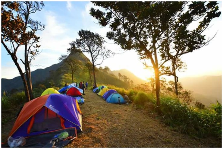
There is no need to rush to set up your tent as there is enough space for 60 people. There is no need to hurry to reserve a spot. More importantly, the staff will take everyone to Khao Chang Puak at the same time, which is 4:00 PM.


After the land was created, everyone waited for the officers to take them to Khao Chang Phuak. Some people were nervous, with trembling hands and legs, while others were busy updating their Facebook pages.
At 4:00 PM, the officials gathered the group and led them on a walk. Many people who did not continue the journey stayed at the camp to cook food and wait.


A moment of rhythm, here is a picture of the dancing meadow. It was so beautiful all the way before reaching the camping spot.

Waiting in line to cross the knife-edge ridge. It's slow going because we have to be careful, and the wind is strong.
The highlight of Khao Chang Puak is the section known as "Sankhom Mit," which translates to "knife-edge ridge."


Left and right views, we are not afraid of heights at all, just some people who are afraid take a long time to make up their minds.


The narrow passageway during the ridge's peak forced many to crawl instead of walk, including even the tallest men.


We have passed the sharpest ridge! Hooray! Don't get too excited, though. We're not at Elephant Mountain yet. On the way there, look to your left and you'll see the Piten Waterfall nestled in the valley.


There is still a way to go.
A photo of a waterfall in a circle.


This is clearly Teletubby Hill!


The hill is crossed, the destination is reached.
All the fatigue finally disappeared with the 360-degree view on the top of Chang Phuak Mountain. The view in front of us can be seen as far as the eye can see. The beauty of nature that we see through both eyes, the swaying blades of grass, the faint scent of grass that floats to our noses, and the cool breeze that blows through our bodies, that's called "happiness".

Wide-angle view


Followed by a series of stunning views.


It's getting late. Officials are asking everyone to return as it will be dangerous after dark.

Upon reaching the campsite, we collaborated to prepare a meal and subsequently gathered around to enjoy it. (The night of our arrival was illuminated by a bright sky filled with countless stars, creating a breathtaking spectacle.) After engaging in conversation, we dispersed to our tents for the night. The temperature was frigid, necessitating the preparation of sleeping bags, warm clothing, and thermal underwear. (It is crucial to note that the wind was exceptionally strong.)


The scene cuts to the morning.


After breakfast, coffee, Ovaltine, and then travel with Ka.
On your way back, please don't forget to pick up the announcement at the park, at the registration point.


In closing, we would like to express our gratitude to all our fellow travelers. We believe that our paths crossing, whether for a brief moment or an extended period, was not a mere coincidence.
Thank you for making the journey meaningful.
Thank you to everyone who shared and read the review. If there is any incorrect information, I apologize.
I'm Che
Friday, October 4, 2024 3:10 PM

