

The journey is more important than the destination.
It is crucial to consider what we have gained along the way.
Inner freedom is paramount.
I cherish the memories of Journey.
On a spinning globe, the only thing that can be preserved is memory.
The journey shapes the destination, leaving unique memories for each traveler.
Unable to deny one's own desires.
Unable to deny one's own heart.
A grueling five-day, four-night trek through challenging terrain, marked by relentless rain, treacherous night trails, and muddy paths. The group faced numerous falls, relentless foot pain, and the arduous task of carrying their own supplies. Avoiding well-trodden paths and popular campsites, they embraced the solitude and rawness of the wilderness.
21/09/2016 Pitukko, 1600 baht, Hin Sam Khon, Mango Peak 30,000 baht.
22/09/2559 to Doi Hua Mot in Umphang, staying at Uncle Kham Sing's house.
23/09/2559 Rafting to Kaeng Moke Do and then trekking to Tee Lor Su Waterfall via Doi Khao On - Pang Mai Khop - Tee Lor Su (to see Tee Lor Su from a new perspective that most people have never seen before. This route has not been used for about 10 years).
24/09/2016 Entered the Ti Lo Su Waterfall, had lunch, collected luggage and walked to the Karen village of Kho Ta.
25th (return day) enter N.T. Khotta, return home by Pahlattha car, pick up at Umphang, prepare to return.
A Gentle Smile Trip: A Budget-Friendly Adventure
This trip is all about experiencing the beauty of nature with a gentle smile. For just 4,300 baht per person, you can enjoy a 5-day, 4-night adventure that includes transportation, meals in the forest and at local restaurants, snacks, guide fees, boat fees, accommodation, and even beer and liquor.
This trip is organized by a group of 10 friends and is not a commercial tour. Their goal is to share the incredible experience they had with others.
Note: This is a review of a hiking trip. As any seasoned hiker knows, the last thing you want to do is take out your camera when you're exhausted. Some people on the trip barely took any photos of the journey. But not me. Even if I was falling headfirst, I would still take a picture. Most of the photos include people because it's a way to document our journey through the forest. We couldn't just wait for everyone to disappear before taking photos. This isn't a tourism promotion review. It's a diary. If you prefer reviews without people in the photos, feel free to skip this one.

This hiking trip was initiated by members of the "Oh Oh" group who had been planning it for quite some time. As the trip date approached, most of the members from the "Oh Oh" group had to withdraw due to commitments, leaving only three people: Che, Lek, and P'Wut. However, they were determined to go ahead with the plan. On September 15, 2016, they decided to open the trip to people outside the group by posting on the "Backpack Travel Trip" and "Trekking Adventure" pages managed by P'Wa. The post briefly stated the following:
#Category 1: Looking for 100% confirmed participants, preferably experienced and physically fit individuals who are not easily bothered. Trip dates: September 21-25, 2016. Destination: Pitukroh, Doi Huamod, Tilasoo, and Khota Ka Do Karen village.
#AUEB Hornbill Group, let's drag our legs and go! Not many people are going, so we need experienced hikers. You will carry your own belongings and share the group's supplies. You will also need to help with the food. If you are looking for a comfortable trip, this is not it. This route is not organized often, so if you miss it, you will have to wait a long time for the next one.
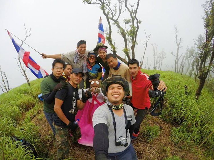
This resulted in a total of 10 members.
1. Mr. Wutthi, the main advisor, was the point of contact and coordinated everything. He took care of everything. (On the last day, we ran into him when he came out to look for us. We apologize for causing you concern. No need to elaborate further, or I'll be buried in mud again.)
10. Silver, nicknamed "Bare-Handed Human," is a versatile member of the team. She cooks, pours drinks, fishes, makes chili paste, sings songs, and more. With her all-around skills, she's like a secretary to Mud. It's no surprise that she was promoted from Non-Rank to Che in a flash.
2. We are honored to have P'Nim join us on our little trip.
3-4. Khun Kwan, the main chef, is very diligent. Every meal is delicious.
5. Folk, who came to the event for the first time, asked Nong where he had been camping. Nong replied that he had been camping since his ROTC days.
6. Young San, whose heart is full of fighting spirit.
7. Virach, who joined the journey.
8. I am not a violent person. I enjoy taking walks in my backyard.
9. We fell together, got lost in the forest together, and ran away from the uncle together with our backpacks. This trip taught us that sanity is very important, as are the things in our backpacks. We collected everything that no one else wanted, and the secretary carried almost 30 kg. Che carried about 16 kg, and we had to help each other. Mod made marks, Che followed the trail, and we helped each other until we got out. We got lost around dusk, and it was raining heavily. The trail was very difficult to follow. P.S. Don't make the secretary angry, or she will be diligent in the kitchen.
On the way back, we left Umpang very late at night. It was raining, and there were landslides blocking the road. The corn truck kept dropping corn along the way. The road was slippery, and there was fog. It was a complete mess.

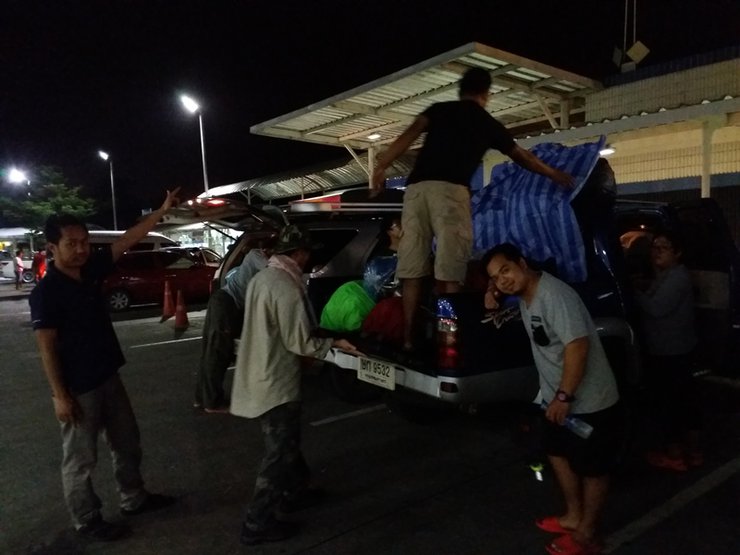
On the evening of September 20, 2016, after work, we met up and took two cars for 10 people. We arranged to put our luggage in Pan Nim's car and covered it with a tarpaulin to protect it from the rain, as it had been raining since we set off. We were a little disappointed because we probably wouldn't be able to see the beautiful view from the top of Hin Sam Khon (our bags were 100% waterproof).
Nestled amidst the embrace of the majestic Thanon Thongchai mountain range, the quaint town of Umphang boasts a plethora of breathtaking natural wonders. From exhilarating whitewater rafting adventures on the Mae Klong River to awe-inspiring waterfalls such as Thi Lor Jor, Thi Lor Rer, Kaeng Sod, Le Tong Ku, and the renowned Thi Lor Su, Umphang offers an unforgettable escape into the heart of Thailand's natural splendor.


Image on
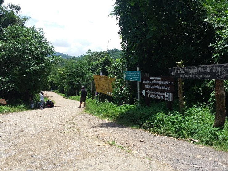
The second visit to Che Ma Ban Kui Leot was on August 28-29, 2016. The previous visit was to look at the campsite and take a walk. I borrowed the picture of the entrance sign from the previous visit because I didn't have time this time.
Image below
The scenic route from Umphang to Mae Sot boasts an impressive 1,219 curves (2,438 curves roundtrip). After two rounds, we were practically delirious from the constant turns. We stopped for supplies and lunch before parking our car in the Kui Le O To village. After changing clothes and preparing provisions, we began our trek to Pitukoro Cave around noon. The journey to the waterfall requires an 8 km hike, with the duration varying depending on the size of the group. Larger groups tend to take longer due to frequent photo stops.

Pitukrok Waterfall is a seasonal waterfall that appears only during the rainy season. Its name originates from the Pitukrok stream, located above the Khun Khao mountain range. Situated in the western forest of Umphang district, Tak province, near the Myanmar border, Pitukrok is considered the highest waterfall in Thailand. During the rainy season, the white water cascading down from the top of the Ma Muang Sam Wan mountain can be clearly seen from several kilometers away.
Travel
The journey begins in Umphang district, where a 4x4 vehicle will take you to the Kui Leut O village. The drive takes approximately 3-4 hours, followed by a 4-5 hour trek to Doi Mamuang Sam Mun. The campsite where the group rested is located at the end of this trek.

The initial section of the trail follows a narrow embankment surrounded by water.
Pitukrok Waterfall is located in the westernmost part of Umphang District, Tak Province, along the Thai-Myanmar border. It is a waterfall with a height of approximately 500 meters.

Things to prepare
1. Camping equipment such as tents, hammocks, sleeping bags, cold-weather gear, rain gear, and other hiking essentials are optional.
2. Suitable attire for hiking includes long sleeves and avoiding jeans.
3. Raincoat, but if you're not afraid of getting wet, you don't need it.
4. A sarong for women to wear while bathing, as this trip will involve outdoor bathing.
5. Flashlight: The forest at night is pitch black. Light is essential for getting around, and a headlamp is recommended to keep both hands free for gripping branches.
6. Medications, snacks, personal dry food, mineral supplements, and emotional support toys.
7. Rubber-soled, high-top canvas sneakers.
8. Snails can sometimes be found on the rocks at Hin Sam Kon.
9. Fabric gloves: These are useful for protecting your hands when climbing rocks or gripping branches, preventing injuries.
10. Most importantly, prepare your body and mind.

Strolling through the rice fields where farmers have just planted their seedlings this month, the rice has grown significantly. The green of the rice leaves contrasts with the vibrant colors of the sky. We fell in love with this place the first time we came here. It's incredibly beautiful.

Another waterway encountered.


The rocky peak where we will camp, the three-piled rock peak where we will go, fade away.


The path is beautiful with various flowers, including water lilies and ginger lilies. Macro photographers will find this place particularly captivating.


Secretary Mod, what are you doing?

Hike in circles, carry your backpack as well. Hiking prohibits leaving your backpack behind, no matter how short or long the trip. The contents of your backpack must be organized as if you were entering the forest every time. We cannot know what will happen in advance, but when necessary, the contents of your backpack will save our lives. Think about hiking in the forest, don't be comfortable. Carry your backpack with you.


The journey began at 11:40 AM and arrived at the waterfall camp at 2:00 PM. Others arrived earlier, but we did not stay at this camp. Instead, we walked to the left, crossed the bamboo bridge, and cut up to Pitukoro.
Note: On my previous visit, I took the right path (which is the path most people take to go up and down this way), but we switched it up. You can go either way, but the left path is steeper and doesn't require a detour.
After crossing over, we took some pictures first. The clearing is the waterfall camp. After playing in the water, we continued walking to the heart-shaped waterfall and went to the place where we would sleep.


The alternating bamboo and open forests, are we calling it right? This path is well-trodden, it's trendy now, isn't it?


The steep path, coupled with the heavy load, left me panting from the start. I wiped the sweat from my brow as I continued my ascent.

We stopped to take a picture with the waterfall and then continued walking.


Continue walking on a gentle slope from this point to reach the campsite of Uncle Kham Sing, where many people camp.


Is the slope steep? Ask your heart. This place is called "Neun Chom Plong" (Hill of Admiration). It's so beautiful.
We did not stop at Khao Lom Sing because it was a weekday and there was no one there. Our group was the only one on the entire mountain, which was super chill.


Macro enthusiasts, don't miss this! I spent a lot of time here.


The younger brother made a funny face.
After passing the viewpoint, the trail becomes a steep bamboo forest, leading to an open field. From here, it's not far to our destination. We were the last group to arrive, having spent too much time playing at the viewpoint before setting up camp. The elevation here is around 900 meters.


The camp atmosphere was lively. Ankhwan cooked omelets, while Che cooked stir-fried curry paste with meat. They also enjoyed snacks and fried dried fish.


Children set up food camps and transported food supplies.


Live well and eat well. This is my own handiwork. I want to show it off.


Sleeping is not a problem. There are tents, hammocks, and canned fish available. (22/09/2016, Day 2)

The morning atmosphere, everyone helped to cook. The ant secretary's chili-fried eggs with fermented pork were delicious.

The chickens were fed so they would have the strength to climb. Sister Phet went to break bamboo shoots with her bare hands and brought them back for us to eat. They were delicious! We ate them for two meals, and even the secretary ant took some home to eat. Imagine that!

After finishing our meal, we set off on foot, leaving our luggage at the camp. We carried two bottles of water and our valuables. Our destination was the Three Boulders.
Is this where the slope starts?


The road is steep and winding.

I'm not going anymore. I'm tired.

Finally arrived. This place, level 1100, has some accommodations. Let's check them out.

AIS signal is available here.


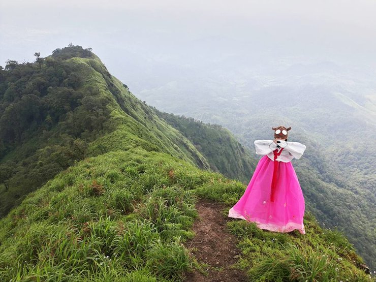
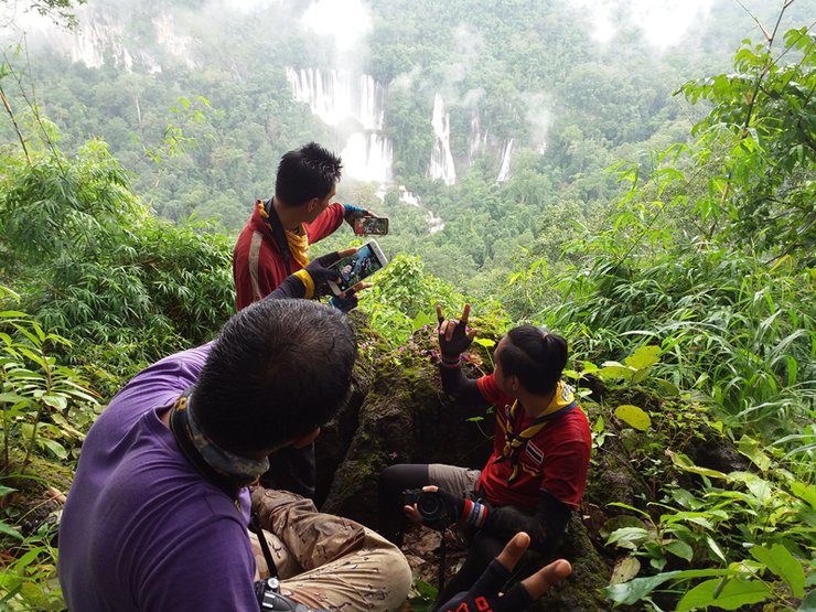
The journey continues, with the destination being the high peak on the right-hand side. It rained every day, and the weather forecast said that the sky would be overcast for five days. It rained heavily on the day of travel, making it difficult to see. On the day of the summit, the sky cleared, and it was almost as if we were bowing down from the foot of the mountain.


Enjoy the long view.


The swaying of the tall grass is beautiful.


A very small person.

Shrimp flower


We have arrived at Hin Sam Khon. The peak is 1600 meters high. Behind us lies Burma.


22/09/2016 2:00 PM. We arrived back at the camp, had lunch, packed our things, and prepared to continue our journey. On the way back, we did not return via the "Neun Chom Plong" trail, but instead took another route that is not commonly used by tourists because it is very steep. Let's see some pictures.


The nails will come off from the first day. The brakes are almost burnt. The axles are almost broken.


The steep, slippery path of compacted earth interspersed with gravel was extremely difficult to navigate. I fell to my knees several times, even rolling a few times for good measure.
The part of the tree that the ant secretary points to is the Haarn tree, which has the same characteristics as the elephant cry tree. However, it is a perennial tree with a trunk size ranging from a finger to a thigh or even larger. The symptoms of its poison are not as severe as those of the elephant cry tree, but the pain lasts longer, is more persistent, and can last for days.
The steep slope offered no handholds, and I worried about falling into the thorny bushes below. As if on cue, the brakes failed, sending me careening into the thicket. Thankfully, my protective gear prevented serious injury, but I emerged covered in thorns.


Crossing the stream, crossing the stream, until walking out of the forest.


Exiting the forest, I flagged down a villager's car and hitched a ride back to the village to retrieve my own vehicle. Then, I continued my journey.
KamSingha Home Stay, Amphoe Umphang, Tak, Thailand. The next morning, we will go to Doi Huamod, go rafting, and go hiking. 2/09/2559 Day 3.

Waking up before dawn to prepare for a scenic view atop Doi Huamod.


After returning from Doi Huamod, we had lunch at the market and bought more supplies for our extended stay in the forest.

All belongings were loaded onto the rubber boat.


Prepare specific equipment for trekking. For trekking, we will raft down the Mae Klong River, passing through the Tee Lor Jor waterfall, which flows through the limestone cliffs, passing through the Ta Khoa Bi rapids, Pha Pheen, Pha Lueat, and Pha Wo. Stop to soak in the hot springs along the way.

The water is very warm. There are grilled bananas and grilled eggs for sale. We also stopped to dig for earthworms.


Upon arriving at Tha Sai or Kaeng Mokid, have lunch and then embark on a 3-hour hike along the Doi Khao Aon-Pang Mai Khop-Thi Lo Su route to reach the NT. Thi Lo Su.

Let's go! We'll be late. We're already hours behind schedule.

Clung to a tree for rest.

Take a break.


As we disembarked from the inflatable boat, the rain began to pour down heavily.

Take a break.


Keep walking, Tayyy. Is this the way or that? Let's go.

I came across Sister Pen, sitting comfortably on a vine.


As she walked, Secretary Mod of Che stumbled and fell to the side of the road. If it weren't for the bamboo grove blocking her, she would have surely fallen further.

It's getting dark. I won't make it in time. Haha.


It's dark now.

To fall like autumn leaves

After exiting the forest, there is a muddy dirt road leading to the Tee Lor Su Waterfall. The walk was incredibly difficult, especially in the dark. The slippery mud made it challenging to keep our footing, and everyone was exhausted. It was a truly harrowing experience.


Upon reaching the Umphang Wildlife Sanctuary, they collaborated to prepare meals.

Eat, gossip, shower, sleep.

Extremely painful.

Armies march on their stomachs. Sister Ann's clear soup and Secretary Ant's pork sausage are delicious.


After breakfast, we set off on foot to Tee Lor Su Waterfall.


The place was practically deserted, with only a couple of small groups present. It was remarkably quiet.


Setting off early in the morning, some people were suffering from sore legs and were walking with their legs spread apart.


The path is raw, fresh, and brutal, crawling through crevices and down holes.


Many people have given up at this point.


We've finally arrived. Isn't it beautiful?


To capture a photograph as a reminder of the time we stood here gazing at the Teel Su from this angle.

She's back. Get ready to see the waterfall from a low angle.


Climbing up is difficult, and climbing down is also difficult.


We finally arrived at the waterfall and were able to enjoy a refreshing swim.


After visiting the waterfall, we had lunch. We were so tired and hungry that we forgot to take pictures. After lunch, we continued our journey to the Kho Ta village.


The journey to Ban Kho Ka Tha, a village located near the entrance to Thi Lo Su Waterfall, covers a distance of approximately 8 kilometers on a rugged road. Accessing Thi Lo Su Waterfall itself is also challenging, requiring a trek along an old trail starting from Long Kaeng to Kaeng Moke Do, Doi Kha On, Pang Mai Khop, and finally Thi Lo Su. From there, an additional 8 kilometers on a岔路 leads to the village. The starting point for this journey is the Thi Lo Su Waterfall office.

The photograph was taken from a newly constructed bridge, overlooking the dilapidated remains of the old bridge.


We slept at the school. It rained the whole way, and we got soaked.

Upon arrival, they immediately engaged in various sports, including soccer, baseball, and volleyball, within the same field. It was truly an exhilarating experience.

Afterwards, they had lunch. Meanwhile, Ms. Pen and the secretary, Mod, went fishing, accompanied by the girls for protection.


The next morning, after breakfast, we will travel to Khok Ta Waterfall, which is not far from the village. The views along the way will pass through the fields and gardens of the villagers.


The soil in the cornfield is extremely harsh, causing cuts on my face, hands, and everywhere else. To make matters worse, I encountered a cow blocking my path.


The image depicts a three-tiered pavilion, locally known as "Wang Samran." The name "Samran" is a corruption of "Sam Lan," which refers to the three tiers of the pavilion.
Khoa Ta Waterfall
"Khok Ta Waterfall" is another tourist attraction located within the Umphang Wildlife Sanctuary. Many visitors agree that its beauty rivals that of the renowned Thi Lo Su Waterfall.
The Khok Ta Waterfall originates from the Khlong Klo Tho stream, similar to the Tee Lor Su Waterfall. However, it is located at the end of the stream before it flows into the Mae Klong River. The Khok Ta Waterfall cascades down limestone cliffs, forming over 10 beautiful waterfalls of varying sizes.


Despite being exhausted and weary from days of continuous travel, the sight of the waterfall rejuvenated them.


After returning from the waterfall, we packed our belongings and prepared to travel to Sop Mae La Mung by crossing a rickety bamboo bridge. If we fell, we would surely end up back home because our backpacks would drag us to the bottom of the river. We adjusted our travel plan. Initially, we planned to walk to Pa Ta Ha, but considering the condition of the younger members, Brother Wut adjusted the route to be a bit closer.

The path is very easy to get lost on, with many岔路.


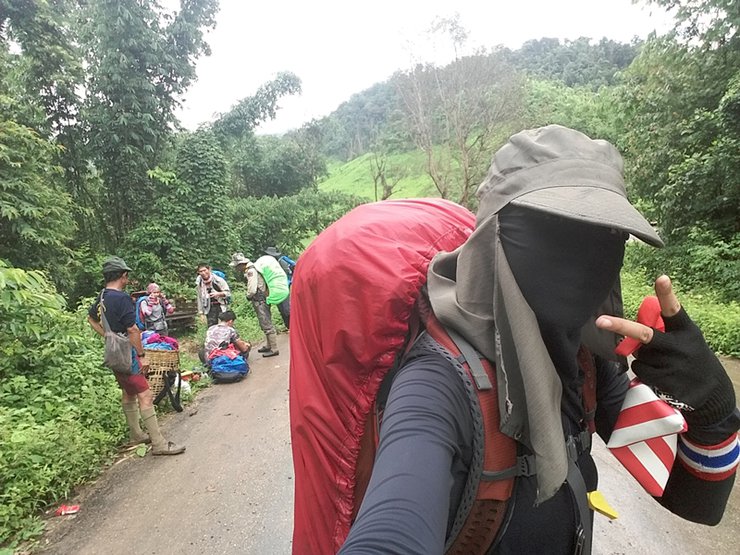
This jungle trek was not only a long walk, but the supplies we carried were just as heavy.


Some people got hurt from walking too much and couldn't carry their belongings, so they helped each other.


Lunch break, difficult to walk, steep, rainy, muddy path, slippery, ouch!


The image below shows the moment when both Che and the secretary, Mod, fell down together. Mod fell onto the ground, while Che's bottom hit a rock, causing significant pain.


Fell again.

The path ascends and descends, following the trail of the roaming elephant.


After a long walk, you will reach the designated pick-up point across the bridge.


The secretary and I went for a walk and got a little lost, but we found our way back.


After emerging from the forest, we headed to a local restaurant for a feast of grilled pork. We devoured almost everything on the menu, racking up a bill of 1,800 baht. The generous owner surprised us with two plates of fried rice and several bunches of fried bananas.
This trip has come to an end. I would like to thank everyone who joined us on this journey. Special thanks to Ms. Anne for the photos at Khok Ta Waterfall and the wooden bridge, and to Secretary Mod for some of the photos. After a delicious dinner of grilled pork around 10 pm, we started our journey back to Bangkok. On the way back, it was raining, foggy, and there was a landslide. Herds of cows were standing in the middle of the road, as anyone who drives this route knows. To make matters worse, a corn truck had spilled corn all over the road. I will share more photos from Uncle Wut later.
I'm Che
Friday, October 4, 2024 3:11 PM


