

Life is a journey, not a destination.
Reflect on a day filled with joy.
Reflect on the stories we have experienced.
Capture the moments, preserve the memories.
Cherish those memories.

Don't hurt yourself by not following your heart.
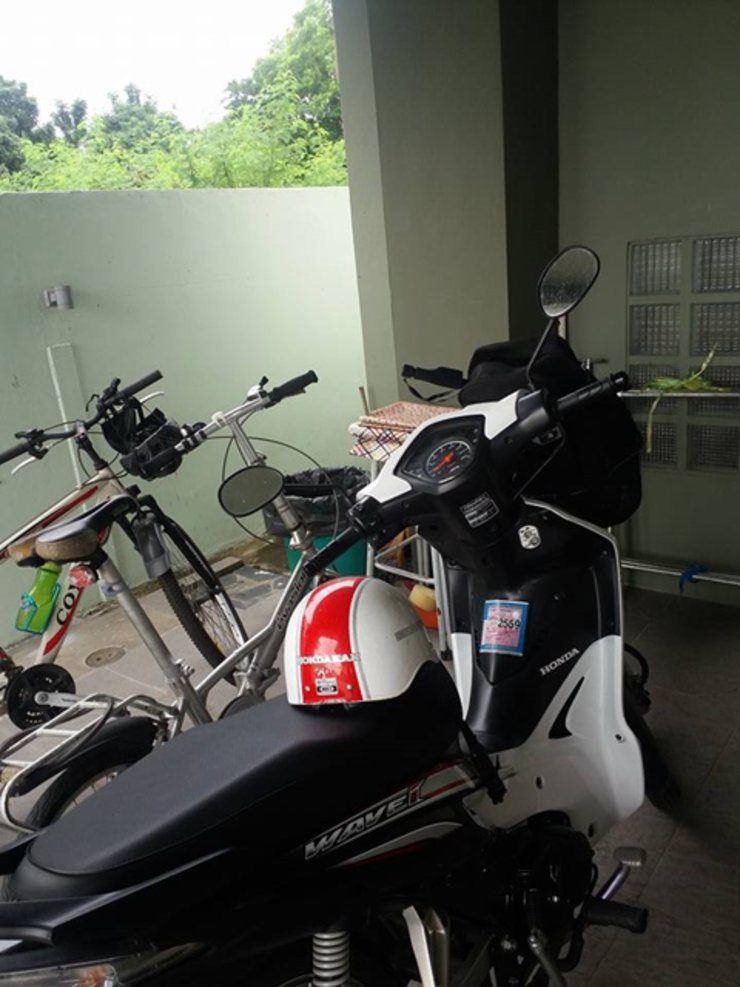
On this trip to visit my sister in Chiang Mai, I had some free time to take my motorbike out for a ride around the neighborhood. Traveling alone gave me a different kind of experience.

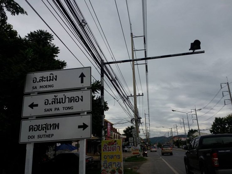
The first day was spent waiting for a friend who was supposed to join me, but she couldn't make it. I didn't find out until late afternoon, so I rescheduled my trip for the 13th. Around 10:00 AM, I left home and headed for the Grand Canyon Chiangmai. I didn't know the way, but I knew to stick to the Hang Dong road and ask people along the way for directions.


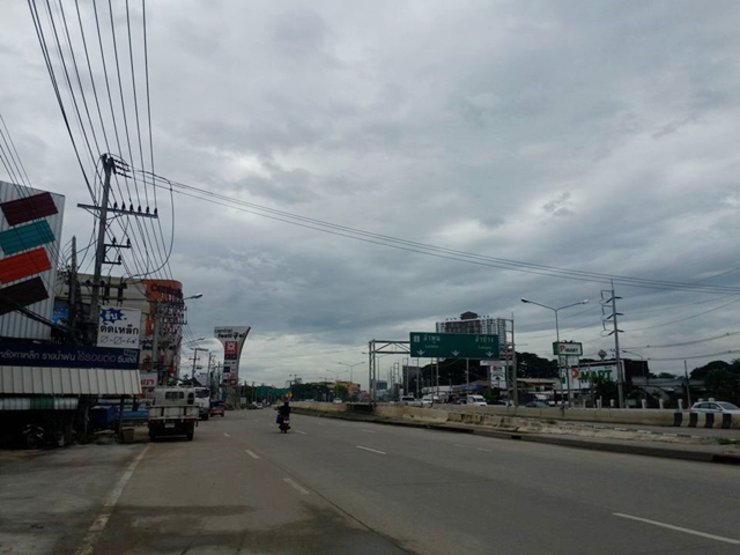
We traveled from the Kad Me Chok area, driving 33 kilometers. The traffic was heavy, and the drivers were speeding excessively. It was a very dangerous situation.
Travel
Follow the irrigation canal road (the same road to the Royal Flora Ratchaphruek and Night Safari) until you reach the Royal Flora Ratchaphruek intersection. Continue straight ahead and you will encounter the Nong Kwao traffic light intersection. Proceed straight for approximately 4 kilometers. You will see the Hang Dong Golf Course on your left. Approximately 300 meters past the golf course, you will find a岔路. Turn right onto the PWS cement factory road. Follow the signs for approximately 300 meters and you will reach the Grand Canyon Hang Dong.


Upon arrival, there is a free parking lot where you can park your car and then walk to purchase tickets.
The ticket can be used as a discount for tea or coffee, or you can add money to exchange for herbal water. I didn't know until later.


The Grand Canyon of Chiang Mai: A Man-Made Marvel
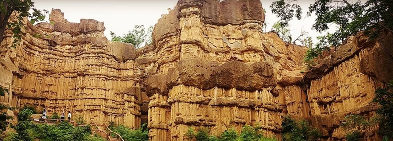
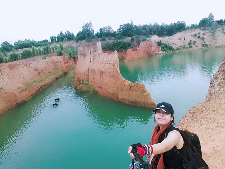
The "Grand Canyon of Chiang Mai," as it is colloquially known, is a former clay pit owned by Mr. Chatchakarin Trakulin-in. Approximately ten years ago, the owner excavated the land for clay sales, leaving behind a large body of water. This impressive site spans an area of roughly 30 rai (approximately 12 acres) and boasts towering earthen walls reaching nearly 15 meters in height, equivalent to a three-story building. The sheer cliffs resemble the natural wonder of the Grand Canyon in Arizona, USA, albeit formed through human intervention rather than natural erosion.
The allure of this man-made marvel lies in its uncanny resemblance to its namesake, attracting visitors seeking a thrilling cliff-jumping experience. However, safety concerns remain paramount, and caution is strongly advised.

The shop offers a cozy atmosphere with coffee and food available.


There are snacks and a place to relax.


The majority are foreigners, Chinese and Korean.


The weather here is unpredictable, with rain and sunshine alternating. Unfortunately, someone stole my selfie stick, which is a shame.

A sign indicated that Ob Khan National Park was only 12 kilometers away. Despite the desolate surroundings and the fact that I was the only person in the entire park that day, I decided to proceed. It was not an ideal situation for a solo traveler.
The scenic paved road connecting Hang Dong district offers breathtaking views and a refreshing climate, making it ideal for a leisurely drive. The two driving routes are: 1) Mae Wang-Doi Inthanon, starting from the forest protection unit at Chom.2 (Pang Derm) along the San Pa Tong-Bo Kaeo road, then turn left at the junction near Ban Huai Kiaeng onto a gravel road until reaching the Doi Inthanon National Park headquarters, covering approximately 41 kilometers. 2) Samoeng-Mae Rim, starting from the national park protection unit at A.Kh.1 (Mae Saep) in Samoeng district, along a gravel road to Ban Sop Win in Mae Wang district, covering approximately 31 kilometers. It is recommended to use a pickup truck or four-wheel drive vehicle for these routes.

I need to buy a new selfie stick at the 7-Eleven nearby. I'm so bummed.

Both waterfalls are suitable for long-distance hiking activities suitable for hikers. However, if you don't want to walk tired, the park office area also has streams flowing through Ob Khan and Ob Hai for sightseeing. It is similar to Ob Luang, although it is smaller in size, but it is equally beautiful. Especially during the late winter, the surrounding forest will change color beautifully. From Ob Khan and Ob Hai, you can walk to see the view at Pha Ok Ma and Pha Tub.


Let's pitch a tent.

Stay here for a while, we will return in the evening. It rained throughout the journey, with occasional clear skies.
I found myself lost and confused on my way home, unable to recall the route due to venturing too far. I had to rely on asking locals for directions.

At 10:00 AM on the 13th, Aunt B said she would take me on a trip after noon. (Aunt B and I met while hiking on a trip to Laos.)


Looking for food near Kad Me Chok


Buy food for yourself and souvenirs. This is the hope of the village.


Looking for snacks


Beam will pick me up at the McDonald's in front of Kad Luang. We are going to Pha Chor together.

Pha Chor, located in Doi Lo District and managed by Mae Wang National Park, is a natural phenomenon formed by wind and rain erosion. It is believed that hundreds or thousands of years ago, this area was the path of the Ping River, as evidenced by the numerous rounded pebbles scattered in the soil. When the Ping River changed its course and flowed elsewhere, this area was uplifted into a high hill. The Ping River sediments accumulated in layers over time and were eroded into cliffs and earth pillars with strange shapes, similar to those found in Pae Muang Phi in Phrae Province or La Lu in Sa Kaeo Province. However, these formations are lower in height compared to Pha Chor, which features large walls and strangely patterned stone pillars reaching up to 30 meters high and spanning hundreds of meters wide. Large beehives can also be found on the cliffs, adding to the wonder of visitors.

Resembling the Grand Canyon in its unique natural features, Pha Chor has earned the nickname "Grand Canyon of Thailand." To reach the viewpoint, visitors must hike approximately 500 meters from the parking lot, traversing a nature trail that includes dry streambeds and an ascent to the cliff. It is advisable to bring water and wear appropriate clothing and footwear, as the path is composed of dirt and gravel, and the weather can be hot. The ideal time to visit is during the morning, when the sky behind the rock formations is blue, avoiding backlight. Alternatively, late afternoon offers the opportunity to witness the golden light illuminating the sculptures, although it may cause backlight due to the setting sun. Pha Chor is a day-trip destination with no overnight accommodations or amenities available.


The shop sells food and snacks.
Travel
The most convenient route from Chiang Mai city is to drive from the city center to San Pa Tong district, then to Doi Lo district. You will see a roadside sign indicating "Pha Chor Tourist Attraction." Follow the signs. The final 7 km of the road to Pha Chor is a dirt road in poor condition, so drive with caution. All types of vehicles can access the site. If you come from Hod district, you will reach Chom Thong district first. Then, continue to Doi Lo district. You will see a sign indicating "Pha Chor" along the way. Pha Chor is not located at the park headquarters as commonly believed. Instead, it is a tourist attraction located outside the park boundary.


A short walk from the parking lot leads to the tourist service center. Nearby is a viewpoint offering panoramic views of the vast Mae Wang forest. On clear days, the view extends across three provinces: Chiang Mai, Lamphun, and Lampang. From left to right, key landmarks include: in Lampang, the Pha Daeng tourist area, Mae Wang National Park, and Wat Phra That Doi Noi in Pa Sang district; in Lamphun, Doi Huachang and Wat Phra That Doi Mokkhalan in Chom Thong district; and in Chiang Mai, Wat Phra That Doi Suthep. Note that these are distant views. For a more precise identification of each landmark, refer to the park's information board located to the left of the viewpoint. The path descends through an open forest, then follows an old watercourse. Along the way, interpretive signs provide information on ten different plant species: 1. non-toxic wild mango, 2. Siamese rosewood, 3. chompoo (used for food and medicine), 4. wild cycad (soil-enriching), 5. Siamese white ginger (leaves differ from flowers), 6. climbing fern, 7. Burmese grape, 8. paper mulberry, 9. Roman pillar, and 10. rock orchid.


I encountered an officer who provided a very detailed explanation.
River stone area
In terms of conveying meaning, I observed that Stations 1 through 8 received minimal attention from visitors, who primarily focused on the highlight Stations 9 and 10. The "River Stone" area between Stations 4 and 5, while possessing a moderate level of interest, often goes unnoticed by passersby.

The weather was neither hot nor cold on the day of the visit.

This year, officials reported an extreme drought, resulting in a lack of flowers and grass growth.


The Roman pillar, a landmark at Station 9, is a 30-meter-high earth pillar. The pillar's surface exhibits patterns formed by the accumulation of sediment layers during the late Tertiary period (when the continents had already moved to their present positions). Subsequently, geological metamorphosis occurred, and the area was uplifted and eroded by water and wind.
Magnificent and beautiful.

Group of soil pillars
From the Roman Pillar viewpoint, I continued along the path that led down below. When I reached this area, which is a highlight, the scene that appeared before me was truly breathtaking and awe-inspiring.


This is Station 10, known as "Pha Chor," a major highlight of the trip.
The Pha Chor formation is composed of sediments deposited at the edge of a basin and at the foot of the Thanon Thongchai mountain range during the late Tertiary period (approximately 5 million years ago). It is believed that this area was once a riverbed, as evidenced by the presence of rounded pebbles and cobbles scattered throughout the soil, resembling river stones.
Subsequently, due to geomorphological changes, this area was uplifted, forming hills and steep slopes. According to the information (from the sign), the Tertiary sediments are relatively young and have not yet been transformed into hard rock. Meanwhile, the alternating layers of gravel and sandstone are resistant to erosion.


After the barrier, continue traveling to Mae Wang District. Upon arrival, you will encounter an elephant camp.
Route 1: From Chiang Mai city, take Highway 108 (Chiang Mai-Hod) for approximately 20 kilometers. At the San Pa Tong district intersection, turn right onto Highway 1013 towards Mae Wang district. After passing Mae Wang Hospital for about 9 kilometers, you will find several riverside restaurants offering food, drinks, and bamboo rafting services.
Route 2 from Chiang Mai city center: Take the irrigation canal road (west side of Chiang Mai city) and drive south along the irrigation canal. Pass Hang Dong district and enter San Pa Tong district. Follow the road all the way without turning anywhere. Until you see the sign to turn right to Mae Wang district, turn right and continue for about 15 kilometers. You will definitely find this water play area.

The cost of sitting at a pavilion in a restaurant is 100-200 baht per pavilion. You must also park your car at the pavilion you choose, as parking space is limited. If you want to go rafting, you can contact the restaurant where you parked your car. The cost is 250 baht per raft, with a maximum of 5 people.


If you enjoy the outdoors and adventure, while also appreciating a relaxing drink and taking in the scenic views of the waterfront, then this is the perfect spot for you. With over 50 riverside restaurants, each housed in a traditional bamboo hut with a thatched roof, you'll find everything you desire. Sit back and enjoy the cool breeze as you savor the local cuisine, including the famous papaya salad with grilled chicken.

In addition to bamboo rafting, there are also nearby attractions such as Maewang Elephant Camp, Maewang Waterfall, and Maewang National Park for further exploration.


The accommodation near the suspension bridge is beautiful and very inviting.


I'm Che
Friday, October 4, 2024 3:11 PM

