

The path to contentment.
I cherish the memories of Journey.
On a spinning globe, memories are the only treasures we can truly hold onto.
The journey's experiences shape distinct memories, even when the destination remains the same.
August 6-7, 2016, an intense trip, a fun trip, a very heavy travel trip, ending behind the lens as usual. No time to edit photos. CR.SARAVUT
Chai Bhumi, A. Chai Thong, Pha Ham Hod, Thung Bua Sawan, Phitsanulok, rafting on the Lam Nam Khek River, Phu Hin Rong Kla National Park, hiking to Man Daeng Waterfall (7 km), and enjoying the night view of Thap Berk.


The 23 members of the trip all set off on the night of August 5th. They met at the Khao Thai Thong National Park around 4:00 AM. The leader arrived at almost 6:00 AM on July 6th, 2016. Meanwhile, Oi waited at the Pannawalai Resort.
1. We first met Big Brother while trekking in Laos last July.
2. 11-passenger van
3. Six-person oil truck
4. Uncle Wut's car, 5 people

We arrived around four in the morning and drove to the lower unit at the tent site for the Krasiao flowers in Traithong. Upon arrival, we found a place to sleep in a corner of the building because it was almost morning and we wanted to sleep easily.
Food and drinks are available only on Fridays, Saturdays, and Sundays.
( Available near the parking lot ) ( Call to confirm availability )
The parking lot is located approximately 50 meters from the Traithong Krachieo flower field.
Camping is available with a tent site near the parking lot.
Restrooms are available near the parking lot.
Cars and vans must park and then take a taxi to...
The road will be 5.5 kilometers of concrete + 1.5 kilometers of gravel.
For optimal performance, consider using a high-clearance pickup truck like the Hi-Lander or Prerunner, or a 4-wheel drive vehicle.
For further inquiries, please contact: -
Thung Salaeng Luang National Park, P.O. Box 1, Nong Bua Rawe District, Chaiyaphum Province 36250
Phone number: 089-2823437


1. The image above shows the restaurant area.
2. Camping ground

Car rental for 30 baht per person.


After a short nap, we prepared to visit the Krasiao flower field. We had to make time to travel to Phitsanulok for whitewater rafting on the Lam Nam Khek River in the afternoon.


The Thung Khao Chiao Field, Khao Phraya National Park, is located within Khao Phraya National Park in the area of Nong Bua Rahe, Thepsathit, Phakdi Chumphon, and Nong Bua Daeng districts, Chaiyaphum Province. It covers an area of approximately 319 square kilometers or approximately 199,375 rai.
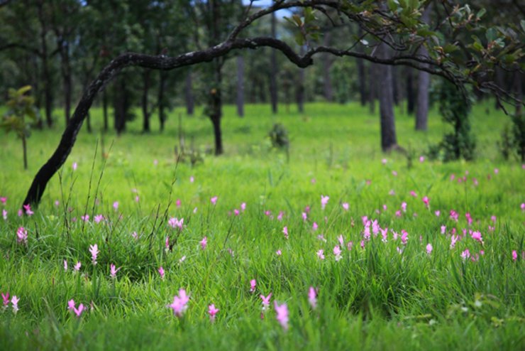
The largest field of Siam tulips in Chaiyaphum Province, Krachiao flowers field in Thaithong National Park is located on the west side of Phang Hi mountain range. It is special because it offers two colors of Siam tulips: pink-purple (Dokbua Saban) and white (Dokbua Thep Apsorn). The field is divided into four main groups with easy walking trails through the dry dipterocarp forest and scenic viewpoints along the cliffs. The total round-trip walking distance is approximately 4 kilometers. There are two options for the walking trail: the first starts from the second, first, third, and fourth groups of Siam tulips.
The third group of siam tulips is located along the path from Pha Pomuang Cliff to Pha Hot Cliff, covering a distance of approximately 300 meters. This group features pink-purple siam tulips, but the density is not as high as the second group. These tulips grow interspersed among rang trees and are scattered throughout the area. From this group, a path branches off to the left leading to the fourth group of swamp lilies, while continuing straight ahead will lead to the second group of swamp lilies.
The second group of siam tulips can be reached by walking straight from Pha Had, a distance of
Approximately 800 meters, or about 700 meters from the group 4 fields of Siam tulips, group 2 fields are a fairly large area with a dense population of purplish-pink Siam tulips. There is a walking path through the middle of the field, lined with beautiful-shaped Siamese rosewood trees that resemble works of art. During periods of low-lying fog, the scene becomes even more picturesque. After visiting the group 2 Siam tulip fields, you can also walk to the nearby Pha Plernin viewpoint to enjoy the scenery.
Group 1 of Kra Jiew flower field
The largest field of Siam tulips in Khao Yai National Park. In addition to walking from the second group of Siam tulip fields through the Pha Mueang cliff, there is also a shortcut from Highway 225 near the Khao Phang Hoei viewpoint to the first group of Siam tulip fields. The terrain of this group of Siam tulip fields is an open field on the eastern slope of the mountain, surrounded by a dense dry dipterocarp forest. There are convenient walking paths and photo spots. On a clear day, you can also see the scenery of the Siam tulip fields down to Nong Bua Rahe and Mueang Chaiyaphum districts.
Source: http://paiduaykan.com/76_province/Northeast/chaiyaphum/saithong.html


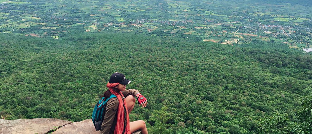
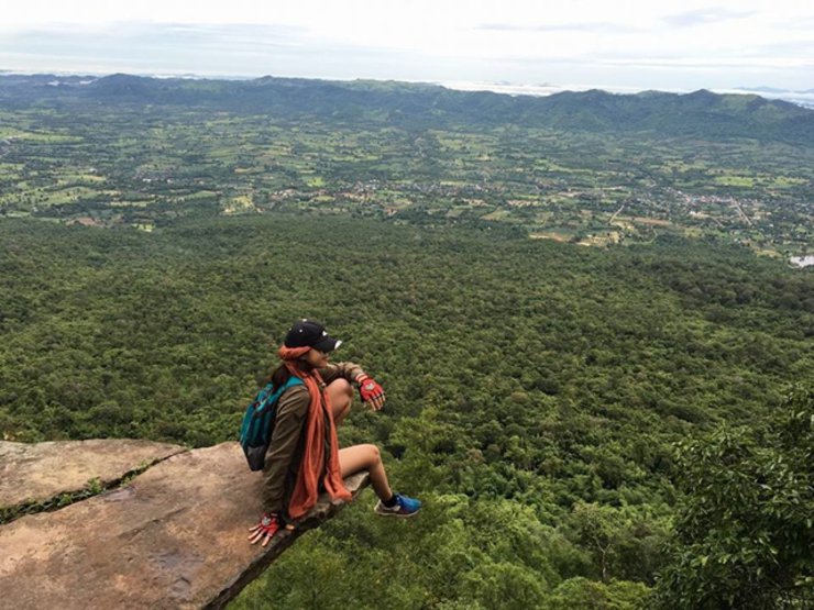
HamHod Cliff

Leave an empty space in the middle for her to pursue her dreams.
This song is dedicated to the secretary.
The HamHod cliff was crowded, so I went to find some new angles.


And then walked to the lotus field.


Beautiful as the story goes.


Behind the lens: A photographer's perspective


Behind the lens: A photographer's perspective

On this trip, Uncle Prasan served as the coordinator and primary photographer.


Continuing on, getting ready to return.


Around 10:00 a.m., after leaving Thung Bua Sawang, we had lunch and prepared to travel to Phitsanulok province to go whitewater rafting on the Lam Nam Khek River.

Due to time constraints, it is not feasible to pick up and drop off as in the first round. Renting a car is more time-efficient.


To lie in wait to photograph those who come by pickup truck.


The atmosphere was electrifying, with the crowd erupting in joyous screams. It's a shame I didn't capture it on video.

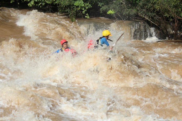
Let's go whitewater rafting.


Arrival at Panavalli Resort at 1:30 PM.

The back will be a suspension bridge.


The Khek River is a medium-sized river originating from the Phetchabun Mountains in Khao Kho District. It flows through Thung Salaeng Luang National Park in the Nong Mae Na Unit of Phitsanulok Province and runs parallel to Highway 12 (Phitsanulok - Lom Sak). The Khek River's winding course features numerous waterfalls, including Sri Dit Waterfall in Phetchabun Province, the renowned Kaeng Sopha Waterfall in Phitsanulok Province, Poi Waterfall, Kaeng Song Waterfall, and Wang Nok Aen Waterfall. The river also boasts numerous rapids.
During the rainy season, this clear and calm river transforms into a raging torrent of dark brown water. While tourists may be hesitant to swim in these conditions, the rainy season attracts the most visitors due to the exhilarating whitewater rafting opportunities it presents.

Team 1. Very good looking team.

Team 2. The President's Team, Team Sayyid.

Team 3. Team Noy Oy Thailand Outdoor

The male staff will guide you on how to raft, paddle, and take precautions. The rafting distance is almost 10 km, taking about 3 hours to pass through 13 rapids with difficulty levels ranging from 1 to 5. This makes the Khek River rafting tour in Wang Thong District, Phitsanulok Province, an exciting, thrilling, challenging, and fun experience. It is considered one of the most popular rafting tours in Thailand.

Prepare to enter the water at: 1. Kaeng Tha Kham 1 – 2
2. Kaeng Thay 1 – 2
3. Long Wave Rapids 2
4. Forest Heritage Rapids 2 – 3
5. Pak Yang Rapids 2 – 3
6. Lhad 2-3 Rapids
7. Kaeng Sap Yang 1 – 2
8. Rachamankla Pier 1 – 2
9. Kaeng Sang 4 – 5
10. Sopharam Rapids 4 – 5
11. Kaeng Dong Sak 1 – 2
12. Kaeng Nang Koi 4 – 5
13. Kaeng Yaow 3 – 4
14. Huen Nam Yen Rapids
15. Keng Thap Khun Thai

The boat was launched, and our group went whitewater rafting at 4-15.

Not yet whitewater rafting, practicing falling into the water, adjusting the body first.


After whitewater rafting, they showered, ate dinner, and went to bed.


Having breakfast and preparing to go hiking, which is about 100 kilometers from the resort.


We stopped for lunch at Phu Hin Rong Kla National Park. The weather was very cool.


With our supplies ready, we set off by car to the Red Mangrove Unit, a short distance of 8 kilometers.
Reaching Man Daeng Waterfall requires an adventurous trek through the jungle, covering a distance of approximately
3.5 kilometers in the rainy season, the path is quite steep and very slippery. Before going down to the Man Daeng Waterfall, you must contact the officer.
The journey to Man Daeng Waterfall takes approximately 2-3 hours on foot, and the waterfall itself is worth spending time exploring.
Approximately 1 hour and another 2-3 hours for tourists who do not focus on taking pictures, but may use
Allow 2-3 hours for photographing the waterfall.

From here, it is a 3.5 km hike to Man Daeng Waterfall. However, we arrived very late at 2:00 PM. Ideally, we should have arrived no later than 8:30 AM.
Man Daeng Waterfall - Thapsakae - Phu Hin Rong Kla National Park
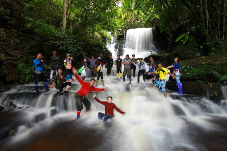
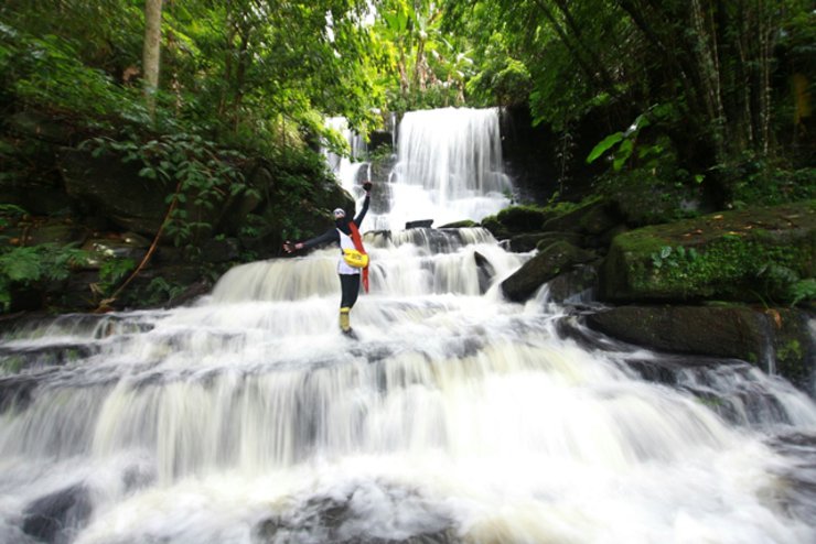
Man Daeng Waterfall is located in Phu Hin Rong Kla National Park. This is my fourth visit to the waterfall, and as always, I came in August. August is another ideal time to visit Man Daeng Waterfall, as the pink dragon tongue flowers bloom during this month. Man Daeng Waterfall has 32 levels, but only levels 1 to 9 are accessible for hiking and photography.


Embarking on the journey at 2:30 PM. Oh my goodness, it's so hot!

A short distance down the paved road, there is a path leading into the forest.


The path is a narrow, single-file trail with clear markings. There are occasional岔路口 (chālùkǒu) or forks in the path.


The initial section of the trail is not steep. The entry point is a narrow gap, easily overlooked as a path leading to a waterfall.
The image is blurry due to movement during capture. We apologize for any inconvenience.


The air was cool and it seemed like rain was about to fall.


The path ahead becomes steep and slippery, especially when it rains, making travel even more difficult.


The path is unclear.


It will then be a banana forest.


And then it becomes a bamboo forest.

The road is beautiful.

Through a long tunnel

Cross the second stream.

Entering the bamboo forest.

There are currently two ways to reach Man Daeng Waterfall:
1. Accessing the waterfall involves entering the Phu Hin Rong Kla National Park in Phitsanulok Province. Upon arrival at the park headquarters, contact park officials to arrange for a guide. Pre-booking is highly recommended. With a guide, the trek involves a 3.5-4.5 km hike through mountainous terrain, with an estimated duration of 3-4 hours (excluding return trip and depending on the hiker's fitness level). The trail begins at Phu Hin Rong Kla National Park and leads to the waterfall, with nine tiers cascading from top to bottom.
2. Access to the village of Ban Man Khao in Kok Sathon Subdistrict, Dan Sai District, Loei Province is challenging due to the rough road conditions. During the rainy season, the road becomes muddy and unsuitable for sedans. High-clearance pickup trucks or four-wheel drive vehicles are recommended. Upon arrival at the village, inquire with locals about a guide to the waterfall. The cost of the guide is negotiable. The trek to the waterfall involves a 2-3 km hike through mountainous terrain, taking approximately 50 minutes depending on the fitness level of the traveler.
The journey begins at Ban Man Khao village, where you can access the Lai Waterfall from the bottom level (ascending from low to high), starting from level 1 to level 9.

This trip, we chose route 1.


The distance from the red sterile unit to the first waterfall level is approximately 3.5 kilometers, but it takes almost 2 hours due to the very muddy and slippery conditions. In addition, there are some sections where you have to descend the hill. Imagine the mud being so muddy that you think you have to brace your feet to avoid slipping, but you still can't. Let's just summarize it with a long picture of the waterfall.


Floor 1
The waterfall consists of 9 tiers, located at the intersection of three provinces: Phetchabun, Loei, and Phitsanulok.
The waterfall is located in Phu Hin Rong Kla National Park, Phitsanulok Province. The entrance and exit are in Phetchabun Province, and the starting point is a village in Loei Province. This waterfall is very beautiful. During the rainy season, there will be a lot of water. What makes this waterfall different from others is that there are pink dragon tongue flowers growing on the rocks around the waterfall, which are a sight to behold (mostly on the 5th level of the waterfall). These dragon tongue flowers bloom only once a year, from July to August (mid-August is recommended). If you come outside of these times, you will not be able to see the dragon tongue flowers.

Second floor

4th floor

4th floor


5th floor


Top 6 floors
Bottom 6 digits

7th floor


Top 8 characters

Bottom 8 characters


The path to each waterfall level is a steep, winding trail that follows the course of the waterfall.


The route can be seen in the picture.

Everyone had a splashing good time playing in the water.


5:00 PM. Walk back to have dinner and prepare to travel back.


Returned around 5:30 PM.

On the way back, we were the second-to-last group to leave. Initially, there were three of us: me, Max, and another woman from another group whom we had helped up. As it started to get dark, Uncle Thong, who was worried that we wouldn't have enough light, caught up with us from the last group, making a total of four people. We reorganized the group with me leading the way and Uncle Thong bringing up the rear.


It is getting dark and it is raining.

Try walking without a flashlight to practice your skills.

My phone's battery died and it was raining, so I couldn't take any pictures. I had to ask Uncle Thong to take them for me.

Departing from the jungle around 7:40 PM, the group took their time, enjoying the atmosphere and taking photos before heading to shower. The last team followed suit around 8:00 PM.


Who else would it be?
Accompanied by photos captured by the photographer.


The photo shows the photographer, Max.
I'm Che
Friday, October 4, 2024 3:11 PM

