Klong Naka Forest, Chom Mine, Thousand-Meter Waterfall, Cheow Lan Dam Crossing, 4 Days 3 Nights
This trip is considered one of the most challenging and arduous journeys, encountering rain, leeches, mud pools, flash floods, and dense jungle trails. Few people have the opportunity to embark on this strenuous trek through the dense rainforest, passing by the abandoned Chohn Mine, which has been left untouched for over 40 years. We will witness the majestic Ton Pahn Waterfall, cascading down a nearly 1000-meter-high cliff. The three-night stay in the wilderness requires exceptional endurance and resilience. Participants must be fully committed, have prior hiking experience, and be self-sufficient. This trip does not include porters, so all belongings must be carried in backpacks.
The arduous trek through the wilderness
This arduous trek through the wilderness presented significant challenges, from coordinating with two wildlife sanctuaries, Khlong Nakha Wildlife Sanctuary in Ranong and Khlong Saeng Wildlife Sanctuary in Surat Thani, to navigating the dense and diverse terrain. Our journey began at the Khlong Nakha Wildlife Sanctuary's Kampuan Unit and concluded at the mouth of the Khlong Saeng River, spanning four days and three nights. The remoteness and abundance of wildlife in this pristine forest make it a rarely traversed path.
Securing fellow adventurers proved equally challenging, with frequent changes in the group composition leading to repeated recruitment efforts.


Head Chef (Me Mayani), Chef Wut, Chef Kam (Ngsai Rambo), Chef Thong, Chef Soei, Pongpang, Nong Senaam, Chef Nokko, Chef See, Tod, Q, Am, and Mod

5-8/5/59
Our sincere gratitude goes to Head Toom (Mr. Lerdsak Sriphrom, Head of Klong Naka Wildlife Sanctuary) and the staff, Uncle Kiew, Brother Nuei, Brother Kai, Brother Jer, Brother Siu, Brother Ped, and other officers of the Klong Naka Wildlife Sanctuary. We are deeply appreciative of their invaluable assistance in providing information and facilitating our trekking experience in Ranong Province.
This was our first time hiking in the south. We were tired of the crowded trails and the hustle and bustle. Around the beginning of March, we started looking for hiking trails with less tourist traffic using old sources. We came across Khlong Nakha Forest, Morakot Nakhon, Muang Chon, and Ton Pahn Metre Waterfall. There was very little information about these forests on the internet, which piqued our interest. We then gathered information and looked for members to join us on this trip starting in March. It was a long time to plan for this trip.
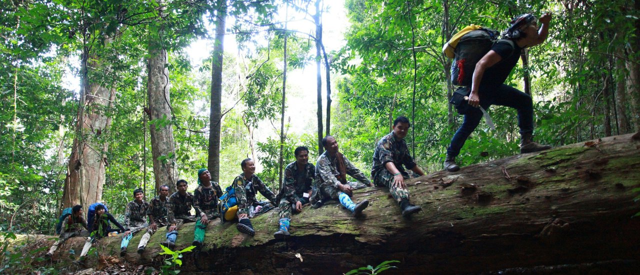
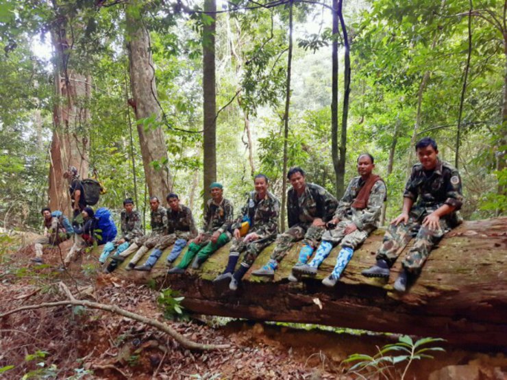
This particular hiking trip was unique in that, in addition to the 5 staff members who were guiding our group, there were also 6 members from the Khlong Nakha Wildlife Sanctuary, led by Head Warden Toon, who joined us to explore the trail. This trip served as a case study for managing future hiking groups, and Head Warden Toon would accompany us only as far as the Choen Mine before returning to the Kamphuen Unit. As a result, there were 13 staff members and 13 members of our group participating in this trip.
Expenses and Contact Information
Please note that expenses may vary. As mentioned earlier, our case is an example, so it is recommended to call for updated information.
Head of Toon, Mr. Lerdsak Sriphrom, Head of Khlong Nakha Wildlife Sanctuary 0818950897
Ms. Paen, for booking a raft at Pak Khlong Saeng (Khlong Ya unit), please contact 083-6906197 for raft and food arrangements.
Contact Raft Klong Ya 061-1869787 for boat and raft with food.
You can contact the boat and raft through either number, but they belong to different owners. Please choose accordingly.


Historical Background
• The Khlong Nakha Wildlife Sanctuary is located in the forests of Ban Na, Chieo Liang, Kaper, Bang Hin, Na Kha, and Kampuan sub-districts, Kaper district, Ranong province. The eastern side of the sanctuary borders Surat Thani province, while the southern side borders Phang Nga province. Due to the area's pristine forest and abundance of wildlife, the government recognized the importance of conserving the forest and its inhabitants. The Cabinet therefore resolved to protect the area as a reserved forest, as announced in the Royal Gazette, Volume 78, Part 94, dated November 14, 1961. Ranong province subsequently declared the forest a permanent forest, as per Provincial Letter No. 4842/2506 dated March 15, 1963. In 1968, the Forest Management Division of the Royal Forest Department dispatched personnel to survey the area's topography, flora, and fauna in preparation for its designation as a wildlife sanctuary. On May 24, 1972, the Revolutionary Council issued Proclamation No. 150, designating the Khlong Nakha forest area as a wildlife sanctuary, as announced in the Royal Gazette, Volume 89, Part 82, dated May 26, 1972. The sanctuary currently covers an area of 331,456 rai.
• Climate characteristics
• Due to its proximity to the Andaman Sea, the region experiences the influence of the southwest monsoon, resulting in frequent rainfall throughout most of the year. The rainy season extends from April to November, followed by a dry season characterized by hot and humid conditions. The winter season is virtually non-existent, with only a slight decrease in temperature compared to other seasons.
Chief Toon, Head of Klong Naka Wildlife Sanctuary

(In the picture, the officer is carrying equipment and specifying the coordinates.)
Wildlife Sanctuary
A wildlife sanctuary is a designated area that provides a safe haven for wild animals. This allows the animals within the sanctuary to reproduce and expand their populations naturally. As a result, some animals may disperse to nearby areas, increasing the overall population of the species in the region.
The establishment of wildlife sanctuaries is a direct result of the need for wildlife to survive and reproduce. This requires essential factors such as water sources, food sources, and shelters. Forests are the origin of these factors, making them increasingly important and crucial for wildlife. When forests are destroyed, wildlife must compete for limited water and food sources, leading to weakened health and increased mortality. Simultaneously, humans have developed increasingly efficient firearms and hunting equipment, making it easier to hunt wildlife. These factors have contributed to the rapid decline of certain wildlife populations, with some species nearing extinction or already extinct. Therefore, efforts have been made to conserve and protect forests as habitats for wildlife in the form of wildlife sanctuaries.

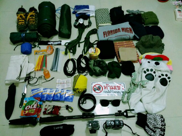
This morning, I packed my backpack for a long hike. #No right to stop her from going. All items were packed in separate bags according to their use and 100% waterproof.
This trip starts in Ranong and ends in Surat Thani.
1. Sneakers (Forgot to bring sandals, so I walked barefoot).
2. Tent
3. Fly Sheet
4. Mosquito net
5. Sleeping bag (missing cover, broken straps, works as is)
6. National flag 🚩🚩🚩
7. Top strap, knee strap
8. Raincoat
9. Chimak fabric
10. Travel day outfit (spandex) and breathable pants
11. Gecko
12. Lightweight long-sleeved rabbit fur coat
13. Long johns (optional, as a sleeping bag may suffice due to their warmth, allowing for comfortable walks even in sub-zero temperatures).
14. Sleeveless pajamas, short pants, quick-drying fabric, sarong, socks, belt
15. Hat Hat Hat Hat
16. Various sizes of rope and belts
17. Gloves
18. Minerals, candies, lighters, plasters, wet wipes, and medicine.
19. Sweat-absorbing headband to prevent sweat from entering the eyes.
21. Camera, music player, glasses, camera, camera equipment.
22. Leech socks
23. Miscellaneous personal items and food.
25. Mosquito repellent
26. Cable Tie
27. Bowl, spoon
Etc. We estimated the weight to carry water, lunch, 1 kg of rice, 1 kg of salted pork, 2 liters of drinking water, and snacks (we carried 1 kg of dried bananas, tears will fall).
The repellent spray is not carried and not used. When entering the forest, you should be able to stay with the forest. You will get used to it.


We have arranged to meet with other members at the Khlong Nakha Wildlife Sanctuary on the morning of May 5, 2016. Please arrive at your convenience.
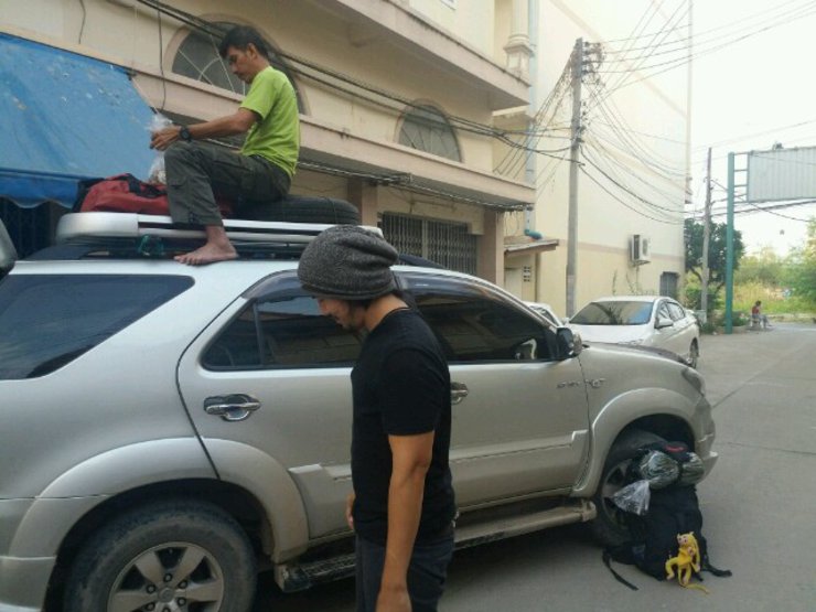
On the morning of May 4, 2016, we set out on our journey. Our companions, P'Wut and Gam (our fearless comrades), picked us up at our home. We shared the cost of fuel and loaded the communal supplies into the car before heading towards Ranong province.
We are the owners of the review.
Name: Monster Che
Race: Half-human
Property: shadow 3
Hiking requires not only physical and mental preparation, but also the ability to handle getting lost. Ask yourself if you are truly ready. At the very least, you should be able to do what you have posted.
1. To prepare for potential emergencies in the wilderness, it is essential to pack dry food, rice, salted pork, salt, and instant noodles in your backpack. These supplies should be sufficient for at least three nights, even if you are participating in a guided tour.
2. At least one pot for cooking rice and boiling water.
3. Possessing rice-cooking skills is highly recommended, as it can prove invaluable in a survival situation. In the event of getting lost in the wilderness, self-reliance becomes crucial, and the ability to cook rice can provide sustenance and nourishment.
4. A backpack should contain a lighter, whistle, flashlight, spare batteries, knife, and medicine.
6. Be able to find safe sleeping accommodations independently.
7. Ability to carry one's own belongings.
Any thoughts to add?
I will make a review when I have time.
While backpacks may hold props, true friends are there for you in times of need.


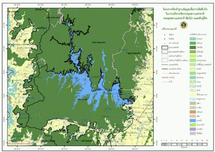
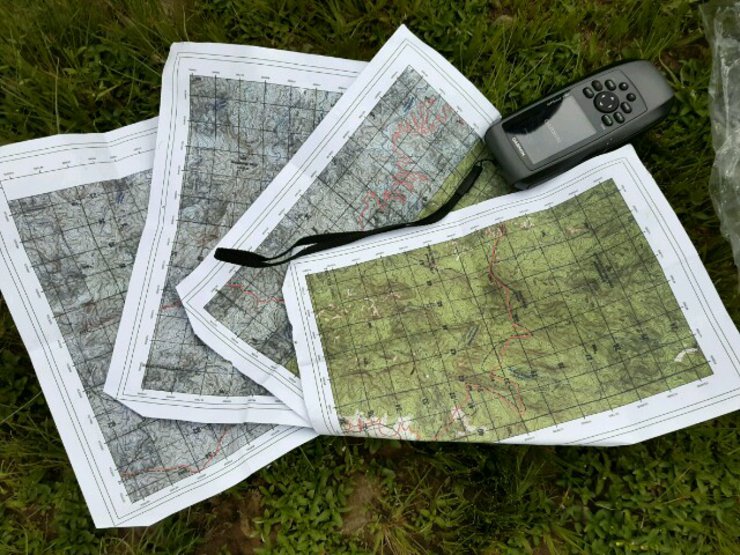
We are curious about the total walking distance in kilometers. Based on information found on the internet, it is said to be 54 kilometers, but this is not very clear, so we need to measure it ourselves from the map.
The straight-line distance from the Kampuan unit to the point where the ship picked up the refugees, as measured on the map in the image, is 60 kilometers.
The total distance covered by the officials after the walk was 85-90 km, as they had to walk across a stream.


We arrived at the Khlong Nakha Wildlife Sanctuary around 8:00 PM, where a park ranger was waiting to greet us.

There are shops in front of the Khon Kaen University campus that sell almost everything. We ordered breakfast and lunch at this shop. Normally, the owner doesn't cook, but he was kind enough to make us chicken biryani and garlic chicken with rice. There are beds to sleep on, and they don't charge for them. We can just put money in the box if we want to.


6:33 AM. All members arrived by tour bus from Bangkok.
Che wakes up early to bother people who are sleeping and constantly calls for food.


After breakfast (breakfast and lunch can be ordered from the shop in front of the unit, which is about 300 meters away), the team leader will discuss the walking plan.


In the picture, Che is not short, but the man in the red shirt is taller than the average human.
9:30 AM: Prepare to depart for the Kampuan unit, where the walk will begin.


The unit then proceeded to organize their belongings and conduct a final check of their readiness.


Upon reaching the "Kampuon" unit, a sub-unit, prepare your equipment and change your clothes before starting the trek. The starting point is called "Km 6," and the trail follows a road leading into an old tin mine. However, the path is not easy to navigate, as trees have grown and fallen across the path due to the mine's closure decades ago. The trail has reverted to a dense forest with many thorny plants. The initial section is flat, but you may need to duck under branches along the way. You might encounter black bat flowers along the path. Around noon, stop for lunch at the Khlong Saeng stream. Take a break, drink plenty of water, and then continue your journey to camp at Km 14. The latter part of the trail follows the stream, and you will encounter rare flowers almost all the way. The final section before reaching Km 14 requires passing through a steep point called "Kruaen Lao Thoi," which involves some climbing and can be tiring.


The path was heavily overgrown with thorns and fallen trees, requiring constant ducking and maneuvering. It was a challenging start to the day.


Marks on bamboo stalks from an elephant incursion. Take a break now and then.
The arduous trek through dense, steep terrain, punctuated by constant ducking and weaving, proved to be an energy-sapping endeavor, especially with the heavy backpacks weighing us down. The thorny vines further impeded our progress, their tenacious grip hindering our every step. The constant struggle against their resistance drained our strength, forcing us into a protracted battle of wills. This relentless obstacle proved to be a significant drain on our physical reserves.


We took a break for lunch, each finding a quiet corner to sit and eat. As we ate, we watched the fish and tadpoles in the water.


Whenever we venture into the wilderness, we never hesitate to capture the moment with our cameras. The uncertainty of our return, influenced by various factors and opportunities, fuels our desire to document these experiences.
Seize the moment and savor your surroundings. Don't rush through life without appreciating the beauty that surrounds you.


Halfway through the first day, Soey started to struggle with the terrain. The constant changes between crossing streams, climbing steep slopes, and walking on loose rocks were taking their toll. Gaem stepped in to help, carrying Soey's backpack to the campsite where they would spend the night.
"Amazing! Say, Kubota's power is real! Let me tell you, carrying an extra kilo in the forest is really tough. Gaem is someone I truly admire for his kindness. He's always helping others, never worrying about his own hardship. Gaem, you have a beautiful heart."


If the path is overgrown, cut it down to the stream.

The officer crawled to drink water.


The first day we met the snail, it was so exciting that we walked and rested alternately. We had to wait for those who couldn't walk, and we had to go together.

Don't worry, I can carry two buffaloes.

There are not many pictures, but they are all beautiful.

Venture through the thorny wilderness, this is the hipster's domain.
Really?


6:00 PM, May 5, 2016


The campsite was located in a steep valley with a nearby stream providing limited water for drinking and other uses. The descent was characterized by a significant incline.
Pictured is Mr. Thong, a conservationist and birdwatcher from Phetchaburi, on his first hiking trip.


Cooking food. This type of field kitchen can feed many people at once.


They sat in a circle to eat, shared stories around the campfire, washed their faces and bodies with water, and then went to sleep. Some slept on the floor, while most slept in hammocks.


The night scene was not captured. ^^

Hiked from the campsite at the bottom of the valley, panting all the way up to the ridge this morning.
Form a line up here.

After walking for a short while, we couldn't find the camera. We remembered that we had spilled water in the waterproof bag the day before reaching the camp and had to take everything out on a steep slope (about 10 minutes before reaching the campsite, it was a very steep slope, we had to use our hands and feet, and sometimes vines and tree roots to help). We forgot the camera. Che, P'Wut, and P'Thong ran back to look for it, but the park ranger was still worried and ran after us. We finally found the camera at the bottom of the ravine. We climbed up and down the hill twice, including yesterday. We were exhausted and almost cried.

Day 2's trail was quite challenging, consisting of old mining roads, some of which were steep and cut into the hillside.


The path is littered with fallen trees and thorns.

Steep sections with sharp turns.

Emerging from the path onto the road, there's no room for error in our acting. We must maintain a flawless appearance at all times, knowing full well that every trip will produce hilarious outtakes that will leave us in stitches.


A large tree has fallen before kilometer 16.
High-quality team, order any action.


They were having a conversation when suddenly he jumped and kicked him.
I will not tolerate this. Do you want to fight?
The destination is not always the most important aspect of a journey; rather, we prioritize the narrative and drama.


Black Ma Sa tree
Ferns in the genus Cyathea are medium to large terrestrial ferns distributed in mountainous regions of tropical forests worldwide, with some inhabiting temperate zones. In nature, these ferns are typically found in humid, high-altitude rainforests with moderate temperatures.

The homeowner was away, leaving eggs behind. A bird's nest was found in the forest. Uncle Thong said not to touch it, as the bird would smell a different scent.


Our group deliberately walked at the back, as a precaution in case anyone got injured or couldn't keep up, allowing us to provide immediate assistance.
Along the way, there was some playful teasing (who did this?).
The work of Ngasai. I arrived quite a while ago and had a long nap.


We walked and talked, taking our time, as we already knew our destination for the night: the Choen Mine.

Covering one's face with leaves obstructs vision, causing inconvenience to others.
This place has a strong mobile phone signal, perfect for enjoying the fun.

After walking for about six hours, they arrived at the Chon Mine.
The Zone Mine, a century-old abandoned mine, derives its name from the abundance of "fern zone" plants found in the area. Mining operations commenced before 1916, and the mine's heyday, over 60 years ago, earned it the nickname "Emerald City." Located deep within the forest, the Zone Mine spans three provinces: Surat Thani to the east, Ranong to the northwest, and Phang Nga to the southwest.
The journey to the Zone Mine begins at the Kampuan Forest Protection Unit in the Klong Naka Wildlife Sanctuary, Suk Samran District, Ranong Province. This route was historically used to access and exit the Zone Mine, requiring nearly two days of trekking.
The journey described in this passage is a trekking expedition through the forests of southern Thailand. The route starts in Kura Buri district, Phang Nga province, and heads north, ending in Kapoe district, Ranong province. The trek passes through Suk Samran district, Ranong province, and Vibhavadi district, Surat Thani province. The author expresses gratitude to the station master of the Kura Buri Bus Terminal for providing travel information and arranging transportation to the starting point. Special thanks are extended to Mr. Chusak Tin Phang Nga, a member of the Kura Buri Municipal Council, for escorting the group to the home of Mr. Sahas Prakobsaeng, an expert on the local forests. Mr. Sahas, 67 years old, practices sustainable agriculture on his land adjacent to the foothills. He guides the group to the forest entrance behind his house and garden, where a small stream flows year-round. The trail was previously used for timber extraction.
http://www.geocities.ws/tongpa/data003/2muangkhon.htm
The following story is a wondrous and mysterious legend that is actually true. It is about the Chohn Mine and a waterfall that is 1,000 meters high. It is believed that this is the only place in Thailand with such a high waterfall. Nearby, there is also a tin mine, which according to legend is the richest source of tin in the south. It took three years to transport equipment to the mine due to the difficulty of the steep, mountainous terrain.

Although I haven't reached the Chon Mine yet, I won't be camping there because I need to leave early tomorrow. Instead, I'm taking photos and exploring the surrounding area today so that I can finish before tomorrow.

The mine is located in the Klong Naka Wildlife Sanctuary, at the junction of the Dan and Phra Mi mountain ranges in Surat Thani province. It is also a tri-border area with Phang Nga province, on the border between Surat Thani and Phang Nga. After spending a night at the mine, the team explored the area and found that it was a beautiful landscape when viewed from the top of Khao Dan. The next day, they inspected Khao Dan and found that it was a mountain range that formed the border between Phang Nga and Ranong provinces. From the peak, they had a clear view of the Andaman Sea and the surrounding landscape. At over 1,300 meters high, Khao Dan is the highest point in the area, offering stunning panoramic views.

The room was littered with the remnants of daily life: worn shoes, kitchen utensils, empty beer bottles, and various other belongings.


Footprints of the owner of the land

The name of the Chon Mine comes from a type of fern that the locals call "Chon tree", which grows throughout the mine area.
The characteristic of the "ต้นโชน" plant is that it has 3 pairs of leaves, totaling 6 leaves.


Scientific name: Osbeckia stellata Ham.
Common name: Indian Rhododendron, Malabar Melastome
Other names: Clerodendrum infortunatum, Clerodendrum villosum, Clerodendrum paniculatum, Clerodendrum fragrans, Clerodendrum inerme, Clerodendrum viscosum.
Flowers: Used as a sedative and to stop bleeding in people with hemorrhoids.
Roots: Used as an antidote for fever, to nourish the body, stimulate appetite, and support the liver, kidneys, and bile.

After walking around, I sat down and thought about how many people must have lived here in the past.
Be prepared for some hardships when traveling with us.
We enjoy sleeping in tents and hammocks. We relish meals cooked in camp ovens. We embrace the feeling of walking in the rain. We are drawn to the verdant hues and earthy aromas of the forest. We find solace in gazing at the flickering flames of a campfire.


Travel offers more than you think.
Emerald City


After taking photos and enjoying the scenery, we returned to the camp. As usual, everyone had already set up their hammocks, showered, and were chatting comfortably. The only ones left were the group of students who had arrived late. We don't prioritize speed in reaching our destination, but rather focus on savoring the journey and appreciating our surroundings.


Sitting around a circle, eating food and listening to stories from everyone, it was such a joy. Tomorrow morning, we'll meet at 5 am, wake up and walk to Khao San Dan to enjoy the view of the Ranong Sea. Prepare your belongings now so that you can get up and go in the morning.
The sky is thundering and lightning tonight, but I'm too lazy to set up a hammock, so I'm just going to sleep on a mat. I'm planning my trip for tomorrow, which will be a journey along the red line. We will be passing through checkpoints for elephants and other wildlife, so we need to be careful.

The atmosphere is great at around 5 am. Bring a headlamp, a bottle of water, instant noodles, Ovaltine, snacks in a waterproof bag, and set off for Khao Daen.


A view from the peak of San Dan Mountain in Ranong, 1,345 meters above sea level, bordering the three provinces of Ranong, Surat Thani, and Phang Nga.


News reports claim to have found a polar bear on the San Daeng mountain range.

These images of young fern leaves were taken from the summit of Mount San Daeng.


Lady's Slipper Orchid
The spot where the plane crashed into the cliff on the San Daeng mountain range.
The wreckage of a Singapore Airlines training aircraft was discovered on the summit of Khao Dan. The two-seater aircraft, en route from Singapore to Ranong with a stopover in Phuket, crashed into the mountain due to poor visibility. Both the instructor and student pilot perished in the accident, which occurred in 2001.


Approximately 10:00 AM, we arrived at the accommodation, had breakfast, dropped off our belongings, and immediately set out on our journey.

After eating, they packed their belongings and continued their journey.

This path, as instructed by Brother Amnuay, requires us to walk closely together without leaving any gaps between us.

The path is constantly ascending and descending throughout the journey. It passes through elephant and wild boar checkpoints, with dense vegetation and numerous leeches. The forest is extremely overgrown.


Please provide a caption for the image.

The child's blue shoes were torn, but kind Uncle Green repaired them.

Climbing ylang-ylang


Found strange things, the fruit is bigger than the head.
The hairs inside the elephant apple can cause severe itching and even death if they fall on the head.

After a short walk, we arrived at the top of Ton Lorn Waterfall.
The most impressive aspect of exploring the waterfall was the pristine white rock formations, the towering height of the falls, and the breathtakingly beautiful and lush surrounding landscape. The sight was truly heartwarming.
The trail follows a stream originating from the Dan mountain range, leading to the 1,200-meter-high peak of the waterfall. During the dry season, the waterfall still exhibits a moderate flow. The most remarkable feature of the 1,000-meter waterfall is its white rock formation, contrasting with the typical black rocks found in waterfalls. The water cascades down a near-vertical cliff at a 15-degree angle, creating a continuous plunge without any tiers. The estimated height of the waterfall from the bottom is approximately 300 meters, resulting in a total height of around 900 meters. The waterfall is situated at an elevation of 1,200 meters, making it a truly majestic sight. The water flows into the Khlong Saeng stream, visible from the top of the waterfall. The waterfall marks the boundary between the Nakha Wildlife Sanctuary and the Khlong Saeng Wildlife Sanctuary. While the waterfall itself is not located within Phang Nga province, the water that flows from it enters the Khlong Saeng Wildlife Sanctuary.
http://narongthai.com/deebooc1.html

Sing a song.
Endure the time when it drizzles, at least it makes us see the difference.
When the rain subsides, the sky will clear, and we will understand how worthwhile it was to wait.

Enjoying a simple yet incredibly delicious meal with a breathtaking view. However, be warned, the surface is extremely slippery, so please exercise caution.
Sunny weather, rain, sunny weather, waiting to watch the video when it rains.

The atmosphere after the rain, standing foolishly on the edge of the cliff.

After lunch and a short rest, they continued their journey around one o'clock in the afternoon.

Along the way, I saw a very large tree.

A large pile of bull bones was encountered.


The rain has arrived, so we quickly walked to the camp. On the way, it started raining. When we arrived at the camp, we immediately set up the main tent and our own tents. In the meantime, some of us went to stock up on water because if the river floods, the water will be too muddy to drink.


After finishing your meal, please pack your belongings and begin your journey. Do not rush, and wait if it rains heavily. Crossing the stream will be difficult, and you may end up stranded for another night or two, potentially losing your jobs.


The journey alternates between wading through water and navigating dense, thorny undergrowth, where leeches are a constant presence.


Treading on water, the stones are slippery; walking in the forest, there are thorns. All along the way, there are animal checkpoints.

Today, I barely had a chance to rest.


The entire route is lined with cascading waterfalls, inviting you to take a refreshing dip. The breathtaking scenery that unfolds on either side of the path makes it difficult to tear yourself away. You'll find yourself wishing you could extend your stay by a few more nights.


Let's have a simple lunch, following the regulations.


Taking a break, I looked up and saw a python flicking its tongue.


The trail opened up to a vast, open field with a cool breeze. If I had another night, I would definitely set up camp here. As I walked, I came across several potential campsites, some with deep pools teeming with fish.


Others took runes and had fun.


Let's dig in and enjoy the meal without further ado.


We have arrived at the waterway checkpoint.

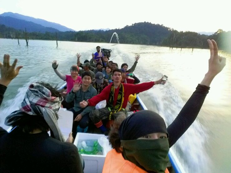
We sailed for three long hours, the vast expanse of water stretching out before us, illuminated only by the piercing beam of our boat's headlights cutting through the inky darkness.
Arriving at the port around 8:30 p.m., everyone else had put away their cameras. However, Che still had a duty to do a review, so he couldn't abandon his task.


This is my life.
How many tomorrows do we have left? How much time do we have?
Each to their own.
I'm Che
Friday, October 4, 2024 3:11 PM

