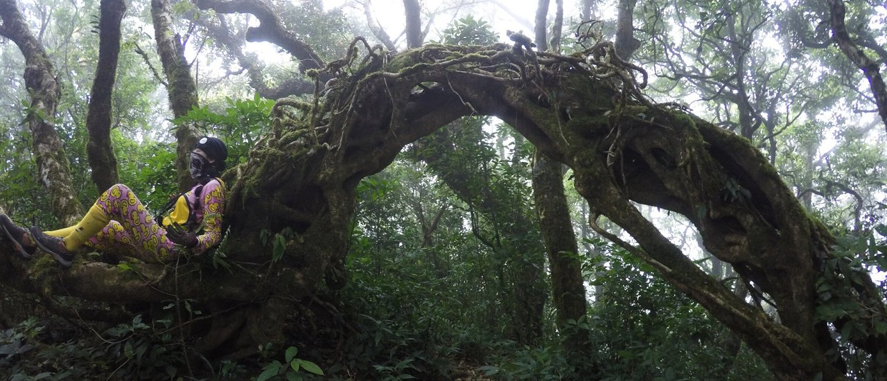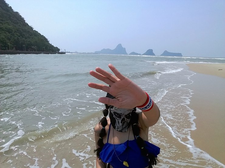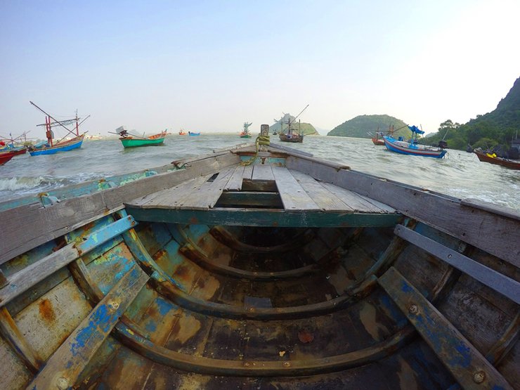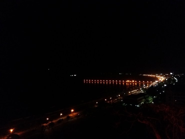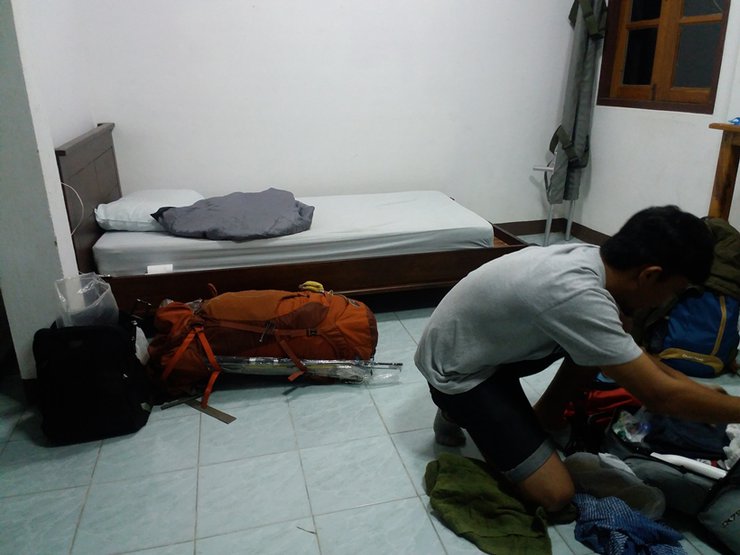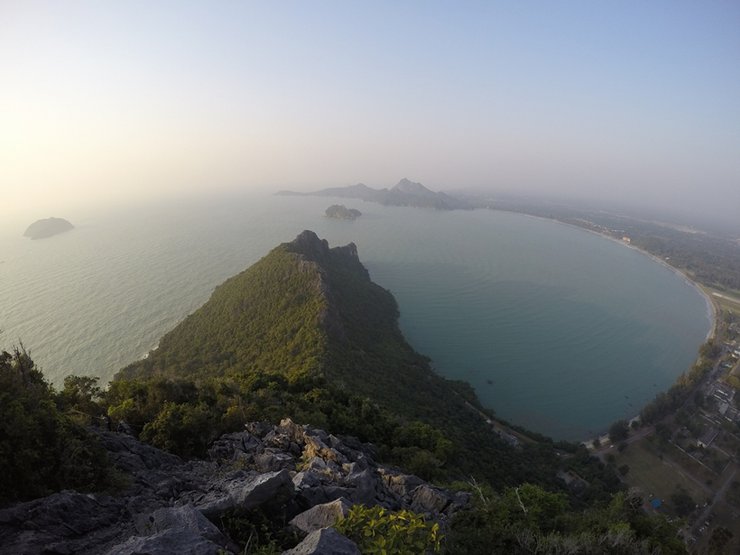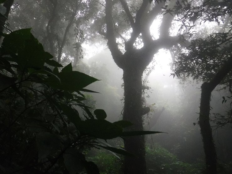


This week, we planned a relaxing trip to the beach for some fishing and rest. However, our plans took an unexpected turn, leading us on an adventurous journey that included climbing three mountains, exploring four beaches, visiting a waterfall, fishing in the sea both day and night, and experiencing the life of a fishing village. All this packed into a 3-day, 2-night trip. We conquered Mount Luang, Khao Chong Krachok, and Khao Lom Muak, relaxed on the beaches of Ban Krut, Ao Prachuap, Ao Manao, and Ao Noi, and immersed ourselves in the local fishing community. We even managed to do some fishing! It was an incredibly fun and memorable experience, and I'll be sure to share all the details with you soon. Please note that the pictures may not be of the best quality as we didn't bring a professional camera. Thank you for following along!

This trip was for four people, and no one was interested in joining. On February 10, 2017, we left Kanchanaburi for Hua Hin, getting off at the clock tower. The fare was - baht, and then we took a bus to Bangkok and Prachuap Khiri Khan for 80 baht. When all the members were present, we traveled to the park in Jack's car, arriving around 3 am. Since there were few of us, the park allowed us to sleep in the tourist service center. Thank you very much. The cost of climbing Khao Luang Prachuap includes a guide fee of 2,400 baht for 2 people/10 people. The more people there are, the cheaper it is, but we split it among 4 people. This trip cost 850 baht per person for the climb and food (normally the climb to the top costs 1,250 baht and takes 3 days and 2 nights, but this trip only took 2 days and 1 night). The mountain is only open for climbing twice a month and is closed during April and May of each year.
Huai Yang Waterfall National Park, Thap Sakae District, Prachuap Khiri Khan Province 77130, Thailand. Phone: 08 4701 2795, 032-619-743.
National Park Entrance Fees
Thai: Adults 20 baht, Children 10 baht.
Foreigners: Adults 100 baht, Children 50 baht
Huai Yang National Park: A Haven of Natural Beauty
Huai Yang National Park encompasses a diverse landscape within the Bang Saphan, Thap Sakae, and Mueang districts of Prachuap Khiri Khan province. Situated at Thailand's narrowest point, the park incorporates the scenic Huai Yang Waterfall Forest Park, boasting numerous stunning waterfalls and a rich biodiversity. This haven of natural beauty, encompassing mountains, waterfalls, and beaches, covers an area of approximately 100,625 rai (161 square kilometers).
Flora and Fauna
The National Park is characterized by a diverse range of forest types, including mixed deciduous, hill evergreen, and dry evergreen forests. The vegetation is dominated by tree species such as teak, sal, pyinkado, rubber, dipterocarp, Siamese rosewood, wild Siamese rosewood, Burmese ebony, rotten egg tree, fig, and various types of bamboo.
The mountainous terrain of Namtok Huai Yang National Park, characterized by steep slopes and connected hills, provides a habitat for diverse wildlife. These include wild elephants, gaur, sun bears, serows, black panthers, gibbons, langurs, dusky leaf monkeys, wild boars, porcupines, barking deer, squirrels, bats, and various bird species such as junglefowl, pheasants, laughingthrushes, rock pigeons, golden-fronted leafbirds, and warblers. Notably, the summit of Khao Luang is home to the endemic Phricotelphrsa sirinthorn crab.
Travel
From Bangkok, take Highway 4 (Phetkasem Road) to kilometer 350-351 at Huai Yang Market (approximately 20 kilometers before Thap Sakae District). Turn right onto Phetkasem-Huai Yang Waterfall Road for approximately 7 kilometers to reach Huai Yang Waterfall. The journey takes approximately 6 hours.
Amenities: Huai Yang Waterfall National Park offers a variety of amenities to enhance your visit. For larger groups and families, there are detached houses with three bedrooms and two bathrooms, providing a comfortable space for relaxation and gatherings. For those seeking a closer connection with nature, there is a designated camping area where you can pitch your tent and immerse yourself in the surroundings. Additionally, if you haven't packed your own food and supplies, there's no need to worry. The park has a restaurant that serves delicious meals throughout the day, ensuring you stay fueled for your adventures.


Morning atmosphere at the park on February 11, 2017.


The restaurant in the park is located in a clean and shady area. There are designated waste disposal points that are well-maintained. The management is excellent, and the staff are friendly and welcoming. I was very impressed.


Let's brainstorm ideas for what to buy or do. The shops here sell things at affordable prices. The last picture shows everything for 20 baht, which is incredibly cheap.


The team returned to the unit for breakfast. Rice was 40 baht per plate, and fried eggs were 5 baht each. The team members were advised to wear black shirts, while the team members from the other team wore blue shirts. Jack sat opposite them.

Let's take a group photo. The officer on the left is named P'Muek, and the one on the far right is named P'Tao. They are the best park rangers in the park.
Huai Yang Waterfall National Park is located on the Tenasserim Hills, a complex mountain range with peaks ranging from 100 to 1,200 meters above sea level. The highest peak is Khao Luang, which serves as the headwaters for several rivers that form the border between Thailand and Myanmar. These rivers include Khlong Ang Thong, Khlong Kaeng, Khlong Thap Sakae, Khlong Cha Kra, Khlong Khai Nao, Khlong Ta Klet, Khlong Huai Yang, Khlong Huai Ma, and Khlong Hin Chuang. To the east, the park borders the coastal plains and the Gulf of Thailand.
The highest peak of the park, Khao Luang, stands at 1,250 meters above sea level. Along the 7-kilometer trail, you will experience the atmosphere of a mountainous rainforest and the cool air. If you visit during the early rainy season, you will also be able to admire the blooming fields of siam tulips and the lush green forests of the Tenasserim Hills, which stretch along the border between Thailand and Myanmar. However, the trail can be quite challenging. The best time to conquer Khao Luang is between October and February.


Our group began our trek at 9:30 AM, starting with a walk through Huai Yang Waterfall.
Huai Yang Waterfall, a large waterfall with seven tiers, boasts a scenic viewpoint on the fourth tier offering panoramic views stretching to the Gulf of Thailand. The fifth tier features a cascading waterfall plunging from a 15-meter-high cliff. As we reached the fifth tier and ventured into the forest with our large backpacks, onlookers at the waterfall curiously watched our progress.


Enjoy a leisurely stroll through the lavender fields and try your hand at some relaxing fishing.


Where did the lavender field go?


The trail begins with a steep incline and dense forest from the outset. The first 4-5 kilometers are not primeval forest, but rather typical southern Thailand rainforest.


The lavender fields have been taken from us.


The first half kilometer is already entertaining, with the steepness of the path.


Less than half an hour of walking and look at everyone's condition.


At this point, P'Muek said to rest as much as possible, as we will have to walk for a long time later.


After a break, we continued our journey. The trees here are tagged.


The road remains the same, steep.


The forest here boasts a diverse range of trees, maintaining a lush green canopy. The central image depicts...


While walking, I stumbled upon this rock and couldn't resist taking a few pictures. I asked an official nearby what it was called, and he said it didn't have a name yet. So, he decided to call it "Tarzan Rock."


The forest here is very lush, with many large trees.
The image on the lower right shows jackfruit growing on the ground.


Resting with P'Muek and P'Tao cheering me on.


The forest here is like the Amazon rainforest, and now the park has camera traps. They just got funding.


The forest is overgrown, and the slope remains the same.


Lush and majestic trees line the path.


After lunch, they continued their journey.


A recently deceased civet was found along the path, likely killed by a large red hawk that was unable to carry it away.
Flying lemur, colugo
The colugo, also known as a flying lemur, is a peculiar mammal with gliding capabilities similar to a flying squirrel. Its appearance resembles a cross between a squirrel and a lemur, leading to its Western nickname. With a head-body length of 34-42 centimeters, a tail of 22-27 centimeters, and a weight of 1-1.8 kilograms, the colugo's primary coloration is brown, adorned with white spots and a net-like pattern extending across its body, legs, and tail. This camouflage effectively blends with tree bark. A distinctive feature of the colugo is its extensive skin membrane, connecting its forelimbs to its hindlimbs, hindlimbs to its tail, forelimbs to its neck, and even between each finger.
Despite their resemblance to other animals, colugos are not squirrels, bats, lemurs, or tree shrews. They are unique creatures with distinct evolutionary origins, classified in the order Dermoptera, which means "skin wings." Only two species of colugos exist: the Sunda colugo and the Philippine colugo. The latter is smaller and slightly lighter than its counterpart.


The journey ends at the final resting place. On both sides, there are water sources called Huai Nam Sai and Huai Nam Daeng. Let's go down and see both sides to see.


The large vines are abundant. The lower image depicts an unidentified tree with a pungent aroma similar to that of the "pla lo" fruit. This perennial tree is commonly found in dense forests.
It is unclear whether the plant belongs to the genus Cinnamomum. Most species in this genus have fragrant leaves and bark and are evergreen trees. They are widely distributed in tropical and subtropical regions, such as Southeast Asia.

The stinging tree, also known as the three-leaved nettle (Dendrocnide stimulans), causes intense itching upon contact.


Having enjoyed the sights and sounds of nature, it was time to continue our journey, leaving behind an atmosphere filled with laughter.


After walking for a while, P'Muk shouted, "We're here!" This place is called "Cliff 1," and the place where we will sleep is called "Cliff 2."


Take a picture at Cliff 1. In the early rainy season, you can also enjoy the view of the blooming ginger lily field.


Following the path, we encountered two paths where the majestic Lion Orchid awaited, welcoming us with its stunning beauty.


Around half past three in the afternoon, after a short rest, they found a place to sleep.


They went out to find water themselves, scooping it up to cook and drink. The stream was not far from their accommodation. On their way back, they brought leeches with them.


Let's have dinner. I'm very hungry. I only had snacks for lunch.


The sky was bright, but suddenly it became dark and foggy. The highlight of this place is the viewpoint on top, which offers a view of three bays. At night, you can see three worlds of stars: stars on the ground, stars in the sky, and stars on the water. Unfortunately, we couldn't see any of them.

After playing and napping, letting the cool mist and breeze brush past my face, I returned to the campsite to rest.


Around eight o'clock in the evening, they went out to search for the king crab.
The Panda crab (Phricotelphusa sirindhorn), also known as the Sirindhorn crab or waterfall crab, is a species of freshwater crab endemic to Thailand. It was first discovered in 1986 at the Ngao Waterfall National Park in Ranong Province. The crab is characterized by its striking coloration, with a white carapace and claws, and purple-black walking legs, eye sockets, and mouthparts. It is distinguished from other crab species by its abdominal segments and the morphology of its first pair of male gonopods.
Reaching a maximum carapace width of 9-25 millimeters, this species is restricted to waterfalls in western Thailand, including Huai Yang Waterfall in Thap Sakae District, Prachuap Khiri Khan Province, and Khao Pa Nen Thung Waterfall in Kaeng Krachan District, Phetchaburi Province.
However, it was not found. The king crab will be like this.


After searching for crabs, I went to sleep so I could wake up early tomorrow. It's very cold.
The image depicts the scene at 7:00 AM on February 12, 2017.


The sky was still overcast in the morning. Normally, if the sky is clear, you can see the view of Ao Manao, Ao Noi, and Ao Prachuap.


Gather your belongings promptly. Around 8:00 AM, we will embark on our journey to the ancient forest.
The ancient forest is characterized by a tropical rainforest or tropical evergreen forest. It is a forest with green leaves all year round. The forest is dense in both the canopy of large trees and the lower floor of the forest, covering most of the area. The trees on the top of Khao Luang will be stunted and not large.


The initial climb reached a peak of 1250 before descending to a cliff face with wild citron trees.


The atmosphere is very humid.


The trees are becoming covered in moss.


The bottom image shows an unusual orchid species, the spider-tailed orchid.


The forest is in pristine condition.


The trees and flowers are incredibly beautiful and abundant.


It's like stepping into a world of magic, just like in the books. Or rather, the books are written just like this place.


The atmosphere at the 1250 peak is captivating, as it straddles the border between Thailand and Myanmar, creating a unique experience of traversing two countries simultaneously.


After exploring the natural beauty of the rainforest, we will continue to the third and fourth cliffs. However, before we proceed, we must pass through the "Forest Gate," which is a stunning sight.


After taking a picture, continue walking to the third cliff.


The third cliff was shrouded in fog, making it impossible to see anything. I knew from the start that even if I reached the top, I wouldn't be able to see any views, but I still wanted to come and see for myself.


Embark on a journey to the 4th cliff, encountering wild pepper plants along the way.


The fourth cliff offered no view, but it was beautiful in its own way, like a magical world.


Around 9:30 a.m., after enjoying the view, we started our descent. Brother Tao suggested taking a different route back, claiming it was shorter and slightly faster than the original path. Prioritizing speed, I agreed to his suggestion.
However, the reality was far from ideal. The descent was incredibly steep, and we were exhausted from running down it. Then, we encountered a steep uphill slope directly in front of us. The shortcut that Brother Turtle mentioned involved climbing the entire mountain. Our legs were weak, and we were completely drained. Brother Turtle, how could you do this to us?
We arrived at the park at 11:47 a.m., showered, and then set off for Ban Krut Beach. It is said to be stunningly beautiful, and we will also go snorkeling at Ko Thalu.


We took a van to the entrance of Ban Krut Beach for 80 baht and then hitched a ride to the beach. The beach was 10 km from the entrance. When we arrived at the beach, we were surprised to see that it was not beautiful at all. There was garbage everywhere. We asked around and found out that there had been a storm the night before while we were on the mountain. The waves were very big, so the beach was not as beautiful as we had expected. We decided to go out to eat instead. Oh, if you want to go snorkeling at Koh Thalu, you can buy a package from here for 400 baht per person. However, the waves were too strong on the day we went, so we couldn't go snorkeling.


After finishing lunch, I hailed a car and took a van back to Prachuap Khiri Khan District.


Upon our arrival in Prachuap Khiri Khan, we were warmly welcomed by P'Poo, who has been incredibly hospitable since day one. Today, she graciously picked us up at the "Saranwithi Bridge".
"Saranwithi Bridge" was once a fishing bridge in Ao Prachuap Bay. After renovation, it has become a popular spot for tourists to enjoy the seaside atmosphere of the three bays.
The Saranwithi Bridge in Prachuap Khiri Khan Province is a royal bridge bestowed by Her Royal Highness Princess Maha Chakri Sirindhorn. The name "Saranwithi" was requested for the fish bridge in front of Ao Prachuap Bay. In the past, it was the Ao Prachuap fish bridge for fishing before the announcement to abolish the use of the fish bridge. Later, the province proceeded to renovate, repair, and construct additional structures. The design and colors are based on the province's railway station, which has a unique and outstanding beauty.

The waves are very strong, so I doubt we'll be able to go fishing tonight. In the picture, my younger brother is pointing to our destination for tomorrow, Khao Lom Muak.


After taking pictures, P'Poo took us to Ao Prachuap where we would camp on the beach. P'Poo kept telling us what was where and even gave us a motorbike to use. Thank you very much. After we finished unpacking, we rushed to the roadside market to buy fishing bait. We arrived just before dusk, and all the shops were closed except for one fresh food shop. The owner of the fish shop gave us a very large bag of fish for only 20 baht.
After catching fish, we continued our mission to climb Khao Chong Krachok to enjoy the night view. (The advantage of going at night is that we don't have to fight with the monkeys.) On the day we went, there happened to be a temple fair.


The view from Khao Chong Krachok is not very beautiful, I apologize.
Khao Chong Krachok, a modest mountain standing 245 meters above sea level, is situated on the shores of Ao Prachuap Bay within the grounds of Wat Thamikaram Worawihan. The mountain's summit features a transparent opening resembling a glass frame. Access is provided by a concrete staircase with 396 steps. In 1954, Phra Thep Sutthimol (Luang Pho Pin), the former abbot of Wat Thamikaram Worawihan, received Khao Chong Krachok from the province to be placed under the temple's care and preservation.
The Bodhi tree on this mountaintop is a true descendant of the original Bodhi tree in Bodh Gaya. It was a gift from His Holiness the Supreme Patriarch, Prince Vajirañāṇavongsa, the Supreme Patriarch of the Sangha at Wat Bowonniwet Vihara in Bangkok, to a devout Buddhist who then presented it to the abbot of Wat Thamikaram Woravihara in Prachuap Khiri Khan on February 21, 1958.
Hooray! The mission is complete.


Descending from Khao Chong Krachok at the speed of light, driven by Chanon's insatiable desire to fish, we carried our fishing rods for two days without a single catch.
We went fishing at the beach next to Khao Chong Krachok. The local children welcomed us warmly and we had a great conversation, as we all shared a passion for fishing.


The first cast was met with a flurry of bites, making for an exciting start. As night fell, the locals suggested moving to a different spot, and we eagerly followed. By midnight, we were back at our accommodation, ready for a well-deserved rest.


We woke up at 5:00 AM and quickly packed our belongings, waiting for Ms. Poo to pick us up. Let me tell you, we had to "do the do" (they let us ride motorcycles without helmets, but everyone had to wear a hat). We left early so that it wouldn't be too hot when we went up.
Prachuap Khiri Khan is known as the "City of Three Bays" because the city center, which borders the Gulf of Thailand, is home to three bays: Ao Noi, Ao Prachuap Khiri Khan, and Ao Manao.
"Ao Manao" derives its name from the bay's curved shape, resembling a lime. The bay houses the Royal Thai Air Force's "Wing 5," which welcomes tourists to explore the military zone.
Lemon Bay was once a historical site. During the Greater East Asian War in 1941, Japanese soldiers landed in Lemon Bay to use Thailand as a passage to Burma.
Another significant tourist attraction in Ao Manao is "Khao Lom Muak," a mountain standing 902 feet (approximately 300 meters) above sea level. This mountain separates Ao Prachuap and Ao Manao. At the foot of Khao Lom Muak lies the "Khao Lom Muak Shrine," revered by the people of Prachuap Khiri Khan as a sacred spirit that protects the people and animals in the area. Additionally, the area around the shrine is home to hundreds of endemic spectacled langurs.
"Khao Lom Mo Wak" is currently not open to tourists every day. The air force base only allows access on public holidays from 6:00 AM to 12:00 PM. Registration is closed when the officials are full. For more information, please contact 086-3970638.


After registering, we waited for the officials to allow us to climb the mountain. When the officials announced, we saw the brave people rushing to the top.
We saw a large group of people running, so we waited a while and then followed them.


Let's embark on a journey to discover if the beauty above lives up to its reputation.


The brave heroes, hehe, he begs your permission to overtake you first.
Note: The spectacled langurs woke up early today and were spotted on the stairs leading up to the building.


The scene is filled with exhausted people. The path is narrow, allowing only one person to pass at a time. Traffic is congested. Those who are in a hurry and possess climbing skills can climb the side walls to overtake others.


The rocks are very sharp and the path is steep in several places. Please exercise caution.


The mountain trail was steep in some sections. Based on observations (or perhaps eavesdropping), a total of 15 staff members were deployed across 8 points along the trail.


To avoid the crowds, we climbed in the afternoon and reached a scenic spot with a beautiful view before reaching the summit.


It took about 30 minutes to reach the summit. Upon arrival, we immediately started taking photos. We took photos quickly and left promptly to allow others to enjoy the view.


Move to that corner.


Scenic view, short walk, free of charge, which is great. However, it is also very crowded.

A group of friends who recognized the raccoon approached to take a picture.


After descending the mountain, we stopped to observe the spectacled langurs.
Southern Spectacled Langur
The Southern Spectacled Langur is a mammal belonging to the langur family. Similar in appearance to the Northern Spectacled Langur, it has a white circle around its eyes, resembling spectacles, hence its name. Its body length ranges from 45 to 57 centimeters, with a tail length of 66 to 78 centimeters. It weighs between 6 and 9 kilograms. Adult Southern Spectacled Langurs have dark gray to almost black fur on their backs, with dark gray fur on the sides of their faces, hands, and feet. The upper legs and outer arms are light gray. A key identifying feature of this species is its black tail fur. Newborn langurs have golden fur.
This species inhabits limestone forests with steep cliffs, as well as rainforests and rubber plantations. It is found in Southeast Asia, including Myanmar, Thailand, and Malaysia. In Myanmar, it is found in the Tenasserim Hills and southward. It is also found on various islands in Malaysia, such as Langkawi and Penang. In Thailand, it is found in Khao Sam Roi Yot National Park and Khao Lom Muak near Ao Manao in Prachuap Khiri Khan Province, Tarutao National Park and Mu Ko Phetra National Park in Satun Province, Khlong Saeng Wildlife Sanctuary in Surat Thani Province, and Wat Tham Khao Plu in Pathio District, Chumphon Province.


Adorable.


Stroll and enjoy the views of both sides of the bay.

We stopped for lunch at a restaurant near Ao Manao Bay and ordered six or seven dishes for a very reasonable price of 600 baht.


After finishing our meal, we had some time to spare, so we rode our motorbike to Ao Noi.
Ao Noi is a small bay located in the northern part of Ao Prachuap, Prachuap Khiri Khan Province. It is a quiet fishing village community. In Ao Noi, there is an important temple called "Wat Ao Noi" or "Wat Tham Phra Non". The "Tham Phra Non" cave is located on the top of the hill. Inside the cave, there are two large reclining Buddha statues. According to the temple's information, these reclining Buddha statues are the oldest and largest in Prachuap Khiri Khan Province. They are a combination of U Thong and Rattanakosin art styles, dating back approximately 300-500 years.


We went to buy fish, squid, and mantis shrimp to use as bait for fishing. The local villagers were very kind and gave them to us for free. Thank you very much.


We went to buy fish, squid, and mantis shrimp for fishing. The villagers here were very kind and gave them to us for free. Thank you very much.


In front of the village, there is a coffee shop that serves delicious and affordable coffee, priced at only 25 baht per cup.


The bay was teeming with anglers, their rods twitching with anticipation. No sooner had I cast my line than a hungry pufferfish attacked, snapping the line or dragging it away. It was time to find a new spot.


The landmark has been relocated to the area under the bridge in Ao Prachuap. This location offers shelter from the heat, a cool atmosphere, and beautiful views.


Here, we managed to catch a fish, so we grilled it and ate it.
Lost in the joy of fishing, I didn't realize the time had flown by until 4 pm. I suddenly remembered I had to go home, and it was almost too late. Phew!

This trip was a whirlwind of walking and sightseeing. We were originally planning to visit the Phraya Nakhon Cave on the last day, but Non and Tan begged us not to go, saying they couldn't walk anymore. You'll have to ask them how strenuous the hike was. Thanks to everyone who followed along. This trip didn't cost much, as we camped on the beach. The only major expense was the entrance fee to Khao Luang National Park. We had a blast on this trip, and we're grateful for everyone who joined us.
I'm Che
Friday, October 4, 2024 3:16 PM

