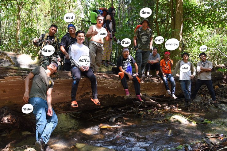


This trip, the Che group went with 7 people: Che, P'Tai, P'Oat, Non, Oil, Tawan, and Sol (photographer). They met up with the Ball group, who had 4 people: Ball, Praew, P'Jong, and Dear. They ended up going together. The Ball team had Ball, Praew, P'Jong, and Dear. They walked together and ended up camping together. It was fun to make new friends. At night, they had a meet-and-greet, which was a lot of fun. Thank you very much to P'Tai for cooking rice and making bamboo shoot curry. Thank you to P'Oat for helping to grill the pork, build the bamboo raft for us to play in the water, and taking us on a tour until almost dawn. And thank you very much to Pa Nim for making delicious dumplings for us to eat. On the way to the waterfall, the Che group stopped to climb and scramble along the way. It was fun. They saw traces of barking deer and wild chickens. After leaving the waterfall, Che, Non, Sol, and P'Oat went on to visit several other places. Thank you very much to P'Samphe for taking good care of us. We climbed the waterfall, and P'Samphe climbed after us at some points. P'Samphe also said that he himself had never been there before. Wait and see in the review.
This trip was a disaster. On Friday night, I got burned by an exhaust pipe. The next morning, I went hiking to a waterfall with a sore body and got hit in the face with a knife, almost breaking my nose. While exploring the side of Pha Taek Waterfall with Director Non, I got lost in the dense forest and heard elephants trumpeting. On the way back, I bumped my head on a rock in a cave, which was a solid block of iron ore, and got a big bump. Finally, while helping a friend unload things from the back of a truck, I got my back almost broken when the friend fell on me.

Khao Laem National Park announces the opening of the "Pha Taek Waterfall" nature study trail. The trail will be open for nature study from February 25, 2017 to April 2, 2017. The trail will be open three days a week: Friday, Saturday, and Sunday. The number of visitors is limited to 20 people per day (or 10 people per group, 2 groups).
Expenses
The cost of the car is 1,000 baht per car. One group uses 2 cars.
2. Guide fee: 1000 THB
3. Porter fee 1400 baht, can carry 30 kg.
Tel. 034-510431
Pha Taek Waterfall: A Hidden Gem in the Heart of Thailand
Nestled within the lush embrace of Khao Laem National Park, Pha Taek Waterfall unveils its captivating beauty in the heart of Thailand's Kanchanaburi province. This cascading wonder, located in the Ban Tipuye forest area of Tambon Chalae, Amphur Thong Pha Phum, is a testament to the region's natural splendor.
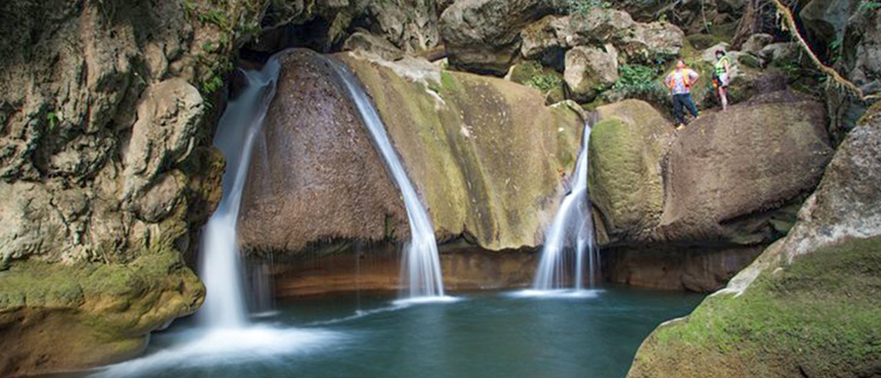
Pha Taek, a limestone masterpiece, boasts four distinct tiers, each cascading from heights ranging between 5 and 20 meters. The year-round flow of water nourishes the surrounding ecosystem, creating a haven for diverse flora and fauna. The cascading waters plunge into inviting pools, offering a refreshing respite for weary travelers.
Reaching this hidden gem requires a journey through the scenic landscapes of Khao Laem National Park. A paved road leads to Ban Tipuye village, approximately 9 kilometers from the park headquarters. From there, a 6-kilometer trek awaits, traversing the remnants of an old logging trail. The adventure culminates at the foot of Pha Taek Waterfall, where overnight camping is available for those seeking a deeper immersion in nature's embrace.
Pha Taek Waterfall stands as a testament to the breathtaking beauty of Thailand's natural wonders. Its cascading waters, verdant surroundings, and secluded location offer a unique opportunity for exploration, relaxation, and connection with the natural world.
Hiking recommendations for the Pha Taek Waterfall Nature Study Trail
1. Prepare your body for a 6 km walk, which will take approximately 4 hours.
2. Hiking attire should be close-fitting and cover the body as much as possible to prevent insect bites. The clothing should be comfortable, flexible, and in colors that blend in with the natural environment. The clothes to be prepared should be divided into 3 sets: hiking clothes, swimming clothes, and pajamas. A jacket and socks should also be included, as the weather can be quite cool at night. Footwear should be sturdy, ankle-covering hiking boots that fit well and can be used for wading.
3. Street vendors (not hired by the group)
4. Essential hiking equipment to bring includes hammocks, tents, sleeping bags, fly sheets, and mess kits.
5. Food is plentiful and the walkways are comfortable.
6. Essential supplies: Common household medicines such as fever reducers, antihistamines, balm, anti-itch cream, cigarettes or other medications, dry and wet tissues. Pha Taek Waterfall has 2 temporary toilets.
7. Individuals with pre-existing medical conditions should bring their medication and inform the authorities before departure.


The journey to Pha Taek Waterfall on Friday night, March 10, 2016, will be spent at the Khao Laem National Park Protection Unit, Checkpoint 1 (Kering Kravia), Moo 2, Cha Lae Subdistrict, Thong Pha Phum District, Kanchanaburi Province. The unit will be on the left-hand side.
Traveling to Khao Laem National Park Unit 1 (Kering Kraweea)
Kanchanaburi City - Khao Laem National Park Protection Unit 1 (Kering Kravia) 170 kilometers
Automobile
- From Kanchanaburi city, drive on Saeng Chuto Road, the main road, until you reach Kaeng Sean Intersection. Turn left following the signs for Sai Yok - Thong Pha Phum District (Highway 323).
- Before reaching Thong Pha Phum district, there is a three-way intersection. Turn right towards Sangkhla Buri district (Dan Chedi Sam Ong). You will pass Wat Tha Khanun.
Bus 999 from Bangkok to Three Pagodas Pass
- Take a bus from Mo Chit Bus Terminal (Bus No. 1) and tell the driver to drop you off at Khao Laem National Park Protection Unit 1 (Kering Kraweea).
Inter-district bus
- Take a bus from Bangkok to Kanchanaburi. Buses depart from the Southern Bus Terminal (Sai Tai Mai) and the Northern Bus Terminal (Mo Chit) and arrive in Kanchanaburi city center.
- Take a bus from the Kanchanaburi city bus station to Sangkhla Buri district and get off along the way.


Park Fees
- Thai adults 40 baht, children 20 baht.
- Foreigners: Adults 200 baht, Children 100 baht
- Bicycle 10 baht each, Motorcycle 20 baht each.
- Sedan: 30 baht each
- Tent rental fee is 30 baht/person/night.


Wake up in the morning, prepare breakfast, and get ready to leave.


According to Khun Bulan Rantee, "Ti" or "Thi" means "water," and "Pu" or "Pu" means "child." A literal translation would be "water child," but the actual meaning is "a small stream, creek, or waterway."
Pha Taek Waterfall is located within the Khao Laem National Park, in the Banthipuye Forest area.
"Tiphuye" in the Karen language means a small stream where "Ye" trees grow. The "Ye" tree is a type of "Turtledove" tree, a plant that grows along the banks of streams in lush forests. Originally, there were many "Ye" trees growing in the Tiphuye stream. The Karen people name their places based on the geographical features and the prominent plants and ecosystems in each area. For example, the Potana Waterfall is named after the Potana trees that grow there, and the Hway Waeng Sachu is named after the Mafai trees that grow there.
Ban Ti Pu Ye is blessed with year-round natural water sources, with three streams flowing through the village: Huai Ti Pu Ye, Huai Chong Kwa, and Huai Ti Rai Pa. These streams provide water for the villagers' agricultural activities, including Huai Po Ta Na, Huai Ti Ya Lung, Huai Haeng, Huai Waeg Cha Chu, and Huai Mae Klong Pho.
The village of Tibuye is divided into 7 administrative villages: Village 1 (Ban Huai Seua), Village 2 (Ban Kering Kravia), Village 3 (Ban Tibuye), Village 4 (Ban Tung Seua Thon, formerly known as Ban Kliti Bon), Village 5 (Ban Phu Tei), Village 6 (Ban Tung Nang Krawan), and Village 7 (Ban Cha-ai).
The community is located on the plains of the Phra Ruesi Bo Ra mountain range, within the Khao Laem National Park. The national park was established in 1991, encompassing the entire village and farmland of the Thiphuye people.


Register to visit Pha Taek Waterfall in Khao Laem National Park. Then take a prepared car to the walking point at Ban Tiphuye.
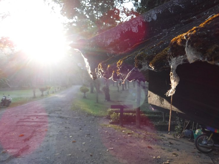
The road is dusty, find something to cover your face.


After driving through the sun and dust, we covered 9 warm kilometers and arrived at the point where we unloaded our backpacks and prepared to set off again.
The area where the car is parked is an intersection that serves as a haul road for old wood.


The path is not steep and is mostly lined with bamboo forests.


Walk across the log.


A short walk uphill


Walking up and down the hill.


Cross another bridge.


Upon reaching the first resting point, we encountered three villagers who had been following us. Upon inquiry, we learned that they were on their way to fish. The picture depicts their fishing equipment.


During the journey, an unexpected incident occurred when the group encountered a band of wild rabbits. Upon closer inspection, it became evident that the rabbits had likely succumbed to fatty liver disease rather than being shot.

Officers used a wall as cover to avoid gunfire. It was intense.


Cross another bamboo bridge, followed by a wooden bridge.


Followed by another wooden bridge.


Visit the bamboo worms.


Upon reaching this point, scattered cave stones began to appear along both sides of the path. We decided to explore the mountain range on the right-hand side.


An exploration of the entire rock face revealed only traces of water cavities, with no caves found. Even experienced climber Samphan admitted to never having been here before, having also come to inspect the area.


As they were traveling, they encountered another group returning from the garden. They playfully sprayed them with water.


They stopped for dinner.


Continuing the journey, we are nearing the camp. Brother Tai carefully carries the banana leaves, which will be used to prepare dinner.


The picture above shows a "ต้นเต่าร้าง" (Entada spiralis) growing on a "ต้นเย" (Ficus religiosa) tree. This plant thrives in the lush vegetation along the banks of streams in the forest.
There are restrooms before the campsite.


Upon reaching the campsite, we encountered Pa Nim's group already settled in for the night. Observing the crowded conditions, we opted to establish our camp on the opposite side of the stream. As the evening approached, preparations were underway for a local ordination ceremony. Professor Jong expressed concern that the festivities might disrupt the tranquility of the surrounding residents.


Let's work together to set up the campsite.


Cook dinner.


Elder sister Tai is looking for firewood to cook rice.


Tai cooked a meal for us to enjoy.


After cooking, they set off for the waterfall.


The final waterfall is a stunning blue pool.


Enjoying a refreshing swim, a black suit, a photographer, and a bed on a bamboo raft with P'Tai.


The truth will always provide a path, but we choose to climb against the waterfall, going further and further back.


Keep climbing, it's so much fun!


While climbing the waterfall, Che stopped to admire the flowers along the path. He stumbled upon a large rock face, where he vermutet that water flowed during the rainy season. The rock in this area was coated with limestone, creating glistening stalactites and stalagmites, making for a truly breathtaking sight.


According to Sampao, this is also his first visit to this area. The survey did not find any caves, only nesting sites and traces of barking deer.

Follow the waterfall until you reach the accommodation.


The team returned to roast chicken and have dinner. Ball's team also came to camp in the same area. So they called them to join the group. They sat and drank until the liquor ran out, then went to sleep one by one, two by two.


After breakfast, we traveled back to the unit. However, the journey was not over yet. I had the opportunity to talk to Brother Sampao and asked him if there were any caves in the area. He said there were many, but he chose to take us to the Kering Kiew Cave because it has a stream flowing through it.
Note: This cave is not yet open to tourists. If you wish to visit, please inquire with the staff.


Upon returning to the unit without changing their clothes, Che, Phi Oat, Phi Sampao, Non, and Saul continued their journey to explore the cave. The cave was located 2 kilometers from the unit. Upon arrival, they parked their car and began their trek. The initial phase involved walking through a rubber plantation before venturing into the forest.


Moderately cluttered.


The cave entrance is not very wide, suggesting that the cave itself is likely not very large.


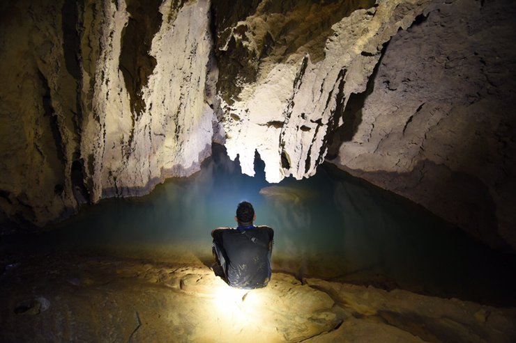
The cave was not as small as we had expected. On the left side, we could hear the sound of rushing water, but we decided to explore the left side first.


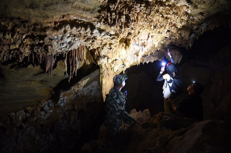
The area is home to a bat population and is rich in iron ore deposits.


There are many small nooks and crannies to walk through. I've only been walking on one path so far, but if I were to zigzag, it would definitely be a long walk.


During the rainy season, the water level rises above the sitting area. We kept moving, but P'Sampao told us to turn back because it was dangerous. By the time we heard him, we were already hoarse from shouting because the water was so loud.

After walking for over an hour, it was almost dark. I decided to leave, worried about my brother Oat, who I had been separated from since entering the forest. I don't know when we got separated.


After exiting the cave, we met up with Oat and went to eat. Sampao joined us for the meal. After eating, we chatted and planned to go watch the view and bathe at Lam Khlong Ngu (It was already 5:30 PM, so watching the view wouldn't be possible as it would be dark by the time we arrived. We decided to relax and hang out instead).


Visit the old mine tunnel of Dr. Phol Kleepbua in Kanchanaburi Province.


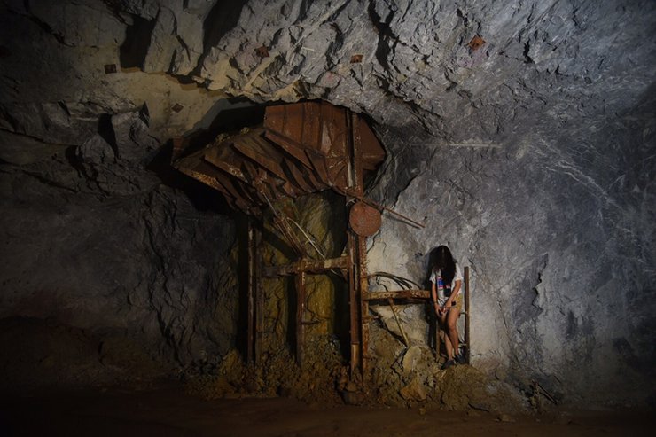
The tunnel, excavated by manual labor, is an old lead mine that has existed for more than three generations. The tunnel itself is large and has branches throughout. However, the mine does not allow visitors to walk off the designated path and only permits them to enter straight ahead. As time has passed, stalactites and stalagmites have begun to form.
Trucks can drive inside. In the past, it was used to transport minerals mined from the mountains.
Mining operations have ceased (due to the expiration of the concession). The deepest tunnel extends approximately 2 kilometers.
The Sahakorn Nikhom Subdistrict Municipality recognizes the potential of these old mines and tunnels as points of interest.
Suitable for organizing ecotourism and adventure activities, as well as promoting income generation for local communities through tourism.
An application for permission to use the area was submitted to the Royal Forest Department, along with a memorandum of understanding for the use of the area.
To develop and open as a tourist attraction and allow local people to participate in the management.
There are a total of 3 tunnels located in close proximity to each other.


Upon entering, we will see traces of mining activity. The path is wet, humid, and muddy, with water flowing throughout. The image above depicts an air compressor used to transport air for use in the mine. The image below shows a hopper for transporting ore.

This area was once a mineral sorting channel, now called the waterfall channel. During the rainy season, water flows down from here, revealing beautiful stalactites formed over time.
Visiting the mine tunnel requires advance permission from the Sahakorn Nikhom Municipality. Tourists are not allowed to drive themselves into the tunnel. Instead, they must use the community's designated vehicles and guides. This is due to the complex nature of the tunnel's paths, which could lead to visitors getting lost or injured.
Tourists interested in visiting the old mine tunnel can contact the Sahakorn Nikhom Subdistrict Municipality for an appointment at 034 685038.
Mr. Samruam Jaisue (Mayor of Sahakon Nikhom Subdistrict Municipality) Tel. 081 995 4997
Ms. Wari Phaphumkerik (Deputy Mayor of Sahakorn Nikhom Subdistrict Municipality) Tel. 084 717 5185


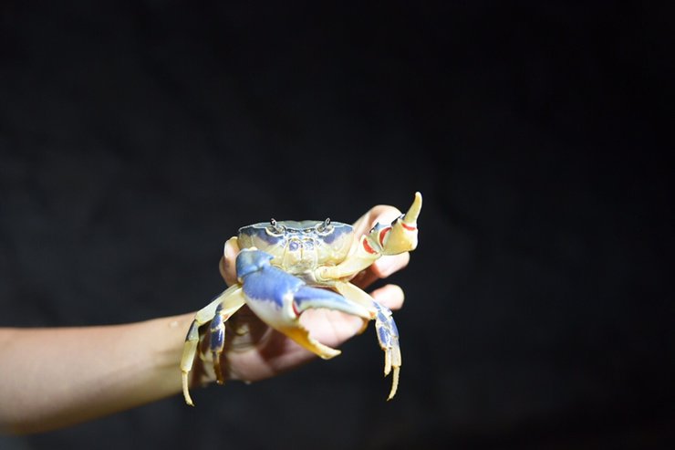
The mine is home to various fish species, including chub, snakehead, shrimp, and crabs (the specific crab species is currently under investigation). This trip was a success, with everyone arriving home around 2 am, except for one individual who arrived at 4 am. We are grateful for the opportunity to have met everyone.
I'm Che
Friday, October 4, 2024 3:20 PM

