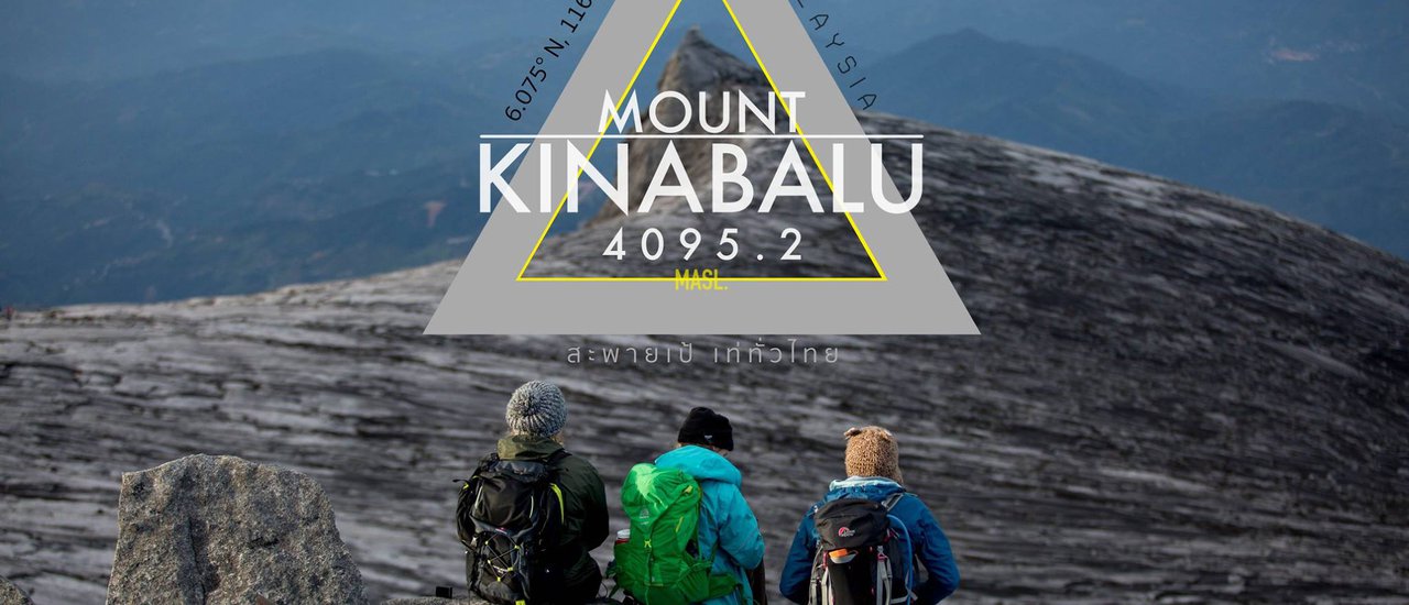
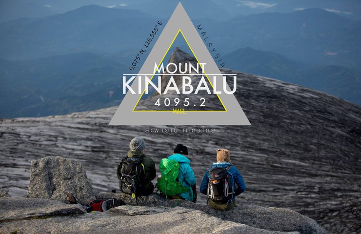
Mount Kinabalu, also known as Gunung Kinabalu in Malay, is located on the island of Borneo in the state of Sabah (with Kota Kinabalu as its capital), Malaysia. It is Malaysia's first UNESCO World Heritage Site, standing at an impressive 4,095.2 meters above sea level. Considered one of the highest mountains in Asia, Mount Kinabalu is a dream destination for many adventurous travelers who aspire to conquer its summit. I, myself, am one of those individuals. I had previously attempted to reach the summit of this mountain, but nature had other plans. An earthquake struck during my ascent, tragically claiming the lives of several climbers. As a result, my journey was cut short at the lower base camp, and I was forced to abandon my plans. For two years, the memory of this majestic peak haunted me, its imposing presence a constant reminder of my unfinished business. It left a lingering sense of incompleteness, as if I had left something undone. This time, however, an opportunity presented itself, allowing me to return and finally achieve what I had set out to do. And so, my journey to conquer Mount Kinabalu began anew.


As an avid hiker, I found the ascent of this mountain to be a relatively straightforward endeavor due to my existing physical fitness. However, for novice hikers or those unaccustomed to high altitudes, thorough physical preparation is essential. Based on my experience, anyone with the determination to reach the summit can do so. Adequate preparation involves regular exercise, dedicating 30 to 60 minutes daily to activities such as running, taking the stairs instead of the elevator, or joining a gym. By consistently engaging in these activities for a month prior to the hike, individuals can ensure their muscles are sufficiently conditioned to handle the demands of the climb.

The Kinabalu登山步道可分為兩部分:
1. Timpohon Gate to Laban Rata (accommodation), a distance of 6 km.
2. Laban Rata > Low's Peak summit: Conquer the highest peak, another 2.5 km.
The two sections of the trail are not very different. The first section is a mix of steep and flat terrain.
Similar to Thailand's Phu Soi Dao, the trail features wide, stepped paths lined with unusual forests, including a particularly stunning giant bonsai forest.
The area is home to a diverse range of bird species and endemic orchids, making it a popular destination for birdwatchers.
The second section of the trail consists of rocky mountains with well-maintained stairs and ropes to assist with climbing in certain areas.
No matter how you walk on the rope, you will not get lost and will surely reach the top.
==============
Although Mount Kinabalu stands at an impressive 4,095.2 meters, our trek began at the Timpohon Gate.
Located at an altitude of 1,866 meters.
The difficulty of the trail is considered moderate, not too challenging. Both experienced and novice hikers can attempt it. Compared to other mountain trails in Thailand, this one is relatively easier.
However, the limitations here include the duration and altitude, which may differ from those in our country.
============
How is the time limit set?
For example, if you arrive at the accommodation after 7 pm on the first day, the buffet line will be closed. However, they will prepare a packed lunch for you.
If you arrive after 10:00 AM, the buffet line will be closed, but you can request a lunch box later.
Reaching the summit after 2:00 AM can be challenging. If you arrive at the checkpoint after 5:00 AM, officials will not allow you to continue. You will have to return to your accommodation, potentially disappointed. While some hikers have missed the deadline and had to turn back, the 1.5-kilometer distance from the accommodation to the checkpoint makes it relatively unlikely.

Equipment is another essential aspect of travel, whether you're exploring forests, climbing mountains, diving, or enjoying the sea.
All activities require the necessary equipment, tailored to the specific location and the nature of the activity.
The preparation of equipment here is almost no different from hiking in the mountains back home.
Moreover, it is even easier in terms of not having to carry much luggage, as we are only going for one night.
The package includes well-prepared accommodation, blankets, soap, shampoo, hot water, and a buffet. There are also shops on the top floor.
Essential equipment for a 2-day, 1-night hike can be categorized as follows:
1 Backpack: Small or medium-sized, to carry water bottles, jackets, packed food, and essential equipment for a 1-night stay on the mountain. Leave unnecessary items at the park below for a small fee. It's best to keep your load light, you might not even need a porter.
To prevent rain from soaking through, clothes and belongings should be tightly sealed in a bag before being placed in another bag.
The two groups will be divided into two sections for the journey: the first section from Timpohon Gate to Laban Rata (accommodation). The weather during this section is comfortable, so shorts or long pants are acceptable, depending on your preference. However, there is a chance of rain, so it is advisable to bring a raincoat in your backpack. If you are prone to feeling cold, bring a jacket in your backpack as well, as you will likely need it.
Part Two: Laban Rata > Low's Peak Summit - Conquer the highest peak. This section requires a hike starting around 2:30 AM. The weather is cold, with temperatures at the summit ranging from -2 to -5 degrees Celsius.
To combat the cold, Thai people typically wear long pants and warm jackets. While pants are a matter of personal preference, jackets are recommended to be worn in three layers:
- The inner layer of the long johns is a regular long-sleeved shirt, which may be the same one we are wearing.
- The middle layer should be a good enough insulator to keep our body heat in and prevent the cold from outside from entering our body.
- This outer layer will cover both shirts and must be highly windproof and waterproof to prevent cold air from entering the shirts.
- Extra layer .. This layer is for those who are extremely cold, just put on the jacket you brought with you. (Note: Raincoats should be carried on all routes because the weather here changes frequently. Take good care of your health) Take the green panel Tiffany with you.
1. Gloves are also essential due to the weather conditions, sub-zero temperatures, and certain sections of the trail that require the use of ropes. Gloves are quite useful, but they can be inconvenient when taking photos. This is one of the drawbacks.
2. Footwear: Essential for any hiker, as traversing the trail barefoot is not recommended.
Hiking footwear here is not particularly specialized, similar to what you might use for trekking at home. Choose something comfortable and that won't cause blisters. I personally used 60 baht studded boots purchased at the park entrance, which also provided waterproof protection during the rain.
In summary, the undergarment should be snug-fitting. If it is waterproof, that would be even better. Let's choose something that we are comfortable with.
3. A headlamp is mandatory for summiting the peak. It must be worn on your head, not carried in your hand or attached to your backpack. Park rangers will not allow you to proceed without one. (Headlamps are available for purchase at the park, but it is recommended to bring your own.)
4. A water bottle should be attached to the side of the backpack at all times, with a minimum of 1 liter of water. For those who can drink natural water, there are water tanks for refilling at every rest pavilion.
- Cold-weather protection: Buff (face and ear covering) and hat.
6. TREKKING POLE: Trekking poles, also known as hiking poles, mountain poles, or walking sticks, can be any type of pole that assists with walking. They provide additional support and stability, especially on uneven terrain, and can help reduce fatigue and strain on the legs and joints.
7. Food: The package includes a packed lunch, but it is recommended to bring additional snacks, such as chocolate, to boost your energy during the hike.
In summary, winter camping in Thailand is similar to camping elsewhere, but without the need to carry a tent or prepare meals, making it a more convenient option for a one-night stay.

Traveling from Thailand is now much more convenient.
Direct flights are available with Thai Smile Airways.
Direct flights to Kota Kinabalu, Borneo
Convenient and hassle-free, eliminating the need for connecting flights. For detailed flight schedules, please visit:
From Kota Kinabalu Airport, the journey to Padang Merdeka is by van to Kinabalu, costing RM5 per trip.
From Padang Merdeka, take a van to Kinabalu National Park for RM25 per person.

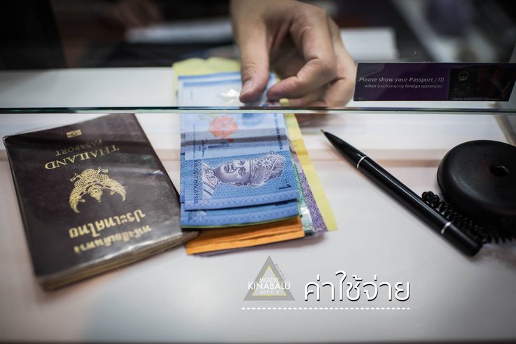
Cost is undoubtedly a primary consideration when planning travel. However, determining whether the cost is reasonable or excessive depends on various factors, including amenities, security measures, and other location-specific considerations.
To visit Kinabalu National Park, advance booking of accommodation within the park is required. The park limits the number of visitors per day to 200. Bookings can be made directly with the park, which offers lower prices compared to booking through agencies.
This section will discuss the cost of climbing.
The prices quoted are for standard routes booked through the park I visited.
The price difference between a 2-day, 1-night trip and a 3-day, 2-night trip, categorized by foreigners and Malaysians.
...
A 2-day, 1-night trip for international tourists costs RM 2130 per person. This package includes accommodation and meals on the mountain.
The cost per person is RM1880 for groups of 2-3 people, and RM1780 for groups of 4-6 people.
The cost is lower than going alone because one guide can handle six tourists.
If you go alone, you will pay the full guide fee. If you go with multiple people, you can split the guide fee. It's that simple.
Therefore, it is advisable to find friends to share the cost with. If you really have to go alone, you may be able to join a group at the event itself.
Those who book this package can stay in Kota Kinabalu city for 1 night on the first day of arrival before traveling to the park early in the morning. The journey takes approximately 2 hours.
Alternatively, you can head directly to the park, where accommodation is available.
A 3-day, 2-night trip (1 night at the bottom, 1 night on the mountain) for foreigners at RM 2280 per person.
2-3 people: RM 2030 per person; 4-6 people: RM 1930 per person.
This package includes one night's accommodation in the park below, which appears to be comfortable and convenient for the time frame.
For more information on prices and details, please visit the website.
Mount Kinabalu Official Website
===============
For those who seem to be moving their entire household to the mountain for one night, please note that it is only one night. There is no need to bring so much stuff. Accommodation, food, soap, and shampoo are all included in the package.
If you have too much luggage to carry, you can hire additional porters for around 500 Thai baht per trip. This means two trips up and down for a total of 1,000 baht.
Maximum weight capacity: 10 kg

"I can go... anyone can go too."
======================
Before going, I had one day to research and read reviews from various sources.
Most of what I read discouraged me, making it seem like a difficult climb. At that time, I was hesitant, and I didn't even have any hiking boots. Would I really have to spend thousands of baht to buy them?
In the end, I bought studded boots for 60 baht at the park entrance, which were guaranteed by the porters there to be the best.
However, this review says it's easy to climb. In my personal opinion, if you compare the trails,
excluding the altitude, it's easier to climb than many mountains in Thailand.
With a distance of 6 kilometers to the accommodation and another 2 kilometers to the summit,
...
If you compare the trails to the summit, Phu Soi Dao is much more difficult to climb.
The trail is wide and mostly consists of good stairs.
The ropes you see people holding for photos aren't really necessary for experienced hikers.
I secretly think they were placed there to create a path to avoid getting lost.
But it's still best to use them to be safe.
======================
Don't worry about comfort. You won't have to sleep in a tent, get rained on,
or poop in the bushes. This place has comfortable beds, hot showers, soap, shampoo,
towels, and clean bathrooms. Along the trail, every 1 km,
there are rest pavilions and clean flush toilets.
There's also a buffet line with many options, and shops selling food and drinks.
However, it comes at a cost. Many people think it's expensive, costing hundreds or thousands of baht.
It's up to each individual's discretion.
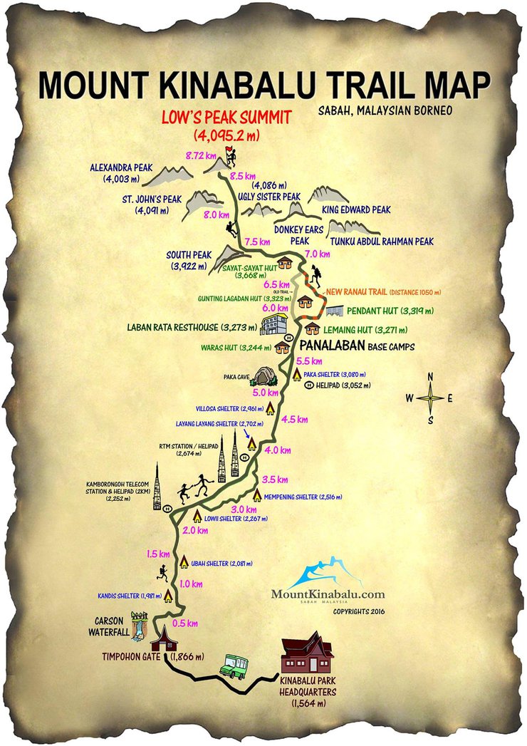
An overview of the Mount Kinabalu climbing route map.
Image source: http://www.mountkinabalu.com/


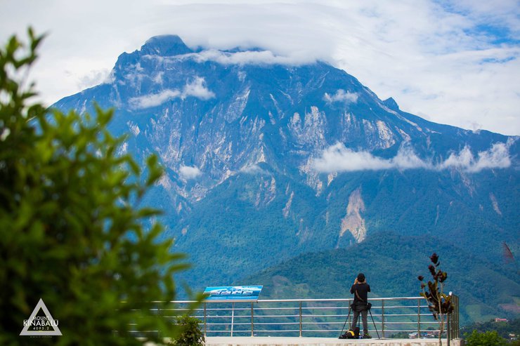
Before embarking on your journey to conquer the summit, let's take a look at the magnificent views of Mount Kinabalu.


Upon arrival at Kota Kinabalu Airport (KK), check in to your accommodation for the first night. This package includes a 4-day, 3-night stay at Kinabalu Park. The first day involves resting at the park's lower region before ascending the mountain. Spend one night on the mountain and one night at a hot spring resort as you descend. All meals are included, except for lunch on the first and last days. This itinerary allows ample time for acclimatization and summiting Mount Kinabalu without rushing. The accommodation at the park's lower region features shared bathrooms with soap, shampoo, and towels provided. Similar amenities are available at the mountain accommodation.


The restaurant will offer a buffet line for both breakfast and dinner.

The day has come to conquer the summit with my own two feet.
The majestic mountain, with its imposing peak, stands tall and defiant before my lodging.

All travelers must register and receive a lanyard to wear around their neck before departure. It is crucial to keep the lanyard secure and avoid losing it.
Failure to present the document at checkpoints will result in denied access.
There is no text to translate in the provided HTML code. Please provide the text you want me to translate.

A simple rice wrap included in the package for lunch on the go.

Guide Soon, my guide for the 2-day, 1-night trek on the mountain, explained the hiking route.

Upon successful registration, a shuttle will transport you to the Timpohon Gate, marking the commencement of your trek. As you embark on your journey, you will encounter the cascading waters of Carson Falls, a welcoming sight for trekkers venturing into the majestic Mount Kinabalu.


"Exhaustion may lead us to focus solely on our destination, neglecting the surroundings. Paying attention to our surroundings can alleviate fatigue." ... Kinabalu is renowned not only for its mountains but also for its birdwatching, orchid viewing, and rare flower spotting, which are equally popular activities.


As we ascend, the landscape transforms, revealing unique flora and breathtaking vistas. Our pace slows, captivated by the beauty of the forest. The allure of the buffet, warm water, and soft beds fades as we immerse ourselves in the present moment, savoring the natural wonders that surround us.


A 6 km hike through the forest, enjoying the birds, trees, and taking photos along the way, with occasional stops to admire the view. Soon, I arrived at Laban Rata (accommodation), my second stop on this trip. It is a lodge located on Mount Kinabalu at an altitude of 3,273 meters above sea level. The accommodation is well-equipped with everything you need, including meals included in the package. It is a buffet with a variety of options. The bathrooms are convenient and comfortable, with hot water, soap, shampoo, and towels provided. The bedrooms have soft beds and thick blankets, in a hostel-style setting.


Aerial view of Laban Rata (accommodation)

Accommodation with a view. Today, we need to go to bed early to conserve energy for tomorrow's climb. We must wake up at 2:00 AM to prepare for conquering the summit.


At 2:00 AM, I woke up before the alarm clock, perhaps because my body had been fully rested since early evening. The most important things now were a flashlight and a thick jacket to help my body cope with the rapidly dropping temperature. After taking care of personal needs, I fueled up with food at around 2:30 AM. It might not have been a typical time, but considering I wouldn't be back for several hours, a full stomach was crucial. Thankfully, all meals were included in the package we had already paid for, so the only additional expense was bottled water. Before starting the hike, I made sure everything was ready: clothes, gloves, a headlamp, and most importantly, the card we had been given at registration. This card had to be kept with us at all times, as it would be checked at the checkpoint we would reach around 2:30 AM. Without the card and a flashlight, we wouldn't be allowed to pass. Additionally, if we didn't reach the checkpoint by 5:00 AM, the officials wouldn't allow us to continue, forcing us to return to our accommodation in disappointment. There had been cases of tourists missing the deadline and having to turn back, but with the distance to the checkpoint being only 1.5 kilometers from our accommodation, it was a rare occurrence.


An hour passed the checkpoint, I slowly followed the rope with the light from the headlamp to guide me. Soon, I reached the highest point of Mount Kinabalu, Low's Peak, at an altitude of 4095.2 meters. Named after the expedition leader, Hugh Low, who was recorded as the first person to conquer Low's Peak. It was not yet 5 am, and another large-bodied Westerner seemed to have climbed faster than usual while the temperature on the summit was -5 degrees Celsius. It was a time when he shouldn't have come at all. At that time, I could only find a rock, a crevice in the rock, where I could hide my body from the wind. It helped to warm my body a little while waiting for the sunrise. ====================== The brightness from the sun began to reveal the landscape more and more. The tourists who followed me also started to climb up to the top one after another. This made the top of Low's Peak look cramped and crowded immediately. I decided to go down and set up my camera, wait for the moment when there were fewer people, and then walk up again.


The South Peak, standing at 3,929 meters, is often seen as the iconic symbol of this region.
Although not the highest peak, it is featured on both the old one-ringgit and one-hundred-ringgit banknotes.


A chilly atmosphere


To document their accomplishment, visitors often take photos with the summit sign. However, reaching the summit of this mountain requires a challenging four-round ascent. During a single trip, the climber ascended the peak four times. One GoPro camera was set up on the summit to capture a time-lapse video, while another was positioned at the South Peak below the summit to capture a different perspective. Due to concerns about camera theft and the need to check battery life and memory, the climber had to repeatedly ascend and descend the mountain. Finally, they were able to capture a photo with the summit sign without any other people present.

The journey is not over yet. After conquering the 4095.2-meter peak, we still have a 8 km descent ahead of us. It's the same path we took yesterday, but this time we're just stopping to collect our belongings, check out, and have one more breakfast. Then it's a long walk down. We might be a bit pressed for time, as arriving after 5 pm could result in additional overtime charges for the car waiting to take us to the park.
===================
This image depicts an alternative route for thrill-seekers.
The steep climb up the cliff face was a challenge, but I would gladly attempt this route again if the opportunity arose.

On the way back, there was no need to pack the camera. We were the first to reach the summit and the last to descend, so everything was rushed on the way back.
============
After a short journey, we arrived at Poring Hot Spring, another popular spot for soaking in hot springs. It was a great way to relax our muscles after descending from the mountain, and it was also our last night's accommodation on this trip.
Soaking in hot springs surrounded by nature after a tiring climb was the perfect way to end the day.
***But wait, the climbing pass that we have been carrying since the day we registered is still useful. By simply showing the pass to the staff, we can enjoy free hot spring access without spending a single ringgit.

The


Accommodation at Poring Hot Spring

In addition to accommodation and hot springs, those who still have energy or have regained their strength from soaking in the tub can take a walk amidst nature on the Canopy Walkway, which seems a bit exciting for me, but may be a bit scary for those who are afraid of heights. What I like is that it is full of lush green forests. Actually, if it weren't for the fact that we had to rush back, we would have walked a big circle... It's a pity that we arrived late yesterday.


Kinabalu Trip Summary
This Kinabalu trip was fortunate to avoid rain, despite the cloudy weather. We still managed to catch glimpses of the sun at times.
Traveling was convenient, with direct flights to Kota Kinabalu, eliminating the need for connecting flights like previous trips.
The hike, as mentioned earlier, was not as difficult as anticipated, but not overly easy for beginners. "If I can do it, anyone can," I say.
The food was decent, not bad for Thai palates, and some dishes were even delicious. However, bringing instant noodles from home is recommended.
Finally, thank you for following, visiting, and commenting. I hope this small review is helpful for those planning to conquer this mountain.
Stay tuned for pictures and reviews from my next adventure!

สะพายเป้ เท่ทั่วไทย
Tuesday, October 8, 2024 11:26 AM

