Connect with me on my Facebook Fan Page "ไปก่อนตาย I'm Traveler" at https://www.facebook.com/Paikontay/
Travel log August 12, 2017
"Khao Sam Roi Yot National Park": A Mountainous Paradise
The name "Khao Sam Roi Yot National Park" alone evokes a sense of ruggedness and adventure. This park, located in the Kui Buri District of Prachuap Khiri Khan Province, Thailand, is a haven for nature enthusiasts and outdoor adventurers.
Nestled amidst towering limestone cliffs, lush rainforests, and pristine beaches, Khao Sam Roi Yot offers a diverse landscape that caters to a wide range of interests. From exploring hidden caves and cascading waterfalls to kayaking through mangrove forests and observing diverse wildlife, this park provides an unforgettable experience for all visitors.
TransportationPrivate car
Route 1: From Bangkok, take Highway 35 (Thon Buri - Pak Tho) through Samut Songkhram Province. Turn onto Highway 4 (Phetkasem Road) at Pak Tho District, passing through Phetchaburi Province, Cha-am District, and into Hua Hin District to Pran Buri District. At the Pran Buri intersection, turn left onto Pak Nam - Pran Buri Road for 4 kilometers. You will see a sign for the park. Turn right onto the road, which is paved for another 31 kilometers, to reach the Khao Sam Roi Yot National Park headquarters.
Route 2: From Bangkok, take Highway 4 (Phetkasem Road) through Nakhon Pathom Province, Ratchaburi Province, Phetchaburi Province, Hua Hin District, to Pran Buri District. Continue to Kui Buri District. About 7 kilometers before Kui Buri District, at Ban Sam Hong at kilometer marker 286.5, there is a left turn. Follow this road for approximately 14 kilometers to reach the Khao Sam Roi Yot National Park headquarters.
Route 3: From Bangkok, take the Thon Buri - Phutthamonthon - Nakhon Chai Si road and turn right onto Highway 4 to Phetchaburi Province. Follow the Cha-am - Bypass route to Pran Buri District. At the Pran Buri intersection, turn left onto Pak Nam - Pran Buri Road for 4 kilometers. You will see a sign for the park. Turn right onto the road, which is paved for another 31 kilometers, to reach the Khao Sam Roi Yot National Park headquarters.
Bus travel
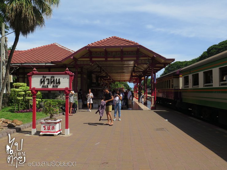
Travel by bus, van, or train to Hua Hin. Then, rent a motorbike in Hua Hin and ride to Sam Roi Yot National Park. This is the most convenient way to travel to the various tourist attractions within the park. Alternatively, if you are traveling in a group, you can get off at Pran Buri and hire a songthaew (shared taxi) to take you to the park.
Due to the long holiday weekend, the traffic was extremely congested. Pan took a van from her house, which is located near Rama 2, right at the entrance of Sai Tai Mai. Normally, it takes Pan about 2 hours to get to Hua Hin, but today it took 4 hours. Oh my god! Pan arrived in Hua Hin after 2 pm. She had made an appointment with her friend in Hua Hin. There were only two of them on this trip.


We took photos and waited for our friends until around 3 pm, then rented a motorbike to drive to Sam Roi Yot National Park.

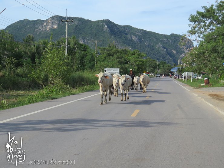
It only took about an hour to get there. The sun was blazing, even though it was already after 4 pm. Haha, on the way, Pan encountered a group of locals who were walking like they owned the street. "Do you know who's the boss around here?" they asked.

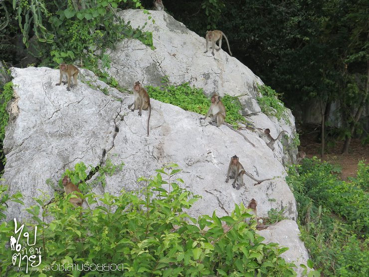
Another gang, I must say, just entering the Khao Sam Roi Yot National Park, you will be greeted warmly by these playful monkeys that roam freely in every corner of the grass and road.

Another monkey, I mean, no, it's Pan himself. He went down to find and catch the monkey, intending to greet his fellow species, but it ran away.

As dusk approached, Pan arrived at the National Park and decided to start with the "Tham Sai" cave, the closest location, to avoid being caught in the dark if they visited other sites first.
Climbing the First Hill to "Tham Sai" Cave
Round trip distance is 560 meters. If you require a guide, please contact us before your ascent.

Tham Sai is located next to Ban Khung Toat Beach, where you can swim. There are restaurants and bungalows available. If you come with a group, this is highly recommended.


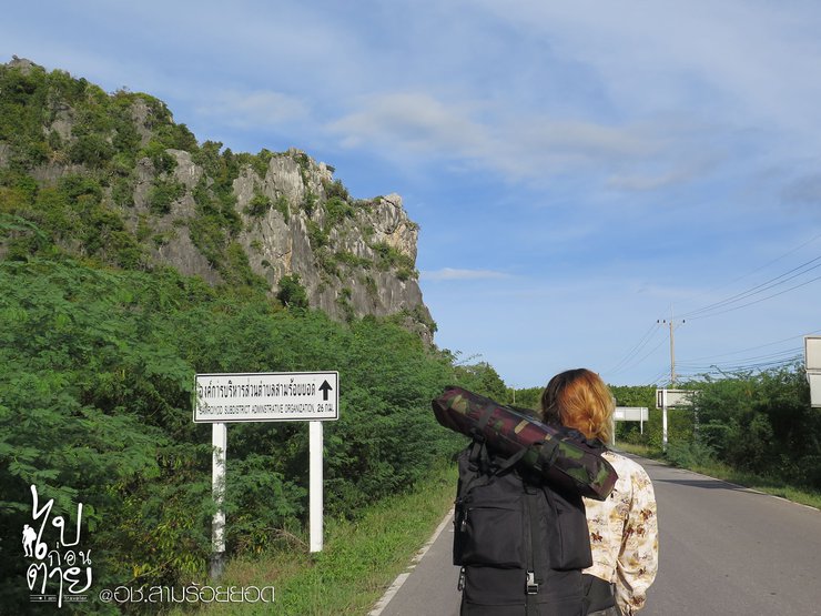
Halfway through the journey, I had to wave goodbye to my giant backpack and let it rest on a pile of grass by the side of the road. Haha, along the way, I would occasionally encounter beautiful ocean views like this, which gave me the strength to keep walking.

He walked slowly, following the path, and there were no people around, making him feel a little crazy. As the evening approached, Pan walked until he saw the mouth of the cave in the distance, which made him feel a little relieved.


Suddenly, my legs felt stronger, so I rushed into the cave. The first thing I saw inside the cave was breathtaking. It was a cave with a ceiling that had been eroded into a cavity, allowing light to filter in. The plants that were exposed to the light grew rapidly, creating a unique and beautiful sight.

The cave is adorned with beautiful stalactites and stalagmites. However, I arrived in the late afternoon, missing the opportunity to witness the sunlight filtering through the cave, which is said to be a breathtaking sight. I will have to return for another visit to experience this natural wonder.
After descending from Tham Sai Cave, the initial plan to camp at Laem Sala Beach was changed to Sam Phraya Beach due to its closer proximity. As dusk approached, Pan expressed concern that trekking across Khao Thian Mountain to Laem Sala Beach might be too dark. Therefore, the decision was made to camp at Sam Phraya Beach for the night.
Three Kings Beach
This beach is accessible by car and is located near the entrance of the National Park. There are shops and very clean restrooms available. However, the park rangers will turn off the lights at 9 pm, and it is forbidden to cook, build fires, or make loud noises. The entrance fee is 30 baht per person.

Due to the cold weather, the photos taken the previous day were not ideal. The next day, Pan went to capture the atmosphere for those interested in camping here.


Tonight, we'll be sleeping here. Pan brought a tent to pitch, but guess what? She ended up sleeping outside the tent anyway. The large canvas was spread out on the sandy beach, and Pan lay there counting stars and listening to the sound of the waves. Could there be anything more blissful?

A friendly reminder for those planning to sleep outside the tent like Pan: don't forget to bring mosquito repellent!
Rise and shine at 5 am! This morning, we'll be witnessing the sunrise from the peak of Khao Daeng.
The Second Mountain: Climbing to the "Khao Daeng Viewpoint"
Riding a motorbike from Haad Sam Phraya, turn left for about 1 kilometer to reach Khao Daeng. At around 5:00 AM, it was incredibly eerie. Be warned, it's very dark, so bring a flashlight. The 1-kilometer roundtrip route is filled with boulders, requiring some climbing at times. It's challenging, especially in the dark, but exciting. Shining the flashlight to find the guiding arrows, we gradually encountered people as the sky began to brighten, making the path visible. I was relieved, as I thought I might get lost in the jungle. Finally, we reached the summit.

After searching high and low, I only found one photo with a sign for the Khao Daeng viewpoint. It was a picture that my friend accidentally took, and to make matters worse, Pan blocked the sign with her body. Oh well, I've come all this way, so I might as well take a picture to commemorate the moment.


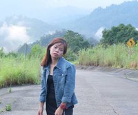
Take a picture of my daughter. We climbed the mountain together, and she's all dirty now.

The view from here is breathtaking. As you walk to the other side of the peak, you will be greeted by a stunning vista of the Red Mountain Temple and the overlapping mountains. The scenery is truly magnificent.


The sun began to shine brightly, so Pan decided to leave. He explained that Red Peak is a relatively small summit, and if more than 10 people climb it, it will become crowded. Additionally, there is no shade available. Therefore, he suggested that they descend and climb the third peak instead.
After leaving the Khao Daeng viewpoint, head straight into the park, following the signs to Phraya Nakhon Cave.
Climb the third hill to the "Khao Thian Viewpoint".
Khao Thian serves as a passageway to visit Phraya Nakhon Cave. If you charter a boat to Laem Sala Beach, you will not be able to climb Khao Thian. But guess what? That would be a big mistake.

The distance is 530 meters, but the trail is more comfortable than other mountains. However, it is still tiring and I was out of breath.

The first viewpoint provided a much-needed boost of motivation to continue the hike. This is Bang Pu Beach, located on the same side as the trail we ascended. For those who wish to charter a boat to Laem Sala Beach, the departure point is here. Each boat costs 400 baht and can accommodate up to six passengers.


As we approach the descent, we encounter a scenic viewpoint overlooking Laem Sala Beach, with its white sands and turquoise waters.

The descent from Khao Thian was tiring, and the next leg of the journey involved walking through Laem Sala Beach to reach Phraya Nakhon Cave.
Laem Sala Beach
This beach was the first place Pan considered camping. Due to its inaccessibility by car, requiring either a boat or a hike over a mountain, fewer people visit this beach compared to Haad Sam Phraya. If Pan had known that Haad Thian was not far away, she would have stayed here instead. The water is clearer and the sand is whiter than Haad Sam Phraya.

Coconut and pine trees are planted in rows, creating a lush and inviting atmosphere. It seems like the perfect spot to pitch a tent.


Now that we're here, Pan would like to take some photos with the children.


Campers at Laem Sala Beach need not worry about food shortages due to difficult travel conditions. The beach offers a restaurant and exceptionally clean restrooms for visitor convenience.
After a leisurely stroll along Laem Sala Beach, we headed towards Phraya Nakhon Cave. If you think you can reach the cave directly by boat from Bang Pu Beach, think again! You'll need to hike up the mountain to reach it. After all, the best things in life are rarely easy to come by.
Climbing the Fourth Hill to Reach Phraya Nakhon Cave

Along the trail, you may encounter occasional wildlife, such as spectacled langurs, which often appear unexpectedly, causing excitement when seen up close. These animals are not afraid of humans and may even make eye contact, as if to say, "This is my territory."

The path leading to Phraya Nakhon Cave is characterized by small and large rocks, with varying degrees of difficulty in walking.

Halfway through the trail, there is a scenic viewpoint. Those who are unable to continue can stop here. Pan took a short break and continued the hike, as the trail was not too strenuous.

Upon reaching the mouth of the cave, I was overjoyed, feeling as if I had accomplished something significant. From the entrance, a staircase descended into the depths. The thought of the climb back up filled me with trepidation.

The first wonder we encountered was the "dry waterfall," a rock formation resembling a cascading waterfall. Due to the absence of water, humans aptly named it the dry waterfall.

Looking up after descending to the cave floor, I realized how far down I had come. The wide mouth of the cave now appeared much smaller.

Turning our attention back to the interior, we encounter the second marvel: the "Bridge of Death." This bridge is formed by the erosion of the cave's upper walls by wind and rain, leaving only a central section resembling a bridge. The name "Bridge of Death" originates from the frequent falls of wild animals from above.

Continuing forward, you will encounter a small path that allows you to cross to the other side.

This is part of Phraya Nakhon Cave. Inside, there are beautiful stalactites and stalagmites. There is also a "relic of Luang Pho Ngern of Wat Bang Khlan" for us to pay our respects.

Next, you will find the "Royal Initials" inscribed by King Rama V and King Rama VII during their visits to this cave.

A stalagmite shaped like a pagoda, known as the "Pagoda-Shaped Rock".

It is believed that if you are single and walk between the two "ต้นซุ้มรอดคู่" trees, you will find your soulmate.

The highlight of Phraya Nakhon Cave is the "Phra That Khuha Khrihasan," a royal pavilion built during the reign of King Rama V.

It stands majestically in the center of the cave. Anyone who climbs the mountain to the cave must come and pay their respects here.
Not far from the exit of Phraya Nakhon Cave, you will find a sign pointing to "Tham Kaew" (Crystal Cave). Pan, of course, headed straight there. Be aware that the entrance road is not paved, so drive carefully.
Climbing the 5th Hill to "Tham Kaew"
This cave is the last one Pan climbed, and it was the most enjoyable for her. The height from the ground to the mouth of the cave is only about a hundred meters, but the path is very steep and the rocks are very sharp.

Those wearing thin shoes should be prepared to cry. The first section involves climbing up ropes, followed by self-assisted climbing using branches and grass.

Upon reaching the cave entrance, we must descend into this hole to embark on our adventure. The cave stretches 200 meters, and according to Pan, the most exciting part lies ahead. Inside, the cave is pitch black, devoid of any light penetration beyond the entrance.

If you need to rent a flashlight or have a staff member guide you, please contact them before going up. As for the raft, Pan and her two friends walked by themselves. Pan warned that if anyone has claustrophobia, they should not go down. At first, they had to crawl, and their hearts were pounding because they couldn't see anyone. Looking ahead, they could only see the end of the light. It was both scary and exciting.

The cave is exceptionally dark because the National Park Authority (NPA) aims to preserve its natural state as much as possible. This allows visitors to marvel at the stunning stalactites and stalagmites illuminated by flashlights. Exploring the cave requires extreme caution due to sections involving crawling, climbing, and squeezing through narrow passages. Additionally, large pits are present within the cave.


We had to use a flashlight to find the arrows that the officers had placed at various points, and then follow the path to reach the exit on the other side of the Tham Kaew cave. It took Pan a long time to find the exit, and he wandered around for a while, thinking he would have to sleep in the cave. Later, we found out that the arrows in the cave had fallen off and were pointing in the wrong direction. Oh, my god!

~ Because you are the light at the end of the tunnel that shines in, changing me to have meaning with your heart........~ As the band No More Tear sang, haha, just seeing the light in the distance makes me so happy.

Once you emerge from the glass hut, you'll be greeted by this breathtaking view. After soaking in the scenery and enjoying the fresh air, you'll descend the mountain with a final burst of energy. It's like conquering the final boss in a video game – maybe a bit dramatic, but that's how it feels.
After showering and packing up at Hat Sam Phraya Beach, where she had camped the previous night, Pan headed to Khlong Ha Daeng. After a tiring climb up several mountains, she wanted to end her trip with a relaxing boat ride to enjoy the birds and the scenery.
Go to Wat Khao Daeng.

In front of the temple is a canal called "Khlong Khao Daeng".

This sentence has been deleted.

The boat trip to Khao Daeng Canal takes about an hour and a half round trip. The cost is 500 baht per boat, which can accommodate up to 6 people. Pan had to wait for other people to join the boat trip to share the cost. However, no one came for a long time, and most of the groups had 6-7 people, filling the boat. Pan eventually gave up waiting because she was worried about returning the motorbike on time. She missed the boat trip. If any of you have the opportunity to take a boat trip on the Khao Daeng Canal, please share your photos!
After missing the boat trip, Pan left Sam Roi Yot and returned the motorbike in Hua Hin. She returned home with both disappointment and fond memories. Thank you to everyone who has read this far. See you again soon, when I will share more stories with you! ^^
Thank you to our camera sponsors, Yim and Gook.
MEEpanda
Tuesday, October 8, 2024 11:28 AM

