As the rainy season arrives each year, I am drawn to a land of captivating beauty, where nature and the way of life of its people have captivated me. Unable to resist, I grab my camera, pack my backpack, and embark on a journey to this enchanting place. This year, I learned about a new waterfall exploration trip organized by the "Khon Baak Pae" group, a hiking group I have been a part of for several years. The trip will explore a new waterfall on the edge of Dong Hua Sao National Park, on the Bolaven Plateau, and venture deep into the town of Sanamxai, Attapeu Province, Lao PDR.
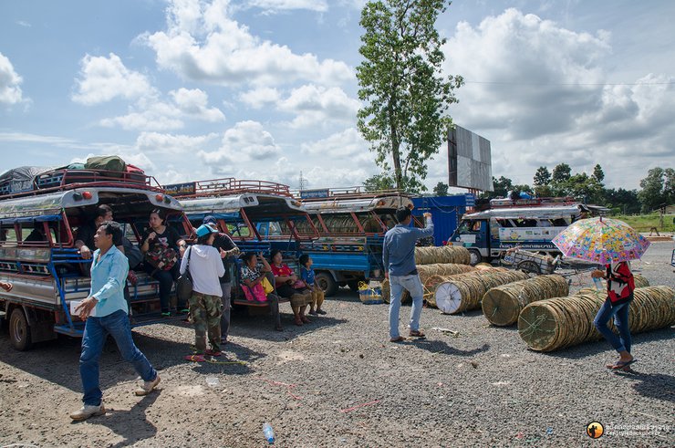
We traveled by Lotus Pipul Tour bus from Mo Chit to Chong Mek checkpoint in Ubon Ratchathani. It was a nail-biting journey as we were worried about being late due to the Mother's Day traffic in Korat. However, we were fortunate to arrive at Chong Mek at 8 am, just in time. After taking care of personal matters and purchasing supplies for the jungle, we passed through immigration and boarded a shared taxi to Vang Tao checkpoint on the Lao side. We then headed to Pakse as planned.


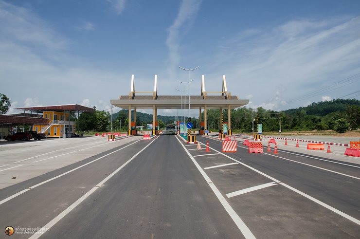
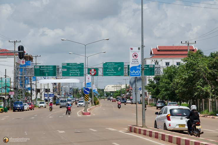
Southern Laos is undergoing rapid development, with noticeable improvements each year. The towns and cities are becoming increasingly cleaner, with clear road signs and traffic signals. While the road from Vang Tao checkpoint to Pakse now requires a highway toll, the journey from Pakse to Pakxong remains a dusty experience due to ongoing road expansion to four lanes. This expansion aims to accommodate the growing number of tourists, particularly from Thailand, who visit the region each year.
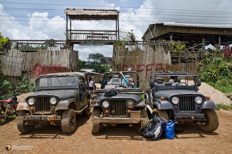
Our destination was Green Coffee, a cafe located approximately 2 kilometers from the entrance of Ban Nong Luang, Pak Song. Here, we transitioned to vehicles more suitable for navigating the forest terrain. Opting for a more relaxed approach, we chose to explore the forest by jeep, a departure from our usual backpack treks. However, securing reliable jeeps proved challenging. The only options available were World War II-era jeeps, remnants of the conflict between the Americans and Russians. Their condition left much to be desired in terms of performance. For our group of over 40 people and camping equipment, we utilized 7 jeeps and 2 pickup trucks.


"Rome wasn't built in a day," so there's no need to rush. About 200 meters after leaving the coffee shop, my car started making a loud noise from the leaf spring. We had to stop at a roadside garage because we were overloaded. Normally, this Jeep Willy model can carry around 270 kilograms and 3-4 passengers, but we had squeezed in 8 people. It started showing signs of trouble before we even started the fight. Thanks to the skill of the Lao mechanic, the repair was completed in less than 5 minutes. He just added some reinforcements to get it running again. After driving for a while, we met the rest of our group waiting for us. One of their cars had a flat tire, so we took the opportunity to get out and stretch our legs. We still had a long way to go.


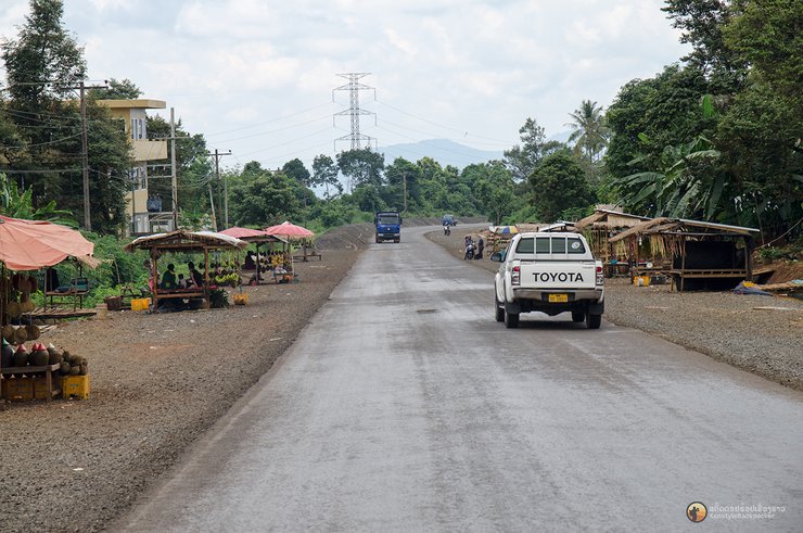
The route we took to explore the waterfall was an old road, approximately 60 kilometers long, cutting through the heart of the forest to Attapeu Province, eliminating the need to detour via Sekong, saving 100 kilometers. This route starts at the intersection of the public park and the Ong Keaw Krom Dam monument, about 600 meters from the Vietnam-Laos War Allies Monument at the entrance to Ban Nong Luang. It branches off to the right, passing through villages and vast coffee plantations owned by foreign investors, heading into the dense forest, where the road is currently being upgraded from gravel to asphalt.
The main route requires a detour via Sanam Sai district before cutting through to Tad Sae Pa, covering a distance of almost 200 kilometers.

The old road cuts through the heart of the forest to Tad Sae Pa, starting from the Ong Kaew Krom Dam Monument, a distance of approximately 60 kilometers. We chose to travel this old route.


The Jeep Willys sped to a halt at a stream, forcing us to "change horses mid-stream" by using a suicide squad to test the waters and cross to the other side. However, the loose soil on the bank made it impossible to climb up, requiring the use of a winch to pull them up. Judging by the situation, it would take a long time for everyone to cross, and they would still have to face the raging waters of another stream ahead, where the water level was still high due to flash floods. It would be impossible to pass, so we switched to using a GMC truck to transport some of the people and supplies. The rest of the supplies were loaded onto the only Jeep that had made it across and sent ahead to the reinforcements. Motorcycles, acting as "fast horses," were also used to run back and forth to coordinate between different points of the journey, as there was no phone signal.


The truck dropped off some of the group along the way, and a van was waiting to transfer the remaining luggage to the destination. The truck then went back to pick up the rest of the people. We walked along the road that cut through Nong Hin village, the only village along the way. We stopped to buy some water to quench our thirst and chatted while enjoying the village atmosphere. We waited for the truck to return to pick us up.


After picking up the group, the truck continued its journey until it reached the second stream crossing. The truck's height was sufficient to allow us to cross, and the driver was familiar with the route. However, it required significant effort to climb the bank. Some individuals opted to walk across the bridge to reduce the truck's load. Following this point, the truck's mission was complete, and the responsibility was passed on to the third mode of transportation, a "mạy่อง" (a type of motorbike with a sidecar). The motorbike waited for us at the final leg of the journey before reaching our campsite near the waterfall.


After a 24-hour journey from Mo Chit, we arrived at the camp near a waterfall in the heart of the At Pu forest. I grabbed a towel and followed the sound of the stream, where I took a refreshing dip in the cool water. The strong current washed away my fatigue and revitalized me. Although it was dark, I could tell that the stream was quite wide. After dinner, we retired for the night, but the intense heat made it difficult to sleep in the tents. Some of us slept outside near the waterfall, while others took advantage of the fans on the porch of the caretaker's house.
The golden light of the sun began to shine on the mountain range. I was awakened by the sound of roosters crowing under the house where we were sleeping. I couldn't sleep anymore, so I got up and washed my face and eyes at the waterfall. Now I could see the clear, cool stream of "Tad Saep" in its entirety. The sight that greeted me was a large stream with mist or fog rising low over the hill in front. But it wasn't what I had seen in the pictures. I kept my doubts to myself and walked back to the camp to ask the waterfall caretaker. It turned out that the picture I had seen was further down to the right, about 500 meters away. My friends had already gone to see it earlier in the morning. I had spent a long time taking pictures of the stream near our accommodation.


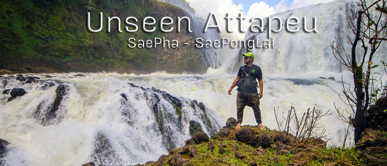
After a 500-meter walk from the camp, turning right, a smooth stream path emerges, accompanied by the continuous roar of cascading water. Curiosity sparked about the hidden waterfall behind the dense foliage. Upon rounding the bend, a moderately sized waterfall came into view. Standing amidst a patch of cogongrass, a clear view of the waterfall from afar was captured.


As we approached the waterfall, the scale that initially made it appear modest grew significantly. The vast expanse of the stream cascaded down a massive ledge, creating a curtain of water that stretched across the river. Enormous boulders, eroded by the relentless force of the current, lay scattered in heaps before us. After admiring the waterfall's beauty for a while, we returned to camp to prepare for our journey to the next waterfall, Tad Saepong Lai, located upstream from Tad Saepha.
**Tad in Lao means waterfall.**


Due to a change in travel plans, we were unable to take the car to Tad Sae Pong Lai. Instead, we had to walk 7 kilometers to reach the waterfall due to the high water level. However, before we could start walking, we faced a significant obstacle: how to cross the river. The local team used a rope tied to two trees across the river and attached it to the boat carrying us. They then pulled the rope to the other side. Those on the shore watched anxiously, hoping we would cross safely. It took an hour for everyone to cross, as the strong current made it difficult to control the boat.


After crossing the stream, we began walking along the path that cuts through the forest. The two waterfalls, Tad Saepha and Saepong Lai, are part of the same river system and are expected to become a tourist destination in the near future. Throughout the trail, we could hear the sound of the river on our left and right, as it occasionally splits into two streams before converging again at Tad Saepha. In some sections, small islands could be seen emerging from the forest.


We walked in small groups, depending on who walked fast or slow. We walked on the gravel road for about 2 hours and then heard the sound of a pickup truck driving behind us with our friends who were at the back clinging to the car. The team was worried that we would be slow, so they drove the pickup truck around the forest to wait for us on the way back. So we got to relax for about a kilometer. We rode down to the nearest point to the waterfall. After getting off the car and walking down the slope not far, when we turned the corner, the sight that we saw was a huge waterfall wall that made me goosebumps.


The closer I got, the more majestic the waterfall became, resembling a giant wall. There were numerous photo opportunities, and the water spray that reached my camera was minimal, so I didn't need to worry much about protecting my equipment. I sat down and absorbed the atmosphere with my eyes, then lay down and soaked in the waterfall's rapids to cool off for a while before finding a spot to take pictures. The area around the waterfall was relatively open, with no trees to obstruct the view, but it was a bit hot. There was a shady spot on the left bank of the waterfall, while the right side was a steep drop that flowed down to Tad Saep. This stream is the headwaters and the same stream that flows through Tad Pha Suam and Tad Etu in Pak Song before emptying into the Sedone River and then into the Mekong River at Pakse.


We enjoyed our packed lunch and took plenty of photos before heading back. This time, an e-taek (a type of motorbike with a sidecar) was waiting to take us through the forest to the main road. The path the e-taek took through the forest resembled an animal crossing, with animal droppings visible along the way. It could also be a path used by villagers to collect forest products or drag wood out of the forest, as this type of vehicle is well-suited for navigating dense vegetation. We were transported in stages, similar to our arrival, and it took until late afternoon to exit the forest. Light rain fell intermittently throughout the journey, and the temperature dropped rapidly as we emerged from the forest, sending shivers down our spines. We regrouped at the Ong Keaw Krom Dam monument to replan our journey. Our original plan was to stay at Tad Huakhon in Lamam District, Sekong Province, but we had lost a lot of time traveling. Reaching Lamam before 10 or 11 pm seemed unlikely, and we hadn't eaten dinner yet. Therefore, we changed our plan and returned to stay at Nong Luang village as before.


The new day began with a shout, "Offer alms to the monks, they are coming!" I sat up, dazed, trying to remember where I was. The night before, the car had dropped us off at Nong Luang village. We had cooked and eaten, then sat around chatting and drinking until 2 am. I had only been asleep for less than three hours. I got up, washed my face to chase away the drowsiness, and grabbed my camera. I went out to capture the familiar scene of Venerable Somwang leading the monks from Kiriwongkot Forest Monastery at the end of the village on their daily alms round. It was a common sight for the villagers, but a rare one in the big city. The Venerable walked past me with a composed demeanor and a slight smile. I felt awkward looking him in the eye, remembering his request not to widely share photos taken in Nong Luang, fearing that it would attract development and change the villagers' way of life.


After offering alms, we had a quick bite to eat at the homestay across from the village headman's house, where we stay every year. A steaming bowl of pho for 45 baht was just what we needed to shake off the drowsiness. We then showered and changed, waiting for the car to pick us up and take us back to the Chong Mek border crossing for our return journey. While waiting, we observed the new generation of villagers, noticing their changes every year. We took a group photo at the same spot as every year to commemorate the trip.


Traveling to Tad Sae Pha - Tad Sae Pung Lai can be challenging if you're going independently. However, if you're feeling adventurous, there's a bus schedule from Pakse to Attapeu, and you can find your way into the forest from there. See this link for the bus schedule: Bus Schedule. Alternatively, you can contact a tour company. Currently, KCINDOCHINA offers tours to the area. You can contact them for more information: KCINDOCHINA. For organized hiking groups, the Backpackers Group is organizing a return trip on September 15-17, 2017. If you're interested, you can find more details here: Giant Tad Sae Pha - Sae Pung Lai Trip.
- Thank you to all my friends who came to watch and like and share. It really means a lot to me.
- Exchange information or ask for travel information Fanpage: Studdoy Hundred Stories
- Follow old articles here All travel trips
สตั๊ดดอย ร้อยเรื่องราว
Tuesday, October 8, 2024 11:29 AM

