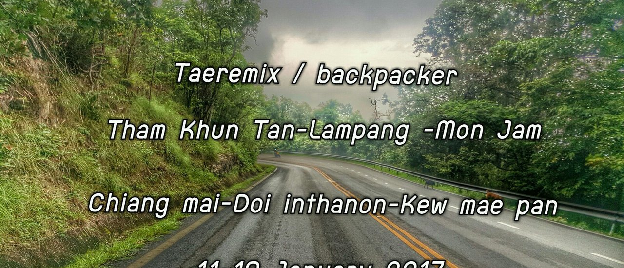
This is a review of a 7-day, 6-night backpacking trip through Chiang Mai and Lamphang provinces in Thailand. The trip covered 1,502 kilometers by train and 785 kilometers by motorbike, visiting 12 tourist destinations in temperatures as low as 2 degrees Celsius. The budget-friendly trip offered a mix of successes and disappointments.
This trip was planned more than a month in advance because train tickets had to be booked months ahead. From December to January, trains to Chiang Mai are fully booked, making it a peak season for the northern railway. We can tell you that this trip to Chiang Mai was incredibly tough; only the strong survive. 😅😅 Some things on this trip were not on the itinerary, and some were beyond our expectations. We traveled simply, without luxury, because we enjoy this type of travel. If you go during December-January, you'll experience the coldest weather ever. Let's follow us on our journey! @HereChiangMai

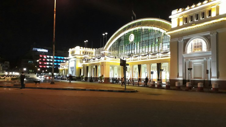
While Hua Lamphong may be a destination for many, it is the starting point for us.


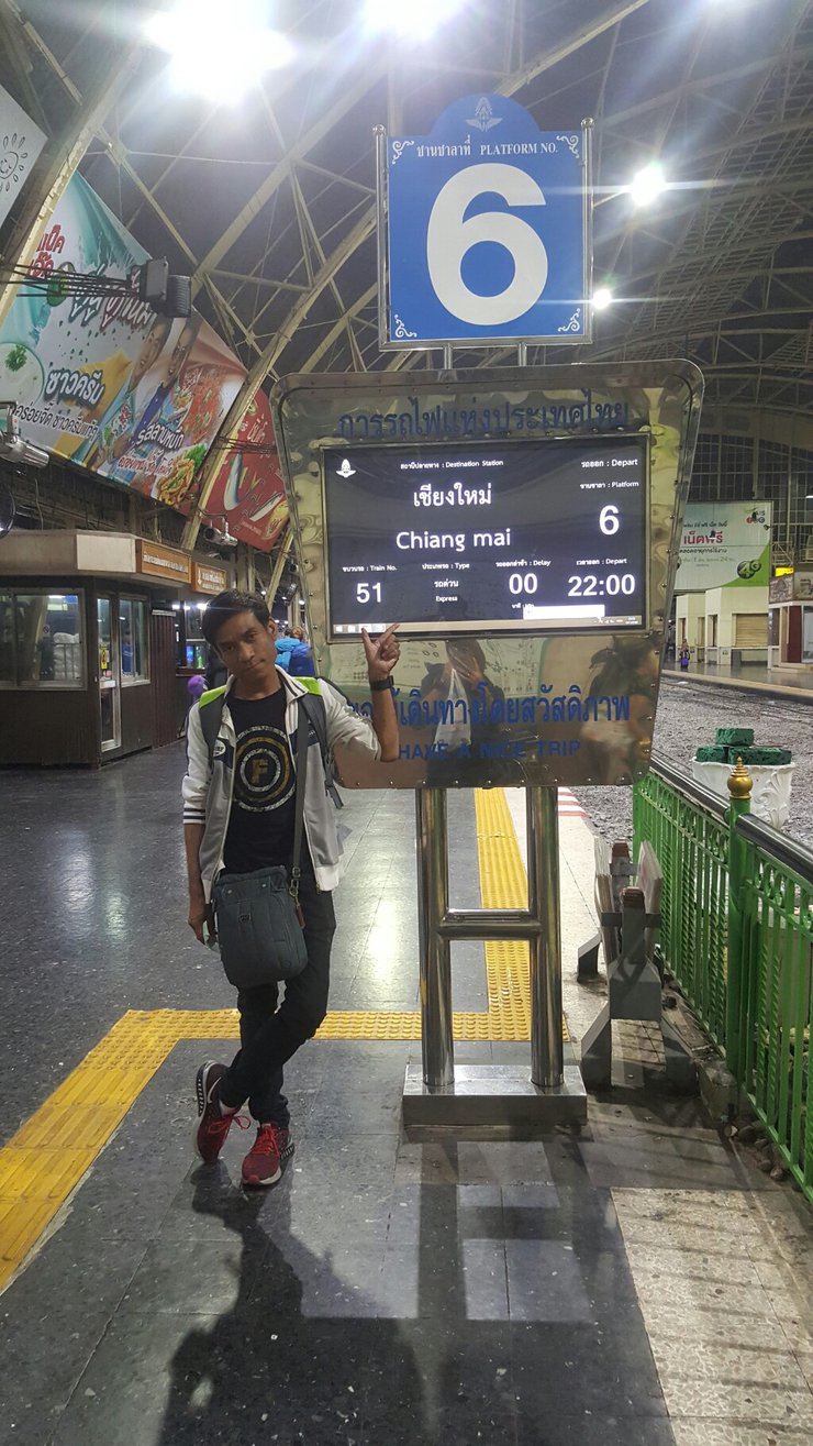
Our journey begins at Hua Lamphong, where we will capture the essence of the station's grandeur before boarding our train at 10 p.m.


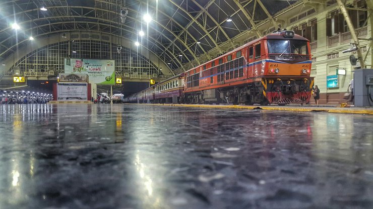
Keep taking pictures while waiting for the train to arrive.

The train was scheduled to depart from Bangkok Station at 22:00, but today it arrived at the platform at 22:40 and finally departed at 23:00, one hour behind schedule. When the train arrived at the platform, I took some exciting photos. We were on Express Train 51 from Bangkok to Chiang Mai. We chose to sit in the fan-cooled sleeper car so that we could take photos in the morning. If we had sat in the air-conditioned car, we would not have been able to take the photos we wanted. P.S. We were going to Chiang Mai, but we only bought tickets to Khun Tan Station. Follow me to find out why we got off at Khun Tan.
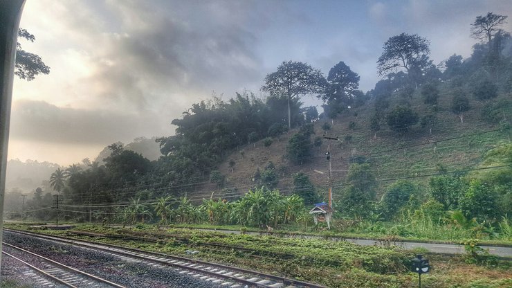
While on the train, we took a nap to recharge for the early morning to capture photos of the fog. We woke up upon arriving at Uttaradit Station.

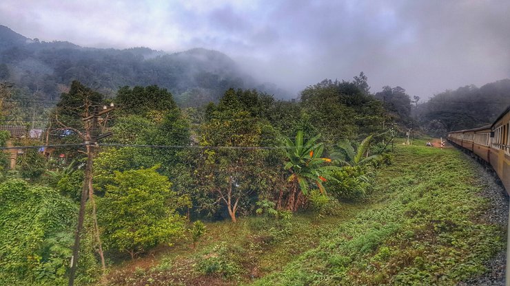
The breathtaking views along the way truly erased all traces of fatigue from the previous night's journey.

The distance makes you forget how far it is.


A hot cup of coffee on the train in the morning is truly blissful.

This breakfast set on the food truck costs 120 baht. The taste is not particularly delicious, but the beautiful view makes up for it.


The highlight of the journey is the scenic route along the Khun Tan River, which runs parallel to the railway tracks. After a short ride, we arrived at Khun Tan Railway Station. We chose to get off here to take pictures of the highest railway bridge in Thailand, which spans a deep ravine. Khun Tan Station is the highest railway station in Thailand, standing at 573 meters above sea level. The station also boasts the Khun Tan Tunnel, which runs through Khun Tan Mountain and measures 1352.10 meters in length. The Thai train service is remarkably punctual, arriving at Khun Tan only 5 minutes behind schedule despite a 1-hour delay earlier in the journey.

Here is Khun Tan Railway Station, the first location.

A group of students on a tour also visited Khun Tala.
This was my first time attempting such a crazy feat: traversing the dark, kilometer-long Khun Tan Cave and then hiking to photograph the 2-tower bridge, the 3-tower bridge, and the composite bridge, covering a distance of approximately 6 kilometers for a round trip of 12 kilometers in 2 hours. Fortunately, we encountered a railway inspection vehicle parked nearby and inquired with the staff whether we could reach the composite bridge and return in time for the 1:30 PM train to Chiang Mai. The staff kindly offered to drive us to the bridge and return to pick us up in 40 minutes to bring us back to the Khun Tan Station.


This is the one that will take us there. Let me tell you, it's not easy to get a seat on this one. Hehe.


I'm in the tunnel now.

Sitting like this is the ultimate unseen experience. 😊😊


First bridge @ bridge 2 tower, crossing a very high cliff, the weather is cool and comfortable.

Let's continue to the 3 Towers Bridge.


The view is breathtaking, making the walk worthwhile.


Walk to the composite bridge.


The view is great, isn't it? Now we walk back to the first bridge to wait for the officers to pick us up and take us back to Khun Tal.


Upon arriving at Khun Ta Ban, I took some photos while waiting for the 13:30 train to Chiang Mai.

13.30 p.m. The train arrived. We said goodbye to Khun Tawan with this picture.

We will cross the Tha Chomphu Bridge before reaching Chiang Mai.


14:35 We arrived at Chiang Mai Railway Station. Then, we took a red songthaew to Chiang Mai Arcade Bus Terminal to pick up the motorbike we had booked in advance through the website of this shop. No deposit was required in advance. The shop's name is "Bigky". There is a technique to get on a red songthaew. If we carry a backpack like a tourist, we will be charged a high price by the red songthaew. The red songthaews will rush to us and ask where we are going. If we answer that we are going here and there, they will offer us a private ride and immediately charge us a high price. The trick is to stand and watch the car that they shout to go to the arcade. Don't get on the car that rushes to us. The car that stands and shouts to go to the arcade costs only 20-25 baht per person. Just wait until the car is full and it will leave.
After picking up our rental car, we drove to the Basic Line Hotel, which we had booked through Agoda. The hotel is located in the heart of the city, on Loy Kroh Road. It is mainly frequented by foreign tourists.
The front of the hotel is a bar that transforms into a relaxed lounge at night. Room rates are affordable, starting at 600 baht per night when booked online.
Our room is in good condition. In the evening, let's go for a walk at Kad Luang Night Bazaar. Nice Bazaar is about 2 kilometers from the hotel. The road around the moat is a one-way street.
The way back to the hotel passes through Tha Pae Gate, so let's stop by and take some photos.
The second location: Nice Barza
The next day, we woke up at 5:30 AM because we had a lot of places to visit. Our first stop was Doi Suthep, which is about 15 kilometers from the city center. We started riding at 6:00 AM, and the weather was perfect at 12 degrees Celsius. Before reaching the top, we stopped to pay respects at the "Kruba Srivichai" shrine.

Venerable Srivichai


The atmosphere on the way up to Doi Suthep.
Upon reaching Doi Suthep, we boarded the electric funicular for 20 baht each. Alternatively, those seeking a more exhilarating experience could ascend the Naga stairs, which comprise over 100 steps. Upon reaching the summit, we took a moment to capture the breathtaking views.

Third place: Doi Suthep
The morning atmosphere on Doi Suthep is cool, around 10 degrees Celsius.


There is also a sea of fog.


The atmosphere is incredibly relaxing. Next, let's go pay our respects at the stupa.


To ascend to the top, one must circumambulate the stupa clockwise while reciting prayers to invoke blessings and auspiciousness into one's life.


We spent about an hour taking pictures on the Phra That.


The atmosphere on the way down the Naga stairs 😄😄

The restaurant is located below the parking area. Grab a bite to eat before you head out.
The next program is the Doi Pui viewpoint, which is about 7 kilometers further up the mountain. The road is quite steep and narrow, making it difficult for cars to pass each other. Please drive carefully.

Continue using the familiar GPS SYGIC for navigation.


The road conditions between Doi Suthep and Doi Pui.

We have arrived at our fourth location, Doi Pui.

Grab a brownie and let's take a quick selfie.


The atmosphere is so refreshing, it makes me forget all my tiredness. The squirrels are so cute, gnawing away at the nuts. 🐿️🐿️

We spent about 30 minutes at Doi Pui, where we took some photos of the signs. Our next stop was to see the "Thai Sakura," the Phaya Sua Krong trees, which required a 10-kilometer drive uphill from Doi Pui. The road was quite challenging.


The road condition was very muddy and narrow, making it almost impossible for oncoming vehicles to pass. I fell once because I had to swerve to avoid an oncoming car.


Traces of civilization 55 😂😂😂😂😂

The pink blossoms of the tiger flower trees are starting to bloom.


The atmosphere along the way, Doi Pui - Sakura of Thailand.

After passing the campsite of Doi Pui National Park, continue driving until you reach your destination.

Here is the Sakura of Thailand, the 5th place.


Here is the Thai sakura.


Beautiful, but it's starting to get hot here 😅😅


The locals enjoy ice cream. 😁😁 We spent about an hour here because we had a program to go to Mae Kampong next. Mae Kampong is about 110 kilometers from this point. So, let's follow. First, fill up the tank and drive for about 1.5 hours. We will arrive at Mae Kampong. The road is not difficult. It is paved all the way with some sharp curves going up and down the hill, but it is a comfortable drive.

I caught a glimpse of a sign.

A selfie to let you know we've arrived!


Nestled in the heart of Mae Kampong village, this enchanting location boasts cascading waterfalls and pristine streams that meander through the community. The year-round cool climate provides a refreshing respite, while the warm hospitality of the locals adds to the charm of this idyllic destination.
The atmosphere in Mae Kampong village is amazing. The roads in the village are very steep. Next time we come, we will definitely stay at a homestay in Mae Kampong. We spent about an hour in Mae Kampong and then drove to "The Giant and the Tree Cafe". We would like to warn anyone who plans to visit The Giant to be careful when driving, as the road is extremely challenging. The right side of the road is a mountain, and the left side is a cliff with no guardrails. Some curves are sharp and ascend at almost a 45-degree angle. Similarly, sharp downhill curves also have a 45-degree incline. Some sections of the road are unpaved.
At "The Giant" coffee shop, there are usually 7 people waiting in line to buy coffee. This shop mainly focuses on coffee, milk, and fresh milk. They also offer canned Coke and steak. The minimum price for coffee is 60 baht.
The suspension bridge has a sign warning you not to cross more than two people at a time.
The restaurant's atmosphere is pleasant. If you plan to visit on a Saturday or Sunday, it is recommended to make a reservation in advance. The restaurant is open from 11:00 AM to 5:00 PM.
The atmosphere is pleasant, although it may feel warm, there is a constant breeze.
We were chilling and enjoying ourselves, and before we knew it, it was already 5:00 PM. We had to hurry back because it gets dark early in the winter and the road is dangerous.
This is a 7/10 latte for 70 baht, but the beautiful atmosphere makes up for it.
On the way back to Chiang Mai city, we stopped at a scenic spot for a photo opportunity. The drive back to the city took about 100 kilometers.
😥😥We arrived at the hotel at 7:30 p.m. Later that night, we went for a walk on "Wualai Road", which is only 3 kilometers from the hotel. It is open every Saturday and Sunday and sells a variety of general merchandise and local northern products.
The place is packed! @This is the 8th location on Niuzai Street.
I'm tired from walking, so it's time to find something to eat.
[Image]
Exhausted from walking, we decided to look for something to eat.


After a delicious meal, we headed back to the hotel to rest up for an early morning. We'll be waking up at 4:00 AM to catch the breathtaking sunrise at "Mon Cham".
Day 3, we started our hike at 4:40 AM. The temperature was 18 degrees Celsius.

The motorcycle ride from the city center is a long one, about 60 kilometers. The route is not difficult, just drive towards Mae Rim District and turn left at the big intersection. Follow the road and there will be some steep sections as you go up the mountain. If you go early in the morning like us, be careful because there are no streetlights on the mountain road, only your headlights.


Here, at "Mon Cham", the 9th place.
We arrived at 6:30 a.m., just in time for the first light. However, the gate to Mon Cham was not yet open. The gate will open at 7:00 a.m.

A gentle reminder that you have arrived.


The door opened and we went in to find a place to take pictures. The weather on Mon Cham was around 10 degrees Celsius, which was just the right temperature for a cold day.

The moon is still up.


The atmosphere was truly extraordinary.


Strolling around to soak up the atmosphere.


This atmosphere would be perfect for a romantic date.^^


There is also a strawberry farm with an entrance fee of 10 baht per person.


The poster requests to post a picture of themself and their older brother.


The sun gradually sets, taking its beauty away from us.


Let's grab a bite to eat before we head out. We ordered a hot bowl of rice porridge with mixed toppings, which was delicious and cost 60 baht. We'll be at Mon Cham for about 2 hours, and then we need to hurry back to Chiang Mai city to check out of our hotel before noon. Our next destination is Doi Inthanon, which is about 200 kilometers from Mon Cham. We'll be riding our motorbikes there. Are you up for the challenge? 😉😉


The atmosphere on the way down from Mon Cham.

A quick stop at Mon Muen on the way through. Hehe.


We quickly returned to the hotel. The return trip was incredibly fast, thanks to the offline GPS SYGIC. When traveling through remote areas like forests and mountains, using Google Maps can be unreliable due to the lack of mobile phone signal. In such cases, SYGIC is a lifesaver. 😲😲😲
We left the hotel at noon and set off for Doi Inthanon, which is about 120 kilometers from the city center. We used Sygic for navigation. The first 70 kilometers were easy to drive, with straight roads and good pavement. Along the way, we saw a PTT gas station on the left. It is recommended to fill up the tank here, as there will be no more gas stations from this point onwards. **Also, withdraw money from an ATM, as there will be no more ATMs on the way up the mountain.** After leaving the PTT gas station, there will be a four-way intersection where you should turn right. However, the next 50 kilometers are quite challenging. Our 125cc motorcycle struggled to accelerate uphill, and the road was very steep in some sections.
This is the one who has been taking us around since day one and is about to take us to Doi Inthanon.
We drove at a speed of 90 kilometers per hour for more than two hours to reach the checkpoint. We had to pay an entrance fee of 50 baht per person to enter the Inthanon National Park. Motorcycles were charged 20 baht, while cars were charged 40 baht.
Here, at "Doi Inthanon National Park," the 10th place.
It's 3 pm now and it's very cold. We have arrived at the coffee plantation park. If you want to rent a tent, you have to rent it here before you can continue.
Enter the park office. There are information signs. The temperature is in the single digits. 😲😲
We rented equipment including two sleeping mats, two sleeping bags, and two pillows for a total of 380 baht. On our way out of the park headquarters, we experienced two earthquakes. This was the first time I had ever experienced an earthquake.
Directions to the campsite, please.
A sign indicating the direction to the camping area.
Within the camping area.
Which tent is empty? We can claim it. But... why are we the only ones here?...
The tent has been chosen, the location is perfect. 😜
This area is designated for campers who have brought their own tents.
After settling in, I went out for a walk to find something to eat. The temperature here is 9 degrees Celsius at 5:00 PM.
The food stalls near the campsite are more expensive than usual, likely due to the difficulty of transporting supplies. It is recommended to walk back down the path towards the campsite entrance for about 500 meters, where you will find a restaurant with significantly lower prices.
From the campsite, you can see the Siriphum Waterfall in the distance.
20x zoom capability.
We walked back to get food, which was cheaper than at the campsite. It was very, very cold. After eating, we walked back to our tent.
Hooray! People are finally here. I thought I wouldn't have any companions to brave the cold with.
There is also a tent neighbor next door.😍😍
Even the toughest of us can't handle the 6°C weather at 8pm. Our breath turns to smoke and we have to rent blankets (50 baht each). There are even showers available (for the 1% who dare!). I'm proud to be part of the 99% who don't shower because it's just too cold. I sleep in a long-sleeved shirt, two sweaters, a sleeping bag, and under a blanket. How cold is it? You tell me! 🥶
On the fourth day, we woke up at 4:00 AM to hike to Kew Mae Pan to witness the first light of day. However, we had to bring our camping equipment to the park headquarters first.

On a single day, 6,650 people visited Doi Inthanon. It was incredibly cold, especially for those who arrived on motorcycles.
On the fourth day, we woke up at 4:00 AM to hike to Kew Mae Pan to see the sunrise. However, we had to return our camping equipment to the park headquarters first.

On a single day, 6,650 people visited Doi Inthanon. It was incredibly cold, especially for those who came on motorbikes. We slowly rode to the Kiw Mae Pan parking lot, and the cold was unbearable. Our lips trembled, and our teeth chattered the entire way. It was so cold that if you were to inject yourself with a needle, you wouldn't even feel it.


Here at Kew Mae Pan, the 10th location, at 5:00 AM, the temperature is 2 degrees Celsius.


The weather is so cold, as you can see from the picture. 😂😂


At the top of Mae Pan Pass, there are shops where you can buy things. In the morning, the best-selling items are hot foods and drinks, such as rice porridge, tea, and coffee. The prices are reasonable, with coffee costing 20 baht per sachet and rice porridge costing 40 baht per cup.

I observed someone wrapped in a towel. Hehe.

In this 2-degree weather, the best companion is "hot coffee".
An unexpected and unforeseen event occurred when we approached the military personnel stationed at Kew Mae Pan to inquire about...
"Excuse me, where do I need to queue to go to Kew Mae Pan?"
The soldier informed me, "Excuse me, younger sibling, today there is a royal visit to Kiw Mae Pan, so the trail is closed for one day." (Damn it! It never closes, but it has to close on the day I come here. It's not easy to get here, you know! I drove hundreds of kilometers through the cold wind and slept in a tent with a temperature of 6 degrees Celsius just to wake up early in the morning to take the first light at Kiw Mae Pan.) Suddenly, the loudspeaker announced, "We apologize to tourists who are going to visit the nature at Kiw Mae Pan. Due to yesterday's earthquake, the park is requesting to close Kiw for one day to investigate the damage to Kiw." So, we had to take the first light here instead.

Camera ready!


Ready!


Adjust the camera's shutter speed to capture the light trails of cars while waiting for the sunrise.


The first light of day as the sun rises above the horizon.


It's too cold to go to the gold shop in this weather. It's only 2 degrees Celsius! 😅😅

From now on, we will avoid motorcycles to challenge the 2-degree cold to conquer the summit of Doi Inthanon. "The highest point of Thailand" During the time that I slowly drove, almost crawling up the mountain to challenge the cold, I found this on the side of the road.


The first sentence is a playful exclamation, roughly translating to "Look at the kale! Wow, it's frosted!" The second sentence is a pun, with "แม่คะนิ่ง" (kale) sounding similar to "แม่คะนิ้ง" (Mother Ning). The sentence playfully suggests that the frost on the kale resembles Mother Ning sitting down.


The weather is incredibly cool. Next, we will explore the nature at "Ang Ka". The entrance to Ang Ka is about 1 kilometer before the top of the mountain.


Extremely shady and cool as well.


Absolutely stunning nature.
After descending from Doi Inthanon, we drove about 10 kilometers and encountered the entrance to Wachirathan Waterfall. Note: I will continue my review tomorrow.
The entrance to the waterfall is easy to find. There will be a sign telling you to turn left from the main road. Drive for about 500 meters and you will reach the waterfall. There is no entrance fee. @ This is Wachirathan Waterfall, the 11th place.
The waterfall is divided into two levels and swimming is not allowed. This point is located at the lower level of the waterfall.
It's very cold now. It's past noon, but it's still cold.
The top of the waterfall. We spent about 40 minutes here. Next, we need to hurry to Chiang Mai city to return the rented motorcycle. Then we will continue to Lampang by train, taking the express train at 3:30 PM. Now there are 3 hours left. We have to speed faster than hell to get into the city. It took us 1.5 hours to return the motorcycle. We also had to pay a fine for damaging the motorcycle when we fell.😅😅😅 Then we rushed to the train station at 3:10 PM. The train was about to leave, so we took some pictures. It's time to say goodbye to "Chiang Mai".
3:30 PM. It's time for the train to depart. Meow, we will be back again. @HereChiangMai
The scenery on the way to Lamphun is beautiful.
Cross the bridge with two towers, the high bridge over the chasm that we explored earlier.
The three-tower bridge is extremely tall.
The train is entering the Khun Tan Tunnel.


The train arrived in Lampang on time at 5:50 PM. @ThisIsLampang


The atmosphere in front of Lampang Railway Station. From here, we will walk to "Inhlong Home", a Lanna-style homestay located about 1 kilometer from Lampang Railway Station.


The evening atmosphere in downtown Lampang while walking to Inhlong Home.

Inthara Homestay offers free bicycles for guests to use. We rented motorbikes at Inthara Homestay for 200 baht per day.
The Lanna-style architecture is a bit spooky, but the atmosphere is very chill. The weather is perfect, cool and comfortable. We'll be staying here tonight, and tomorrow we'll take a motorbike trip to Wat Luang Pu Pha Daeng, also known as "Wat Luang Phi Jazz," which is about 70 kilometers from Lampang city, according to the map.
[Spoiler] Click to reveal hidden textL


Contrary to expectations, the road is not as difficult as I thought. It is easy to drive. If you are coming from Lampang city, drive towards Chae Hom district. Follow the road for a long time. After about 50 kilometers, there will be a fork to turn left. **Pay close attention to the temple sign, as it is very small.**


The temple entrance is well-paved with asphalt, offering a clear view of the pagoda's peak in the distance on the mountaintop.

Try zooming with a 20X lens.

This temple is divided into three levels. The first level is the temple itself, where monks reside. The second level is a parking lot with shops and restrooms. The third level is the top of the stupa. Upon arrival, visitors must park their vehicles at the first level and transfer to a 4x4 truck provided by the temple to reach the second level. The road beyond this point is challenging. The round-trip fare is 100 baht per person. The truck will depart once it is full.


The ascent is approximately 3 kilometers, as challenging as Khao Khitchakut, but vehicles cannot pass each other here. A queue system is in place to prevent oncoming traffic. Vehicles ascend until they reach the summit, and descending vehicles can only proceed once the ascent is complete. It is highly recommended to find something to hold onto during the ascent, as the road is truly treacherous.


Upon reaching the second floor of the temple, visitors will be greeted by staff who will advise them on the remaining uphill climb of approximately one kilometer. It is highly recommended to use the restroom on the second floor, as there are no restrooms or shops available further up the mountain. Shops on the second floor offer water and food for purchase. **It is strongly advised to purchase a bottle of water, as it will undoubtedly be needed during the climb. 😜😜**


This is the only shop in this area. The view is incredible, isn't it? You can see the entire city of Lampang.


There is a simulated cave before the ascent. ^^

Inside the cave.

The author and his brother are ready to climb the mountain.


The initial section of the trail is a well-maintained road, but the real adventure begins after this point.


The stairs are well protected with iron railings, so there is no need to worry about falling.

Looking back 😅😅


A reassuring sign indicates that we are almost there!


At this point, the OP must rely on purchased water.


There are many signs again. 😝😝

For this type of terrain, it is recommended to wear sneakers.

We have finally arrived, my friends, after a strenuous climb of over a kilometer.

This is a resting area. Please walk straight ahead.


Turn right, it's the top of the pagoda. Turn left, it's the pavilion. Let's turn left.


Looking down, wow!! How high is it? Ask your heart. 😎😎

Although the sun is hot, the wind is very cool.


The surrounding atmosphere of the pagoda's peak.

How is it possible for the pagoda to stand without falling over?

Zooming in 5X, I finally understand. We will now walk to the opposite side and head to the pavilion in the distance.

On a mountain like this, a generator is needed.


There is a Buddha statue at the entrance of the pavilion.

Exceptionally shady


The surroundings of the pavilion are windy.


Repeat the recording. ^^
The pavilion was quickly filled with people. We left the place at 3:30 PM because it was still a long way to descend the mountain and return to Lampang city. We had to catch a train back to Bangkok at 8:15 PM. This was our 12th location, the Chelimphrakiat Phra Chom Klao Rachanuson Temple, dedicated to King Rama IV (Luang Pu Pha Daeng).
We stopped for a bite of Isaan food before returning to our accommodation, Inhlong Home.
We were very impressed with Inhlong Home. It's a homey and friendly place to stay. On our way back to Lamphang Railway Station, we planned to walk, but the owner called and said, "Wait a minute, I'll take you." We were very touched by his kindness.
Leaving Inhlong Home with this picture. If we have the chance, we will come back again. @Inhlong Home Resort "Accommodation for hundreds, views for millions" https://www.facebook.com/InLhongHomeResort/
In front of Lampang Railway Station.
20:15 The train has arrived. Goodbye, "Lampang".
A digital sign indicates the origin as "Chiang Mai" and the destination as "Bangkok".
The train doors will open automatically.
At 8:00 PM, the train attendant will convert the seats into double-decker beds. Since we boarded at 8:20 PM, many seats have already been converted into beds.
This is our seat.
Free water is available, one bottle per person.
The train's information is displayed on a monitor.
There are also CCTV cameras.
[Image]https://f.ptcdn.


Each seat and bed will be equipped with a power outlet and a reading lamp.


We arrived safely at Bangkok Railway Station at 6:20 AM.


We express our gratitude to the State Railway of Thailand for ensuring our safe journey. We also extend our appreciation to the provinces of Chiang Mai and Lampang, as well as to the natural beauty of Thailand, which provides us with stunning tourist destinations.
Importantly, I would like to express my gratitude to my kind brother who has accompanied me on every trip.
**Estimated expenses:** Round-trip train fare + motorbike rental + fuel + accommodation only. **Food expenses are not included.**
Thank you for following my mediocre reviews until the end. I appreciate your support.
Find us on our page, Deawpapai.
Facebook Page: Taeremix.Backpacker
This link directs you to the Facebook page of Taeremix.Backpacker.
Taeremix
Wednesday, October 9, 2024 5:58 PM

