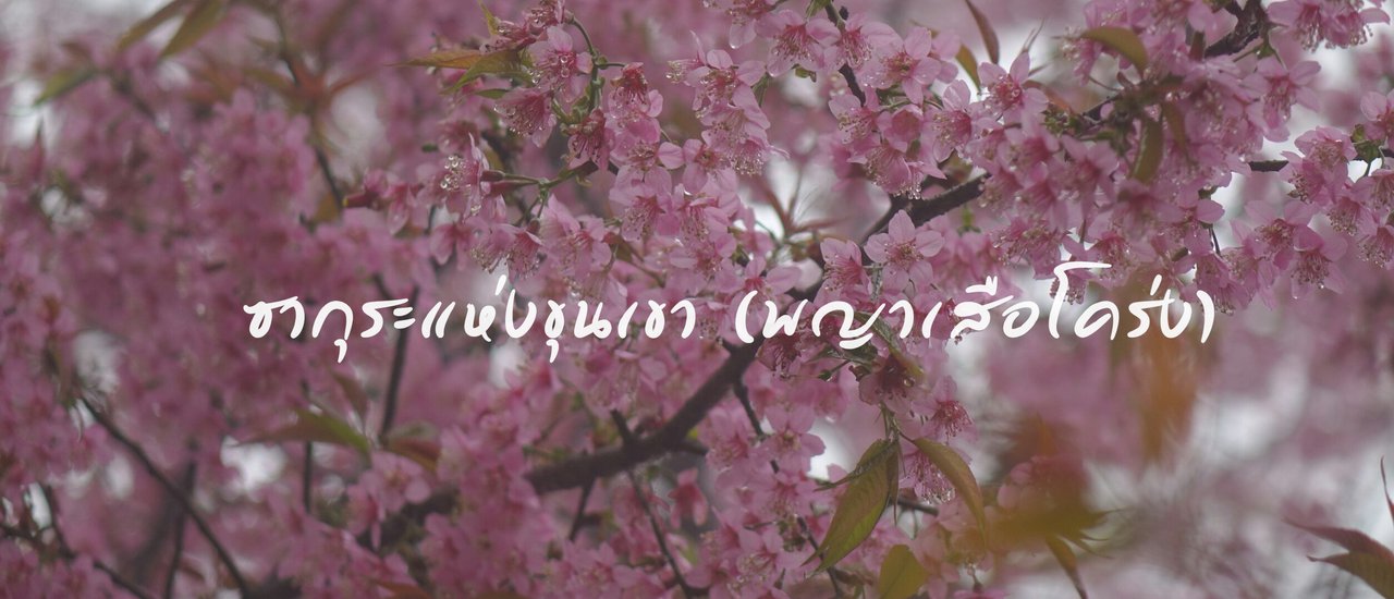


The starting point of this journey was initiated by the TAT Chiang Rai, who invited us to explore the Khun Korn Waterfall - Pang Khone - Pha Lang - Doi Chang route. This trekking trip aimed to discover the blooming of the Wild Himalayan Cherry blossoms, admire waterfalls, experience local communities, and savor local coffee and cuisine. Naturally, being eager to make the most of the trip, we explored additional tourist attractions to share with our fellow travelers.
This trip took 3 days and 2 nights. Before embarking on the journey, we had to find travel companions. This trip was joined by Nong Kong and Nong Poon to complete the experience. Stay tuned for our travel updates.
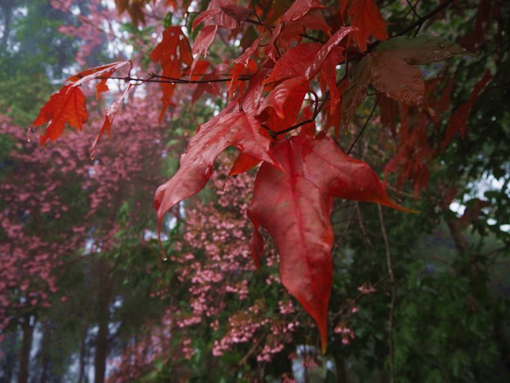
Boy, I'm on my way, but it's been drizzling all the way. Boy replied that here they call this phenomenon "Mei".
"The word 'เหมย' in the northern dialect means fog or dew. The word 'ขาบ' likely originates from the northern dialect 'ตกคาบ', meaning to leave a mark. Therefore, 'เหมยขาบ' could refer to fog or dew that leaves traces in the form of ice crystals."
"เหมยขาบ": A Northern Thai Term for Hoarfrost
"เหมยขาบ" is a term used in northern Thailand to describe the phenomenon of hoarfrost, which is a thin layer of ice crystals that forms on surfaces like leaves and blades of grass when the temperature of the surface falls below the freezing point. This occurs when water vapor in the air condenses directly into ice crystals, bypassing the liquid phase.
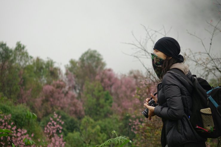
Photographer Thatchakrit Kaantiwat and Che


On the evening of January 11, 2018, the three of us embarked on our journey using the land transportation services of Somboon Tour.


"We arrived in Chiang Rai around 7:30 AM. Initially, we planned to rent a dirt bike, but we couldn't find one. The type of motorcycle suitable for riding uphill should not be an automatic transmission; a manual transmission is recommended."
The rental price of the car is 300 baht per day. The helmet is 150 baht for 3 days. The fuel cost is 90 baht per car. The total cost per person is 1040 baht for 3 days.
Our first destination was Khun Korn Waterfall, originally known as Tad Mok Waterfall by the locals, where "tad" is a Lao word meaning "waterfall".
Khun Korn Waterfall is located in Mae Korn Subdistrict, Mueang District, Chiang Rai Province. It is one of the most famous natural tourist attractions in Chiang Rai. The area is surrounded by mountains with an altitude of 700-1500 meters above sea level. It takes about 30 minutes to travel from Chiang Rai city. When you get off the car, you will feel the cool and shady atmosphere from the nature that welcomes visitors all the time. Here, everyone will meet Khun Korn Waterfall, which is known as the highest waterfall in Chiang Rai. The waterfall is about 70 meters high from the top to the bottom. The terrain of Khun Korn Waterfall is located in the Mae Lao National Forest Reserve on the left bank and the Mae Kok Forest on the right bank. The altitude is between 700-800 meters above sea level. This area is surrounded by steep mountains, which are the source of the Mae Korn River. The Mae Korn River is formed by the confluence of the Mae Korn Stream, Mae Mon Stream, Ya Dee Stream, and Lao Ai Stream. The Mae Korn River then flows into the Lao River. The Mae Korn River is the source of Khun Korn Waterfall, which has water flowing all year round.
Khun Korn Waterfall is located approximately 33 kilometers from Chiang Rai city. Visitors can travel by private car via Highway 1 for about 13 kilometers to Rong Khun village. Then, turn right onto Highway 1208 for approximately 5 kilometers until reaching the Ban Mai intersection. Turn right again onto Highway 1208 towards Khun Korn Waterfall for about 12 kilometers. The journey continues on foot for approximately 1.4 kilometers to reach the Khun Korn Waterfall Forest Park.


On the way, we stopped to take pictures at the White Temple.


Next, Singha Park (Boon Rawd Farm) in Chiang Rai, the tea plantation of Singha Beer. Today, the weather is not cooperating, but there are still many tourists. An interesting activity is cycling around the area.


On the way, we encountered many cyclists, likely drawn by the scenic route. Before reaching the waterfall, we encountered a checkpoint manned by officials. We inquired about entrance fees, and they informed us that there were none. With that, we eagerly proceeded towards the waterfall.


The journey continues on foot to the waterfall, a distance of approximately 1.4 kilometers. It is advisable to pack a small backpack with water and snacks before setting off.


The trail is easy to navigate and lined with a variety of plants and bamboo, making for a pleasant walk.


The waterfall was reached before one could even break a sweat.


The Khun Korn Waterfall is located in a national forest reserve consisting of the Mae Lao Forest on the left bank and the Mae Kok Forest on the right bank. It was designated as a forest park on January 21, 1982. Since then, the Khun Korn Waterfall Forest Park has become a popular recreation spot for Chiang Rai residents and tourists seeking pristine nature. The area is characterized by steep mountains surrounding the source of the Mae Korn River, which is formed by the confluence of the Mae Korn, Mae Mon, Ya Dee, and Lao Ai streams. These streams converge to form the Mae Korn River, which eventually joins the Mae Lao River. The Mae Korn River is the source of the Khun Korn Waterfall, which is 70 meters high and flows year-round.
Amenities
The park does not offer accommodation. Visitors are required to bring their own tents if they wish to camp overnight. The entrance fee for adults is 20-80 baht (depending on the park), and for children it is 10-40 baht (depending on the park). Children under 14 years old are admitted free of charge, while students are charged the child rate. For more information, please call 0 53726368.

After visiting the waterfall, we said goodbye to the park ranger and the cat named Kitty, and continued our journey to Pang Khon Village.


The next destination is the "Royal Project Development Station for Highland Agriculture at Ban Pang Khong, Chiang Rai". In the picture on the left is the way to Khun Korn Waterfall, and on the left is the way to Pang Khong Village.
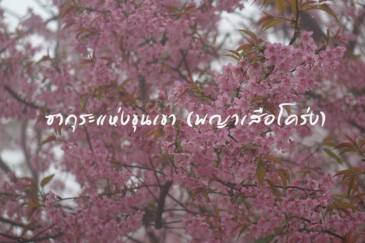
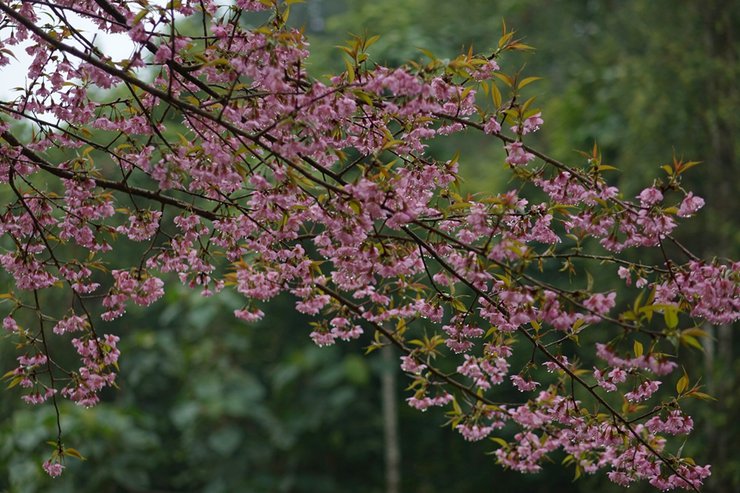
Nestled in the village of Pang Khong, nestled within the embrace of Mueang District, Chiang Rai Province, lies a breathtaking spectacle that unfolds each January. Tourists flock to witness the vibrant tapestry of "Thai sakura," also known as the Wild Himalayan Cherry, as it paints the landscape with its delicate pink hues. The blossoms adorn the slopes of Doi Pang Khong, particularly around the Agricultural Promotion Center, where their presence is especially pronounced.
Pang Khong village is located approximately 20-30 kilometers from the city center. The majority of the village's population are hill tribe people who build their houses on the mountainside. Their primary occupation is agriculture, particularly coffee farming. The village is renowned for its coffee, and visitors should not miss the opportunity to sample it.
Transportation:
Travel time: Approximately 30-40 minutes from the city center.
Route: Follow the Khun Korn Waterfall route. Before reaching the Khun Korn Waterfall office, there will be a sign indicating the entrance to Huai Chomphu sub-district. Drive along the concrete road for about 10 kilometers. When you reach Pang Khon village, drive up towards Ban Pha Lang. There will be a sign indicating the entrance to the Pang Khon Highland Agricultural Promotion Center. If you are unfamiliar with this route, you can ask local residents for directions along the way.


The car drove for about 10 kilometers on a concrete road (this route is often used for trail running events).


The village was shrouded in mist or "mei" as Boy had mentioned, with rhododendrons blooming throughout the area. Initially, we planned to drive straight to the research station, but we decided to stop by Pang Khone School on the way. Fortunately, we did, as the locals informed us that the heavy rains had made the roads difficult for motorcycles. We contacted Father Luang (whose name is Son) to take us up to the research station. He charged 600 baht for a round trip, but since we were staying overnight at the station and continuing on to Pha Lang, we ended up paying 1600 baht.


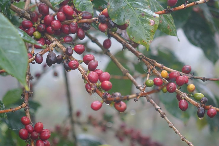
From Pang Khon Village to the station, the view on both sides of the road is of coffee plantations, cherry trees, plum trees, and other crops planted by villagers. These are in full bloom with pink flowers during the winter season. The mountain rainforests are covered in mist almost all year round. The forests are home to a variety of edible plants, including the wild fig, whose fruit can be eaten as a snack. The Arabica coffee plantations are laden with ripe red berries, waiting to be harvested and processed into the fragrant coffee that will soon be on your table or desk.
The paved road ends, giving way to a gravel path. In dry weather, it's easily passable by foot, bike, off-road vehicle, or car. The surrounding landscape is a tapestry of coffee plantations, cherry orchards, plum trees, and other crops cultivated by local farmers.
For those without a car who wish to stay at a homestay in the village, local villagers offer transportation services for sightseeing. For those without a car, motorbike, or bicycle, you can park your vehicle in the village and use the available transportation services for sightseeing.
Accommodation: There is a homestay called "A-Khan Noi" located in the Pang Khon village, right next to the main road. They offer tour guide services. Contact Mr. Son at 084-4875808 for more information.


Brother Boy arranged accommodation for us at the project, or those who wanted to could pitch tents in the Horn area. The view was beautiful, but the weather was very cold in the morning, so we chose to sleep in the house. Along the way, there were tiger lilies and cherry blossoms blooming all along the road.


The Highland Agricultural Research Station at Ban Pang Khong offers visitors a unique and beautiful experience, blending natural beauty with the way of life of various hill tribes. Located approximately 40 kilometers from Chiang Rai city, the station is easily accessible. The journey to the station presents stunning scenery, with lush forests alternating with mountain ranges. Along the way, visitors can encounter the lives of three ethnic groups: Akha, Yao, and Musoe, who coexist with the forest and practice agriculture. These communities are located in the villages of Pang Ta Krai and Pang Khong, which lie on the route to the station.
Project Background
On March 13, 2002, Her Majesty the Queen visited the Doi Gia Forest Reserve, the source of the Pa Chom, Pha Lang, Hin Khao, Ya Dee streams, and the Mae Korn River in Mueang District, Chiang Rai Province. She found that the area, which is 1,400-1,600 meters above sea level, was a source of water that had been encroached upon and cleared for thousands of rai. Some areas were planted with illicit crops, which would have an impact on border security. In addition, the area was a route for drug trafficking from outside the country into Chiang Rai city, passing through Ban Pha Lang (200 Yao households), Ban Pang Khon (100 Akha, Yao, and Musoe households), and Ban Mae Mon (100 Lisu and Akha households). The residents of all three villages had encroached upon and cleared the forest for shifting cultivation, destroying the source of the river and causing landslides and siltation. As a result, the amount of water flowing into the Mae Sa River, the main river of Chiang Rai Province, has decreased. In addition, Mae Korn Waterfall, a beautiful natural waterfall with a height of about 70 meters, is experiencing a decrease in water volume, which will destroy the beautiful natural tourist attraction.
To address the issue of deforestation, Her Majesty the Queen recognized that forest officials alone could not prevent encroachment and clearing by villagers. Therefore, she deemed it necessary to involve the villagers in forest conservation, which is the source of water resources. The "Small Houses in the Big Forest" project was initiated at Doi Kiew, where the Support Foundation for the Promotion of Arts and Crafts will provide training in arts and crafts and instill knowledge of agriculture and nature conservation among the villagers in the area. The aim is to achieve harmonious coexistence between people and forests, where people become guardians of the forest, and the forest provides shade and a source of food for the people. Additionally, it will help conserve natural waterfalls, making them beautiful and sustainable tourist destinations for the future.


The summit of Doi Inthanon, at an altitude of 1,600 meters above sea level, offers breathtaking views of the mist-shrouded valleys of both Mae Chaem and Mae Taeng districts. During World War II, the Japanese army established a radio relay station on the peak, remnants of which remain visible today. The agricultural area of the station features a diverse mix of crops, including high-quality Arabica coffee, alongside economically significant temperate fruits such as Chinese chestnuts, macadamia nuts, lucky nuts, Chinese hawthorn, peaches, persimmons, plums, pears, strawberries, and plums. Additionally, seasonal vegetables like sweet gourd, Hong Kong kale, and sweet peppers are grown and sold.


The station is blanketed in the pink hues of the Dok Phaya Sua Krong flowers, shrouded in a light mist and cool air. The atmosphere is truly delightful.


The atmosphere is incredibly serene and captivating. I am already enamored with this place.


Mr. Phu Pha led a tour of the coffee plantation and various crops, explaining the coffee processing steps.


Phu explained the coffee processing steps to me.


Coffee cherries, when ripe, come in two colors: a deep red, slender variety similar to a cherry, and a yellow variety. The latter is more expensive than the former.


Photographer P'Son


Cherry blossom

For tourists who enjoy observing plant species, a 2-kilometer walk will take you to the site of the千年古茶树, the largest of its kind in Thailand. The journey is accessible throughout the year, although the rainy season can make travel challenging due to slippery roads. This destination is suitable for both Thai and international tourists.


After exploring the area, we returned to our accommodation. Mr. Phu gave us a bunch of fresh vegetables. Before arriving at the station, we had stopped to buy some supplies, so we won't starve. There are no restaurants on the mountain, so we have to cook all our meals ourselves.


The previous night was extremely cold, around 5 degrees Celsius. Thankfully, we had brought sleeping bags, otherwise we would have surely frozen to death. On the morning of the 13th, we woke up early and took another walk before returning to prepare breakfast. Today, we planned to visit the Pha Lang village. Mr. Som arrived to meet us at the agreed time.


The distance from the research station to Ban Pha Lang village is approximately 8 kilometers.


The journey offers stunning views, with sections where the road runs along a ridge, providing panoramic vistas on both sides.


Villagers have reported facing difficulties for the 65 years since the village was established. Access to the village becomes impossible during the rainy season, often preventing residents from seeking medical attention. In such cases, they resort to traditional herbal remedies. As Thai citizens, they appeal to government agencies for assistance.
In addition to the inconvenient and unsafe travel, villagers in Ban Phai Lang also have to live in darkness at night because their village has not had electricity since its establishment. Although there are electric poles in the village, there is no electricity supply. These electric poles were installed in 2003 and have now become a monument for the villagers to look at.
The residents of Ban Phai Lang are facing significant challenges, including difficult access due to inconvenient roads and a lack of electricity for over 2,000 people.


Upon reaching Ban Pha Lang, the task at hand is to scale the Black Cliff in search of rare, indigenous herbs. Only once a year, during the heavy rainy season, can these herbs be found. Some are critically endangered and exclusive to this region, fetching high prices of over a thousand baht per kilogram. Villagers brave the treacherous climb during this specific period to collect these valuable herbs.
Macaeub is a local medicinal plant that is commonly used in all parts of food, such as laab chili paste, to give it a unique aroma. The seeds of macaeub are currently priced at thousands of baht per kilogram, and the rarest part is the root.
The "squirrel flower" lives in tall trees. It is risky to climb down the slippery, moss-covered trees to collect them.

According to local villagers, there is a large cave called Rishi. When we inquired about a guide, no one was willing to go during this period. As a result, we were unable to ascend to the top of the Black Cliff and enter the cave.


During the harvest season, Che visited the village. Father Luang informed him that the primary crops were coffee and black beans, with lychee being the most renowned. The villagers lack access to electricity and reside far from the previously bustling village center. As a result, many have relocated to other areas.


We prepare to travel back to continue our journey to Pang Khong Waterfall.


The path to Pang Khong Waterfall winds through a coffee plantation, offering stunning views of blooming tiger lilies along the way. The journey involves a car ride followed by a 2-kilometer hike through picturesque trails.


A 30-minute walk will take you to Pang Khong Waterfall, a new tourist destination developed by local villagers. The waterfall has 12 tiers, and visitors can walk from the 12th tier down to the 1st tier.


Pang Khong Waterfall has water all year round.

Villagers believe that there is a footprint of the Buddha on the 12th level above the waterfall, so they have surrounded it with bamboo.


Villagers collaborated to build a bridge to enjoy the scenic waterfall.

After returning from Pang Khone, we were all famished and eager to try the local cuisine in the village.


Let's stop by A-Khanoy Restaurant for a bite to eat.


Rooms are available.


If you're visiting Pang Khon, be sure to stop by AKHA NOI COFFEE for a taste of local cuisine.
The cost of food is 100 baht per person.
Ginseng and Tangkuei Decoction
Smoked pork
Spicy minced meat salad with aromatic herbs.
Stir-fried kale from the mountains
Coffee leaf salad
Tomato chili paste
Fresh vegetables
- Coffee 55 baht
- Accommodation 650 baht
- Local product, coffee, 150 baht per bag

After lunch, take a break to allow your food to digest. Then, browse the local products and prepare for your journey to Doi Chang.


There are several routes to Doi Chang, but I recommend taking the route through Ban Huai San. The distance from the entrance to Doi Chang is approximately 15 kilometers. The road is paved with concrete, but it is narrow and steep. Along the way, you will enjoy beautiful scenery and pass the Huai San Plapla Reservoir.
Traveling by private car
From Chiang Rai city, follow Highway 1 towards Phan District for 22 km. At kilometer marker 807, turn right onto Highway 118 (Mae Suai - Wiang Pa Pao - Doi Saket - Chiang Mai) and continue for 23 km until kilometer marker 134. This is the Doi Wawi intersection, marked by numerous sweet corn vendors. Turn right onto the RPHC Ban Tin Doi - Ban Mai Mok Jam road, passing the entrance to the Mae Suai Dam. The road is paved and winds along the mountainside for another 5 km. A left turn leads up a steep dirt road to Ban Doi Chang, 22 km away. This route requires a four-wheel drive vehicle.
There are three routes to reach Doi Chang village:
- Mae Suai District - Ban Tin Doi - Saen Charoen - Doi Lan - Doi Chang Coffee Factory - Doi Chang, 28 kilometers.
2. Huai San Stream (Mae Lao District) - Huai San Lisu - Doi Chang Highland Agriculture - Doi Chang, 15 kilometers
3. Mae Suai District - Ban Tin Doi - Rim Kheu Mae Suai - Thung Phrao - Huai Khrai - Doi Chang, a distance of 30 kilometers.

Along the way, there were people cycling, trail running, and cheering, making for a lively atmosphere.


Doi Chang: A Mountain of Opportunity
Doi Chang, nestled in the Doi Wawi mountain range, stands as a beacon of agricultural innovation and cultural diversity. Located in Ban Doi Chang, Moo 3, Wawai Subdistrict, Mae Suai District, Chiang Rai Province, this towering peak serves as the source of the Mae Korn River and a haven for various hill tribes.
Initially established as a high-altitude agricultural experiment station, Doi Chang aimed to promote the cultivation of temperate crops and curb slash-and-burn farming practices. Over time, it evolved into a center for knowledge dissemination and support for plant and production factors.
This transformation reflects Doi Chang's commitment to sustainable development, fostering economic opportunities for local communities while preserving the ecological integrity of the surrounding environment.
The name "Ban Doi Chang" is derived from the shape of the mountain, which resembles two mother and child elephants facing north (towards Chiang Rai city). It can be clearly seen from Ban Doi Chang School. Pha Hua Chang, with a height of 1,800 meters above sea level, is a scenic viewpoint with a cool climate year-round, with an average temperature of 18 degrees Celsius. Doi Chang is renowned as one of the largest coffee-growing regions in Thailand. Visitors can admire the coffee plantations in full bloom, as well as the vibrant pink blossoms of the Sakura or Wild Himalayan Cherry, while also experiencing the local villagers' artistic way of life.


Taste the Arabica coffee.
Due to its high altitude exceeding 1,000 meters, Doi Chang is an ideal location for Arabica coffee cultivation, resulting in high-quality yields.


A field of flowers and fruits of the cold season, the flowers of Nang Phaya Suea Krong are blooming.
This is a farm that grows temperate fruits, including chestnuts, macadamia nuts, plums, peaches, plums, and coffee. The fruits are harvested in the winter season, but are not available for sale. Staff members are available to guide visitors around the farm. Doi Chang has a pleasant and cool climate, making it an ideal place to relax during the months of December to early January. During this time, the wild Himalayan cherry blossoms bloom, turning the mountains a beautiful pink.


Sacred well
The Significance of Doi Chang's Buddhist Park
Nestled within the Doi Chang mountain range lies a significant site for Buddhist devotees: the Doi Chang Buddhist Park. Established in 1989 under the stewardship of Luang Pho Amnaj Silkhuno, this park has become a haven for spiritual practice and environmental preservation.
The park boasts a pristine natural landscape, untouched by human intervention. At its heart lies the Emerald Pond, a testament to the area's ecological richness. Its vibrant green hue reflects the abundance of life that thrives within the surrounding forest. The air is alive with the sounds of nature, from the croaking of frogs to the chirping of crickets, creating a symphony of tranquility.
A winding path leads from the pond to the Buddhist sanctuary, where various Buddha statues stand as symbols of peace and enlightenment. These figures offer a place for devotees to pay their respects and engage in spiritual reflection.
The Doi Chang Buddhist Park serves as a reminder of the harmonious coexistence between faith and nature. It invites visitors to immerse themselves in the serenity of the forest while seeking spiritual solace.


A tranquil and serene atmosphere.


The sacred well, located in the Doi Chang Buddhist Park, is one of the nine sacred waters used in the water-taking ceremony to mark the 60th birthday anniversary of His Majesty King Bhumibol Adulyadej. The Doi Chang Buddhist Park is a well-preserved natural forest with a large pond at its center.


We opted to pitch our tents outside, but for those who prefer, there are numerous lodging options available. Following our visit to Doi Chang, we will proceed to Huay Kaew Waterfall.


Huai Kaew Waterfall is located in Ban Pong Nam Ron, Moo 7, Doi Hang Subdistrict, Mueang District, Chiang Rai Province, 6.5 km from Huai Mak Liam Hot Spring. It is a large waterfall with a strong flow of water all year round and is 25 km from Chiang Rai city.
The provided text is empty. There is nothing to translate.
Transportation: Private car. Take the same route as Huai Mak Liam Hot Spring. When you reach Ban Pha Sa-erd, about 1 km before the hot spring, there is a left turn onto a compacted dirt road. Pha Sa-erd Wanaram Temple is a landmark. Not suitable for sedans. Distance 5.6 km. Then walk another 1 km to the first level of the waterfall (walk around the waterfall - Akha hill tribe village (homestay) - parking lot).


The Huai Kaew Waterfall is not well-known to tourists. If you want to visit the waterfall, you should contact the staff at the Huai Mak Liam Hot Spring for a guide. You should also bring water and food with you. The Huai Kaew Waterfall has three levels, each with its own unique beauty. There are many beautiful photo spots, which are very popular with tourists.
A cascading waterfall plunges approximately 30 meters from a towering cliff and massive boulders into a pool below. The lush surroundings create a tranquil atmosphere, inviting visitors to take a refreshing dip in the cool water.
The second tier of the waterfall is a 200-meter walk from the first tier, where you will see the cascading water.
A 40-meter-high waterfall cascades down a steep cliff. A compacted earthen path allows visitors to walk alongside the waterfall on both sides. The second tier offers several scenic viewpoints, and the base provides a space for relaxation. A vast and picturesque tea garden is located near the waterfall.


A vast and picturesque tea garden


We still have some time left, so let's go sightseeing. It's not far from here.


The Khun Korn National Park encompasses an area of approximately 458,110 rai (732.98 square kilometers) and encompasses four former forest parks: Khun Korn Waterfall Forest Park, Huai Kaew Waterfall - Huai Mak Liam Hot Spring Forest Park, and Pong Phabat Waterfall Forest Park. The park spans across the districts of Mae Chan, Mueang, Mae Suai, and Mae Lao in Chiang Rai province.
The provided text is empty. There is nothing to translate.
Location: Lam Nam Kok National Park, Doi Hang Subdistrict, Mueang Chiang Rai District, Chiang Rai Province 57000, Thailand. Phone: 0 5360 9238, 0 53167142. Email: [email protected]
Traveling by car from Chiang Rai province, follow the Chiang Rai - Ban Den Ha intersection road, passing Meng Rai Maha Rach Camp, to Doi Hang Subdistrict, reaching Ban Pha Sa-erd, a distance of approximately 19 kilometers. Then continue to the National Park headquarters at Huai Mak Liam for another 1.5 kilometers. Alternatively, you can take a long-tailed boat or raft from the Kok River Bridge in Chiang Rai city to Huai Mak Liam, a distance of approximately 20 kilometers.


The atmosphere is fantastic.


The park also features the Huai Mak Liam hot springs, a natural geothermal wonder with continuously flowing hot water. Visitors often immerse eggs in the springs, resulting in a richer, more flavorful taste compared to regular boiled eggs. The surrounding area boasts scenic views of the Kok River and offers camping facilities for overnight stays.

This trip would not have been possible without the help of the students who assisted with the care. Thank you for the beautiful pictures.
Photographer Thatchakrit Kaantiwat and Che
Thank you to our sponsors.
Chiang Rai, Thailand
Facebook page for Biking at Chiang Rai
I'm Che
Monday, November 11, 2024 9:55 AM

