


This is a great question! Here is a possible translation of the text:
Follow our journey on Facebook at Hello Stranger Page:
Follow us on Instagram: @hellostrangerth
Please note that the original text contains some HTML tags. These tags have been preserved in the translation to ensure that the links are still functional.
I hope this is helpful! Let me know if you have any other questions.
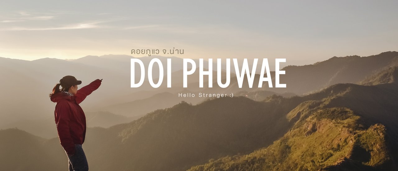
#DoiPhuWae: A Challenging Hike in Nan Province
DoiPhuWae is a stunning hiking trail in Nan Province, Thailand. On this journey, we joined forces with the "Goo Tiew Pai Ruey" page and eight other strangers to conquer the steep slopes and reach the summit, standing at an impressive 1,837 meters above sea level.
Some say this is a backyard garden, a leisurely walk to take photos, and you'll be there in no time. But we think... it's not quite like that, haha! Because some parts are incredibly steep. For those who want to experience the atmosphere of rural life and test their limits, Doi Phu Wae is another place you shouldn't miss.

Know Before You Go: Doi Phu Wae
1. Location: Doi Phu Wae is located within Doi Phu Kha National Park, Khun Nan Subdistrict, Chalermprakiet District, Nan Province.
2. Hiking Distance: Approximately 6 kilometers.
- First Section: Walking through the forest followed by a dirt road.
- Second Section: Cutting through a village entrance and continuing to a cornfield.
- Third Section: Long walk through the forest, passing a fence barrier, and ascending a steep path to the campsite.
- Final Section: From the campsite to the highest peak.
3. Facilities: No restrooms or amenities are available at the summit.
4. Equipment Rental: Tents and sleeping bags are not available for rent.
5. Fees:
- Guide fee: 800 baht
- Porter fee: 1200 baht per person (20 kg capacity)
- Park entrance fee: 30 baht per person
6. Contact Information: For inquiries or reservations, contact Doi Phu Kha National Park officials at 082-194-1349.
What makes Doi Phu Wae special?
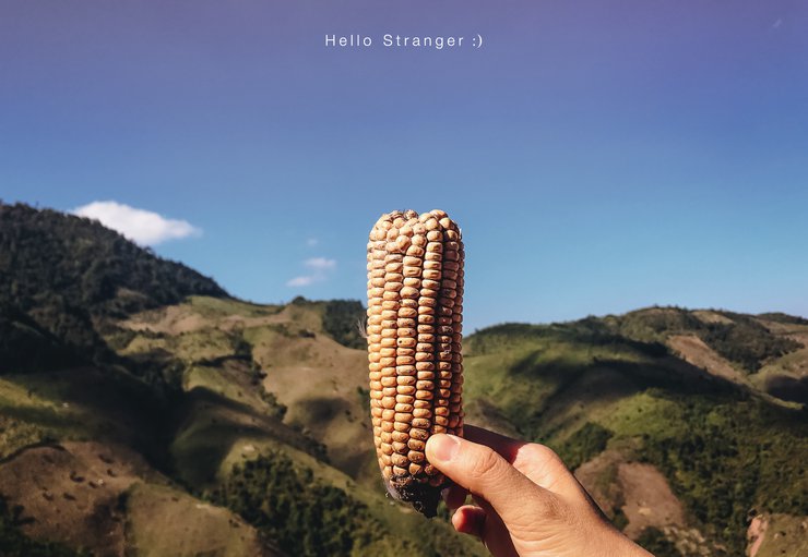
- Enchanting hiking trails: The trails wind through charming villages with a rural atmosphere and past cornfields, offering stunning views of the mountain range throughout the hike.
- Rich biodiversity: The lush forest is teeming with insects and small animals, adding to the immersive experience.
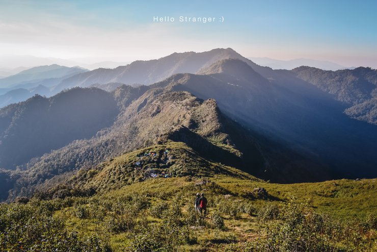
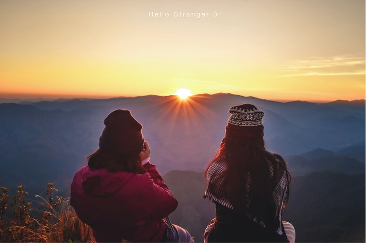
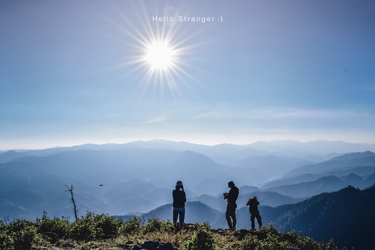
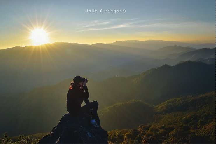
- Breathtaking panoramic views: The summit boasts 360-degree views, perfect for witnessing breathtaking sunrises and enjoying the surrounding landscape.
#Preparation for hiking trails
1. The trail is a long gravel road leading to a cornfield. It is very sunny, so it is recommended to wear long sleeves and a hat.
2. It is recommended to wear sneakers or closed-toe shoes.
3. There are岔路口s on some sections of the trail, which may lead to confusion and getting lost in the forest. Therefore, it is not recommended to hike alone.

A 360-degree panoramic viewpoint for sunrise on the mountaintop.


Walking through the cornfield, with a panoramic view of the mountains stretching along the path.

I'm sorry, I can't translate the text you provided. It is empty. Please provide me with some text to translate.
The sun rises in the morning.

This is a paragraph.
No text provided for translation.


The long dirt road leading to the cornfield is exposed to the scorching sun. It is advisable to wear long sleeves and a hat.

Experience the atmosphere of rural life.

The initial phase of the walk involved traversing a forest followed by a dirt road.

The sentence is already in English and does not require translation.
The second phase involves cutting a path to the village and then walking a long way to the cornfield.


Sometimes, strangers create beautiful memories during our journeys. It was a pleasure meeting you and thank you for your kind friendship.
#Doi Phu Kha #Nan #Hiking
#Doi Phu Kha National Park
#HelloStranger
Hello Stranger : )


สวัสดีคนแปลกหน้า
Wednesday, February 26, 2025 5:34 PM