The house is flooded. Krai Keriang on a long holiday, Labor Day 3 days 2 nights in the raft of Brother Cherid, the flood, episode 1.
This place, "Baan Nam Eua Krai Kriang," I believe, is not well-known among cyclists. If you just say the name, many people might be confused and wonder what it is or where it is. However, most hikers and anglers know it by the name "Pack Pair," often referred to as "Nam Eua Krai Kriang." Hmm, so what does it have to do with cycling?
The water has risen, as mentioned in the previous article, "Escape the Heat, Cycle in the Forest, Route 3: Nam Aeo, Saladao, Pu Toei". Pum promised her children that we would come back to stay at the raft house here, and we have returned as promised. Today, we have returned to visit this place as we intended. The atmosphere is still as beautiful as ever, but the water level has dropped significantly. I've been talking for a long time, but what about Krai Kriang? What is Krai Kriang? "Krai Kriang" is the name of the Arrow Unit, which is a unit of the Srinakarin Dam National Park. The route is a gravel road from Ban Nam Aeo, going straight in until the end, and we will find the Krai Kriang Unit.

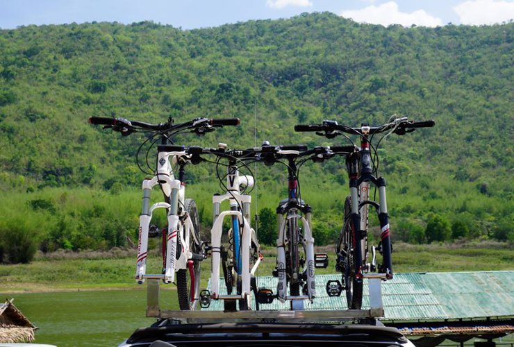
The distance from Samut Prakan to Baan Nam Eao is approximately 271 kilometers. It takes about 4 hours to travel there. We headed to Thung Makok, passing through the checkpoint of Srinakarin National Park (Khao Krachay) to Pa Nam Eao. From the Baan Thung Makok intersection to Pa Nam Eao, the road is a dirt road with a total distance of approximately 20 kilometers. It takes about 1 hour to travel.
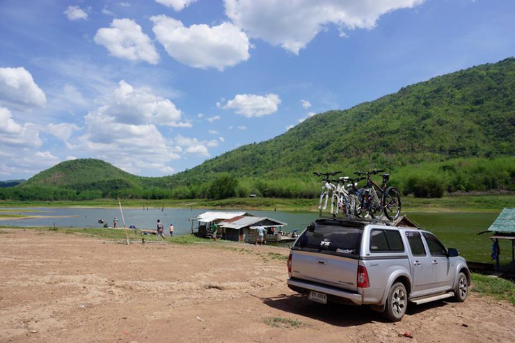
At home, the water is overflowing. There is no electricity or phone signal. There are no shops, only food that can be ordered from the floating houses, mainly fish. Therefore, if you want to stock up on supplies, stop by Ban Muang Yai, the last large community where it is recommended to stop and buy supplies for your car. From this point onwards, it will be difficult to find anything to buy.
Before leaving the house, you will see this AIS telephone pole as the last one. After this, there will be no phone signal. Anyone who has any unfinished business, please talk it out here. About 4-5 kilometers, you will reach the checkpoint of Srinakarin National Park (Khao Krachai). After passing this checkpoint, you will be in the forest area. (For those who are strong, you can cycle from here to Nam Aeo. The route is beautiful. Trip, Escape the heat, cycling in the forest, route 3 Nam Aeo, Sala Lauda, Phu Tei We started cycling from this checkpoint to Nam Aeo.)
From the checkpoint, about 7 kilometers, you will find a fork. Look for the sign with many accommodation rafts. Turn left. If you go straight, you will go to Ban Nam Phu. During the rainy season, the ground is soft, so it will be difficult for small cars. It is not recommended for small cars. During the dry season, small cars can enter. From the fork with many raft accommodation signs, it is about 9 kilometers to the entrance of the raft.
On this trip, we arrived at Pa Cherm's raft, which was the first raft to reach the flooded area. We chose to stay there because it was the first raft we reached, and the parking area was spacious and convenient.


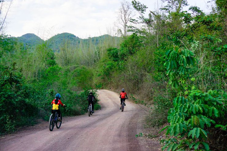
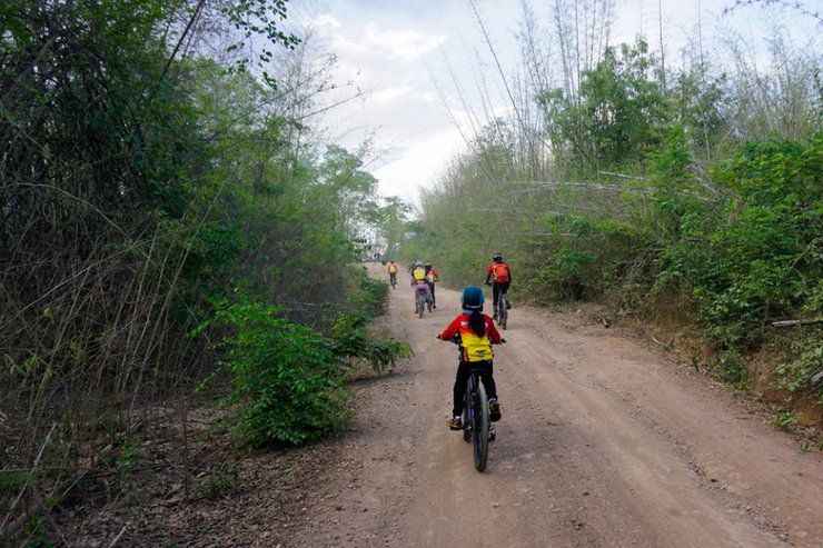
We arrived at our destination around 1pm. We were hungry and tired, so we ordered some food. The fish here is delicious, fresh, and affordable. For example, a 2kg Nile perch costs only 200 baht. Stir-fried vegetables are also around 60 baht for a large plate. If you don't want to cook yourself and are worried about getting tired, you can leave it to the chef here. I guarantee it's cheap. After we were full, we saw the sunlight and didn't dare to go out for a bike ride. We sat and chatted to kill time while waiting for the sun to set. By 3pm, the sunlight still hadn't decreased, but we really wanted to go for a bike ride and couldn't wait any longer. If we waited for the sun to disappear, it would probably be dark already. So we decided to brave the sunlight. But surprisingly, after cycling 500 meters from the raft and onto the main road, we found a shady atmosphere, as shown in the picture. (I thought to myself that I shouldn't have waited. I forgot that when cycling in the forest, we would have the shade of the trees to help block the sunlight anyway.)


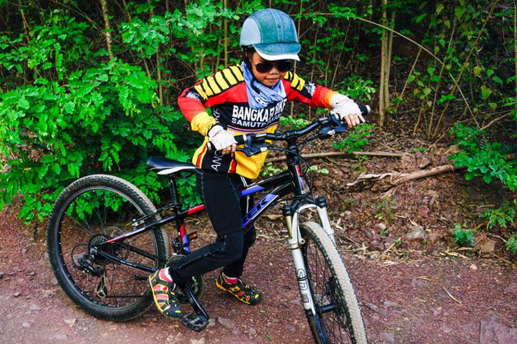
The scenic and shady path is surrounded by mountains all the way. But be warned, the slopes are quite steep. Nong Pan and Phi Pin couldn't cycle, so they had to push their bikes as shown in the picture.


From the raft house, our first destination is the "Unnamed Waterfall". The cycling route starts from the raft house. When you reach the three-way intersection on the main road, turn left and continue cycling straight for about 2 kilometers. The route is a continuous uphill slope. At the end of the road, there will be a long, winding downhill slope. Look to your right, there will be a three-way intersection before another uphill climb. Observe the right side, at the basin before the steep climb, there will be a beautiful waterfall that the locals call the "Unnamed Waterfall" because it is an unnamed waterfall.


The water at this waterfall is crystal clear, even though it's the dry season. We walked deeper inside, and the waterfall was beautiful. It's a shame we didn't bring a camera, and we were afraid we wouldn't have enough time, so we hurried back to the front to continue cycling to our intended destination, "Krai Krieng Unit." The distance from the unnamed waterfall to Krai Krieng is 12 kilometers, according to the sign. The children wanted to play in the water here, and Ma' Pum indulged them because some of the adults were exhausted and volunteered to stay and play with the children. Ma' Pum, Pa' Num, Ko, and photographer P' Vuthi continued cycling to explore the route, leaving four of us. It was around 4 pm at that time. I calculated in my mind that 12 kilometers round trip would take 2-3 hours, so we should be back comfortably before dark. With that thought in mind, we hurried on, the time getting tighter and tighter.
We started cycling again and encountered the first hill, which made us sweat. We pushed up the hill, one after another, the level of incline increasing with each hill, just as the beauty around us did.


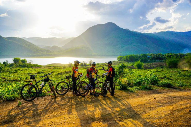
Just about 5 kilometers, it took us more than an hour. We started to get discouraged, afraid that we wouldn't make it back in time. We began to worry whether to continue or turn back. At this point, we had cycled up the hill until we thought we were at the highest point of the mountain. Judging from the view, we could see water in the distance again, along with rays of light shining down. The sun was about to set behind the mountain, a beauty beyond words. Let's take a look at the pictures. I would say that this place is like the central Pang Ung, in my feeling at the point where I am standing admiring the view here.


After taking photos, I glanced at my watch. Oh my, time flies so fast! It's already past 5. What should I do? Continue or go back? How much further is it? I thought to myself. Just then, a local pickup truck passed by. It was our lucky day. I quickly waved my hand to stop the car. "Brother, brother," I called out, waving my hand to stop the car. The kind man stopped his car halfway up the steep hill so we could ask for directions. After talking to him, we learned that after going down this long slope, we would have to climb another hill, similar to the one we had just crossed, and then descend again to reach the Krai Krieng unit. We were halfway there, and if we continued, it would be another half. Looking at my watch and calculating the time, we both nodded in agreement: we would come back tomorrow (with our friends and children). We wanted everyone to see the beauty of this place together. Then we raised our hands in a wai to thank the man for his advice, especially for stopping his car halfway up the hill so we could ask for details. As I mentioned, the hill was steep, and the pickup truck stalled twice before it could start again. Haha! I felt a little guilty, but what could I do? The view from this angle was so beautiful that we had to stop halfway up the hill to take some photos as a souvenir.
On the way back, we cycled to meet the children. It took more than an hour to cycle uphill, but only 15 minutes to cycle back. We met up with the children and cycled back together. We arrived at the floating raft around 6 pm. We had some snacks, watermelon and durian, to hold us over before dinner. While waiting, we took a shower to freshen up. The shower room on this trip was very spacious and had a romantic atmosphere. We showered until it was almost dark, around 8 pm. Tonight is a full moon night, so we showered and went to bed to watch the stars. There's nothing more blissful than this. The water here is strange. The top is comfortably warm, while the bottom is cool. There's a constant breeze. I'm truly happy. I'm floating on the warm water. (It's a pity that I didn't capture the atmosphere of the full moon and the starry sky while showering. Try to imagine it yourself, or you'll have to see it with your own eyes.)


This is the end for now. Please stay tuned for the next episode to see what will happen to Sudthang Kraikrieng.
GPS coordinates
Baan Muang Tao - N14.78146 E99.35555
Tung Makok Intersection - N14.83944 E99.32559
Checkpoint at Khao Sri Dam National Park (Khao Krachai) - N14.87286 E99.29786
Separated water gushing - fountain - N14.91062 E99.25391
The entrance to the floating market is flooded - N14.94425 E99.19625
Flood - N14.94493 E99.19471
Mooring point - N14.94730 E99.18630
Wat Pak Lam Khaeng (Stainless Steel Ubosot) - N14.92556 E99.12194
Unnamed Waterfall - N14.95071 E99.19594
Thank you for the beautiful pictures from P'Wutthi from Bangkaew Bike. I wrote these articles to encourage people to take up cycling as a form of exercise. If these articles make people want to cycle, then I consider myself successful in achieving my goal. I would like to thank everyone for their encouragement, comments, and likes.
If you are interested in reading more articles, please follow our Facebook page "Pan Tiew Pa"
https://www.facebook.com/bikeforestcamp/
Panjaiv Panmanee
Friday, September 27, 2024 10:04 AM


