Beyond the Season of Phu Kradueng
[Live Recording of My Journey]
Follow other works from Page https://web.facebook.com/omeoyou

Even if you're not interested, you've probably heard of Phu Kradueng in Loei Province. However, my 'travelogue' of Loei this time doesn't include Phu Kradueng at all. This is probably due to my habit of making quick decisions and loosely planning my trips.
The first thing to note is that Phu Kradueng National Park is closed for natural restoration from June 1st to September 30th of each year. I thought to myself that it wouldn't be a problem, as there is a lot of information available about Phu Kradueng. Even if I were to walk in blindly, I wouldn't get lost easily. I could always come back next time.
Secondly, I heard about the Phi Ta Khon festival from another friend who asked, "Are you going to see Phi Ta Khon?" This sparked my interest in staying in Loei from June 25th, the day I was scheduled to visit my friend in Loei province, until July 7th, 2016, the day of the largest Phi Ta Khon procession.
The problem arose because the time spent in Loei was almost half a month. Where can I go now?
During the first phase (25th-28th), there's no need to worry. You can stay at your friend's house and take photos around the neighborhood. However, after you part ways with your friend on the 28th, things become uncertain. I've only planned potential destinations, and I'll need to assess the situation on that day to determine the most suitable option.
The rain was not harsh on me.
June 25, 2016, woke up at 1:20 am. I had already prepared my things, so I was not in a hurry before going to my friend's house near Charoen Nakhon (Bangkok). We actually started our journey at 3 am. My friend rode pillion on my motorbike. My belongings, including camera equipment, were packed in a box on the back of the bike and strapped on top of the box. My friend had nothing but a notebook in a bag on his lap.
Taking the Rangsit route, the rain started falling from Don Mueang. We decided to push through, hoping to outrun the rain. Thankfully, after only 10 minutes, we were clear of the rain. We continued on to Saraburi, Lopburi, and Phetchabun, stopping for lunch at a gas station in Phetchabun where we encountered no further rain.
The provided text is empty. There is nothing to translate.
Memorable moments along the way

The next morning, still captivated by the skywalk and eager to capture more angles, I left my accommodation around 6:30 am. I retraced my steps, photographing various points of interest.
The air cools significantly as we enter Phetchabun, with frequent glimpses of cloud-covered mountains. The cool breeze against our skin brings an indescribable sense of comfort. This is especially true on Route 2016, which connects Phetchabun and Loei. The road climbs to the summit of a mountain range, winding its way through the peaks. The scenery is so breathtaking that I couldn't resist returning the next morning (June 26, 2016) to capture more images. During my journey on June 25, I had only taken a few photographs.

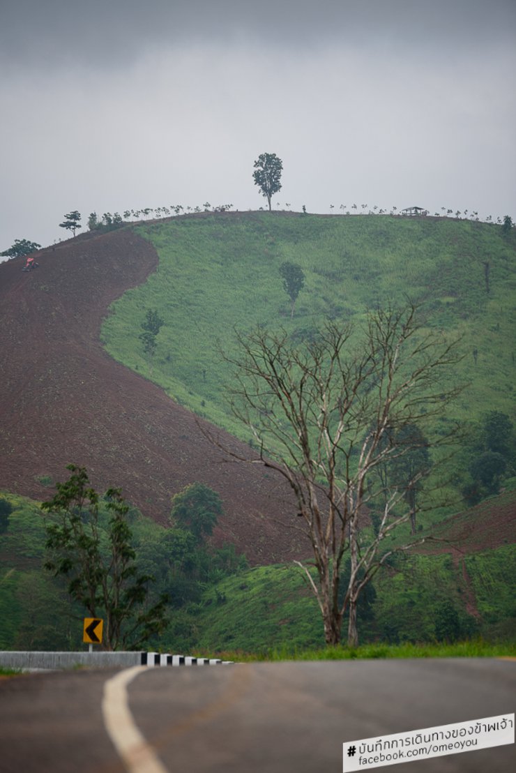
The view of Phu Ho, also known as the "Fuji of Loei" by some, but this angle is not taken from Phu Pa Po, which the authorities are promoting as the viewpoint for the "Fuji of Loei". I took it from the road 2016, because it is also in the same area, just a different angle from Phu Pa Po.

On the way back to the accommodation after finishing taking pictures, I saw Phu Ho, or Fuji of Loei again. But many people might wonder why the area on the top looks narrow. That's because this angle of Phu Ho will look narrow. Drive on, you will see Phu Ho with a large cross-section.
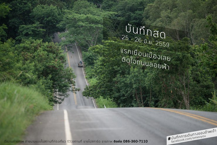
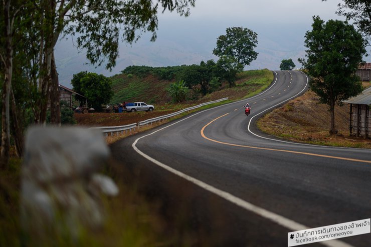
The road in 2016, I would not be wrong to call it a sky road. If you get to see it with your own eyes, you will feel the freshness of the cool air, even during the day. The mountains in this area have mostly become bald, and have become agricultural land, which is mostly used to grow corn. Although it is not right that the forest area has disappeared and become a bald mountain, it must be admitted that some of the views are strangely beautiful if we look closely. The red and orange colors of the bald mountain soil, alternating with the yellow of some plant species, the green of the remaining forest, the trees, and the blue of the sky, it looks beautiful in that reflection.

On Highway 2016, there is a viewpoint. While it doesn't attract many tourists, it offers a consistent view.
The view is a mix of barren mountains, agricultural land, and patches of forest, offering a different kind of beauty. It's a reflection of the area's character, with its ups and downs. The air is fresh and cool, especially in the early morning, although the fog can make it difficult to take clear pictures.

This is a picture from the viewpoint.
In the early morning, as I retraced my steps to photograph this road, I encountered a thick fog that obscured the view. While the images may appear blurry, the actual experience was one of refreshing coolness.

A tractor ascends a steep incline to reach a farm on a barren mountain.

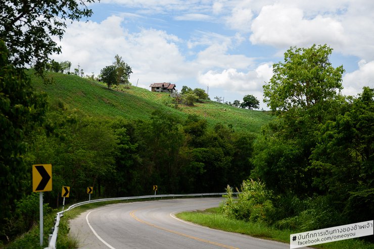
On the left is an abandoned house. I thought it was beautiful, so I drove back to find the angle of this picture twice.
Certain sections of the road feature rest stops and scenic viewpoints of Phu Luang established by the authorities. I encountered tourists throughout my three laps around this area, albeit only 1-3 vehicles at a time. However, this viewpoint has not been actively promoted, leading me to believe that tourists simply stop to admire the scenery as they drive by. Despite being located in a rural area atop a mountain, this road experiences consistent traffic, with vehicles passing by every two minutes at most.

At this point on Highway 2016, the road sits atop a mountain ridge, creating the sensation of driving on a road suspended in the air.
There is no text to translate. Please provide the text you would like me to translate.
My friend informed me that people who travel to Bangkok by private car often use this route, while tour buses typically take the route to Chaiyaphum province instead.

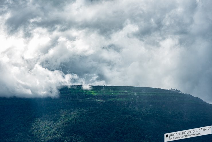
A view of Phu Luang peak on a cloudy day, seen from a cassava field in a friend's area.
Note: The original text is empty, so the translation is also empty.
Photo spot coordinates: https://goo.gl/maps/ddSYVD2tPm32
Upon arriving at a friend's house in a village in Wang Saphung district, we took a short break before heading out to take pictures of the mountain range known as 'Phu Luang', which was shrouded in mist. The peak has a unique characteristic: some sections of the summit are open with few trees, revealing beautiful layers of rocks. Phu Luang is a relatively short mountain range, but it is adjacent to Phu Ho, also known as the 'Fuji of Loei' because its summit is a large plain resembling Mount Fuji.
The forest rangers have recently closed the main trail to Phu Luang, which is the most popular route for hikers. While there are other trails used by locals to access the mountain for foraging, these are not officially sanctioned and may not be safe for visitors. As a result, I was unable to reach the summit of Phu Luang during my visit.

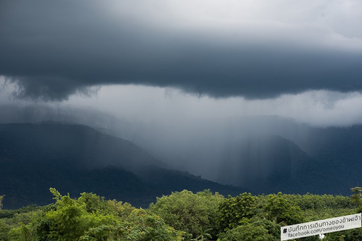
The rain is pouring down in sheets, visible from afar. This kind of scene is rare in the city because it is not open enough to be easily noticed.
The provided text is empty. There is nothing to translate.
During my two-day observation on the summit of Phu Luang, I noticed that the peak was almost constantly shrouded in mist or clouds. Before the rain arrived, dramatic cloud formations could be seen from afar, and rain could be observed falling in the distance. This unusual sight, visible only in such vast open spaces, was a rare and memorable experience for a city dweller like myself. While locals might not find it particularly remarkable, I was deeply impressed.
A friend who was riding pillion on my motorbike stayed at his house.
We were discussing whether it would rain. My friend said it wouldn't for a while, but less than a minute after we finished speaking, raindrops started to fall. Even though the main rain band was far away, the wind there was very strong, causing some of the raindrops to be blown a long distance.
This is nonsense.
Tomorrow (June 27, 2016), my friend will have to run errands for his family. This means that I will have to wander around looking for places to take pictures on my own. My friend often mentions Nong Hin district, so I thought I would stop by there for a bit. I've heard there are some tourist attractions there, even though I'm not really interested in the place myself.
On June 28, 2016, I had to part ways with my friends. They were returning to Bangkok, while I had to decide whether to stay and photograph the Phi Ta Khon festival on July 7th or return to Bangkok myself. If I stayed, the loose plan I had made for exploring Loei would become even more chaotic. I would have to wait and see what inspired me to stay or return to Bangkok.
Old review thread about tourist attractions:
Giant water lilies, sunset at Talay Noi, water buffaloes, migratory birds, Lamphu trees - Talay Noi - Phatthalung (http://pantip.com/topic/34977668)
The serene wooden bridge, a testament to the Mon people's way of life - the Mon Bridge - Sangkhla Buri - Kanchanaburi (http://pantip.com/topic/34907371)
Admire the sea of mist and experience the warm hospitality at Khao Pha Nen Thung - Khao Pha Nen Thung - Kaeng Krachan National Park - Phetchaburi (http://pantip.com/topic/34582338)
Bang Phra Reservoir, a paradise for cyclists looking for a group of friends - Bang Phra Reservoir - Chonburi (http://pantip.com/topic/35208447) I'll update the thread later, it might take a while because I just got back to my friend's house after hiking up a mountain that few people know about (except locals). Its name is Phu Pok, 1160 meters high. The road is terrible. I've never had a car accident in my life before, but I went up this mountain and crashed twice. I don't usually get cramps in my legs, but on this mountain, I got them over and over again, both in my calves and thighs.
Although the weather was beautiful and impressive, today was a day of mixed fortunes. Due to heavy rain, I was fortunate enough to seek shelter in a local villager's home. They kindly offered me a meal and took me to a scenic spot behind their house, near the infamous "100 Corpses Curve" (located slightly further up the road) on the way to Phu Ruea. This particular viewpoint is only accessible through the villager's property.
A kind soul offered me water while I was hiking up the mountain that changed my life. I had never (fallen off my bike) before, but I did this time (fallen off my bike) and foolishly went up without a single bottle of water. A kind farmer gave me water.
I can translate the provided text from Thai to English, ensuring a simple and concise tone, without sending the original text, and focusing solely on translating the sentences or phrases. Here's the translated text:
"I guarantee it's worth it to follow me up to Phu Pok. Hopefully, the damn phone will accurately record the coordinates. But anyone who goes up there and plans to sleep on it, think carefully. I don't guarantee your safety. I saw a mud puddle with animal droppings on the mountaintop where they raise cows, but they have a fence. Anyone who goes up there must close the fence. Why? If it's a carnivorous wild animal, you'll be in trouble. You should ask the staff at Phu Luang (drive a little further and it will be the Phu Luang Wildlife Sanctuary, which was where I was originally going, but it's closed for forest restoration). The next record is already up, follow the link: http://pantip.com/topic/35324083"
เดินทางตามฝัน
Friday, September 27, 2024 10:22 AM

![cover Live Recording 25-26 June 2016 [First Visit to Loei, Impressed by the Sky Road].](https://asset.readme.me/files/49624/cover.jpg?v=da9bed3a)
![cover Live Recording 25-26 June 2016 [First Visit to Loei, Impressed by the Sky Road].](https://asset.readme.me/files/49624/thumb.cover.jpg?v=da9bed3a)

