
This trip was reviewed last year. ^^
Two years ago, our group of five (with permission to mention names, if anyone has heard of the "Hell Trip" average, you might know them and make it easier to decide whether to follow this trip or not, haha) consisted of:
- P'Oat Travel Life
- P'Kan Nan Touring
- P'Po Yokee
- Pa Tae at Phuket
- And me, little oily.
The Story of Doi Pha Wi: A Frustrated Attempt to Reach the Summit
This story recounts the experience of a group of adventurers who attempted to reach the summit of Doi Pha Wi, a mountain located in northern Thailand. The journey began with the discovery of the peak on a military map over a decade ago. With the advent of Google Earth, the possibility of an ascent seemed more attainable, and the group decided to embark on an expedition.
Their initial hope was fueled by the belief that a path to the summit existed, based on information gathered from local villagers who referred to the peak as Doi Pha Wi. However, their optimism was short-lived. They were misled by a guide in another village, resulting in a wasted day of waiting.
Determined to continue their quest, they sought guidance in the village of Ma-O-Ko, the actual starting point for the ascent. Unfortunately, their timing was inconvenient, as the villagers were away tending to their fields. With limited time remaining, the group was forced to abandon their attempt, leaving them with a sense of disappointment and wasted effort.
The story highlights the challenges and uncertainties associated with exploring uncharted territory, even with the aid of modern technology. It also emphasizes the importance of accurate information and reliable guidance when venturing into remote areas.
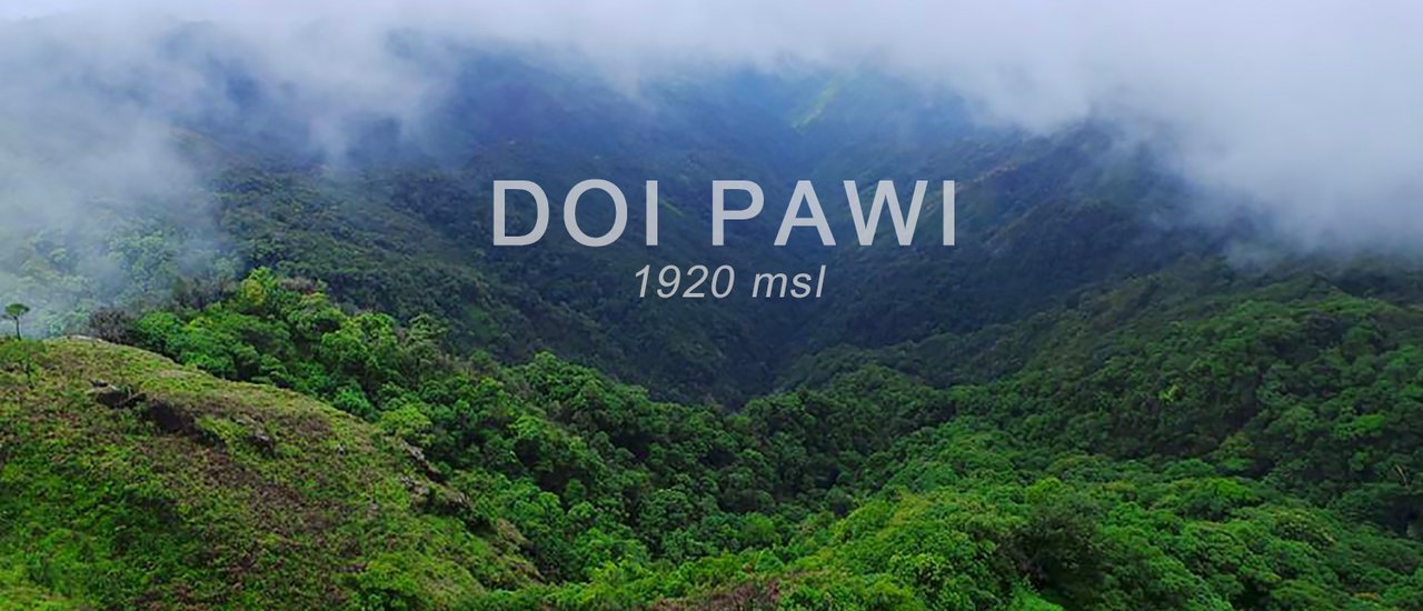
Yet, the towering Doi Pha Wi peak, shrouded in clouds and majestically beckoning, has always captivated P' Oat's heart whenever he passes through Umpang.
This time, he decided to reorganize the trip and invite members to join him again. This exploration trip consisted of four people: P'Oat, who was the leader as usual, Jeh N'goh, and P'Noi, who were regular adventurers. As for me, I was the weakest link in the trip due to a treacherous pair of shoes. I had to grit my teeth and endure, losing my composure significantly. The shoes were the culprit.


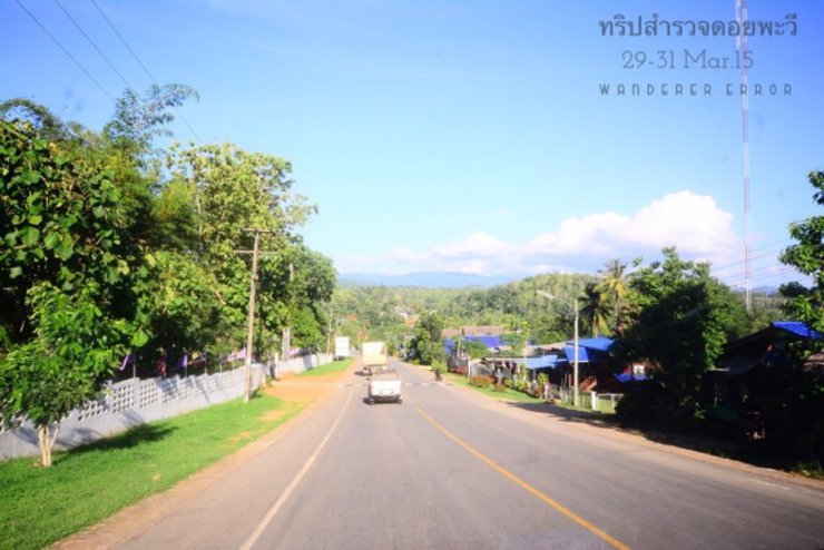
After leaving Bangkok and arriving in Umphang in the morning, we stopped for breakfast and picked up a Karen-speaking interpreter at Mr. Singhkam's house, who we had asked to find someone for us. We bought supplies and lunch, then headed to Mae Jan village, which is on the same road as the route to Tee Lor Su, but with a turn into the village. There were quite a few turns, but luckily we could vaguely remember the way and used Google Maps to help us navigate.

Upon arriving at the Ma-O-Ko village, we initially managed to secure a guide and porters. They requested to bring a friend along, to which we agreed. However, they disappeared on their motorbikes. We waited for hours, even eating our packed lunch from the dormitory, but they never returned. After three long hours, we realized we had been tricked by the Karen people once again. Feeling defeated, we started discussing our next move. Just as we were about to accept the possibility of venturing up the mountain alone, a young man from the village, recently returned from his farm, offered to guide us. His name was Paka-la, whom we called Pakorn Lam, and his father, Pa-Chai. Although they spoke limited Thai, Gant, our interpreter, helped us communicate. This unexpected turn of events lifted our spirits considerably.


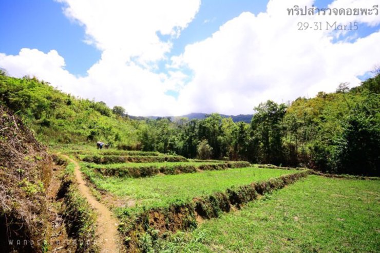
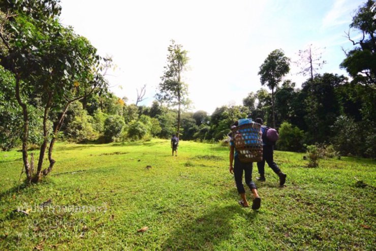
With a complete team of 7, they set off at 13:00 with supplies for 2 nights, heading into the forest. The initial section was through rice fields and local weirs, but this was short-lived. They then entered a dense jungle, which was predominantly uphill.

There are some sections with beautiful flat lawns where you can rest before climbing the ridge.


After walking for about two hours, we reached a grassy clearing on the ridge. Looking back, we could see the Thai forest on the left and the Burmese forest on the right.

The stark contrast in forest density is undeniable, with our dwindling native trees. However, this view offers a unique and contrasting beauty.


On this grassy field, a small stream flows beside it. From the bright sunshine, but when you start walking up the mountain in the forest on the ridge, the air around you turns into rain and thick fog. The weather changes from hand to back, which is the same when you return. The other side is foggy all the time. When you reach this field, the sky is clear. So, Brother Oat named this point "Two Seasons Field".


After a few seasons away from the clearing, it has become a mix of forest and rocky plains, dotted with large, strangely shaped boulders along the cliff edge. It is also filled with blooming purple En'ao trees, which are now bearing fruit. The fruits are large, edible, and plentiful, enough for us to pick and eat our fill as we walk through the area.

They say this herb is similar to the one found on Doi Luang Chiang Dao, which porters use to pickle liquor. It tastes like ginseng.

The path above is littered with white stones that resemble marble but are likely not. Does anyone know what they are?
During the winter months, you might encounter wildflowers and wild orchids. The high altitude and humidity contribute to the year-round cool climate.

The trail from the 1,200-meter contour line to the summit is exposed, offering breathtaking views on clear days. However, during our ascent, the ridge was shrouded in persistent rain and mist, making navigation challenging. As dusk approached, we pressed on, eager to reach the shelter before nightfall.
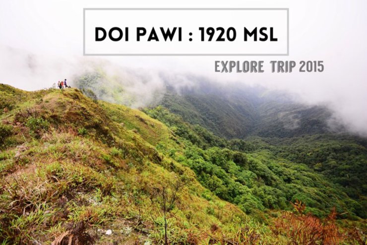
Despite the thick fog, the occasional gusts of wind provided glimpses of the surrounding scenery. Although visibility was poor, everyone in the group agreed that if the sky cleared, this would undoubtedly be another mountain with stunning views along the trail.
This trip, we walked at the very back. The trail wasn't difficult, similar to Phu Soi Dao, but we were unprepared. We wore shoes that weren't meant for hiking, making it a very painful experience. Despite the discomfort, we persevered and continued our trek.

Emerging from the forest, we began to follow the contours of Doi Pha Wi, arriving at a valley beside the mountain. This area likely marks the border with Burma (in fact, it probably starts from the ridge). Here, we set up camp for the night. There was an old hut, built for pilgrims to rest, as there was a small pagoda nearby that people likely visit to pay their respects.
The hut was well-equipped with kitchenware and seemed comfortable, so we decided not to pitch our tents or hammocks. Instead, we all snuggled up inside the hut, which was quite warm.
The group camped near a small stream, less than 10 meters away, which provided enough water for bathing and cooking. While water seemed plentiful on the mountain, its availability throughout the year could not be guaranteed.
Originally planning to stay for two nights, the group had to reconsider their plans due to the overcast weather with no signs of clearing. The guide informed them that they could reach the summit the next day and return to the village in one go. Consequently, they decided to shorten their stay to one night.
The night passed with the wind, which seemed to threaten to collapse the old hut at any moment. As a result, we all slept fitfully, tossing and turning. It's hard to imagine whether we would have been able to sleep at all if we had pitched our tents outside.
This morning, the thick fog made it difficult to get out of my sleeping bag. The fog remained dense as usual. Nevertheless, we had to reach the top of Doi Pha Wi to fulfill our long-awaited goal.


After breakfast, we packed up camp and walked for a while before leaving our bags at a rock crevice on the way up to the top of Pha Wi.

Even on our peak, we see nothing but fog.


Despite waiting for the sky to clear for half an hour, we saw nothing and had to give up.


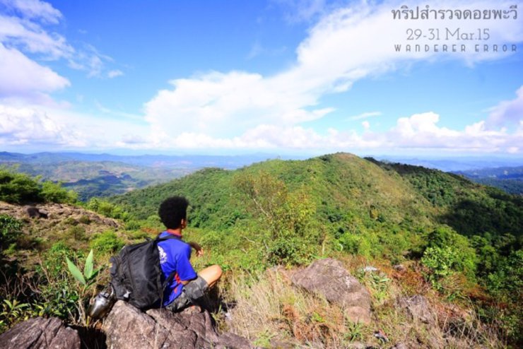
However, on the way back down, the sky cleared, revealing a dense green forest below and a fleeting glimpse of the cliffside view.


Before the wind blows the fog back, obscuring everything around me once again.


We continued to bring up the rear of the procession as before. As we descended the mountain, our fingers gripped the handlebars so tightly that they hurt. Unable to bear it any longer, we decided to change into flip-flops, come what may. Although there was a risk of being bitten by leeches or slipping and falling, our lives improved significantly. I'm telling you.

This type of bamboo is considered rare. In Thailand, it is found in the Thung Yai Naresuan Wildlife Sanctuary, on the 1,800-meter-high Pha Ti mountain. I once ate it on Mount Murai in Burma, and it was delicious with chili dip.

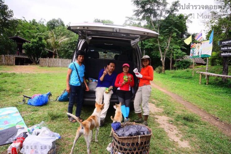
After a midday break, we returned to our vehicles parked by the village stream. We examined our wounds from donating blood to the leeches, which had bitten everyone. We felt sorry for the two dogs that had followed us, as they likely had been bitten by many leeches as well. We saw them licking their wounds repeatedly.

Our trip was a resounding success, leaving everyone in awe of the breathtaking scenery. The consensus was that the beauty of this place rivals, if not surpasses, that of Mon Jong. While the panoramic views of Mount Pawi and its surroundings were partially obscured, we are determined to return and capture the full splendor of this hidden gem.


The preliminary travel information may not be very accurate. This was our first exploratory trip, and we did not bring any official measuring tools. We estimated the distances ourselves, but we hope it will be helpful.
Upon reaching Umphang, follow the road towards Thi Lo Su. Drive straight ahead and you will see a fork leading to the Mae Jan Subdistrict Administrative Organization (SAO). From there, I'm afraid I can't provide specific directions as it involves several turns. However, you can ask the locals for guidance.
- The trail from the starting point at 800 meters to Camp 1 at 1,700 meters is approximately 6 kilometers long and takes about 3-4 hours to complete. The difficulty level is comparable to that of Phu Soi Dao, but without the stairs and handrails. The trail can be slippery when wet, so shoes with good traction are recommended.
- The trail to the summit is approximately 1 kilometer long and leads to the peak of Doi Pha Wi, which stands at an elevation of 1,920 meters.
- The mountain has small water sources for use, and at this altitude, the air is cool all year round.
- There is ample space for camping. The 2nd season field can also be used for camping. However, tents are still necessary because the huts are not very spacious and have limited sleeping capacity.
The forest is very fertile, so it's no surprise that there are a lot of big slugs.
- Although the starting point is on the Thai side, the peak of Mount Pawi is located in Burma. Therefore, to enter the area, permission must be obtained from the Mae O Ko Border Checkpoint, and a local guide should always accompany you.
- It is important to note that this area is not yet officially open to the public. As such, there may be potential dangers. Two years ago, soldiers warned us that some areas may still contain unexploded ordnance. It is unclear whether this was a genuine warning or simply a scare tactic. Local villagers may be able to guide visitors through safe paths, as they are familiar with the area and have traditionally used these routes to cross the border. Additionally, if you encounter Burmese citizens while hiking, the local guide can act as a mediator to ensure they understand you are simply tourists with no malicious intent. However, it is crucial to remember that there are no guarantees of safety once you cross the border into Myanmar. It is essential to be vigilant and remain within the designated paths.

Doi Pha Wi is a beautiful and pristine location with an abundance of unspoiled forest. It is a worthwhile destination for those seeking new experiences. While the hike is not easy, it is not more challenging than many other mountains in Thailand.

Alternatively, you can contact Mr. Singha of "Singha Homestay" to help coordinate the arrangements. We do not receive any commission fees. When we left, we did ask for Pako's number, but we thought it would be better to leave it with someone in Umphang in case he could develop it into a trip for other tourists. Additionally, there is no phone signal in Mae O Ko, so if you can't reach him by phone, Mr. Singha can still contact him in advance. This will save you from having to risk finding a guide yourself on the spot, as there is a high chance of missing out (like we did). Moreover, as more tourists become interested in traveling there, it will help to distribute income to the local community.
Currently, there is no official management in place. Anyone who wants to go can still do so easily.
• Our small first steps are often the greatest in our hearts, even with the occasional error. •
Thank you for reading.
Oil . Wanderer Error
https://www.facebook.com/WandererError/
Note: I apologize if the photos appear repetitive. I wasn't sure how to capture them differently, as everything is white.
Wanderer Error
Friday, September 27, 2024 10:28 AM

