


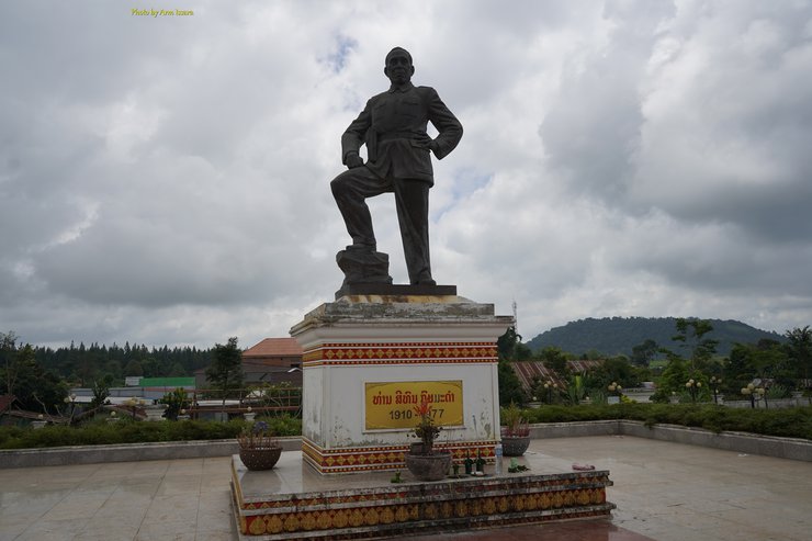
Pakxong is a charming Laotian town that offers a refreshing escape from the hustle and bustle of city life.

The climate here is pleasantly cool all year round, with no scorching summers. Even when other places are sweltering, Pak Song remains comfortably cool. The wind that blows through the mountain peaks brings with it a refreshing chill and morning mist.

On a sweltering day, I boarded a bus in Pakse, Laos, having just crossed the border from Thailand. Drenched in sweat, I headed straight for the main bus station, where I would embark on a journey to southern Laos. This station serves as the gateway to destinations such as Sekong, Attapeu, and Don Khong, eventually leading to the Cambodian border at Stung Treng.

As soon as the sweet-chilled transport truck from Savannakhet to Pakse and Sekong ascended to the plateau on the mountainside where Pakse is located, the cool breeze that blew against my face made me feel inexplicably refreshed. I turned to ask the Lao passenger sitting behind me, "Is it always this cool in Pakse?"
"Where is this place? The air is so refreshing."
"The air here is very cool," my Laotian fellow passenger, "Pak Song," told me. "Thai people love to come here."

I learned about "Pak Song" from Google. It is a small town located in the northeast of Champasak Province, 50 kilometers from the provincial capital. It covers a total area of 355,235 hectares and borders the following provinces and towns: to the north, Laongam District, Salavan Province, and Thateng District, Sekong Province; to the south, Sanamxay District and Samakkhixay District, Attapeu Province; to the east, Lamam District, Sekong Province, and Xaisomboun District, Attapeu Province; and to the west, Bacheung District and Pathoumphone District, Champasak Province.

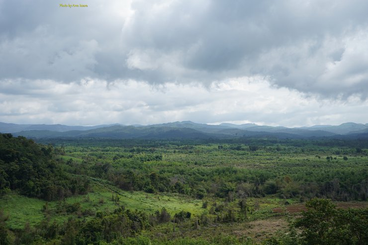
The Pakxong district is located in a mountainous region, with elevations ranging from 600 meters to 1400 meters above sea level. The majority of the district's terrain is flat, extending from north to south along the banks of the Huay Champy, Nong Hin, Thung Set, and Huay Nam Sai rivers, reaching the town of Thateng in Sekong Province. The eastern portion of the district, with the exception of the Phou Phimai protected forest, is primarily used for agriculture, with rice and coffee being the main crops. The northeastern region, bordering the districts of Lamam and Xaisomboun, is characterized by rolling hills and is largely dedicated to aluminum mining concessions and industrial crop cultivation.

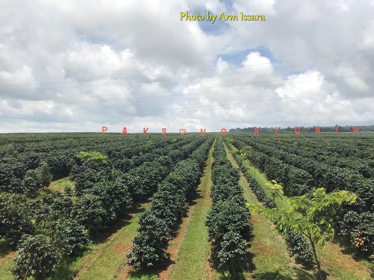
The mountainous area is the location of Pakxong city, which is mostly covered by natural forests and some coffee plantations. This has earned the city the reputation of producing the most delicious coffee in Laos. Due to the area being the site of an extinct volcanic crater, the soil is rich in natural minerals. Coffee cultivation here does not require the use of fertilizers or chemicals, as the coffee trees grow and produce fruit naturally.

As mentioned earlier, Pakxong is a coffee town. Therefore, Thai investors, including the Chang Beer Group, have established coffee plantations and scenic cafes in the area. Similarly, Dao Coffee, owned by Lao coffee magnate Ms. Daoreuang, and previously endorsed by Thai singer Thongchai "Bird" McIntyre, is also cultivated in Pakxong.

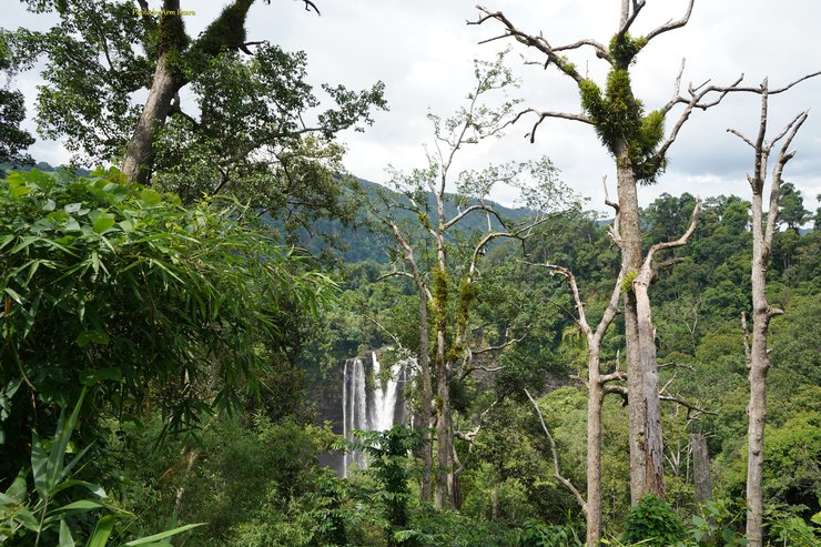
Pakxong is a city located on a high mountain with a cold climate, dense jungle, beautiful nature, and numerous waterfalls. These features make it a popular tourist destination for those seeking to experience nature firsthand. Notable waterfalls include Tad Fa, Tad Yeung, and the highest waterfall in southern Laos, Sekatham.

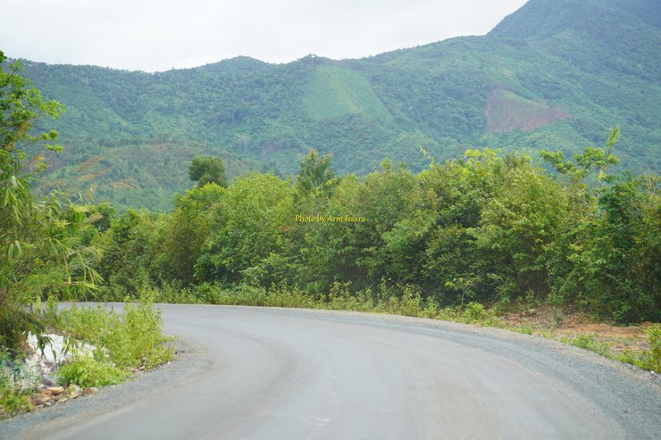
In this excerpt, the author embarks on a journey to Sekatham Waterfall, nestled at the foot of Mount Luang, the longest mountain range in Laos. This majestic mountain stretches from Savannakhet Province, traversing the entirety of southern Laos, and reaching the Cambodian border. The path leading to Sekatham Waterfall winds through the Bolaven Plateau, home to the iconic "Neua Hua Sao" (Girl's Head Hill). Along the way, the author encounters villages inhabited by the Laven people, who reside amidst the scenic landscape.

The Laven people are an indigenous tribe who have resided on Mount Luang for generations. During a conflict in the forest during a change in government, some Laven people fled to the lowlands and settled in this area. As a result, they became known as the Laven people.

Many people have wondered about the identity of the Laven people. The name "Laven" is not their original tribal name, but rather a designation based on their location in the Bolaven Plateau. Therefore, the Laven people are named after their ancestral homeland, which is part of the plateau's name.

While the original name of the Laven tribe was Jaru, no one currently knows what their original name was, except for the elder Laven who remember and pass it down to their descendants, saying, "Our original name was the Jaru people."

On my journey to Sekak Waterfall, I stopped by the scattered villages of the Lawen tribe. Modern Lawen houses are under construction, but at the same time, they are preserving their traditional houses, which are a symbol of their identity, from being lost to modernization and progress.

A family we encountered was in the process of giving birth. The Lavean people have a belief in ghosts and unseen evil spirits. They believe that when a child is born, the blood and amniotic fluid that comes out with the child will attract spirits and evil things that will come to eat the child, its organs, and the placenta, which could endanger both the mother and the child.

To ward off evil spirits and malevolent entities, according to their beliefs, bonfires were lit beneath the stairs on all sides of the entrance to prevent anything from sneaking up. During this time, both the bride's and groom's families took turns guarding the area, ensuring that no one involved approached and that nothing unusual passed through.

We can take pictures, but we cannot go up to the house. It is considered disrespectful to the spirits.

Leaving this spot, I headed towards Sekatham Waterfall, passing through the orange orchard of Thanathon Garden, which has invested in Laos. It is a large orange orchard covering half of the valley. After passing this orange orchard, we will encounter Sekatham Waterfall, hidden in the middle of the forest on the right-hand side, roaring with the sound of a massive amount of water falling from the top of the mountain to the ground below, scattering into foam.

Standing on opposite sides of the waterfall, we could only watch as the Sekatham flowed. The long, high stream of water cascaded down into the stream below, with no path for climbing or playing in the waterfall like at other places. Our guide told me that a foreigner once tried to climb to the top of the waterfall, but he ended up falling to his death below. Since then, Sekatham has strictly prohibited tourists from going to the other side.


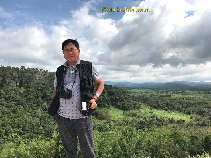
I was busy capturing footage, mainly in video format, as it was needed for editing a documentary program. As a result, I have very few still images from my recent trip to Laos. Additionally, I was traveling alone, in a hurry, and trying to collect as much material as possible. After leaving Laos, I returned to the orange orchard and then traveled back to Pak Song. On the way, I stopped at the Pak Song Highland coffee farm to try a bag of their coffee, which was quite delicious.

----------------------------------------------
Travel Log
Board the bus at Mo Chit Bus Terminal - Pakse 900 baht
Take a bus to the main Pakse bus station, then transfer to a bus to Pakxong for 40,000 kip.
From the mouth of the bag to Sekataka Waterfall, visit the tribal villages of the Bolaven Plateau, rent a car for 1 day, the car price is negotiated.
Accommodation in Pak Song City

Luxury accommodation, Dan Ngam Pak Song Hotel, around 1000 baht, the best and newest.
Phu Tewada Hotel, approximately 800-1000 Baht.
Recommended Guesthouse for Budget Travelers: Simalee Hotel, 350 Baht, Located on Main Road
Thank you.
- Infinity Plus Trading Co., Ltd.
- FOTOPRO THAILAND provides photography equipment support.

อาร์ม อิสระ
Wednesday, February 26, 2025 6:52 PM