Hiking the Heights of Mo Ko Chu: A Journey Through the Mae Wong Forest
Nestled amidst the lush greenery of the Mae Wong Forest, Mo Ko Chu stands tall at an impressive 1,964 meters above sea level. This captivating peak beckons adventure enthusiasts and nature lovers alike, offering a thrilling escape into the heart of Thailand's wilderness.
Mo Ko Chu's allure lies not only in its majestic height but also in the diverse ecosystem it encompasses. As you ascend the mountain, the landscape transforms from verdant forests to open meadows, each teeming with unique flora and fauna. The crisp mountain air invigorates the senses, while the panoramic views from the summit leave you breathless.
Whether you're an experienced hiker or a novice seeking a challenging yet rewarding experience, Mo Ko Chu promises an unforgettable journey. Embrace the tranquility of the forest, marvel at the breathtaking vistas, and immerse yourself in the raw beauty of nature's embrace.

Note: This thread focuses on images. I want the images to tell the story, so you can visualize it. The images were taken with a DSLR camera and a mobile phone, because sometimes it's too tiring to pick up a large camera.
Let's go then.
Many people may have heard of it, especially in this era where social media reaches every area, making news more accessible. For myself, I heard about it 7-8 years ago when a colleague invited me to go. At that time, the trip took 5 days and 4 nights, which was quite difficult to take time off work. So the trip was put on hold. Then, in 2014, Mae Wong National Park opened reservations for the annual Mogoju conquest trip for 2014-2015. This year was the first year that the travel time was reduced to 3 days and 2 nights. For whatever reason, the "Find a reason to hike…carry on your shoulders" group wasted no time in gathering 12 members, as per the park's rules, and waited for the trip reservation to open. There was some drama about the time to send the reservation email, but my group got trip number 14 and made it through the round. The rest was just waiting for the trip according to the scheduled date and time.
Further information on Mae Wong National Park from Wikipedia
Mae Wong National Park: A Haven of Waterfalls and Natural Beauty
Mae Wong National Park encompasses parts of Pang Sila Thong district in Kamphaeng Phet province and Mae Wong and Mae Poen districts in Nakhon Sawan province. Characterized by its mountainous terrain, the park serves as the source of several streams and boasts four to five stunning waterfalls. Notably, it is the origin of the Mae Wong River, a tributary of the Sakae Krang River. The park's landscape also features rocky rapids adorned with smaller waterfalls and picturesque natural cliffs.
Covering an area of approximately 558,750 rai (894 square kilometers), Mae Wong National Park currently faces the construction of the Mae Wong Dam within its boundaries.


Note: As of today, the porter fee has been adjusted to 500 baht per person per day.
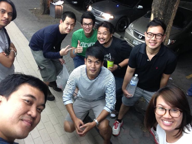
As we prepared for the trek, we gathered additional hiking gear. On February 6th, 2015, our group of 12 split into three cars for the journey. The first car departed in the afternoon, while the second and third followed around 9 pm. The drive from Bangkok to the park headquarters took approximately four and a half hours. We took our time, stopping at gas stations and taking selfies along the way.

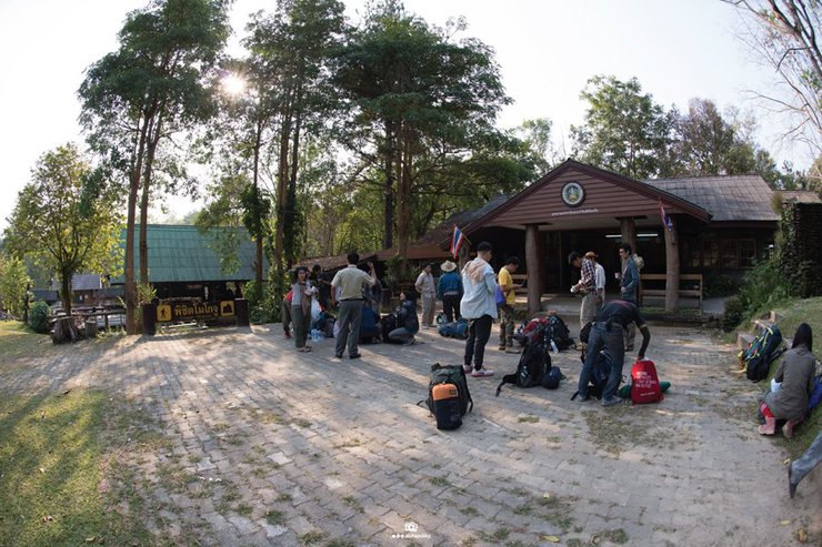
Arriving at the park headquarters around 3:30 am, we found a place to sleep and rest for the next morning. At 7:00 am GMT, we woke up to a chillingly cold air, a stark contrast to the temperature when we arrived by car at 3:00 am. It was a time when Thailand's temperature had dropped again in a week. How lucky could it be? After waking up, we took care of personal business and packed our belongings. We also prepared fresh food to take up and cook in the forest.

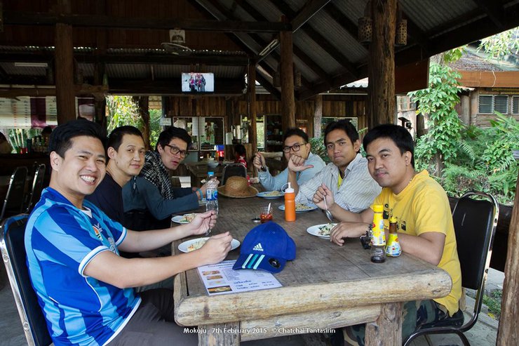
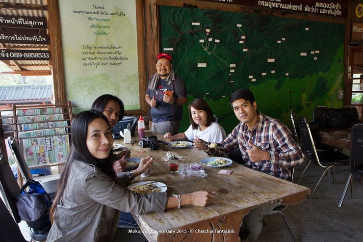
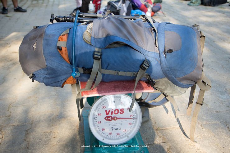
The porters' luggage was weighed, and then they ate breakfast prepared by the park.


Weighing in and taking funny photos, still unaware of what fate awaits them.


For P'Chat, the eldest of the group, he carried the most weight, including the camera bag, which weighed around 20 kilograms.

This section will provide an overview of the travel route for this trip, based on GPS tracking data.
Office - Mae Kasa Camp 15.5 km
Mae Kasa Camp - Mae Rawa Camp 4.0 km
Mae Reua Camp - Mae Reua Waterfall 3.0 km
Mae Rawa Camp - Khlong Nueng 5.0 km
1.7 km from Khlong Nueng to Campsite
Campsite - Yod Mok Ko Chu 1.3 km
(The distance is flat) but it seems that the distance from canal one to canal two is missing.

Having familiarized ourselves with the route, we embarked on our journey, starting with a ride on an "e-taek" (a type of local truck) to reach our destination at Mae Krasa Camp, a distance of 16 kilometers, taking approximately 3 hours.

They are smiling and cheerful.

Riding in a tuk-tuk, the bumpy ride without shock absorbers sent shivers down my spine with every pothole.

After sitting for a while, we had to get out and walk for a bit, as the car seemed unable to climb the hill.


"Let's just walk a short distance, not far. Consider it a warm-up for our bodies. Once we get on the bus, we can continue taking pictures."

We arrived at Mae Krasa Camp at noon. After unloading our belongings and having lunch, we continued on foot to Mae Reua Camp, a distance of 4 kilometers.


After finishing our meal, we set off on our journey. After walking for a while, we crossed a wooden bridge and took some pictures.

I crossed over to ambush from the other side.

The trail continues along a flat, easy path through a bamboo forest with scattered large trees.

This woman consistently led the group to their destination throughout the trip, her seemingly endless energy a source of wonder.

This new member, who had never been hiking with the group before, was eager to explore the wilderness. She carried a heavy backpack filled with camera lenses, ready to capture the beauty of the trail.
The backpack weighed at least 10 kilograms, and this was her first time hiking.

Due to the weight limit of 20 kilograms per porter, any excess weight must be carried by the porters themselves, with each porter carrying an additional 10 kilograms or more.

This person is the champion. They are carrying a backpack as heavy as a porter's.

Along the way, we occasionally encountered tiger droppings (as identified by the park rangers, who explained that tiger droppings contain fur from their prey).

We took a few breaks along the way, but we made good time and believe we will reach Mae Ya Waterfall on schedule.

Let's have some fun and record a video.

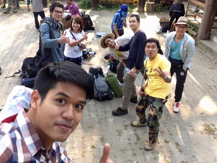
And then there's the selfie, which is a must-have among teenagers (probably the older ones).

Continuing on, we arrived at Mae Rawa Camp around two in the afternoon, taking about an hour and a half. Upon arrival, we did not set up camp yet.
We will continue to Mae Reua Waterfall and then return to set up camp later. If we are late, it will be dark and difficult to walk back.

Once all members have arrived, prepare your swimwear, bring a bottle of water, and get ready for some fun in the water.

Some sections of the trail were challenging, especially for those carrying heavier loads. However, fellow hikers were always willing to lend a helping hand, demonstrating the camaraderie and support that prevailed throughout the journey.

From Mae Reua Camp to the waterfall, the distance is approximately 3 kilometers, which takes about 1 hour.

And then we finally arrived at the waterfall. I was so relieved when I saw the majestic waterfall in front of me.

If it were the rainy season, it would be much more spectacular.


It would have been a shame if I hadn't come here. It's a long way to walk.

It is customary to play in the water when visiting a waterfall. What are you waiting for? Jump in! Oh my god, it's freezing!
The water was extremely cold, making me shiver uncontrollably.

After spending an hour at the waterfall, we returned to the campsite. I opted for the convenience of sleeping in a hammock, but feel free to choose a tent or a sleeping mat, whichever suits you best. The Mae Reua camp is situated near a stream and offers restrooms for your convenience. Savor this first night to the fullest, for tomorrow will bring the real adventure.

The atmosphere of the stream near the accommodation is suitable for bathing, washing your face and brushing your teeth, as well as washing dishes.


And of course, we can't forget the Iron Chef who created this luxurious meal for us in the middle of the forest.
What joy is greater than a full stomach? For an army marches on its belly. But if the enemy attacks, one must relieve oneself.


This is a can of tuna.


We are preparing dinner and some for tomorrow night to save time in the morning.
As the evening deepened, we gathered around a table, sharing a meal and exchanging thoughts. Laughter erupted intermittently, causing us to feel a pang of self-consciousness.
Another group is similar because they have all gone to sleep. Then, around 11 pm, they go to bed, whoever is sleeping.
It rested its body to regain strength.


On the morning of February 8th, 2015, we ate breakfast and prepared our lunchboxes for the day.
Pack food for the journey, then gather your belongings to move camp. Leave anything unnecessary behind to lighten your backpack, then…

Let's continue our journey now, because if we delay, we will arrive at dusk. And the real journey begins now.
Today's trail is an 8-kilometer uphill climb with a backpack weighing approximately 10 kilograms.
Traveling on flat ground is already challenging, but now I have to defy gravity. This is the first time I've carried such a heavy backpack on a long journey.
There will be fewer photos during this time as they have been stored in my backpack. Only photos taken with my mobile phone will be available.

In the initial stages, the group remained cohesive. However, as time progressed, individuals began to disperse at varying intervals, their pace dictated by their respective physical capabilities.


The distance to Khlong 1, where there is a stream to refill water bottles, is significant. Therefore, it is crucial to manage the water supply carried in the two bottles.
For me, a bottle of plain water and a bottle of mineral water, totaling more than a liter. Walk and sip, don't gulp until you're full, because the water will run out.
The journey will be arduous, passing through bamboo forests, then mixed deciduous and dry evergreen forests.
Large trees are becoming more prevalent.


The trail is quite steep, with some sections being very steep. During the dry season, the forest and ground will be dry, so be careful not to slip.

At times, there must be ropes to hold onto.


We arrived at Khlong 1 around 1:00 PM and had lunch there. The highlight was the delicious drip coffee.
The hot, fragrant coffee from Honduras gave me an immediate burst of energy to continue my walk.

This is coffee.


The climb from Khlong 1 gradually increased in elevation, causing the group to spread out according to their individual leg strength. A small group of 4-5 riders, including myself, found ourselves trailing behind.
And then we arrived at Khlong 2, the last water source before reaching the camp. From here, I added 3 liters of water to my weight, just like the others who had to help carry water to the camp for cooking and drinking. God, the added weight made the walk twice as tiring. Fortunately, the distance was not too far, only 1 kilometer.

Upon arriving at the base camp, I dropped my backpack to the ground, feeling a sense of relief. However, there was no time to rest, as I needed to hike up to the Sail Rock to catch the sunset.


It takes about 45 minutes to reach the summit, which is called "Mogochu".


And then they took a lot of photos together.


After enjoying the view for a while, we descended back to the camp to prepare food and rest. The wind was strong and the air was very cold.
No matter how many clothes one wears, it is impossible to resist the cold. One must stand by the fire to find some warmth.
At this camp, I opted for the "pla too" sleeping arrangement, which was simple and convenient (to be honest, I was too lazy to tie up a hammock). We went to bed around 11 pm.
Silence then ensued.

A luxurious, almost final meal. It took almost until 9 pm to finish cooking and eat.

The morning of February 9th, 2015, at 5:00 am, we woke up to the cold to watch the sunrise. I chose to cover myself with a sleeping bag to protect myself from the wind. While waiting for the sun to rise, I looked for angles to take pictures of the sky as it gradually changed color. The wind was strong, and it was cold. The camera lens was covered in condensation.


The weather wasn't great, so we didn't get as many good photos as the other groups. However, the view from up here was truly beautiful.

The trekking team, carrying their backpacks, conquered another mountain.


In the late morning, we returned to the camp to continue our journey. Today's trek would be a long, single-day hike to Mae Krasa Camp, where the "e-taek" truck would pick us up. There would be no overnight stay. If the ascent was challenging, the descent was even more so. Why? Because our legs had to bear the weight of our bodies and backpacks, putting equal strain on our toes and knees. We had to make good time to get out of the forest before nightfall.


We walked and ran, gritting our teeth, all the way to Mae Rawa Camp before finally eating.


We arrived at Mae Krasa Camp at 5 pm and continued our journey by car. During the ride, we enjoyed stargazing from the vehicle. We reached the park headquarters around 8 pm.
This concludes our trip. Thank you for watching.


All photos were taken by me and my friends who went on the trip together. You can see more at:
1. www.facebook.com/casao.punyasai/media_set?set=a.10152656893226821.546341820&type=3
2. www.facebook.com/phatarakorn.u/media_set?set=a.10152547523421688.517421687&type=3
3. www.facebook.com/tle.siriwong/media_set?set=a.10153102625617002.1073741874.503897001&type=3
5. www.facebook.com/tien.luang/media_set?set=a.10206174674748079.1073741848.1300307508&type=3
There is no text to translate in the provided input. Please provide the text you would like me to translate.
This is mine.
numishiro
Wednesday, February 26, 2025 9:34 PM


