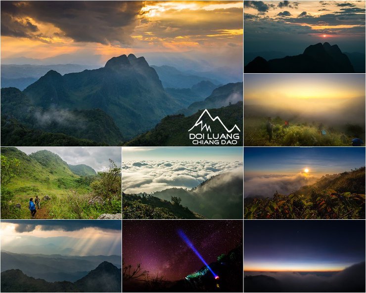
Greetings once again, friends! After writing about my Mogokju trip earlier this year, the end of the rainy season always makes me crave the wilderness. This time, my destination was Doi Luang Chiang Dao, and I'm here to share my experience on Pantip once again.

For older threads on Mogok, please click here: http://pantip.com/topic/33260417
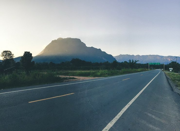
Approximately 11 years ago, during an internship in Chiang Mai, I had the opportunity to visit Chiang Dao district during my days off. The first time I saw this mountain, I was stunned by its towering height, reaching towards the sky. A few years later, I learned that it was possible to climb to the summit. From that moment, I knew I had to conquer this peak someday. Finally, on November 27-29, 2015, the time was right, and I embarked on my journey to the summit of Doi Luang Chiang Dao.

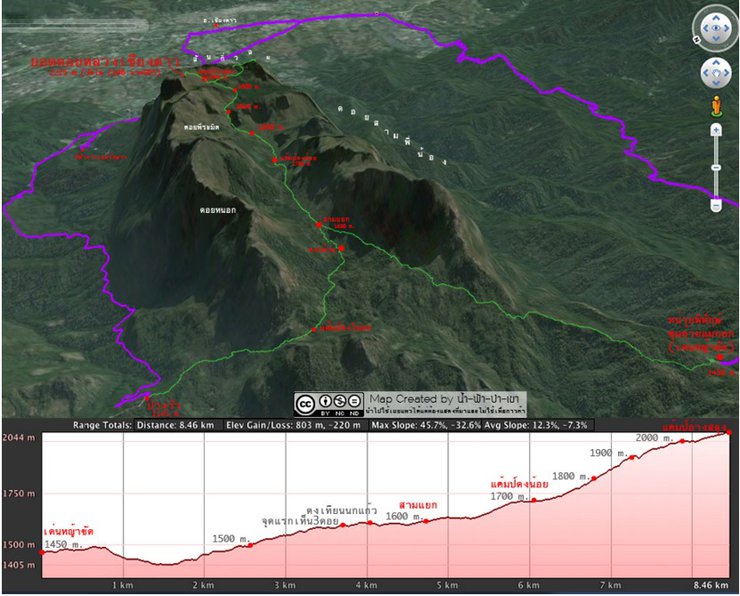
Doi Luang Chiang Dao is the third highest mountain in Thailand, after Doi Inthanon and Doi Pha Hom Pok, with an elevation of 2,225 meters above sea level. There are two main trails to the summit: Den Ya Khat and Pang Wa. For experienced hikers, the Pang Wa trail is recommended, while the Den Ya Khat trail is more suitable for beginners and offers more scenic views. The Pang Wa trail is shorter but steeper than the Den Ya Khat trail. There are no water, electricity, or toilets on the summit, only pit toilets provided by park rangers. I prefer open-air toileting in the forest. When going to the toilet, please find a spot away from the main trail to avoid disturbing other hikers. After using the toilet, it is recommended to cover it with tissue paper or bury it.

This image, borrowed from "Water-Sky-Forest-Mountain," clearly illustrates the hiking trail and its elevation changes.

Let's get down to business. My group, "Looking for Trouble Hiking," is a small group of like-minded individuals who organize our own trips without relying on tour operators. This trip had 13 members, a mix of old and new. We originally aimed for 17, but we couldn't find any more. 13 it is then! (We'll be recruiting more women for the next trip.) We organized the trip ourselves, without using a tour operator, so we had to plan everything. This included researching travel information, renting a van, dividing up the communal supplies (like cooking equipment), and planning the meals we would eat on the mountain for five days. We bought the dry food in Bangkok, but we bought the fresh food at the market in Chiang Dao. When everything was ready, and we were mentally and physically prepared, we set off on our adventure.

The photo shows 12 people, including myself, the photographer, making a total of 13.
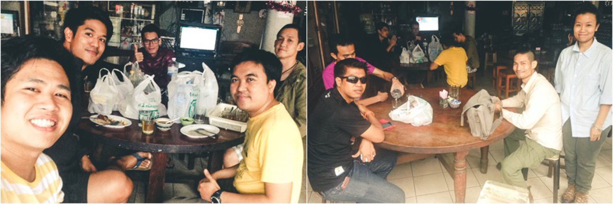
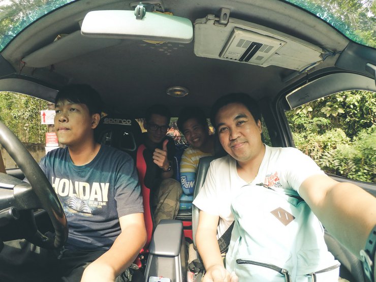
On November 26, 2015, we met at the BTS Mo Chit station at 8:00 PM. We traveled by two vans, and it was around 10:00 PM when the whole team was finally assembled and we set off. We arrived in Chiang Dao at 8:00 AM and bought some additional supplies and had breakfast. We ended up at an old-fashioned pork leg rice shop that had been in business for over 20 years (I can't remember the name of the shop).

After finishing our meal at 10:00 AM, we took our time and relaxed, as we were not in a hurry. One of the advantages of traveling independently rather than with a tour group is the flexibility to manage our own time and adjust our plans as needed. Around 11:00 AM, we arrived at the Chiang Dao Wildlife Sanctuary headquarters. We registered, paid the fees, and waited for the pickup truck arranged by the staff to take us to the starting point of the hike. The fees are as follows:
Entrance fee 40 baht
Camping fee 40 baht
Garbage deposit fee 300 baht
Porters earn 500 baht per day per person.
The cost of a round-trip transfer to and from Den Hin Ngad is 1200 baht (one way).
Pang Wa section 600 baht (one way)

The journey to Den Hin Ngad Station was quite long. I thought I would have reached the summit, which is 1,200 meters above sea level. If I had started walking from the foot of the mountain, it would have taken me 4-5 days.


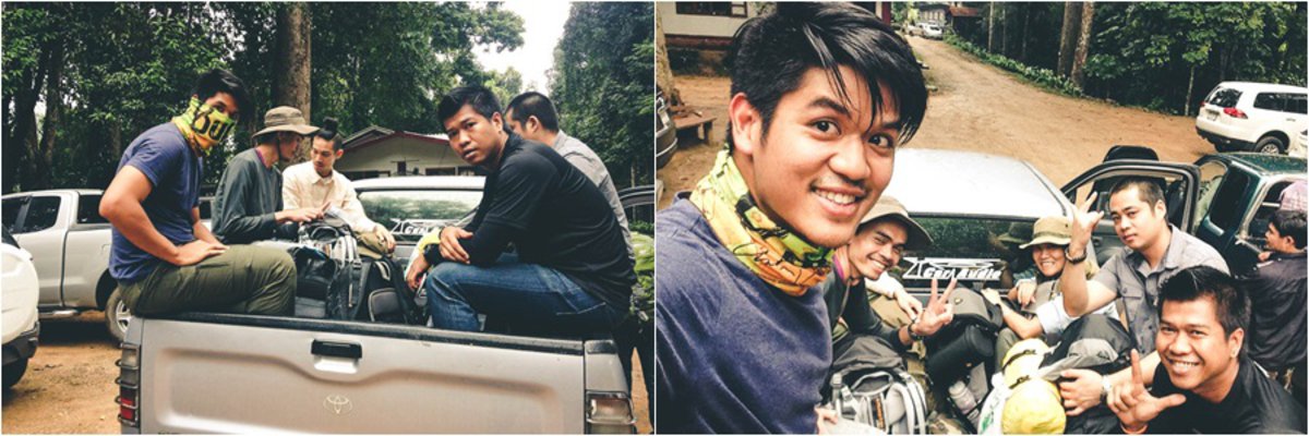
We arrived at the starting point for our hike and prepared to continue on foot.

Let's have lunch here and take a photo before we leave. Let's show our bright and happy faces.

The trek began around 1 pm, and it was evident that we would arrive at the campsite after dark. Due to morning rain and overcast skies, we opted not to rush to catch the sunset. Instead, we enjoyed a leisurely pace, ensuring we reached the campsite before nightfall to avoid difficulties setting up our tents. The distance from Den Ya Khat to the campsite was 8.5 kilometers.

A quick glance at the sign, and a thought crossed my mind: "This is easy."

The initial section of the trail is relatively flat and easy to navigate, offering scenic views and ample opportunities for photography without significant exertion. However, beyond an elevation of 1,700 meters, the path becomes progressively steeper, gradually ascending to an altitude of 2,xxx meters.


Walking and stopping to take pictures. Wow, you're not afraid of the dark, are you? The sky is already cloudy.

They say the destination is the goal, but the journey is also important, so I took pictures of the trees and grass.


Sometimes I get secretly filmed. How are you doing? B1 is easy, B2 is a breeze.

They strolled along, taking photos as they went, still walking in a group.

We met a group of leaders who were waiting for us, so we took a break to take some photos together.

This is the face of the group leader. Almost every trip, new members tend to walk ahead, not knowing where they got their fitness from, and then say it's their first time walking.

Along the way, we made friends with other groups who were also hiking up the mountain, including the "Cool Backpackers of Thailand" page admin. We met them at a rest stop at the three-way intersection, but unfortunately, we didn't get a picture with them. During the hike, we captured the beautiful scenery, but why just capture the view? Having people in the pictures adds to the story. That's where the GoPro comes in handy, making selfies easier.

Walking through a small patch of banana trees.

Continuing our walk, we arrived at the Sam Yaek Pak Wan intersection. We decided to take a break and have lunch there. At this point, our group had caught up with the other groups, even though we had started walking last.


After finishing our meal, we continued our journey. The sky looked ominous, threatening rain. If it started to pour, we would be soaked. As we walked, we passed a field of blooming sunflowers and enjoyed the scenic mountain views.


We traversed the mountains that enveloped us on all sides.


The final stretch is here, but I'm still feeling relaxed. No matter how tired I am, I'll smile for the camera first.

Our trek took approximately four and a half hours. My group opted to have porters carry only our shared supplies, while we carried our personal belongings. The porters here can only carry a maximum weight of 20 kilograms per person. For this trip, I carried 13 kilograms, which wasn't the heaviest in the group. One of the newer members, full of enthusiasm, managed to carry almost 20 kilograms. With this weight and the distance, not to mention the uneven terrain, it was tiring, and I even got cramps. But we didn't leave anyone behind. I usually brought up the rear to look after the team (although, in truth, I walk slowly). I waited for the member who was experiencing cramps until we reached the campsite, just as it was getting dark. Fortunately, our friends who arrived earlier had already set up the tents, so we could rest and immediately start preparing dinner. The meal was simple: vermicelli soup, fried pork (we had originally planned to grill it, but open fires were not allowed), omelet, chili paste, and shredded pork. After eating, we sat around talking, but the cold, strong wind, and fatigue soon drove us into our tents to sleep.


On the morning of November 28, 2015, at 4:30 AM, we woke up to hike to the top of Kew Lom for a sunrise view. Unfortunately, the entire area was covered in fog, obscuring the scenery. We took some pictures of flowers while we waited, hoping for the fog to clear. We sat and enjoyed hot coffee and took photos until 10:00 AM, but the sky remained overcast.


Despite the lack of clear skies, the Yod Kiew Lom peak offers numerous scenic spots for photography. Embracing the opportunity, we embarked on an exploratory walk, capturing candid moments in the absence of panoramic vistas. Equipped with a Xiaomi Yi camera, we indulged in a delightful selfie session, making the most of the trip.

Okay, here is the translation of the text:
"Show the group logo. Next time, we'll screen it on the front."

A group photo is a must-have when you're with a group. One, two, three, click!


This is the Iron Lady, the strongest member of the team, leading every trip. She is simply amazing.

I'd like to show off my cool moves too.

It was past 10 am, and the fog was still thick everywhere. I decided to return to the tent to prepare lunch and take a nap.

Along the way, I captured images of flowers and leaves.


This round, there was a macro lens included, so I was able to take many beautiful pictures of flowers.

After preparing a meal and eating, we waited until 4:00 PM before ascending to the summit of Doi Luang Chiang Dao to witness the sunset. It is important to note that campfires are strictly prohibited here, and porters are vigilant in enforcing this rule. Additionally, all waste generated must be carried back down the mountain to preserve the natural environment.

Around four o'clock, we started our ascent to the summit of Doi Luang Chiang Dao.

The ascent is quite steep, with some sections requiring scrambling. The rocks are sharp, and a fall could easily result in injuries. I can attest to this from personal experience.

Fortunately, the heavens smiled upon us, allowing us to witness the breathtaking spectacle of sunlight piercing through the clouds and illuminating the earth below, creating a dazzling beam of light (okay, maybe I'm exaggerating a bit). This was the perfect moment to unleash a barrage of photographs, so why hesitate? As for me, I didn't have my DSLR with me, so I used my small camera until the battery died. A minor遗憾, but nothing major.


The view is so beautiful that I want to stand here and soak it in for a long time.

This is the spot where people come to Chiang Dao to take photos. I managed to get a shot from this angle, haha. I'm not afraid of heights, but sitting here for a long time made me feel a bit dizzy and my legs started to shake.

The long-awaited moment finally arrived as the sun gradually descended, casting a breathtaking spectacle that drew gasps of awe from the crowd.


As the light began to fade and the crowd thinned, making it difficult to see, we decided to take some playful photos.


This image is titled "Love for Chiang Dao".

We stayed up until dark before returning to our accommodation. On the way back, we played around with taking pictures of the stars. Unfortunately, the Milky Way wasn't visible this month. The night was colder than the previous one, so we cooked a lot of food because we had a lot of leftovers. Afterwards, we drank some alcohol to keep warm. I was wearing four layers of clothes and a sleeping bag, but I still couldn't resist the cold. I kept waking up because it was so cold.

A glimpse of the elephant's tail.

We persevered until the appointed time of 4:30 AM to prepare to capture the sunrise. Fortunately, the sky was clear, and the sea of mist appeared. We waited patiently until the first light gradually emerged.


The dense fog caused condensation on the lens, resulting in blurry images despite attempts to wipe it clean.

As the sun emerged from behind the clouds, a breathtaking sea of mist came into view.


Timelapse image

Click here to watch the video.

A.
Capture the morning's beauty once more.

Don't miss the opportunity to take photos with the sign! Strike a pose and capture some memorable moments.

This new member, Brother Mam, is very cool.

Today, we enjoyed a cup of freshly brewed coffee on the mountaintop, its aroma filling the air. The hot coffee paired perfectly with the cool mountain breeze, creating a truly invigorating experience. We savored the moment, soaking in the atmosphere before descending to prepare our meal and pack our belongings for the return journey.


Group photo with a sign as a souvenir.

We had breakfast and packed lunch for the road. We left around 10:30 am. Before we left, we took another group photo. This trip has the most group photos of any trip we've taken.

On my way back today, the sky was very clear, allowing me to see many beautiful views of the sky and the tops of the grass.


It is natural for the descent to be faster than the ascent. In just a few hours, we reached the three-way intersection and took a break for lunch.

We continued our hike, this time descending towards Pang Wa. The initial path was relatively flat, allowing for a leisurely pace. However, as we approached the designated steep section, the incline became significantly more challenging. The ascent was arduous, extending for approximately a kilometer. Individuals with knee issues should exercise caution, as the trail was somewhat slippery. Fortunately, my deep-treaded shoes provided adequate traction.


The remaining group is small. The leading group has probably already reached the destination and is resting.

At approximately 3:30 PM, we arrived at the Pang Wua sign. We took a picture to show our friends who were coming later that this was the way to go. It was a lot of fun. Then we took a car back to the office to shower. It was very refreshing.

It is natural that in a group with many men, there must be cold beer to drink to refresh the heart. Eat rice, eat fish, clear expenses, surprise the wedding anniversary for Brother Mam and Sister Koi, new members who have just hiked with our group. Then we returned to the real world, each going our separate ways to fulfill our duties. The past 2-3 nights were just for us to remember the good experiences and friendships. Finally, thank you to all my fellow travelers. See you again. #Find a reason to hike... carry on your shoulders.

Credit: All photos from friends on the trip
And another video on our journey.
numishiro
Wednesday, February 26, 2025 9:34 PM


