

November 26-27, 2559 (Buddhist calendar)
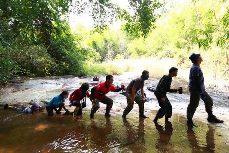
A 9.2-kilometer hike to the Lower Lam Ee Su Waterfall, returning to the Salak Phra Forest Protection Unit. Spending more nights in the forest than at home, I feel like I'm growing fur like a monkey. No matter how difficult it is, the destination is stunning. I love the trail and my companions. It's good for the soul. Missing you, nature lovers. Thank you to all the officers, especially Mr. Suchart, Mr. Tum, and Mr. Faeng. Thank you to Head Ranger Phaithoon for allowing us to witness the beautiful nature. (This area requires permission to enter on a case-by-case basis and is not yet a designated camping site.) Follow our adventures.
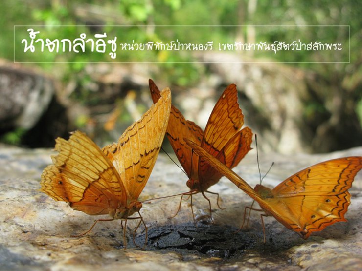
The Nong Ree Forest Protection Unit is the easternmost forest protection unit located in the Bo Phloi District. The unit's office is situated along the Huai Esu stream, offering scenic views and recreational activities. The Lam Esu Nature Study Trail is also located within this area.
This trip required special permission from the district office as our route was not the designated nature trail. We were heading to Lam Ee Soo Waterfall. Our team consisted of Che, Secretary Mod, Tiw (Uncle Ta-liew), Sai Nam, Oil, Non, Mai, and four park rangers.
Few people have heard of or visited the Salak Phra Wildlife Sanctuary.
In the past, Kanchanaburi's forests were abundant with wildlife, forests, and natural resources. However, after the Second World War (1941-1945), wildlife was hunted to near extinction. Most hunting was not for sport, but for extermination. For example, people would ride in jeeps with spotlights and shoot any animal they saw, regardless of its species or usefulness. Even monkeys, gibbons, and langurs, which are beautiful animals that adorn the forest, were shot until they were almost extinct. Wild rabbits, which were once common in the fields, were also hunted to near extinction. The peacocks, which were the source of the song "Khemarat Traiyok" by Prince Naris, were also shot until there were almost none left.
Salak Phra Wildlife Sanctuary is the first wildlife sanctuary in Thailand.
The Salakpra Wildlife Sanctuary in Kanchanaburi Province, formerly known as Thung Salakpra, was once a haven for diverse wildlife. Traditional hunters, such as Noi Inthanon and Dr. Boonsong Lekagul, were familiar with the area, as evidenced by their writings about hunting expeditions in Thung Salakpra. The abundance of wildlife was attributed to the vast grasslands surrounded by hills, rich in grasses and fruit-bearing trees like tamarind, banyan, olive, and hog plum. Over 100 salt licks, essential for wildlife, were also present. Thung Salakpra covered an area of approximately 20,000-23,000 rai and connected to another grassland, Thung Nam Oon, spanning around 10,000 rai, allowing animals to migrate freely. The sanctuary was also traversed by streams, including the Huai Sadong or Huai Salakpra, providing a year-round water source for wildlife. Additionally, a stunning waterfall graced the area where Thung Salakpra met Thung Nam Oon. However, prolonged hunting by both professional and recreational hunters has significantly reduced the once abundant wildlife population.
The government subsequently established the area as a wildlife sanctuary, which was officially declared as the first wildlife sanctuary in the Royal Gazette on December 31, 1965. Covering an area of approximately 963 square kilometers or 602,000 rai, it became the first wildlife sanctuary in Thailand. Subsequently, on February 3, 1972, some areas were revoked for the purpose of granting mining concessions, reducing the area to approximately 936.20 square kilometers or 585,125 rai. On August 11, 1977, some areas were revoked for the construction of the Srinagarind Dam and for the resettlement of people from the flooded area, leaving an area of approximately 858.55 square kilometers or 536,594 rai.


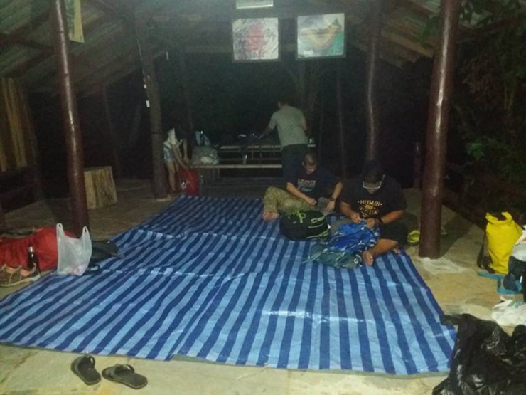
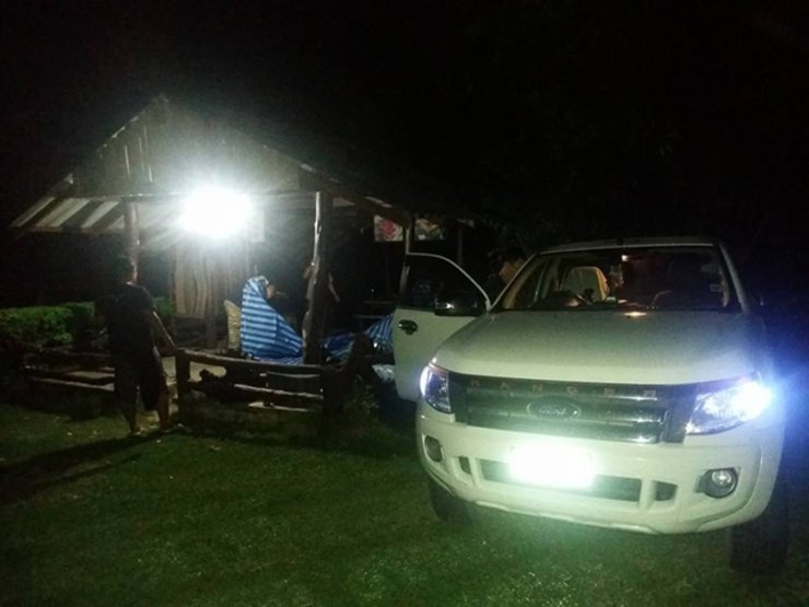
The group arrived at the park at 11:50 AM on November 25, 2016. They set up their flysheets and slept there. The late arrival was due to some members traveling from Bangkok. The route is suitable for pickup trucks.
The Salakpra Wildlife Sanctuary serves as the headwaters for numerous streams that converge into the Khwae Yai River, a tributary of the Mae Klong River. The Srinakarin Dam and the Tha Thung Na Dam are located within the sanctuary.
Interesting facts
In 1957, Dr. Boonsong Lekagul discovered that the Salakpra Forest was home to almost every species of wildlife found in Thailand.
The idea of establishing Salak Phra Forest as a national park emerged, as mentioned in a passage from the book "Traveling the Forest".
"...from Kanchanaburi, we arrived at Lad Ya Subdistrict, which holds historical significance as a former battlefield where we once..."
Shortly after passing the Burmese victory at Lad Ya, we saw a sign on the side of the road that read, "Kaeng Krachan National Park. Hunting is prohibited."
The driver slowed down as we approached a concrete bridge over the Lam Ta Phoen River. We saw the place where...
The National Park's office is a large house located at the foot of the bridge on the opposite side of the Lam Ta Phoen River.
Geology
The Karst Topography within the wildlife sanctuary is characterized by limestone bedrock and unique geological formations, including sinkholes and caves. These caves, such as Tham Kaew and Tham Chor, represent a distinct ecosystem that warrants further research to understand its role in wildlife conservation and human history. Tham Kaew awaits scientific verification, while Tham Chor, with its multi-chambered structure and challenging rope-assisted entry, served as a hideout for insurgents.


Wake up and make breakfast.
Administrative and management characteristics, including the division of areas for management.
1. Strict Nature Reserve Zone: This zone is characterized by its pristine plant and forest communities, making it crucial for conservation. It serves as a habitat for wildlife and a source of water resources. No human activities are permitted in this zone, ensuring minimal disturbance to wildlife and the surrounding natural environment. This zone encompasses a significant portion of the wildlife sanctuary, including the Tung Nam Oon and Tung Salak Phet areas, which are vital water sources and wildlife habitats.
2. The Primitive Zone is an area designated for the protection and preservation of plant and animal communities, as well as the original natural conditions. It encompasses the area surrounding the restricted zone and allows for limited use for activities related to the conservation of natural resources, research, and education. This zone aims to ensure the sustainable preservation of the area's ecosystem for future generations.
3. Recovery Zone: This zone encompasses areas where the natural environment has been degraded and requires restoration to its original state. This is achieved through reforestation and allowing natural regeneration. These areas include those previously encroached upon for agricultural purposes and those where natural resources have been depleted due to natural or anthropogenic factors. The restoration of these areas aims to maintain the long-term ecological balance.
4. Nature Education and Interpretation Service Zone: This zone encompasses areas of natural beauty and educational value, designated to foster public awareness and understanding of conservation. It aims to promote responsible resource utilization and encourage active participation in conservation efforts. Within the wildlife sanctuary, this zone includes the Khao Nam Phu Wildlife Research and Development Station and nature trails.
The Khao Nam Phung Wildlife Conservation and Development Station provides education on nature and wildlife. It offers nature interpretation activities led by trained staff and the Dr. Boonsong Lekagul Nature Study Trail. As a unit of the Royal Forest Department located within the Salak Phra Wildlife Sanctuary, the station aims to educate and raise awareness among youth and the general public.
The Wildlife Protection Unit of Salak Phra Wildlife Sanctuary offers nature trails for educational purposes.
The Mae Lamun Forest Protection Unit is located in the upper part of the area. The location of the unit offers a view of the Mae Lamun stream, which joins the Mae Pla Soi stream and flows into the Srinagarind Dam. Behind the office, there is a nature study trail.
The Huai Sadong Forest Protection Unit is located at the mouth of the Huai Sadong stream, which flows into the Tha Thung Na Dam. The unit has one nature study trail located on the opposite bank of the stream. The Khao Nam Phung Wildlife Development and Conservation Station, a significant location for nature study and environmental training, is situated across the stream.
The Nong Ree Forest Protection Unit is the easternmost forest protection unit in Bo Phloi District. The unit's office is located along the Huai Esu stream, offering scenic views and recreational activities. The Lam Esu Nature Study Trail is also situated within this area.
5. Intensive Use Zone
This zone is designated to accommodate facilities and infrastructure for staff operations, public services related to nature education and interpretation. The area includes the headquarters and ranger stations of the wildlife sanctuary, the wildlife conservation development and promotion station, and the central forest fire control center.
6. Special Use Zone: This zone is designated in this plan period to prevent encroachment by the public. Clear measures and appropriate land use plans are in place in accordance with the direction and policy of the state. The area in this zone includes the area of public encroachment around the wildlife sanctuary.
7. The buffer zone is an area surrounding the wildlife sanctuary, mainly consisting of conservation areas, national forest reserves, areas under the responsibility of government agencies, and areas held by the people. It is designated as a controlled and promoted use area with a suitable land use plan that benefits conservation and does not cause impacts or threats to the natural conditions within the wildlife sanctuary.


After lunch, they prepared provisions for the midday meal and divided them into seven piles to be carried by the group.
Wildlife Sanctuary Office and Forest Protection Unit
1. Wildlife Conservation Division, Salakpra Wildlife Sanctuary/ Nong Hoi Forest Protection Unit
2. Mae Lamun Forest Protection Unit
3. Huai Mae Pla Soi Forest Protection Unit
4. Forest Protection Unit of Mong Kra Tae
5. Kaeng Kaeb Forest Protection Unit
6. Huai Sadong Forest Protection Unit
7. Tha Thung Na Forest Protection Unit
8. Wildlife Conservation Unit of Chong La
9. Salakpra Wildlife Sanctuary
10. Forest Protection Unit of Pha Lat
11. Forest Protection Unit of Salob
- Khao Chong Pratu Wildlife Sanctuary
13. Nong Ree Forest Protection Unit


The area surrounding the unit is bordered by a stream, although it is unclear whether the stream flows year-round. Clean restrooms are available. Local residents and visitors frequent the area for recreational swimming during weekends. However, overnight stays are currently prohibited.
The forest in Nong Ree sub-district exhibits a diverse natural landscape, encompassing both mixed deciduous and degraded deciduous forests. The total forest area covers 63,993 rai, accounting for 59.92% of the sub-district's total land area.


Maintain a clean campsite, share communal supplies, avoid personal porters, and collaborate on carrying equipment. Prepare meals together and gather to listen to Headman Suchart explain the route and plan the journey. Pack your backpacks and prepare for departure.

Our group is composed of individuals who share a passion for outdoor activities, hiking, and nature. Despite our diverse backgrounds and personalities, we each possess a unique style. Some of us are spiritual, while others prefer a fast-paced approach. Some are meticulous planners, while others embrace spontaneity. This eclectic mix creates a harmonious balance, reminding us that we don't need to conform to societal expectations. Each of us is a limited edition, with our own distinctive qualities.
The Nong Ree Forest Protection Unit is the easternmost forest protection unit in the Bo Phloi District. The unit's office is located in
The banks of the Huai Isu stream boast scenic beauty, making it ideal for recreational activities. The Lam Isu Nature Study Trail is located within this area. However, the waterfall itself remains closed to the public due to its remote location, fragile ecosystem, potential danger from wildlife, and the heavy workload of park rangers.
The majority of Nong Ree sub-district is characterized by rolling hills or foothills, with some areas of alluvial plains interspersed with mountains. Two main streams flow through the area: Lam Ta Phin stream, which originates in Nong Prue district and flows through Nong Ree sub-district before continuing south to join the Ban Tha Sao stream in Lat Ya sub-district, Mueang district; and Lam E Su stream, which originates in the western part of the sub-district and flows into the Lam E Su reservoir before joining the Lam Ta Phin stream.
Ta Phoen in Nong Ree sub-district


The journey began around 8:30 AM.


The initial section of the trail follows a scenic and shaded nature path.


I recall walking for about three minutes when Che took a picture while we were enjoying the journey. We heard a loud "boom" and turned to see Secretary Mod slip and slide down into the stream. I don't know what happened, whether she wanted to take a bath or something. I couldn't help but laugh.


The initial section of the trail is a bamboo forest, offering an easy walk with comfortable temperatures.


The trail began to ascend steeply. We asked Uncle Thongsee about the condition of the path, and he replied that it was "like cutting through bamboo," meaning it was easy to walk on. (We thought we might have to bribe Uncle Thongsee to clear the path for us.)


After walking for a while, they began to form factions and fight among themselves, breathing heavily.


After a long walk, they stopped to rest by the stream. Youxin couldn't wait to scoop up some water and drink it.


Suchat and Fan (pictured above) provided us with knowledge and stories throughout the journey.


After taking a break, we continued our journey. Along the way, Mr. Suchart continued to describe the various things we passed.


Image above
The herb **Strychnos axillaris** is known by various local names, including: **Maluemkham** (Chiang Mai), **Kraidailing** (Ratchaburi), **Kraidawok Choknui** (Chaiyaphum), **Krueasiao** (Tai Yai), **Kraidawok Maluemdam** (Northern Thailand), **Bandailing**, and **Langling**.
Characteristics of monkey ladders
The monkey ladder vine is a large, deciduous, woody vine with tendrils. It often climbs and spreads over the canopy of other trees. The mature vine is hard, tough, flat, and has regular, wave-like curves, resembling steps, hence the name "monkey ladder." The young branches have sparse hairs, while the mature branches are smooth and hairless. Its distribution range includes India, Indochina, and Indonesia. In Thailand, it is found throughout the country except for the southern region, in provinces such as Loei, Chaiyaphum, Nakhon Ratchasima, Ayutthaya, Kanchanaburi, Saraburi, Chanthaburi, Chonburi, Prachinburi, Trat, and Prachuap Khiri Khan. It typically grows in dry evergreen forests and moist deciduous forests.
Vines are climbing plants that lack woody stems and rely on twining or clinging to larger trees or cliffs to reach sunlight for photosynthesis and food production.
Meanwhile, trees that lack sufficient strength will be entangled by vines and pulled down by strong winds and storms, a natural selection process.
The direction can also be determined by observing the first round of the vine. If it goes in a certain direction, it means that direction is the east.
Vines also serve as a transportation system for various monkey species, allowing them to swing from one place to another.


This is a cliff with an open view, overlooking a stream below. However, no photos were taken.


The path is beautiful.


Hiking requires constant vigilance. Awareness is paramount, necessitating observation of surroundings.


Let's stop for a swim at the first spot. It's getting hot.


Let's play with bubbles.


Many people are eager to play, waiting with anticipation like giraffes with their long necks. The price is...


Continue the journey.

The tree has thorns.


Another stop is a long, sloping path that is said to be especially beautiful during the rainy season.


The route is stunning, with numerous opportunities to stop and admire the scenery along the way.


Capture member photos.


The fun is over, let's move on.


Strolling and observing the surroundings.


The path continues, and the scenery remains beautiful at every turn.


Let's stop here for lunch.


Happiness is truly this simple: unpretentious.


Mai got a cramp. Ton helped a lot. He plays football, so he knows how to do first aid.


Before the meal, an incident occurred. Brother Ton, who was washing his face, slipped and fell into a very high waterfall. Fortunately, his head did not hit any rocks. At first, we thought he was playing on a water slide, but upon closer inspection, we realized he had slipped and fallen. We were all very scared.


After lunch, we continued our trek. The trail was overgrown, requiring us to cut through vegetation. In some sections, deep gullies required assistance to cross.


The trail traverses steep cliffs, descends into valleys, and follows streams.


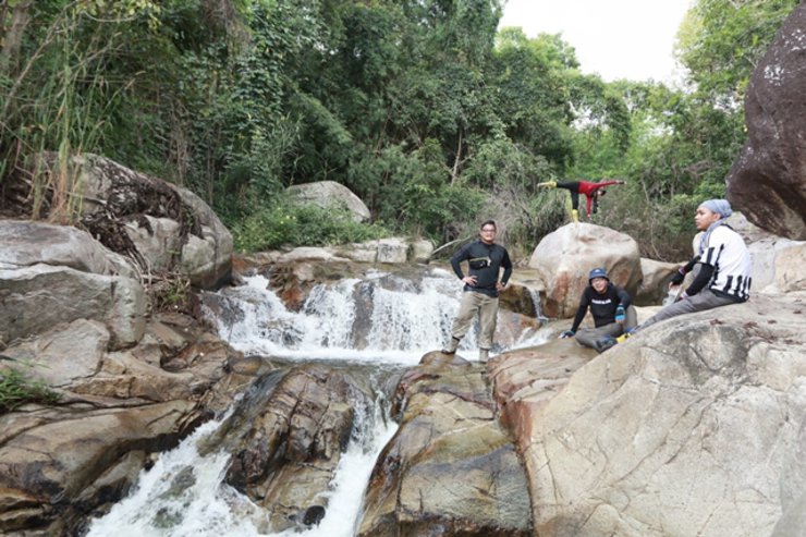
Stroll along the stream.


The scenery is truly beautiful.


After walking to the campsite, set up the hammocks and central camp. Then, we will continue walking to the Lam Ee Soo waterfall.


The path to the waterfall


Lower Lam Ee Su Waterfall


My brother mentioned that this is the lower waterfall. If we want to reach the upper one, it will take longer. Next time, we will try to reach the upper waterfall.


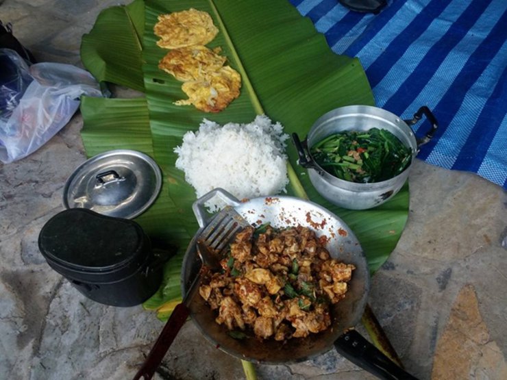
After playing in the waterfall, we returned to our accommodation and cooked a meal.


The menu is simple and straightforward.


The morning atmosphere


Have breakfast and pack lunch. Today is not in a hurry.

Group photo, packing up belongings, and preparing for the return journey.


Return to the original route.

On the way back, the water level was just a few centimeters from the hornet's nest. Fortunately, it didn't break, or else we would have had to run for our lives.

After exiting the forest, we showered, ate, and said goodbye to the park rangers. We then parted ways and returned home.
This trip was incredibly beautiful. Our forests are still pristine. Thank you to everyone who read my review to the end. I apologize that the waterfall photos may not be the best.
I'm Che
Friday, October 4, 2024 3:11 PM


