
The journey is more important than the destination.
It is crucial to consider what we have gained along the way.
Inner freedom is the true form of liberation.
I cherish the memories of Journey.
On a spinning globe, the only thing that can be preserved is memory.
The journey shapes the destination, leaving each traveler with unique memories.
Unable to deny one's own feelings.
Unable to deny one's own heart.
I arrived home at 7:00 AM on 3/10/2016 (this trip was 50 kilometers). Luckily, the sky was clear, the light was beautiful, and there was even the Milky Way. It was really beautiful.
Phu Kradueng National Park, 2 days 1 night, very fast-paced hike due to limited time.
We decided to take this trip on the afternoon of Friday, September 30, 2016. We had just returned from a long hike on September 21-25, 2016 in Tak Province, and my legs were injured from water blisters. But something inspired us to go to Phu Kradueng, even though it had never crossed our minds before. We had no information, so we just decided to go. We packed our bags and figured out the details on the tour bus. Stay tuned for the story. (The photos are not color-enhanced, and the weather conditions are real.) If you carry your own belongings, bring your own tent, sleeping bag, and food, the cost will not exceed 1,200 baht. If there are any errors in the information, I apologize.

Descending from the mountain first, please. Let me take a walk first and wait for the sunset. Luckily, the sky is clear.
Ultimately, the entire story concluded with a sense of longing.
Every journey brings joy and contentment to the soul.
Vivid images that make you feel like you're there. Reviews that make you feel like you've been there for years, even if you've only been there for a day or two.

Phu Kradueng National Park, the second national park in Thailand, is located in Si Than Subdistrict, Phu Kradueng District, Loei Province. It is a sandstone mountain with a flat top, forming a large plateau covering approximately 60 square kilometers. The park's elevation ranges from 400 to 1,200 meters above sea level, making it a popular natural tourist destination in Thailand. The highest point, Khok Meuang, reaches 1,316 meters above sea level.
Hikers are permitted to ascend Phu Kradueng National Park between 7:00 AM and 2:00 PM daily. After 2:00 PM, access is restricted due to the 4-5 hour hiking duration, which coincides with dusk. Hiking in low-light conditions presents safety hazards and increases the risk of encountering nocturnal wildlife.
Phu Kradueng National Park is open for tourism and overnight stays on the summit from October 1st to May 31st each year. The park is closed for tourism and overnight stays on the summit from June 1st to September 30th each year to allow for restoration during the rainy season.


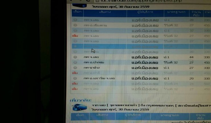
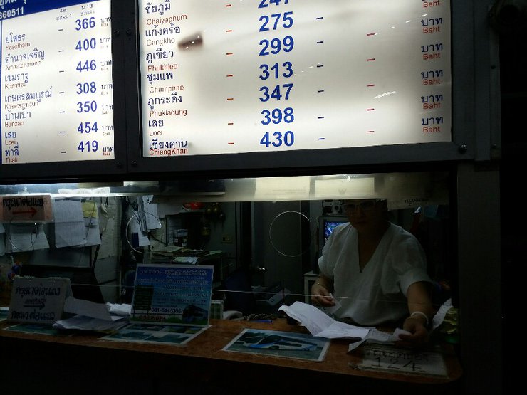
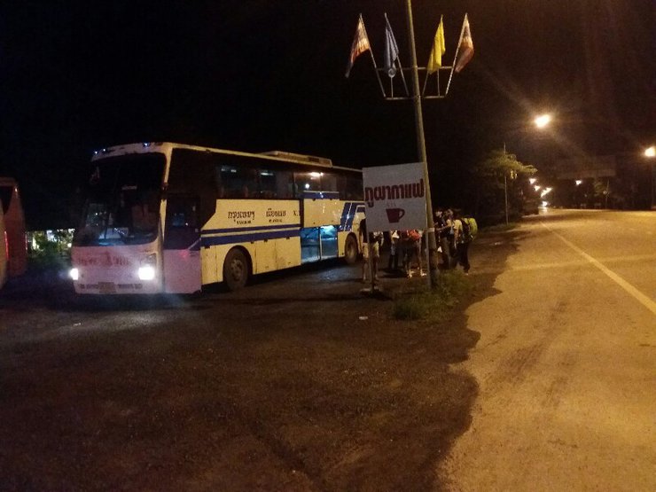
Urgent decision-making leads to a rush to find tickets as it is the first day of the opening of Phu Kradueng National Park. Tickets are almost sold out. The outbound journey is with Air Muang Loei 330 + service charge (departure time from Mo Chit 2 at 20.45, arrival at Pha Nok Khao at 5 am). Inform the driver to drop you off at Pha Nok Khao. The return journey is with Phu Kradueng Tour - Mo Chit 2 347 + service charge (departure time at 21.40, arrival at Mo Chit at 5 am). The pick-up point is the same as the drop-off point, Pha Nok Khao. Alternatively, for those who are not in a hurry, you can purchase a return ticket from P'Aew, who is located next to Pa Kim's shop. If you have any questions, you can ask P'Tee, who sells rice. From my experience using the services of both companies, I recommend using Air Muang Loei as they are more punctual and cleaner.


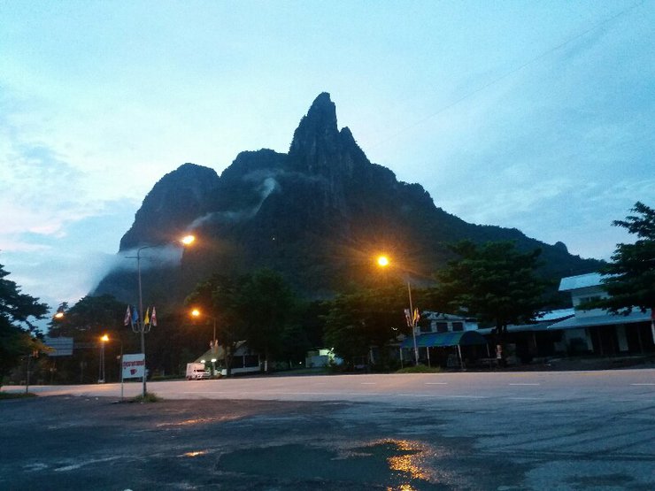
At 5:00 AM, there were quite a few people at Pha Nok Aew. On the first day, over 500 people climbed the mountain. On the second day, 2/19/2016, there were 35 people.


You can stop by here for lunch, snacks, and water, or there are shops across the street. If you have your own car, there is a 7-Eleven on the right-hand side, not far away. We brought three liters of water, snacks, milk, instant noodles, bread, and all sorts of things. It's expensive up there, but don't worry too much, they have transportation costs.

Initially, I planned to share a red car ride. However, by a stroke of luck, I encountered Mr. Phu and Bobby, who were also visiting on the first day. As a result, I joined Bobby in his private car.
Pack like you're going on a regular hike, bringing all the essentials. A hat is recommended due to the intense sun, which can cause sunburn. Don't forget a warm jacket, as the temperature drops significantly at night.

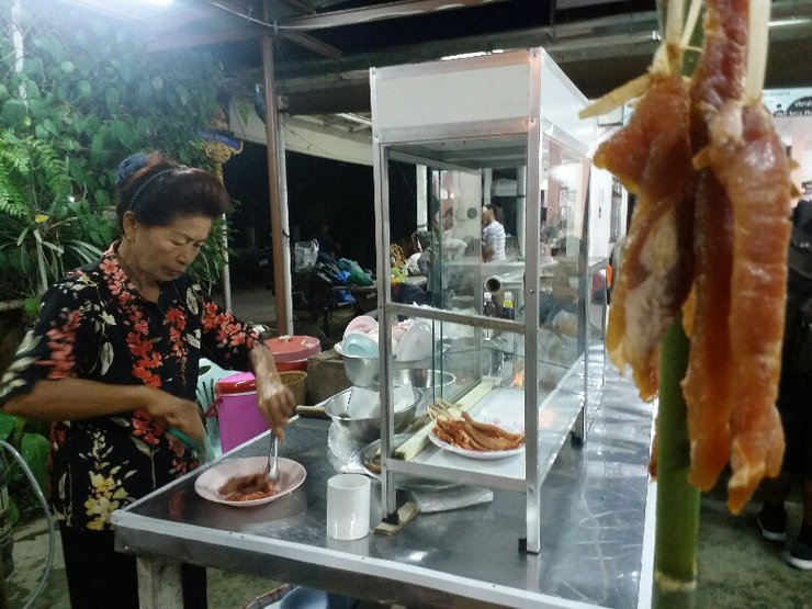
After eating, we set off. 40 baht per box.

Shared rides available for those without personal vehicles. Meet at the side of Auntie Kim's shop. Cost per person is 30-50 baht, depending on the number of passengers.


You will be charged a parking fee. The officer will give you a card to keep and exchange when you return.


The entrance fee is 40 baht per person. Those who wish to reserve tents, porters, sleeping bags, etc., can contact the park in advance. However, I did not use any services at this point. The friends I met all brought their own supplies, including food.


Behind the office, there is a shop selling leech socks for 50 baht a pair. They look good for taking pictures, but... suddenly, my hiking boots broke. I looked around and wondered what to do. I decided to buy a pair of studded sandals for 80 baht to wear for the time being.

Ready to go.


Pay respects at the shrine first and read the various signs.


Could this group please take a picture?


The ascent to the mountain opens at 7:00 AM. Start your hike at the Ban Sri Than service point, register the number of people in your group, and present your purchased tickets.
The challenging ascent to the summit of Phu Kradueng National Park covers a distance of 8,800 meters. The initial 5,500 meters involve a steep climb, followed by a relatively flat 3,300-meter stretch leading to the park's visitor center. This arduous journey is divided into sections known as "sam," each varying in length, incline, and terrain.
From the Sri Than Park office, we will encounter Pang Khok Ka - Sam Haek - Sam Bon - Sam Khok Ok - Pran Pran Pae - Sam Ko Sang - Sam Khok Wua - Sam Khok Phai - Sam Khok Don - Sam Krae - Lang Pae.


The journey began at 7:20 a.m. on October 1, 2016.
The first section of the mountain climb is called "Sam Haek," which covers a distance of 700 meters from the park headquarters to the foot of the mountain.


The scenery along the way is refreshing, with lush green forests that are pleasing to the eye.


Capturing the atmosphere as it unfolds.


Time for a chat.
A leisurely walk is recommended, and those who get tired can rest. It is advisable to wear long pants to avoid injuries in case of falls. Bring water, snacks, a sweat towel, and lunch. If you want to save money, bring your own food. If you prefer to relax, bring money as there are vendors selling food and drinks. Items carried by porters will arrive later, so it is recommended to carry essential items yourself.


We are almost at Sam Haek.


Approximately 200 meters from Pang Gawk Ka, you will reach Sam Haek.
A "sam" is a location where groundwater or spring water emerges at the earth's surface or on a cliff face. In the past, hikers would stop to rest or drink water at various "sams." Even though it is no longer necessary to find water in the forest when hiking up Phu Kradueng, "sams" remain places to rest, find food, and drink water. Along the various "sams" on the Phu Kradueng trail, there are restaurants, although not at every "sam."
Bobby has arrived in record time and is now ahead. Mr. Phu, who is carrying a heavy load, is walking behind and should not be far from Bobby.
The uncle returned to his family to have dinner together at Sam Haek (this family invited him to chat during Sam Haek, the uncle has come many times, listening to him tell stories, the uncle seems very happy, even telling that he once fainted here, they still laughed happily).


Restaurants near Sam Haek

Passion fruit is also available.


There is also a bathroom.


A young porter


The scenery along the way is truly beautiful. I'm so glad the sun is out.


Let's take a look at the food prices.

It's delicious, you have to try it. (He said it's boiled, it's boiled, boiled egg, not roasted.)


Follow the picture.


You will encounter peddlers taking breaks at various shelters along the way.


Walking and taking photos is a pleasant experience.


The cool breeze makes for a pleasant stroll, even without taking breaks.


Please be careful when using the stairs.


Who else would it be but me?
Arrived.

Continuing our journey to the Wankwang Service Center. Here, we see porters using carts.
(Note: The image size may have changed as the camera used was initially a mobile phone.)


The path is clear, but the sun is scorching hot.

Blinded by love, everything seems beautiful.


Pong, these two people


Hornbill or Naga Crest
Montien Thong
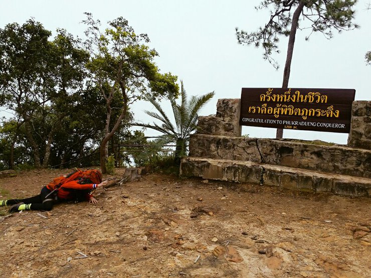
Rolling around on the ground to take pictures.


Beware of the elephants, beware of the elephants, beware of the elephants.


Upon arrival, report to the designated location for further instructions.


Let's see which way to go.


Campers who do not bring their own tents can rent them from the park. Those who bring their own tents can choose their preferred location and set them up accordingly.


Food is plentiful and readily available, with options like iced coffee, congee, and even barbecue readily accessible. It's almost more convenient than staying at home.

We set up camp, put down our backpacks, and got ready to hike. We weren't hungry yet, so we left the sticky rice with pork that we had brought with us. Our backpacks were still full of bread.


From Wang Kwang Service Center to Phra Phuttha Metta Ground.


Lan prasrinakarin
Walk without talking or wearing headphones. If something happens, you won't be able to run away in time.
The Phra Si Nakarin Square, also known as the Phra Phuttha Metta Square, houses a Buddha statue with a rich history. The Phra Phuttha Metta statue, revered for its sacredness, was constructed in 1920 by Luang Wichit Kunsan, the district officer of Wang Saphung, in collaboration with local residents. The statue served as a spiritual anchor and a testament to the community's unwavering faith. Originally unnamed, the statue was bestowed with the title "Phra Phuttha Metta" in 1983 by Her Royal Highness Princess Srinagarindra, who graciously oversaw the restoration of the statue and its surroundings with marble. During the ceremony, Her Royal Highness opened the statue's eyes, adorned it with hair, and bestowed upon it the name "Phra Phuttha Metta," which it bears to this day. Numerous bells hang in front of the statue, a testament to the devotion of visitors, and a large bell stands ready to be rung.


After paying respects at the temple, we set off for the Anothat Reservoir. Oh, I forgot to mention that Mr. Phu and Mr. Bobby were cooking lunch, so we left first and agreed to meet at Pha Lom Sak.


The atmosphere is pleasant.


Homeowner

Two-leaved pine cone or seed.
Take a break to admire the interesting things along the way.

Left: Shrimp claw flower. Right: A type of sausage.
2. Left - Silver button 2. Right -

Beneath the dew drops

Manithida, Kung, Water Mimosa, Swamp Senna, and Field Senna


The Anothat Lake is a large body of water with cool water. It serves as a resting spot for tourists during their hike to Pha Lom Sak. The lake is approximately 2254 meters from the campsite. If you start your hike from the campsite at around 2:00 PM at a leisurely pace, taking photos along the way, you will reach Anothat Lake around 3:00 PM. It is a suitable place to rest and have lunch. From Anothat Lake, the distance to Pha Lom Sak is approximately 6511 meters.


Pha Hieap Meng, a breathtaking viewpoint on Phu Kradueng Mountain, is a popular spot for tourists to admire both daytime and sunset vistas. This expansive rock platform offers stunning panoramic views, and the prospect of witnessing a sea of mist from this vantage point is truly captivating. Additionally, there are convenient shops available for visitors.


Pha Hieap Meng, offering one of the clearest views of Phu Ruea, boasts a unique rock formation that serves as a popular spot for visitors to sit and admire the scenery. Adjacent to the large rock platform lies a series of smaller rock formations along the mountain ridge, providing ample space for tourists and leisure seekers to capture photographs at their leisure.


The original plan was to visit a waterfall, but we ended up at Pha Hieap Meng instead. Now, we have to continue walking to Pha Lom Sak.


Two leeches attached themselves to me while I was taking a low-angle photograph.

Stop for lunch at the first restaurant over there.


The sky is clear today. I captured some photos to share, but my photography skills are not very good.
The Pha Lom Sak viewpoint, located approximately 9 kilometers from the park headquarters, features a vast rocky plateau with a lone pine tree clinging to the edge of a cliff near a rocky outcrop jutting out into the air towards the south. From Pha Lom Sak, visitors can enjoy breathtaking panoramic views of the mountainous landscape of Phetchabun province. This vantage point also offers one of the most spectacular sunset views in the region, making it a popular destination for photographers and media personnel. As the sun dips below the horizon, the sky transforms into a canvas of vibrant colors, creating an unforgettable visual spectacle.


After dinner, around 6:30 PM, we started our journey back to the tent site. On the way, the Milky Way was stunning. We arrived at the Wang Kwang Tourist Service Center at 9:10 PM. Upon arrival, we showered and went to bed. On the first day, we walked a total of 38 kilometers, including some loops.

Waking up early and leaving in the morning, I stopped by to tell Mr. Phu that I was going to Pha Nok Aen. He was still asleep.


I encountered two elephants on the path, which startled me greatly. I feared being trampled, but fortunately, they passed by. Next, I came across a patch of wild white roses.


The courtyard of Wat Phra Kaew features a majestic standing Buddha statue at the center of a vast stone plaza. Nearby, a small tree adorned with numerous hanging bells stands close to the Buddha. The courtyard is situated approximately 1378 meters from the camping ground, towards Pha Nok Aen. Tourists who visit Pha Nok Aen for sunrise often return via the Wat Phra Kaew courtyard due to the similar distance.


The journey to explore the beauty of Phu Kradueng begins at Pha Nok Aen, the first tourist spot of each day. As the only sunrise viewpoint on Phu Kradueng, Pha Nok Aen attracts numerous visitors during peak season. Park rangers guide tourists from the visitor center at 5:00 AM daily. While the sunrise may be elusive on some days, multiple visits often reveal its breathtaking splendor. The distance from the visitor center to Pha Nok Aen is approximately 1582 meters, resulting in a roundtrip of 3 kilometers. Alternatively, returning via Lan Wat Phra Kaew extends the return distance to 2148 meters. (Note: Taking the Lan Wat Phra Kaew route both ways resulted in an eerie solitude.)


After that, they walked back to their accommodation and had breakfast before continuing their journey.


Having traversed numerous forests, I have never felt as apprehensive as I do now. The abundance of wildlife sends shivers down my spine. Today's plan is fraught with excitement.
Follow the stream from Wang Kwang Station. You will find the confluence of two streams, with the stream you need located on the right-hand side (although not visible). Continue along the stream for 300 meters, where you will find a path leading down on the right-hand side.
After that, walk back up and walk against the current to the large cave, then climb the hill and exit the way back to the office through the Buddha of Mercy, and return to the accommodation.


The path to Wang Kwang Waterfall, where I met a friend.

Wuang Kwang Waterfall cascades down a wide, rocky cliff. During the rainy season, the waterfall is magnificent, but during the dry season, the water flow is significantly reduced. The waterfall is located 735 meters from the campsite, and from there, you can continue hiking to the newly discovered Pen Waterfall, which is approximately 1576 meters away. The trail does not pass through the Lan Phra Si Nakharin. Beneath the rocky cliff of the waterfall, there is a large cavity that can be explored. Due to the high humidity, leeches are commonly found in the vicinity of the waterfall.


Let's continue to the next waterfall, Phor Phon, Pen Phop Mai, and Pen Phop Kao.


Continue.


The newly discovered Phet Phon Pha waterfall cascades down a rocky cliff, 2564 meters from the tent site along the Phra Sri Nakarin trail, or 2311 meters along the Wang Kwang waterfall trail. The trail winds through an open forest with scattered pine trees, occasionally opening into clearings. Before reaching the waterfall, there is a wide clearing with maple trees. The Phet Phon Pha waterfall is a popular attraction for tourists visiting Phu Kradueng during the winter season, when the maple leaves turn a vibrant red. However, the leaves sometimes change color and fall faster than expected, with new, light green leaves emerging.


Continue.


The Phor Phon Pha waterfall is located 558 meters from the Pen Pha Phob Mai waterfall. From the Pen Pha Phob Mai waterfall, the trail becomes steep for a short distance before continuing along a stream. The waterfall has a large, flat rock platform with a pool suitable for swimming. The area is shaded by large trees.


The trail to Phaen Phop Waterfall, located approximately 342 meters from Phoen Phop Waterfall, features a stream with a rocky bed, resulting in crystal-clear water. The streambed is dotted with pools of varying sizes, reminiscent of the 3000 Bok in Ubon Ratchathani province. The trail is shaded by lush vegetation, providing a refreshing respite.

Phu Pha Phop Waterfall


Let's go down and walk in the water. It's beautiful.


You won't get lost if you keep walking back.


Starflower


Thamyai Waterfall, Phu Kradueng National Park
General Information
The trail to the waterfall is only 1.4 kilometers from the Phaeng Phob Waterfall, which may seem like a short distance for nature lovers who enjoy birdwatching and admiring the diverse flora. The trail is surrounded by a dense, evergreen forest with larger trees than any other waterfall trail. You might even spot the pink-flowered Begonia sp., with its yellow central stamen, which thrives along high-altitude paths in the mountainous rainforest. Along the Tham Yai trail, there are sections that run alongside a small stream, where maple trees are scattered. In early January, the trail becomes a vibrant red carpet as fallen maple leaves blanket the forest floor. The beauty of the Tham Yai Waterfall is unique due to the massive, haphazardly stacked boulders. The stream is flanked by maple trees, and when the red leaves fall, they paint the green rocks, adding color and vibrancy to the landscape.


Returned.


Park accommodation

After arriving at the office, have lunch, pack your belongings, and descend from the mountain before 2:00 PM. Upon descending, take a shower and then take a car to the original bus stop to board the bus. I hope this review will be helpful for those who are planning to travel. I am also happy for those who met me and came to say hello, take pictures, and chat.
I'm Che
Friday, October 4, 2024 3:11 PM


