"Let's go to Doi Pitu Kho, brother. I want to go," a junior friend asked. "I just went there last year," I replied. "You're a newbie, brother. Last year, you didn't even reach the 30,000 mango peak, did you? This time, climb to the top," he urged. When he tempted me with the 30,000 mango peak, I had no choice but to agree.
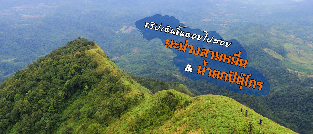
The Pitukrok Waterfall, a heart-shaped waterfall in the Umphang District of Tak Province, is well-known among nature enthusiasts. Along the same route, there is also a mountain peak over 1,600 meters above sea level called Doi Mamuang Sam Mun, offering an additional challenge for those seeking adventure.
Last year, I went to play in the water at Pitu Kho, but I missed the opportunity to climb the 30,000 mango trees and only reached the viewpoint. This time, I took it as an opportunity to redeem myself, as my junior said.

The nearest village to the Pitukrok Waterfall and Doi Mae Moei Sam Wan is the Karen village of Gui Le O To, which manages the area in collaboration with tour operators in the Umphang district. Visitors can contact tour operators in Umphang or local guides in the village. However, contacting tour operators is recommended as not all villagers are fluent in Thai, and limited phone signal makes communication difficult. Additionally, transportation needs to be considered as Gui Le O To is located 70 kilometers from Umphang.
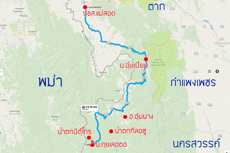
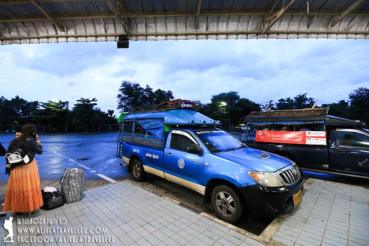
The journey to Umphang begins in Mae Sot district. For a full backpacker experience, you can take a shared taxi from Mae Sot Bus Terminal on the Mae Sot-Umphang route. However, be warned that this journey is very long, taking almost five hours. You will also need to take another shared taxi from Umphang to Peing Keling to reach Ban Kui Le O. Therefore, if you need to save time, hiring a car is the best option.

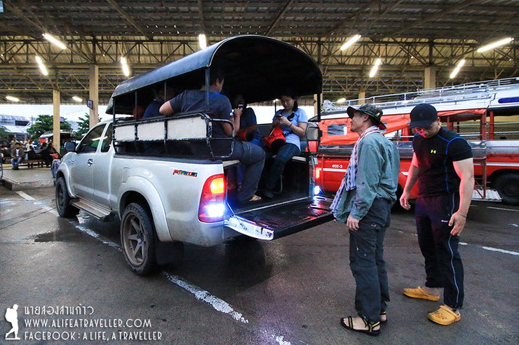
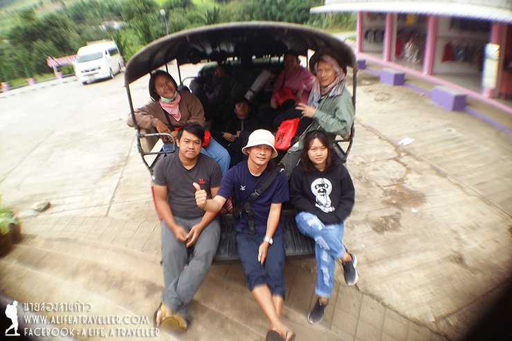
I opted for a pickup truck rental from a tour operator in Umphang for the entire trip, covering round trips between Mae Sot-Umphang and Umphang-Kui Le O. The standard price is around 7,500 baht. My group of eight (with a maximum capacity of ten) split the cost, resulting in less than 1,000 baht per person for the entire 600-kilometer journey. It's definitely a cost-effective and time-saving option compared to taking public transportation.

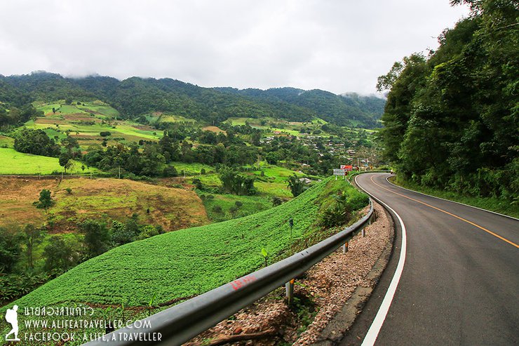
Our trip began in early July, on a weekday before the Buddhist Lent holiday. Eight of us gathered at Mae Sot Bus Terminal at 6:30 AM. We drove along the elevated highway, Route 1090, passing through Phop Phra District. We stopped for a break at Ban Uem Piem before entering Umphang District. As you might expect, the road was full of winding curves that could make you dizzy. If you're prone to motion sickness, it's best to take medication beforehand, or you might find yourself feeling unwell before even reaching the forest. (Haha...)
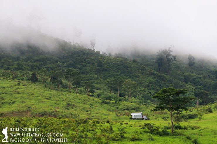
The scenic route of Highway 1090 during the rainy season offers breathtaking views, lush greenery, and a refreshing mist.


Arriving in Umpang District at around 10:00 AM, we prepared our belongings for the final time, bought fresh food, ate lunch, and then continued on to Ban Kui Lae Tao, approximately 70 kilometers from Umpang.
We traveled on a weekday and did not make any prior arrangements for transportation. Therefore, we had to find a guide at the Ban Kui Let village. This was not difficult, as we simply informed the village chief that we needed a guide to Pitukroh for one person, with an overnight stay. Within a short time, we had a guide ready to go. The standard rate for a guide is 1,000 baht per night.

We began our hike around 1:30 PM. The initial section of the trail traversed through local farms, where it was easy to get lost due to the numerous intersecting paths leading to different fields. During a previous attempt, we had a poor guide who led us astray, resulting in a confusing detour. Throughout the hike, the rain kept falling, making the trail muddy and slippery.


After walking for a little over an hour, we entered a dense forest. From this point on, the terrain was significantly different from what we had encountered earlier.


An hour later, shortly before four in the afternoon, we reached the campsite by the stream. However, before the campsite in the Pitu Kho trek, there were many points. Besides this, there were also below the waterfall, the way down to the waterfall, and on the viewpoint. However, there is currently a new regulation that allows camping only at this point.
A brand-new galvanized iron shed provided shelter for our group, eliminating the need to compete with others for cover during rain. Additionally, a new bathroom facility was constructed, featuring a well-maintained soakaway pit and a piped water supply from a nearby stream for cleaning purposes. These improvements significantly enhanced the overall comfort and convenience of the campsite.


We camped, pitched tents, hung hammocks, cooked rice, and prepared meals together. It was a relaxing experience.


After finishing dinner around 7:30 PM, we were likely exhausted from our long journey that began at 9:00 PM the previous day. We all fell asleep without a care in the world, experiencing an unusually quick and deep slumber. We woke up very late, having slept for over ten hours. (Haha...)
Waking up refreshed and ready to conquer the day
The day began with a sense of invigorating freshness, fueled by a night of deep and restful sleep. The mission for the day was to conquer the peak of a mountain, reaching a height of 30,000 mangoes. Before embarking on this challenging journey, the team knew the importance of a hearty breakfast. They prepared a delicious meal of fried noodles, ensuring they would have enough energy to sustain them throughout the day.
As for me, my cooking skills are the worst in the group, so I'll excuse myself to take pictures of the waterfall next to the camp. It's noticeable that the water is lower and clearer today than when we arrived yesterday. This is a good sign that the weather on the mountaintop will be better.


Belly full, dishes washed, belongings packed, ready to go... Looking at the clock, ten minutes to ten, let's start walking.

The trail from here onwards becomes increasingly steeper, unlike the approach to the camp, which was mostly flat or with small inclines. It was quite a challenge, even though we were carrying no weight.


After an hour, we reached the old campsite before the waterfall. It was in a state of disrepair, unlike the previous year when the camp was well-maintained. As I mentioned earlier, they are trying to limit camping to the bottom area only for the sake of order.

This is the point where we will descend to the Pitu Kho Waterfall, but we will do so later as we must first ascend to the summit of Mango Three Hundred Thousand.
The steep climb continues, but soon we will be rewarded with breathtaking views that will invigorate our spirits.


After a while, we reached the waterfall. Even though it was the same scene I had seen before, I still couldn't help but gasp in awe.

With a final push, we reached the landmark viewpoint of Doi Ma Mo at approximately 11:30 AM. The atmosphere was joyous as we took photos, capturing the stunning waterfall, the ethereal mist, and the lush greenery. The experience was truly exhilarating.


This is the shoulder of the mountain, approximately 1,300 meters high. The peak, however, is around 1,600 meters, so we must continue to ascend. When I asked the shy guide if it would take two hours to reach the top, he chuckled and replied, "It depends on how fast you walk."
We devoured our instant noodles at the scenic viewpoint. The peak of the mountain was still shrouded in thick fog, but at this point, we didn't care. We were determined to reach the summit, come what may. All that mattered now was conquering the mountain.

The ascent from the viewpoint to the next ridge is truly brutal, with a steep incline that is enough to discourage even the most determined hiker.


The view from the top was breathtaking, with the mist, forest, and waterfall creating a harmonious and picturesque scene. Notably, this was the first spot with phone signal (AIS), so we took a longer break (laughs...).


From this point, we have to hike up several more ridges. We pass one ridge, only to be met with another, and then another. It seems like it will never end. However, the views are breathtaking, making the hike enjoyable.


Walking to this point, looking back, the sky is incredibly open. It's so beautiful that I can't describe it in human language (lol...)


And finally, around half past two, we reached the top of Doi Mamuang Sam Mun, which many people call the flag-raising stone pile because there is a flag planted on the pile of stones. Even though we arrived on top when the sky was cloudy, completely white and couldn't see anything, everyone was happy. The important mission was accomplished.
Our guide was asked how the name "Three Ten Thousand Mangoes" came about, even though there wasn't a single mango tree in sight. The guide responded candidly, "I have no idea."


The descent was the culmination of our group's arduous climb to conquer the thirty thousand mangoes. As we descended, the skies cleared, revealing a breathtaking panorama. The sights that had eluded us on the ascent were now laid bare before our eyes, filling us with an indescribable sense of joy.


After a long descent, we arrived at the (abandoned) campsite.
We only stayed at the waterfall for a short time before moving on as dusk began to fall. The path to Pitukrok Waterfall from here is all downhill.
Crossing the stream a couple of times, it took no more than twenty minutes.


And the heart-shaped waterfall of Umphang Forest embraced us once again, filling our hearts with the same joy as before.

The sentence is already in English and does not require translation.

The sentence is already in English and does not require translation.

We spent some time playing in the stream below, and at six o'clock in the evening, we waved goodbye to the white heart and walked back to the campsite.


After about an hour, we followed the waterfall back to the camp, arriving just as it was getting dark at 7 pm. Local villagers and a Phang Nga tour group were preparing the area for tourists during the long weekend, making the camp less quiet and pitch-black than the previous night.
It's dark, let's start cooking. What are we waiting for? (Haha...)


The beautiful scenery and wonderful experiences we encountered today have left us feeling energized. We chatted and ate dinner until nearly 10 pm before finally retiring for the night. In the middle of the night, a heavy downpour began. Thankfully, our corrugated metal shelter provided excellent protection from the rain.
The next morning, there were no more tasks. We woke up and relaxed, cooked and ate breakfast, and packed our things. Around 10:00 AM, we started our journey back. The villagers put up this sign, making us the first group in the history of Pitu Koh to take a picture with it. (Haha...)

And that concludes our mission to the Pitu Kho Waterfall and the conquest of the 30,000-baht Doi Mamuang peak.
For me, this route may not be the most challenging or demanding, but due to the fortunate timing and various other factors, I was able to witness breathtaking views that perfectly matched the difficulty level. This makes this route one of my most cherished memories.
Summary of the trip:
- Route: [Name of the route]
- Difficulty: Moderate
- Highlights: Stunning views, perfect balance of challenge and reward
- Overall experience: Memorable and enjoyable
Note: The original text is in Thai. The translation is based on my understanding of the text and may not be perfect.
Transportation
- Bus from Bangkok (Mo Chit Bus Terminal) to Mae Sot: Public buses operated by the Transport Co. Ltd. (BKS) are available, with options including regular buses (373 THB) and VIP buses (580 THB).
- Pick-up truck charter from Mae Sot to Umphang and Kui Lae: A round-trip charter for a pick-up truck accommodating up to ten passengers costs 7,500 THB. It is recommended to contact Dok Siew Tour (089-860-5070, 089-958-9347) for this service, which includes a shower facility before and after the mountain ascent/descent.
- Public transportation: A shared taxi (songthaew) operates between Mae Sot and Umphang, with the first departure at 7:30 AM (fare: 150 THB). From Umphang, another shared taxi can be taken to Peing Keling (fare: 100 THB), which is the drop-off point for Kui Lae village.
Hiking to Pitukroh Waterfall and Doi Mamuang Sam Wan
Hiking Time:
- From the starting point at Ban Kui Leot to the riverside campsite: approximately two hours.
- From the campsite to Pitukroh Waterfall: approximately one hour.
- To reach the viewpoint on Doi Mamuang Sam Wan: 1.30 hours.
- From the viewpoint to the summit: another two hours.
Accommodation:
- For a trip focusing only on the waterfall and viewpoint, one night's stay is sufficient.
- For those aiming to reach the summit of Doi Mamuang Sam Wan, two nights are recommended.
Leeches:
- Leeches may be encountered, but their presence is not significant. During our trip, we only encountered one leech near the campsite.
Guides and Porters
- Tour operators in Umphang will provide guides. If you need to hire a guide yourself, you can contact them directly at Ban Kui Leut Ao. The cost is 1,000 baht per night per person. They can carry light loads, but if you need a porter to carry heavy loads, you may need to pay extra.
Follow my travel adventures on another channel.
http://www.facebook.com/alifeatraveller
นายสองสามก้าว / A Life, A Traveller
Tuesday, October 8, 2024 11:23 AM

